For some individuals outdoor
recreation is simply relaxing at the beach. Trinidad has numerous beaches and outlined
below are some of the beaches found around Trinidad. An excellent source of
additional information on
the beaches of Trinidad and Tobago is "A Guide to Beaches and Bays of Trinidad and
Tobago" produced by the Institute of Marine Affairs.
The links listed below
will take you to specific information on the particular beach.
To find the beaches referred to on this page, in the overall geographic space of
Trinidad, see the Trinidad Map. To help you have a
safe and enjoyable time at the beach, see our article on Beach Safety. To
see a listing of beach houses, villas, vacation cottages, guest houses and hotels
available for rental in Trinidad, click on this link to the Accommodation
Page.
If the information you are seeking is not on this page, visit the other
pages in the top banner or use the search box below to search this site. When searching,
you do not need to enter the word "Trinidad" in your search.
For information on the beaches in Tobago, visit our
affiliate web site, Caribbean
Outdoor Life.
Blanchisseuse was first settled by French immigrants to Trinidad in 1783 and is named
after the French word for "washer woman". It is located on the north coast of
Trinidad and is a small village on the sea coast backed by the Northern Range. There are
several rivers in the area. Overall it is an area of rustic charm. It has always been and
continues to be a small village with a few small hotels and guest houses along with seaside rental cottages.
The village of Blanchisseuse ends at the
suspension bridge that
spans the Marianne River. This river enters the sea at Blanchisseuse Bay and freshwater
marsh vegetation exists along the banks of the river near the mouth while freshwater swamp
forest exists further inland. Kayaking and
Camping are popular activities along the Marianne
River. After the suspension bridge there is a hiking trail that follows the coast
to the village of Matelot. Two other popular hikes in the area are to the Avocat Waterfall and to the Three Pools. The Blanchisseuse area is a
favorite of bird watchers particularly along the hiking trail and along the
Arima-Blanchisseuse Road.
The two most popular beaches in the Blanchisseuse
area are Blanchisseuse Bay and L'Anse Martin. Blanchisseuse Bay is at the end of the North
Coast Road and is approximately 1.4 kilometers in length. The popularity of this beach
stems, not from the sea, which has plunging breakers and strong rip currents, but from the
swimming in the mouth of the Marianne River which enters the sea at this bay.
There are several entrances to
Blanchissuese Bay. The easiest and most popular entrance is at the side of the
restaurant attached to the Laguna Mar Beach Hotel. At this point a concrete walkway leads
from the road to the beach. This entry point is popular because it leads directly to the
section of the beach where the Marianne River meets the sea. It is a picturesque walkway
with a mixture of heliconia, ginger lilies and swamp vegetation lining both sides.
If persons desire to drive their vehicle along the
concrete path a small fee must be paid, however for those walking along the
path there is no fee.
It is also possible to access the bay at its eastern end
by going through a small campground that has been created by the owner of
that property. Again a small fee must be paid if you desire to park your
vehicle at the campground and walk onto the beach.
L' Anse Martin is a small beach with
the entrance to the beach being via a concrete footpath opposite Surfside Inn. Parking is
on the side of the roadway in the immediate vicinity of the beach and persons then walk
down the footpath to the beach. The beach is composed of fine white powdery sand with a
backdrop of mainly almond and coconut trees. At both ends of the beach there are small
rock pools. For most of the year this beach has moderate surf with only a gentle westward
drifting current. L' Anse Martin is sometimes used by weekend surfers as it is easily
accessed, being only one hour's drive from Port of Spain. The beach does not normally have
large crowds and so surfers do not generally have to contend with the problem of bathers
being in their path while they are riding a wave.
Other beaches in the area are Damien Bay, Stone Steps,
Yarra and opposite the police station.
Damien Bay is on the western outskirts of Blanchisseuse village where you first begin to
encounter seaside homes but before you get to the heart of the village with the shops,
Police Station and Health Center. On the main road after passing Yarra River and
immediately before the Wasa Pumping Station the road takes a left turn and on the bend
there is a track on the left. This track leads to Damien Beach. The track is wide enough
for vehicles to drive to the beach and cars can be parked along the edge of the track.
Damien Bay has a wide flat sandy shore backed by a variety of shade trees.
In the western half of Blanchissuesse village, after you
pass the intersection of the North Coast Road and the Arima-Blanchisseuesse Road, there is
along series of steps that lead from the main road to the top road. Directly opposite
these steps is a short dead-end street with a Ministry of Works compound on the corner. At
the end of this street it is possible to walk behind the Ministry of Works compound and
access some concrete steps that lead to a beach. This beach we have named Stone Steps
beach. This beach has golden sand and is shaded by trees growing out of the cliff face.
There is a sharp drop on entering the water and there are rocks in the water but the
clarity of the water is superb. Above the beach at the end of the road there is a nice
liming area with a strong sea breeze, concrete benches and table shaded by young coconut
trees, perfect for a cook.
For many individuals beach going ends at the spring bridge that
spans the Marianne River. This suspension bridge is
one of the two
remaining bridges of this type in Trinidad, with the other located at La
Ruffin in Moruga. It has become an attraction and some people visit simply to feel the
undulating motion as you drive across while others come to admire the beauty of the scene.
While many believe that the beaches end at the bridge, hikers have long known that
there are beautiful beaches beyond. The road after the bridge is the starting point for
the hike to Paria and Matelot.
After the bridge the road is composed of packed gravel and then eventually becomes hard
dirt and grass. It is possible to drive for a considerable distance along this road and
reach the two beaches described in this section. The drive is however best accomplished in
the dry season as there are sections along the road where the passage of vehicles has
created mud pools, which even 4-wheel drive vehicles have difficulty navigating, and there
are two sections where the road surface is smooth clay on an incline.
If one begins at the suspension bridge, after 0.4 kilometers you encounter the first
major mud pool opposite a new housing development. The majority of individuals choose to
park their car at this point and continue on foot. Along this leg of the trail there are a
few beach/country houses set on either side. After approximately 20 minutes you encounter
a cream house set slightly above the trace. The trail bends right, then goes straight and
then bends left. On the left bend there is a track on the left, opposite a metal gate and
marked by two metal poles. This track leads downhill to Ti Delma beach.
Ti Delma is set within a small cove and because of its location is usually empty and
when occupied it generally at most has two or three young people. The beach has evidence
of sand flies but they are only a problem in the rainy season during the early mornings
and late afternoons. Ti Delma is used for camping and there is room for at least three
small groups.
As you continue along the trail after Ti Delma, a variety of birds are heard and seen.
Particularly eye catching are the silver-beaked tanagers with their velvety red almost
maroon feathers and silver-white beaks. Among the various clumps of heliconia,
hummingbirds hover drawing their daily supply of nectar.
After a thirty minute walk you encounter Laspor beach. There two large rocks stand like
center pieces on a tableau of the roiling sea. A small grove of almond and coconut trees
at the entrance, combined with the sea breeze provides a refreshing cool spot after the
walk. This is a beach that exists exactly as nature made it. There are no facilities and
everything that you require must be brought with you (and taken back when you leave). The
sea at Laspor can be very rough, especially when the tide is rising, and so the beach is
best suited for relaxing and developing a harmony with nature.
For those who do not want to endure the full rigors of a hike to Paria but still want to
enjoy the gifts of our North Coast, a hike to these two beaches is a perfect introduction.
Yarra_Beach
Yarra Bay is a dramatic beach. From the moment you walk down the
hill you are struck by the visual beauty of this beach; the coconut trees lining the
shore, the wide sand expanse, the blue water, the huge rocks standing in the center of the
bay with the sea surging against them and seemingly unable to prevail plus the red clay
cliffs at the western end. Yarra Bay lies on the western outskirts of Blanchisseuse
immediately after the village of La Fillette. Its entrance is not easily seen and so often
bypassed as individuals travel along the road to Blanchissuesse. Yet this secluded bay is
an ideal location for a beach side picnic in the midst of a true untamed Caribbean
setting.
The ocean at Yarra surges in from the deep, so that it is not a beach known for swimming
but rather for contemplation of the beauty of nature. Yet those wishing to swim are not
without a choice at Yarra for on the western end of the beach the Yarra River widens and
then flows into the sea. In walking from the road way one traverses the length of the
beach and at the centre of the beach you can walk around a small headland or use a
concrete pathway that skirts the edge of private property. As you walk along the beach,
you realise that Yarra Beach is used by the giant leatherback turtles as a nesting
site for laying their eggs.
At this western end of the beach, the river flows slowly with
clear water between sandy banks. There is a grove of short coconut trees that lies between
the river and the sea, while along one stretch of the river almond trees line the bank.
Early mornings are super peaceful at this spot with birds tweeting in the trees and the
cries of the gulls from the offshore rocks.
Although many persons unknowingly pass the entrance to Yarra Bay, it is very easy to
access. Just after the village of La Fillette there is a high school and then the Yarra
River crosses the roadway. Shortly after the bridge across the Yarra River, the road
ascends a hill and at the top of the hill, opposite to a yellow house is the entrance to
Yarra Bay on the left. Yarra Bay has neither lifeguards nor any facilities.
The beach at Chupara is one of
Trinidad's north coast beaches that is easy to miss as you drive along the North Coast
Road. Lying on the outskirts of the village of La Fillette, the beach is not immediately
visible from the road. The entrance to the beach is at the end of the long straight road
just before La Fillete village and at the side of an upscale walled housing development.
There is limited parking space for approximately 6 cars on the road leading to the beach
and any others have to park on the North Coast Road.
As you walk along the road leading to the beach, a cooling breeze flows past your body and
as you come closer a magnificent view of the North Coast unfolds, with the green forest
clad mountains rising up from the blue Caribbean Sea. The route to the beach is via an
asphalt paved path that zigs zags down the hillside and then changes to a series of
concrete steps. This path leads to a small bay backed by steep cliffs. Here are golden
sands onto which rolls clear water. Anchored in the bay are several fishing boats. This is
a typical north coast beach in that there are no houses directly on the beach and there
are no life guards on this beach. In the village of La Fillette there is a grocery and
some small stores where ice, drinks and snacks can be purchased.
Sand Flies can be a problem on this beach during the rainy season in the early mornings
and late evenings. Even if you do not bathe and choose to drive further on, it is worth
stopping at Chupara to enjoy the view.
Another notable beach that is near to La Fillete, goes by the name of 100 steps. This
beach is approximately 3/4 of the way along the long straight road just before La Fillete
village. You turn on to Mitchell Trace and drive a very short distance to park. From this
point it is a pleasant forest walk with bamboo, guava and other trees arching over and
providing shade, while birds chirp in the trees. Within five minutes you arrive at the
steps leading to the beach. In going down to the beach you need to be aware that the last
section of the steps has been washed away by the sea, so a rope is useful to ease your
descent to the beach and aid your return from the beach.
This long (2.2 kilometers) lovely beach is named after the caves that lie on the
southwestern end of the beach. These caves are reputed to have been the hiding places of
various smugglers. Located approximately 7 kilometers east of Maracas
Bay along the North Coast Road, this is an extremely popular beach for both bathing
and camping. On the eastern end, on a low cliff
above the beach, there are beach facilities consisting of a snack bar, showers, toilets,
changing rooms and car parking. The eastern end of the bay is more sheltered and
lifeguards patrol this section with posted flag
warnings. The western end of the bay is backed by natural vegetation and it is not
advisable to frequent this section because of security concerns. Also on the eastern end
of the bay is the fishing depot where fresh fish is sold every day. For those who prefer
to catch their own fish, Las Cuevas is a popular
fishing location. There are two small inns that overlook the bay. Sand Flies can be a
problem on this beach during the evenings in the rainy season.
At the eastern end of Maracas Beach there is a small headland
and then another bay. Most locals commonly refer to this as Tyrico Bay. This beach is
actually a continuation of Maracas Bay and the real Tyrico
Bay is further to the east. This beach is accessible by car, as it is approximately
one kilometer after Maracas Beach on the North Coast Road. It is very popular because it
is possible to drive the car on to the beach and so have your car near to where you are
relaxing. There is a small river at the eastern end of the beach in which children
sometimes bathe. Lifeguards are assigned to this beach.
Approximately 2.5 kilometers after Maracas Beach there is a small
road on the left that goes downhill past a cell tower. This road leads to the real Tyrico
Bay. The beach is a mixture of sand and pebbles plus a delight for the sun seeker as there
are not many shade trees. There are a few houses in the immediate vicinity of the beach
but there are no amenities nor are there any lifeguards.
Maracas Beach is approximately 30 minutes from Port of Spain and is probably the most
popular beach in Trinidad. Lifeguards patrol the beach and warning flags are posted. There are changing
facilities, picnic tables and snack booths. Sit-on-top kayaks can also be rented at this
beach. Approximately three quarters of the way along the beach there is a small concrete
jetty, on which people occasionally engage in fun fishing. At the western end of the beach
is a fishing depot at which it is possible to purchase fresh fish on most days. There is a
small hotel and a few rental beach houses at Maracas Bay. Within one minute of the beach
is the Maracas Bay Agritourism Park which has mini-golf, fishing, a children's playground,
fireside cooking and a setting designed for relaxing in nature.
During the 1920’s and the early part of the1930’s, the Point Cumana and
Carenage districts were popular seaside vacation areas. There were beach houses available
for rent and families would take their children to enjoy the school holidays. Those who
could not afford to rent a beach house would travel to the area on a Sunday to enjoy
bathing in the sea. With the advent of mass ownership of automobiles, the popularity of
these areas has declined, as it is now easy for much of the population to travel to other
beaches in Trinidad. In addition seafront construction has removed much of the coastline
from public access.
Point Cumana and Carenage however still have several small beaches that are convenient
for those in the Port of Spain area who desire a quick sea bath.
Along the Western Main Road opposite Seaview Gardens, is a small beach composed mainly
of sand and gravel. The beach is immediately off the main road, so that you can literally
jump from the road on to the beach. There is a single Almond tree that provides shade on
this beach.
Further along the Western Main Road, a short distance after Seaview Gardens is another
small beach, which is popular with nearby residents especially on Sundays. Most of the
time the water at this beach is very calm. The shore is mainly composed of sand and two
almond trees provide shade. The beach is visible from the main road and as you swing off
the main road there is parking for approximately 6 vehicles.
Opposite School Street in Carenage, there is a beach that is
divided by the small Notre Dame De La
Mer Chapel. The entire bay is known as St Peter’s Bay. The entrance to the beach
is the roadway next to a former gasoline station. Cars can be parked on the roadway
leading to the chapel. On the right of the chapel two wide spreading almond trees provide
shade. The beach on the right is mainly composed of sand. On the left of the chapel the
shore is a mixture of sand and stone.
Williams Bay
is a large bay along the Western Main Road at the entrance to the
Chaguaramas peninsula. It is a popular bathing area with the most popular
section being the area next to the Police Post on the western side of the
bay. The beach is approximately 1.1 kilometres in length and made up of sand
and pebbles. As you move into the water the surface becomes a mixture of
sand and mud. Williams Bay is usually very calm which partly accounts for
its popularity, in addition to its proximity to Port of Spain. Another
reason for the popularity is that the sea here is very shallow and one can
walk for a considerable distance in the water. The water is usually clear
though in the rainy season it can be turbid because of sediment and debris
brought down by the rivers.
On the eastern end of the bay there are
kayak rentals,
bicycle
rentals and Jet Ski rentals.
There is a large grassy area in the center, behind the beach, that is used
for windball cricket games.
The extreme eastern end the bay is often used by
recreational fishermen and a paved
pathway alongside the edge of the retaining sea wall allows individuals to
drive their vehicle to their desired fishing spot. Some persons park in this
area and picnic or have a bar-b-que.
The Chaguaramas Development Authority which is responsible for the overall
Chaguaramas peninsula has enhanced the western end of the bay with the
construction of a boardwalk. This Boardwalk is 1,300 feet starting at
the middle of the Bay and continues until the Chagaramas Police Post. As is
fitting for an area that is in a national park, efforts have been made to
have the area ecologically friendly. The boardwalk, seating, security booth
at the start, garbage bins are all made from recycled materials mainly
plastic and the lighting for the area is solar powered. The physically
challenged have been catered for as there are wheelchair ramps. There are
food vendors at the western and eastern end of the Bay and water toy vendors
at the western end of the bay.To cater for the persons who come to the
boardwalk, the CDA has created a paid carpark across the street and as the
car park is backed by shady trees, on weekends some persons simply relax in
the carpark while other members of the family cross the road to bathe.
In addition to bathing, some persons previously came to this beach simply to
sit on the low sea wall that separates the beach area from the road and
enjoy the atmosphere.
The Boardwalk encourages even more people to come to the area as it has
strategically placed seating with wi-fi hotspots to encourage persons to
sit, relax and surf. Throughout the week
persons visit the Boardwalk to exercise, bathe, relax or picnic. The
presence of the CDA security officers, along with the lighting throughout
the area has resulted in persons coming to the Boardwalk in the night, in
addition to in the day. Friday and Saturday nights are particularly popular
with individuals strolling along and enjoying the view. On Sunday
afternoons the area at the western end of the Boardwalk can be packed with
people and the car park area can be noisy with loud music, however the
middle sections and eastern end of the Boardwalk is less crowded. As well as
using the seating areas some persons spread blankets on the grass or place
beach chairs under the trees and simply look at others strolling along.
Chagville Beach is actually a continuation of the larger Chaguaramas Bay that contains
Williams Bay, however it is separated from Williams Bay by an entertainment compound and
moorings for boats. Chagville Beach lies to the west of Williams Bay along the Western
Main Road in Chagaramas. The beach is man made, composed of large grained brown sand,
gravel and remnants of white coral. As you enter the water the sea floor becomes sandier.
This is a calm beach with relatively low waves. The water is usually clear but during the
rainy season it can become muddy due to silt brought down by the rivers.
The beach is backed by a wide grassy area with Almond trees scattered along the beach
front. On the eastern end the almond trees form a grove and in the grove are food and
drink vendor huts plus a KFC restaurant. In the center of the beach area is a paved car
parking area and to the west is an unpaved car parking area. Chagville Beach is a very
flat beach and at its western end is the Chaguaramas
Military History Museum. The area is usually quite breezy and so this beach is often
used by windsurfers
and kite
boarders. There are changing rooms and toilets near the center of the beach but there
are no lifeguards.
Chagville Beach is also a popular beach on a Sunday afternoon. It is not as crowded as
Williams Bay because it is a longer beach allowing more persons to enjoy the beachfront.
Apart from the calmness of the water and its proximity to Port of Spain, its popularity
stems from the fact that across from the beach is a Public Transport bus stop and there is
a regular bus service to the area.
Located at the end of the Tucker Valley Road in Chaguaramas is Macqueripe Bay. The
Tucker Valley road is the first right turn off on the Western Main Road, immediately after
the Police Post in Chaguaramas. The water in this small bay is usually clear and calm. During
November to April, the sea may be rough on some days. As you enter the water the beach has
a downward slope.
The Tucker Valley Road ends in the paved car park and
the Chaguramas Development Authority has erected three carat roofed huts
immediately before the carpark for the relaxation of visitors. There is also
a children's play area with slides and rope climbs. There are public toilets
and changing rooms and also picnic tables and benches.
The beach lies at the base of a hill below the carpark
and there is concrete walkway leading to the beach. At the beach area there
are also benches. There is a life guard station although this is not always
manned.
Given its close proximity to Port of Spain and the
clarity of the water, this beach can be crowded on weekends.
Scotland Bay is on the northwestern tip of Trinidad in the Chaguaramas penninsula. It
faces the First Boca. In the 1870's Scotland Bay was a little village composed mainly of
fishermen and farmers. The village expanded in the 1920's and 1930's with the construction
of holiday homes. In 1941, the Chaguaramas penninsula was leased to the U.S. government
for the construction of an army base and all residents were required to leave. Although at
the present the penninsula has reverted to the Government of Trinidad and Tobago, there
are no homes at Scotland Bay nor roads to the bay. All access to the bay is by boat. The
bay is backed by cliffs with sand and shingle beaches. The U shaped bay is very sheltered
and so an excellent location for swimming and snorkelling. It is in a rain shadow area and
so has clear water for the majority of the year.
The island of Chacachacare has several lovely beaches and bays, including Bulmers Bay,
Sanders Bay, Rust's Bay, La Chapelle Bay. Most of the beaches are only reached by boat or
by hiking along old paths that were created either when the island was leper colony or in the early days when the island had several
agricultural estates. Most of these paths are now overgrown. The two most popular beaches
are La Tinta and Coco Bay.
La Tinta Bay is the most popular beach on Chacachacare. It is a short walk across the
isthmus from the main landing point at Perruquier Bay. The beach is
approximately 300 metres in length and composed of sand and gravel. The bay gets its name
from the fact that the dark sand causes the water at times to look "inky" (Tinta
being spanish for ink). The water is however very clear and relatively calm. The bay is
one of the nesting sites for the hawksbill turtle and is also a popular camping site.
This beach is easliy reached from Perruquier Bay. You simply follow the
main road going past La Tinta and continue as the road ascends. At the first left turn in
the road there is a track that descends on the right. This track takes you to Coco Bay.
This small bay is backed by a wide flat area with numerous shade trees. The waters of the
bay are very shallow for a considerable distance out. The sea floor is sandy at the start
of the bay and then turns to a sandy bottom with a muddy feel. As Chacachacare is an
uninhabited island, there are no lifeguards or beach facilities.
Matura Beach, on the east coast of Trinidad, is part of Matura Bay that
also includes Rincon Beach. On this beach the vista seems
endless as the Bay stretches for 12.8 kilometers. Backed by natural forests and coconut
trees the beach appears almost as it would have in the 15th to 18th centuries when
Trinidad was first being settled. The shore has brownish-grey sand and as you enter the
water, it is steeply sloping. This beach is not recommended for swimming as the waters are
rough with strong currents. There are no lifeguards on this beach nor are there any
houses. The access to the beach is in Matura Village on Orosco Road, which is between the
Police Station and the two shops (in Trinidadian parlance, at the junction). Matura
Village is on the northeastern penninsula along the Toco Main Road. Orosco road is in a
passable condition (as at September 2007), although there are spots where the asphalt has
been worn through and the road is mainly gravel and stone. The drive to the beach is
approximately 10 minutes from the junction. There are signs along the road which direct
you to the starting point for the turtle
nesting tours, as Matura Beach is one of the prime locations for the nesting of the
leatherback turtle.
This beach is often confused with Salybia
because most Trinidadians pronounce both words in an almost identical fashion. Sally Bay,
which is also called Saline Bay, is located after Matura Village, along the Toco Main Road
but before Balandra Bay. The main entrance to the beach is
immediately before the bridge spanning the Rio Seco River and runs parallel to the river.
There are strong offshore currents that flow in a westerly direction and to the center of
the beach is a small offshore reef. The attraction of this beach for many individuals is
that the Rio Seco river empties into the sea at this beach and the river near the mouth is
quite wide and suitable for swimming. Kayak Rentals
are also available at the beach front. Lifeguards patrol this beach. There is a beach
facility with toilets and showers that is open on weekends and public holidays. Snack
vendors usually operate on this beach on weekends. There is a hotel that fronts onto this
beach and several beach houses along the Toco Main Road, immediately before the beach.
The starting point for the hike to the Rio Seco
waterfall is shortly after this beach, along the Toco Main Road.
Just to the north of the Rio Seco river off the Main Road is a road on the right that
leads to the northern section of the beach. There is a wide flat area that is used for car
parking and camping among the shade trees. The water
in this section of the beach is generally calm. It should be noted that there are no
lifeguards on this section of the beach.
Sally Bay also has historical significance to Trinidad
in that in 1786, land was granted by the Governor, Don Jose Chacon, to the
Black Caribs who came from St Vincent seeking refuge from the English. They
remained in this area until 1795 when they returned to St Vincent in
rebellion against the English.
After Matura village and river, there is
a faded sign that announces the entrance to Rincon Beach. Parking is
immediately off the road and there is a pleasant track that leads gently
downhill to the beach. At the base of the track is a shady grove of coconut
and sea grape trees and then one steps onto the sand. This grove is ideal
for relaxing Sunday lunches and snoozing away an afternoon with a good book.
The actual beach is an extension of Matura Bay. There is evidence of rip tides and strong currents
along this beach, which make it advisable to avoid swimming in this area. The beach is a
turtle nesting site so permits are required in order to be on the beach at night during
the turtle nesting season.
Balandra Bay is in north east Trinidad further along the Toco Main Road,
after Sally Bay and
Rincon Beach. Balandra Bay Road is on the southern side of the Toco Main
Road and leads directly to the beach. The shoreline is gently sloping and
backed by coconut, almond and sea grape trees.
Balandra Bay is a deeply indented bay and the currents in this area are
negligible, particularly at the northern end next to the headland and wave
heights average 42 centimeters. As a result of the easy access and the
negligible currents, Balandra Bay is very popular for swimming. This
popularity means that on a weekend the road leading into Balandra Bay will
have cars parked on both sides and unfortunately some of these car owners
believe in enjoying themselves by playing their car stereos very loudly. As
the bay is deeply indented however there is room to spread out on the beach
away from the noise makers. The area where the road ends is the most popular
section of the beach and the water can have a muddy appearance when the
bottom is stirred up by many feet. As you move further into the water or
along the beach its clear nature returns.
There are no toilet facilities at this beach or any lifeguards. At the end
of the road there are two small shops that sell snacks, soft drinks and
sandwiches. There is a fish depot at the end of the road so that in the
afternoons there is the opportunity to purchase freshly caught fish.
There are rental beach houses in the village of
Rampanalgas which is nearby.
Camping on this beach is particularly popular at
Easter.
Adjoining Balandra Bay on the northern side is Sena Bay. This Bay is
extremely scenic with the look of an untouched coastline. For its
approximately one (1) kilometer length the beach has golden brown sand that
is backed by coconut trees which climb the gentle slope and the waves roll
into the gradual U shape of the bay. The absence of houses on this bay plus
the sweep of sand and coconut trees with its virgin appearance encourages
visitors to walk along its one kilometer length.
Unlike other bays on the north east coast of Trinidad, Sena Bay is not a
deeply indented bay but rather has a gradual U shape. The waters of the
Atlantic Ocean flow onto this bay and so natural driftwood is washed up onto
the beach by the ocean currents. These longshore currents flow northwards
and wave heights average 180 centimeters. Sena Bay is dangerous for swimming
and there are no lifeguards. The beauty of the bay however makes it a lovely
place for a picnic.
The almost constant wind driven waves create a location that is ideal for
surfing and so the southern end of Sena Bay is used for
surfing but surfers do so at their own risk. On most weekends one can
find individuals surfing at this bay, usually they are a combination of
locals living in the area and persons who have driven up from other parts of
Trinidad. The southern end of the bay is also used by those who enjoy surf
fishing. (link from fishing page)
The easiest access to Sena Bay is through Balandra Bay. One drives down
Balandra Bay road to the end and then walks along the beach going past the
fishing depot. The headland that comprises the southern end of Sena Bay is
also the same headland that forms Balandra Bay. After one goes past the
fishing depot and the small stream that flows at the side of the depot there
is a gentle footpath that crosses the headland taking you onto Sena Bay.
Some individuals choose instead to park on the Toco Main Road and use paths
from the main road that lead onto the beach.
Unlike Balandra Bay, Sena Bay is rarely ever crowded. On weekends, apart
from the surfers, there are generally only a few persons picnicking on the
beach. On weekdays the beach is a study in beautiful seclusion.
Known by many weekend beach lovers as the place to stop and get ice, drinks and other
supplies at Arthur's Grocery & Bar, Rampanalgas has more to offer. Directly across
from the grocery are steps leading to a delightful cove that in the dry season has
shimmering light green water. From a height the water allows you to see straight to the
bottom. The shore has numerous coconut trees for those who do not want to be exposed to
the direct rays of the sun after having their swim. Although not considered a major
surfing location, there is a small fringing reef on the southern side of the cove, which
provides waves for short board surfing.
The crescent shaped beach front
is composed of white powdery sand and scattered along the beach are large pieces of
driftwood that make natural seating and resting places.
The sea bottom in this area is a mix of sand and rocks. On the right (south east) corner
of the beach, the sea bottom is mainly rocky and is exposed at low tide providing an area
for beachcombing and exploring. In the central part of the beach the sea floor is mainly
sand and this is the best area for bathing. As you progress further out into the water you
eventually encounter a rocky area that runs parallel to the shore. Because of the rocks in
this area, this beach is best suited for a sea side picnic with short dips in the water
rather than an extended bathing experience.
For those who wish to have more than a one-day visit, in the Rampanalgas area there are
numerous vacation cottages, plus a nature resort, a bed & breakfast inn and a newly
built hotel. Another of the attractions for this area is a two-tiered waterfall. The area also boasts
several streams with bathing pools.
Shortly after Rampanalgas along a bend of the Toco Main Road
is a tiny sheltered inlet, known to some as Cobra Bay. The Bay is visible from the road
and the entrance to the bay is via steps notched into the short hillside. It is possible
to park along the road side but parking is limited with spaces for possibly four vehicles.
On the Toco Main Road at the 33 kilometer distance marker is
a small cove where two rivers run to the sea at either end of the cove. The cove is
adjacent to the main road and there are a few locations where there is sufficient space on
the edge of the road to park your vehicle. There are two main attractions at this
location. The first is the overall ambiance of the spot. The second attraction is that
at the northern end of the cove, a small river flows to the sea and the accumulation of
beach sand prevents the river from flowing directly into the sea creating a small pool. The sea can be rough at times on this beach and there are no lifeguards so most
bathing is done in the pool. This beach is also a popular camping location and on many weekends, family groups
can be seen enjoying this scenic spot.
Along the Toco Main Road, shortly after the 21 mile marker there is a narrow bridge and
immediately after this bridge set in a grove of trees is a small parking area that has
space for three or four vehicles. This grove is the entrance to two of the hidden beaches
in the Toco area. On the right of the grove is a path that that leads to a small cove with
very clear water. A cable has been tied to ease the very short descent to the beach.
Entering this cove is a small river of pure river. It is possible to walk from the
beach under the road and proceed up the river.
On the left of the grove is another path that leads to another small cove with very
clear water. On this path the tree roots have created a natural path.
For both of these beaches there are rocks offshore that have created a natural
breakwater and so the water in both of these coves is very calm.
This beach is along the Toco Main Road after Rampanalgas Village and
before Cumana Village. The beach is directly opposite Khan Avenue. Guayama Beach is
visually dramatic and its tremendous beauty encourages individuals to stop and picnic. On
most weekends you will see groups relaxing on the edges of this beach either as a
"pit stop" along the way to other areas on the northeast penninsula or
picnicking with their family.
Guyamara Beach is an area of heavy surf and currents that is not
suitable for swimming but good for fishing.
The heavy surf and steep profile at the water's edge also create the conditions that are
favored by nesting leather back turtles.
In the village of Cumana Toco there is a street called Dabadie Street, on which the
Seven Day Adventist Church is located. At the end of this road is a short track that leads
to a small cove. There are rocks offshore that create a natural reef which shelters the
beach area creating calm conditions near to shore. The beach is a mixture of pebbles and
sand. At the water’s edge the beach is rocky with small flat rocks under the water
and so it is best to bathe in this area during high tide. On the left (northern side) of
the beach a small river wends its way to the ocean.
Along the Toco Main Road, next to the Catholic
Church in the village of Cumana, Toco is Cumana Depot Road that leads to a long beach
that most of the time has only a few people. An offshore reef shelters the southern part
of the beach. For persons wanting to go to Cumana for a vacation, there are beach houses that front directly onto this beach and
numerous other vacation cottages in the Cumana
area. The Tompire River which is good for kayaking
is immediately before the entrance to the village. The Tompire River mouth beach is also a
site for the nesting of the leatherback
turtles.
For campers the Cumana area offers several amenities; the only gas station in the Toco
area, the only ATM in Toco, several shops and bars. Freshwater is available at the Fishing
Depot at the northern end of the beach. There are no toilet facilities however on this
beach nor are there any lifeguards.
Gajadhar Trace is along the Toco Main Road in the village of Cumana shortly after the
40.5 kilometre marker. The eastern section (right) of this Trace leads to the sea. After
1.2 kilometres the road ends and there is a track which bears left and leads to the beach.
The walk to the beach takes approximately 5 minutes down a slight incline. This beach is
just around the northern point of the Cumana Depot Beach. The beach
is sandy and backed by a mixture of coconut and other trees providing plenty of shade.
Like most Toco beaches a small river runs through the beach to the sea but the river at
the beach is not good for bathing as the water is stagnant in this area.
Along the road leading
to the Toco Lighthouse,
and shortly after the Toco Composite School but before
Salybia Bay, lies Patience Bay. This is a small
bay with a sand beach that is backed by a mixture of trees so those who like
the beach but do not like the sun can find shade. This beach is another
favorite location for campers and
during the leather back
turtle nesting season, this beach is visited by some of the turtles.
This small bay is protected by a fringing reef and on the north-eastern end
the reef and rocks form a pool. At low tide these rocks are ideal for
beachcombing.
Access to the beach was previously via a footpath; immediately
after the Toco Composite School the road bends right and on the bend is a
track that leads to the beach, however the construction of a beach house has
made it difficult to access the beach via that path. Further along the road
there is a small stream that crosses under the road and eventually empties
into the sea on the beach. The beach can be accessed by parking your car on
the road and walking along the banks of this river and the distance to be
traversed is very short (5 minutes walk). In periods of heavy rain however
the stream tends to increase in size and flow onto the pathway along its
banks so this route is best used during the dry season. As this beach does
not facilitate people driving their cars directly onto the shore it does not
have the crowds that are often found on other Toco beaches on weekends and
holidays.
The fringing reef which is on the left side of the beach has created a
surfing location as the reef causes the pile up of water for the formation
of the waves. These waves are usually in the 3 to 6 feet height. There is a
current off the reef that flows in a westerly (left) direction.
Salybia Bay always presents a beautiful scene. The two indentations of the
bay with the blue green water plus the coconut and almond trees lining the
shore is always an attractive sight. The eastern section of this beach is
protected by a fringing reef providing a calm area at low tide. At high tide
the waves break over the reef and generate westerly flowing currents. The
western section of the beach does not have a reef and is deeper but with
weak easterly currents.
These two sections of the beach provide very good areas for swimming. One
however should not attempt to swim in the middle section of the beach as
there is a strong current flowing in this area going from the eastern
section of the beach towards the western section and out into the open
ocean.
Along the shore there are coral fragments in the sand which have been washed
ashore from the reef, and so wearing beach shoes (water shoes) is advised.
On the eastern section of this beach some people attempt to snorkel, however
given the large number of persons who bathe in this area, marine life is
extremely limited.
There is plenty of shade along the shore as the beach is backed by a grove
of coconut, almond and other trees. There are numerous vendor booths in the
vicinity with some offering full meals in addition to beach articles such as
floats, towels, beach shoes, boogie boards etc. Some of the vendors
have also created showers and toilets that are available for a fee. There
are lifeguards stationed at the beach throughout the week.
This beach is off the Toco Main Road, approximately 2 kilometers after the
Toco Composite School. It is an extremely popular beach for
camping, particularly at Easter. There are no beach houses or vacation
rental cottages directly on this beach, however there are beach houses and
three
beach resorts nearby and the entire Toco area has numerous beach houses.
Further along the road after Salybia beach is Galera Point with its famous
lighthouse.
The reef on the eastern section of the beach makes this a popular area for
weekend surfers. As the waves break on the reef, the surfers paddle across
the protected bay to the outer side of the reef to catch the waves that are
breaking on the outer side of the reef. Our
Surfing Page has other areas that are popular for surfing.
The one drawback to Salybia Beach arises from its popularity. On a holiday
weekend it is necessary to go early to get a good parking spot. After a
holiday weekend the area under the grove of trees can be littered with the
remnants of people’s picnics as many persons do not take away their food
containers and bottles.
La Fouray Headland and accompanying beaches is one of Toco's hidden treasures. The
majority of persons who go to the Toco
Lighthouse never imagine that the area exists. The headland provides commanding views
of the coastline. On the left of the headland is a sand and rock beach with pools, which
are protected by larger rocks offshore that dissipate the waves. On the right of the
headland is a sloping sand beach where the waves roll gently onto the shore. Both beaches
are safest at low tide, particularly the rock beach where at high tide the sea covers the
rocks with a heavy surf.
In addition to sea bathing, La Fouray is used for fishing and camping.
Along the road leading to the Toco Lighthouse, immediately after Salybia Bay is a wooden bridge with a gravel road on the
right. This gravel road leads to La Fouray. After driving 1.8 kilometers (5 minutes),
there is a road on the left. On turning onto the road on the left, 1.7 kilometers (7
minutes) drive along this road brings you to La Fouray. Both of these roads are
agricultural roads that were once paved and still have paving in parts but are now mainly
gravel and dirt roads. They are navigable by car in the dry season but are best traveled
by SUVs and pickups that can handle the ruts and bouncing.
On the western outskirts of the village of Toco, along the Paria Main Road that leads
to Mission, Lance Noir, Sans Souci, Matelot and other points west, is the Toco Fishing
Depot. The Depot lies in a cove that has clean clear water. In the waters of the cove are
numerous rocks that while a hazard for boaters are a boon for bathers as they break some
of the force of the waves. These rocks also create small pools at the ocean's edge that
are very nice for relaxing in, at low tide.
The beach is a mixture of white powdery sand and pebbles. The beach area is narrow with
the land at the edge of the beach rising approximately 12 feet to the level of the road.
Along the hillside is a mixture of fruit trees consisting of pomerac, papaya, breadfruit,
mango and coconut. You can walk down the hillside from several points along the roadway or
use the steps at the western end of the cove where there are hand railings or access the
beach by walking through the fishing depot. As you immediately enter the water there is
gravel however within a few feet the sea bottom becomes sand.
This beach is also used by surfers, you can see a video of the surfing action on this
page by visiting our Surfing Page.
This beach lies a short distance after the Toco Fish Depot on the Toco Main Road. It is a scenic
location with a wide shore of white and gray sand backed by almond trees. This beachfront
invites you to stop and picnic as the road runs alongside the beach, making it possible to
literally drive off the road and park on the beach. The wide spreading almond trees
provide shade for relaxing and dozing away an afternoon. Those interested in weekend camping will find Mission Beach a good location.
On this beach the submarine electricity cable that supplies electricity to Tobago
leaves Trinidad. While the beach has a wide flat sandy top, as you enter the water the
land slopes steeply. At high tide this steep profile creates tumbling wages that crash
onto the shore. The steep profile of this beach and wide flat sandy top create the
conditions that are favoured by nesting leather
back turtles.
The name Mission arises because around 1738, the Catholic Capuchin
priests founded a mission in this area in an attempt to convert the Amerindians. The existing Catholic church is
on the site where the first church was erected.
As you head west along the Paria Main Road, shortly after the village of Mission Toco is the smaller village of Trois Roche. This village is
often known to drivers as the village with the red Guyana timber house on the hill.
Immediately before the house just off the road is a small, sandy beach. This beach has
rock pools that have been described as "offering a pleasant salt-water jacuzzi
experience
Sans Souci is another of the French place names in Trinidad. Lying along
the road that leads from Toco to Matelot, this village is after Lance Noir and before Gran
Riviere. Known for the surfing that takes place in its waters,
Sans Souci has two popular beaches, Big Bay and Reef Break. The best time for swimming is
May to September when the currents are at their weakest.
Big Bay is a really long beach that is well suited for jogging and playing games. The
strong breeze coming off the ocean also makes it well suited for kite flying. Big Bay is
really scenic and so ideal for simply having a picnic on the beach. Part of the bay lies
alongside the Paria Main Road so it is easy to pull aside and enjoy the ambiance of the
surroundings. There is a flat grassy area that can be used for parking vehicles while you
enjoy the beach. A small hotel overlooks the beach at Big Bay and there are some rental
beach houses plus bed and breakfast operators in village. At Easter the beach is used for
camping.
Sans Souci is another of the locations in Trinidad where you can view the nesting of turtles.
Gran Riviere is named after the large river that enters the sea
at the edge of the village and the name is derived from the French words for large river.
The Gran Riviere beach is the premier leatherback turtle-nesting site in Trinidad. During
the nesting season (March to September) the beach is closed at night to all except those
who have purchased passes to view the nesting. The beach is however open during the day
all year round. To access the beach you turn right off the Toco Main Road onto Hosang
Street in the village of Grande Riviere.
The beach is wide with considerable length and steeply sloping as you enter the sea.
Almond and other trees back the sandy shoreline. The beach has two aspects, the slope to
the water and a flat plateau top with the loose sand favored by the turtles. Between May
to October the beach has plunging waves averaging 100centimeters and there are moderate
strength longshore currents in the eastern section that flow towards the northwest. At
other times of the year, the waves are higher averaging 200 centimeters and bathing is
unsafe. For bathers in this area, the prime attraction is the wide Grande Riviere
River that enters the sea on the eastern end of this beach.
This windswept beach is on the east coast on the eastern outskirts of Sangre Grande. It
has dramatic beauty as the coastline extends for miles with no habitation. This beach is
ideal for picnicking, great care should however be exercised when swimming. There are no
lifeguards on this beach, nor are there any facilities.
The beach is a turtle nesting site
and access is gained via a wooden boardwalk over a swamp area.
To get to North Manzanilla you follow the Eastern Main Road to Manzanilla from Sangre
Grande. Immediately after the Manzanilla Gas Station and just before the Anglican Church
you take the left fork in the road. Along this road you will see the Manzanilla Police
Post. Follow this road for approximately 4.5 kilometers and then take the road on the left
(there is no sign). If you miss this left turn do not worry because shortly after the main
road ends in a dead end above the beach
North Manzanilla Beach is sandwiched between Matura Bay and
Manzanilla Bay. The beach is approximately 1.5 kilometers in
length and backed by cliffs on either end with a flat grassy area in the centre that is suitable for camping or beachside cookouts. The
beach area is composed of grey brown sand. Being along the same coastline as Matura Bay
and Manzanilla Bay it is to be expected that moderate longshore currents will flow.
In this area, part of the Third Company of soldiers from the American war of 812 was
settled. This settlement took place during 1815 and 1816 and was part of the settlement of
six companies of negro soldiers who had fought alongside the British in the American war
of 1812. In 1841, these soldiers began to grow cocoa and coffee, today many of these trees
can still be seen as you drive through the area. The Other Places of Interest Page
in the section on The Company Villages
has more information on these soldiers.
North Manzanilla was also the site of the first Jungle Warfare School established by
the U.S. Army. To learn more about the American military presence in Trinidad during World
War II see our section on Former U.S. Army Bases.
One of the joys of visiting Manzanilla is cruising along the seashore surrounded by
coconut trees with the ocean on the side. Manzanilla Bay (also called Cocos Bay) is on the
east coast and is over 20 kilometers in length with a constant wind flow from the sea.
Manzanilla was named by the Spanish after the manchineel trees that grew in the area
because the fruit reminded them of little apples. How the Manzanilla coast came to be
heavily populated with coconut trees is somewhat of a mystery but one common belief is
that the coconut palms were carried to this coast from Africa by the winds and waves.
Another story is that in 1760 a Portuguese ship bound for Brazil with Javanese coconuts
was shipwrecked on the coast and the coconuts landed on the coastline when the holds of
the ship broke open.
There are beach facilities (changing rooms, snack bars, toilets, showers) on the
northern end of the beach. Care should be exercised when bathing in the sea at Manzanilla
as there are currents and rip tides. There are lifeguards at this beach but only in the
area of the beach facilities. There are several small hotels at the northern end of the
beach and beach houses available for rental. There are also a few beach houses along the
middle portion of the beach.
Manzanilla is another of the popular camping
locations in Trinidad. The Nariva River, which empties into the sea on Manzanilla Bay, is
a popular fishing spot and also good for kayaking. A visit to a mud volcano can
easily be incorporated into a day trip to Manzanilla as there is a mud volcano at Cascadoux Trace,
Manzanilla.
Manzanilla is one the beaches where the Ministry of Tourism has constructed
beach facilities for use by the public. Situated close to the northern end
of the beach, almost immediately as you descend along the Manzanilla Mayaro
Road and sight the sea, this facility is lovely place to relax and enjoy the
ocean breezes and view the ocean. The facility is raised above the actual
beach with a boardwalk that you can stroll along and enjoy the view. At
several points along the boardwalk are steps that lead down to the beach.
Within the beach facility there is parking for vehicles and bathroom
facilities. There is a $1 charge for use of the bathroom but no charge for
the vehicle parking. On the outside of the facility there are several snack
vendors and a bar is located close by. The Manzanilla Beach Facility has
onsite security officers and life guards are posted at the facility every
day. Scattered around the entire area are benches and picnic tables and of
course the coconut trees for which Manzanilla is famous.
It
should be noted that on a Public Holiday and after noon on a Sunday this
facility is usually filled with people, however on other days it is a
peaceful and serene place.
Further
along the Manzanilla coast in the vicinity of the Nariva River the
Government has constructed a
walkway along the sea
front that is pleasant to stroll along and enjoy the ocean breeze and
view.
Mayaro is on the East coast of Trinidad and is one of the earliest villages in Trinidad
having been settled by the original Amerindian inhabitants of Trinidad. The name is an
Amerindian word meaning the place of the Maya plant. In 1783, the Spanish Governor of
Trinidad, Jose Chacon, gave land grants in the Mayaro area to the French immigrants
leading to the growth of the area. Mayaro has the longest beach on the island of over 9
miles. It has been a favorite holiday place for generations of Trinidadians with small hotels, guest
houses and holiday homes throughout the area. Chip-chip (Donax striatus), a bivalve
with bluish white to pink shells that is found buried in the sand in the inter-tidal zone
is abundant in Mayaro. Chip-chip is a delicacy that can be prepared in various ways.
Along Mayaro Beach there are areas with rip currents, side currents and
inshore holes. Eight sections of the beach are patrolled by lifeguards from 10.30am to
5.30pm and these areas are:
Indian Bay
Bourmount Beach
Radix Beach
Plaisance Beach
Church Road Beach
Derose Beach
St Anns Beach
Rabitta Beach
Camping is popular along the entire length of
the beach and kayaking is possible in
the Ortoire River. In Plaisance (Pierreville) can be seen the former Mayaro Post Office which is
on the National Trust register of historic buildings, while the St Joseph Statue, which is over 140 years
can still be seen standing next to the beach near Point Radix. There is a mud volcano at Cascadoux
Trace which is easily accessible and viewing the Point Radix offshore mud volcano can also
be combined in the same visit. At nights the glow from the offshore oil and gas platforms illuminate the
horizon along the entire length of the beach.
Most people associate the coastline of central Trinidad with
mangrove facing the Gulf of Paria and mudflats. Indeed most of the coastline in central
Trinidad is of this type with the mudflats at Waterloo being a famous birdwatching area.
Carli Bay is therefore a real surprise.
Getting to Carli Bay is very easy. One simply takes the Couva Main Road and travels west.
At the intersection of the Couva Main Road and the Southern Main Road, one remains on the
Main Road, which at this point becomes the Carli Bay Road. The road eventually crosses
through the Point Lisas Industrial Estate and continues to the sea.
On arrival at Carli Bay, the first surprise is that
Carli Bay has a beach composed of sand. The sand is a mixture of light brown quartz and
shells and runs in a thin strip along the entire shore. Away from the water's edge, the
sand is covered with short patchy grass. Along the beachfront there are almond and other
trees providing shade in the grassy area. In an even row along the seafront are benches
and picnic tables and people park their vehicles on the grassy area and use the benches
and tables for enjoying the view plus having family picnics. In between the tables there
are a few vendors selling snacks.
In addition to sea bathing, Carli Bay is used by recreational fishermen. On the southern
side of the beach, there is an area reserved for religious activities, while behind the
immediate beach area is a large grassy park area planted with young trees and maintained
by the Lisas Gardens Community Group. There are no lifeguards at this beach and in the
rainy season the water can be brown coloured.
Along the southeastern coast of Trinidad after Mayaro, lies
Guayaguayare. On Tuesday 31st July 1498, Christopher Columbus on his third voyage of
discovery sighted this particular coastline and named the island, La Trinidad. On
approaching land he named the peninsula, Cape Galera, which is shown in the photo above
and is known today as Point Galeota. Guyaguyare also has the distinction of having the
first commercial drilling of oil in July 1902 on the banks of the Pilot River. It is not
the first oil well in Trinidad, as that had been drilled in 1867 by Walter Darwent at
Aripero in South Trinidad, going to a depth of 200 feet. The Other Places of Interest Page
provides more information on Trinidad's oil fields.
Guayaguayare Bay extends for approximately 5 kilometers with clear water most of the
year, except after heavy rainfall. The best place for swimming is the center of the bay.
To the west of Guyaguyare is the Trinity
Hills Wildlife Sanctuary and Nature Reserve, Trinidad's oldest nature reserve.
Guyaguyare Village has several beach houses that are used by persons on holiday.
Gran Chemin in Moruga is believed to be the location where Christopher Columbus first
came ashore in Trinidad. This historically significant fact is commemorated by a sign and
cross on Gran Chemin beach. The landing of Christopher Columbus however is not the only
significant historical event in this area. The main road leading to Gran Chemin parallels
a trail that was used for centuries by the Guarahoon Indians who visited Trinidad,
travelling in their dug-out canoes across the channel from Venezuela.These Amerindians
came to Trinidad to trade and to worship on San Fernando Hill and Mount Tamana as
they considered these sacred places. This trail was so frequently used that by the early
1800's it came to be known as Indian Walk. The Moruga Road
passes through a series of villages known as Third, Fifth and Sixth Company. These names
are the result of the settlement in Trinidad in 1815 and 1816 of six companies of negro
soldiers who had fought alongside the British in the American war of 1812. The Other
Places of Interest Page has more information on these villages that came to be called The Company Villages.
Gran Chemin Beach is a 1.2 kilometer fine grained light brown sand beach. According to
the IMA's Guide to Beaches and Bays of Trinidad and Tobago, low energy
spilling breakers, 20 cm in height characterize the bay with longshore currents flowing to
the west. During periods of strong winds large plunging breakers are experienced. In the
rainy season, the water colour is brown because of the outflow from the Orinoco River.
Gran Chemin has an active fishing industry with many boats using the beach as their home
port. The village abuts the beach and there are a few small shops. To get to Gran Chemin
you travel east from Princes Town and turn onto the Moruga Road at St Julien. The Moruga
Road runs for approximately 23 kilometers and ends at Gran Chemin.
The village of
La Lune lies on Trinidad's southern coast in the Moruga district and with a
French name meaning "The Moon", the beach here can be beautiful in the
moonlight.
To get to La
Lune you travel east from Princes Town on the Naparima Mayaro Road and turn
onto the Moruga Road at St Julien, which takes you through the various "Company
Villages". The Moruga Road runs for approximately 23 kilometers and ends
at Gran Chemin. As you approach Gran Chemin you begin to see several signs
highlighting various historical points of interest, such as the bunker that
was used during the early 1900's for storing dynamite. La Lune Beach lies to
the west of
Gran Chemin and so at the Gran Chemin village center you turn right
(west) onto La Lune Road.The main occupations in this
area are fishing and agriculture and La Lune Road runs alongside several
cocoa estates that shade the road.The drive along La Lune Road
shows that in this area the cocoa estates are being revitalized as the area
under the cocoa trees is kept clear. The road is narrow but reasonably paved
allowing an easy drive and in less than 15 minutes you are in the village of
La Lune. This is a very small village with no big shops and after La Lune
the only remaining habitation is the village of Marac, so if you need to get
any last minute items you should try to get them in Gran Chemin.
The sea at La Lune exhibits the typical appearance of beaches that face the
Columbus Channel; a beautiful mixture of blues and greens during the dry
season and a brownish colour during the rainy season when the waters of the
Orinoco River in Venezuela infuse the channel with its runoff. Another
aspect of La Lune beach is that at high tide the sea covers the entire beach
but at low tide the entire beach is exposed providing a great location for a
beach side picnic and for swimming. The main beach at La Lune was previously
an anchorage for fishing boats but now a desalination plant has been
constructed at that location; however there is a path at the side of the
plant allowing access to the beach. Further along the road after the
desalination plant there is a road on the left that provides access to
another beach.
An alternate
route to La Lune is to use the Penal Rock Road from the village of Penal.
This road is in good condition and runs through several acres of teak forest
before joining the Moruga Road at the village of Basse Terre.
In a
sense Marac Village is truly the end of the road; one cannot drive any
further south-west as beyond the village is forest. Marac lies to the west
of La Lune Village in Moruga; it is a reasonably
short drive of 3.2 kilometers or 6 minutes along a well paved road from La
Lune.
The
village has a number of potential tourist attractions which include the
Marac mud volcano, the Marac Pitch Lake, the Marac Rock Quarry and the
remains of American Radar equipment that was installed during World War 2 to
detect enemy vessels entering the Columbus Channel. There are two principal
roads that run through the village, La Lune Main Road and Moreau Road, which
connects Marac to Penal Rock Road; however the Moreau Road is in bad
condition.
Marac is an extremely small village and at the center of the village which
is the intersection of La Line Main Road and Moreau Road is the London
Baptist Primary School and a small parlour. Turning left (south) at the
intersection leads to Marac Beach.
Marac beach is a lovely little cove, with a small river at the rear of the
beach. The road to the beach ends just above the beach and it is possible to
park along the sides of the road although on an incline. There are no
buildings or facilities in the immediate area around the beach, so it is a
truly natural setting. We were advised that bathing is possible at this
beach but best done at low tide, as during high tides such activities are
hampered by huge rocks in the bay. At certain times of the year (April -
May), the Sargasso seaweed washes up on the beach.
Punta del Playa beach is also known as L'Anse Mitan Beach and is probably
the site of Christopher Columbus landing in Trinidad in 1498 as the
Moruga River also known as the River of Hope enters the sea at this
beach. Punta del Playa is separated from Gran Chemin beach by a small
headland. The beach is bisected by the river and at high tide the
combination of the sea and the river comes completely up the shore. Behind
the shore is a wide flat area that is ideal for parking and picnics as it is
shaded by coconut and other trees. This beach is used for a variety of
recreational activities such as sea bathing, kite surfing, fishing, while
the river is used for religious ceremonies and kayaking. Sand flies can be a
problem on this beach during the rainy season.
To get to Punta del Playa one goes to Gran Chemin and turn left in
the junction on the road that goes past the Health Centre. This road runs
alongside the beach and also leads to La Ruffin.
La Ruffin Beach lies to the east of Gran Chemin, Moruga and is accessed via La Ruffin Road that
intersects the Moruga Road shortly before Gran Chemin. The road crosses the River of Hope
using one of the two remaining operational spring (suspension) bridges in Trinidad. The
other spring bridge is at Blanchissuesse. The River of Hope
is a good location for fishing and kayaking.
La Ruffin Beach is along the same coast as Gran
Chemin Beach and so the water conditions would be the same. The beach has no human
habitation, or life guards or support services.
L' Eau Michel beach is on the south eastern coast and is reached either by
boat or by hiking. The hike is often combined with a visit to the L' Eau Michel mud volcano. From the mud
volcano the hike is approximately 30 minutes going through teak forest for most of the
journey. The last 10 minutes of the hike goes through secondary forest and is a downhill
walk. On this last segment the hiker finds relief from the sun through the overhanging
branches. On this last portion of the trail, manakins can be heard dancing at their leks.
This beach is best visited at low tide because at high tide the sea covers
the entire beach area. The shore is backed by low cliffs. There are small submerged rocks
in the water and so it is advisable to wear beach shoes when bathing.
This beach has sand flies but they are not usually a problem except during
the early morning and late evening hours particularly during the rainy season. There are
no lifeguards on this beach or toilet facilities. The edges of the beach have overhanging
trees that provide shade.
The name Morne Diablo immediately invokes
the image of the devil and indeed there is some connotation/association with
the Devil in the name Morne Diablo. There are those that say that the name
of the area is Spanish for Devil's Mountain. The word "Morne" is however a
French term and there are those who say that the correct spelling for this
part of Trinidad & Tobago (T&T) is the French version "Morne Diable" and it
means "Hell of Hill". However the Spanish version is the one that has stuck
over the years.
The journey to Morne Diablo Beach takes one through the Southern Watershed
Wildlife Sanctuary which was proclaimed in 1934. This Sanctuary covers 4,630
acres (1,874 hectares) and rises from sea level to a height of 460 feet at
Devil's Knoll with most of the area between 15m and 45m high. Within this
wildlife sanctuary can sometimes be seen Toucans, Amazon Parrots,
Blue-headed Parrots, Parakeets, Black and White Woodpeckers and Cravats. A
large part of the Sanctuary is a Teak Plantation and most of the drive to
the beach goes through the teak plantation. Within this teak plantation
there is also one of
Trinidad's mud volcanoes, known appropriately as the Morne Diablo Mud
Volcano.
As a result of the Southern Watershed Sanctuary extending to the sea there
are no houses or any other buildings at Morne Diablo Beach except for a
fishing depot. Morne Diablo Beach is on the Columbus Channel and indeed
because of the Wildlife Sanctuary the coast looks much like Columbus would
have seen it when he sailed past here in 1498. This is not the romanticized
Caribbean beach of waving coconut palm trees but rather this a long flat
beach backed by low hills with the green vegetation crowning the top and in
some cases flowing down the sides of the cliffs. During the rainy season the
water at this beach can be brown colored because this beach is on the
Columbus Channel which separates Trinidad from Venezuela and the discharge
from the Orinoco River delta flows through this channel. In the dry season
however the ocean takes on the tropical blue green hues. There are no
lifeguards or other facilities at this beach however if you are present when
the fishing boats come in you can purchase freshly caught fish.
To get to Morne Diablo Beach one goes to
the village of Penal and then turns onto the Penal Rock Road. After
approximately 15 minutes along the Rock Road you get to the Morne Diablo
Quarry Road. Unfortunately there is no sign on the Rock Road indicating the
turn off. There is however a gas station at the corner and it is the first
Gas Station after Penal. From the turn off onto the Morne Diablo Road it is
8 kilometers to the beach.
This beach in south Trinidad is found by going to Siparia and turning onto the Coora
Road and then onto the Penal-Quinam Road. From Siparia village it is approximately a 15
minute drive to the beach. The road goes through rural countryside with open grass areas,
bamboo clumps and a teak plantation. Along the drive, old oil pumping jacks can be seen that are still in
operation under a farm-out program.
Quinam Beach is approximately 1.6 kilometers in length with low waves. The currents
along this beach are moderate. The Ministry of Tourism maintains a life guard station on
this beach. There is a large car park directly facing the beach. The Ministry of
Agriculture maintains an recreational park, 150 meters before the beach, which has an
interpretative center, huts, tables, benches, barbecue pits. Camping and fishing are
popular at this beach in addition to swimming, kayaking,
windsurfing.
As with other beaches along the south west and lower south east coast in the
rainly season the water can have a brown appearance but turns into beautiful
blue green shades in the dry season.
An alternate route to this beach for those coming
along the SS Erin Road from Penal is to turn onto the Penal-Quinam Road
shortly after the village of Penal. This is a well paved road that would
allow you to arrive at the beach within 15 minutes of starting on the Penal-Quinam
Road.
Beach Camp in Palo Seco on the south-east coast possesses one of the easily accessible
beaches on this coast. Residents of the area sat that the beach is excellent for bathing
and fishing. To get to this beach you drive along the Siparia-Erin Road going past Santa
Flora to Palo Seco. You make a left (eastern) turn on to Beach Camp Road and proceed to
the end of the road in the vicinity of the Petrotrin housing compound. A short walk from
the end of the road takes you to the beach. There are no lifeguards or visitor facilities
on this beach. The Anglais Point mud
volcano is on the western end of this beach allowing you to combine a visit to a mud
volcano with a sea bath.
Puerto Grande is a beach for those who like a little adventure in their
beach visit. The area known as Puerto Grande lies on the south east coast of
Trinidad between Erin and Chatham. To get to Puerto Grande one can travel
along the Siparia-Erin Road and at the Erin Police
Station one turns onto the Erin Cap-de-Ville Road. From that turning it is
approximately 4 kilometers to the area known as Puerto Grande. Alternatively
one can travel from Point Fortin
along the Guapo Cap-de-Ville Road until the intersection with the Erin
Cap-de-Ville Road and then follow that road to the Puerto Grande Village. At
Puerto Grande there is a large sign that indicates the road to the beach and
from that turning point it is approximately 6 minutes drive to the beach.
The road leading to the beach is largely paved although bumpy and just a
little wider than one car width.
Puerto Grande is another of the undeveloped beaches of the south coast. On a
typical day there is nothing at the beach but the waves and the Pelicans
diving into the water after the plentiful fish along that stretch of
coastline. Being on the southeast coast this beach faces the Columbus
Channel and so has the typical appearance of beaches in that area; a
beautiful mixture of blues and greens during the dry season and a brownish
colour during the rainy season when the waters of the Orinoco River in
Venezuela infuse the channel with its runoff. Puerto Grande however is also
backed in many parts by tall cliffs.
While driving to Puerto Grande can be an adventure especially for those who
do not often travel far from the precincts of the urban areas of Trinidad,
getting to the sea shore is the real adventure. The paved road leading to
the beach area ends on a cliff overlooking the sea and to prevent persons
from driving too close to the cliff edge a bamboo barricade has been erected
to stop cars a safe distance from the edge. After parking one walks past the
barricade to the cliff top and then follows a track that leads southwest
(staying well back from the cliff edge as the cliffs along this coast
topple from the top). The track leads past the remains of an old house and
then the land slightly rises to an area with clumps of bamboo and then
descends. It is at the descent that there is a track that veers off and
leads to the sand. In all an eight (8) minute tramp through the bush that
properly prepares you to enjoy the beauty of the beach scene.
The Los Iros beach seems to always have constant breezes, making it a favorite for windsurfers. It has been also been a favorite
vacation location for southerners since the 1920's and although its popularity as a
vacation location has declined there are still rental beach houses and a guest house. The
beach is approximately 2 kilometers in length with light brown sand. The waves have an
average height of 40 centimeters. There are weak to moderate longshore currents along the
shore and care should be exercised on the eastern end where the currents are strongest.
The Ministry of Tourism has lifeguards posted at this beach. During the rainy
season, sand flies are plentiful.
To get to this beach one uses the San Fernando-Siparia-Erin Road and then turns onto
the Los Iros Road.
Erin Bay has one of the most picturesque beaches in Trinidad with a vista that typifies
the dream of a Caribbean beach. This is a long flat beach with powdery white sand edged by
an aquamarine sea. It is a photographer’s delight with fishing boats drawn up on the
sand at low tide and some floating in the water, while on the shore egrets and gulls can
be seen wading in the pools left by the retreating tide.
Going to this beach is one of those occasions when the drive is a pleasure, taking you
through numerous small villages and towns. You go past Siparia, Palo Seco and Rancho
Quemado. Along the route are constant reminders of Trinidad’s petroleum exploration past.
The beach is on the Siparia Erin Road and you turn left just after the St Francis of Assisi Roman Catholic
Church and just before the Police Station. Erin is believed to have been settled by
the Amerindians around 500 AD. The name however is a Spanish word as
="560" height="315" src="https://www.youtube.com/embed/TRg6nQI31e0?si=HOuMx-eS9rn6Uc4x" title="YouTube video player" frameborder="0" allow="accelerometer; autoplay; clipboard-write; encrypted-media; gyroscope; picture-in-picture; web-share" referrerpolicy="strict-origin-when-cross-origin" allowfullscreen>there were Spanish
settlers in
this area and the St. Francis of Assisi church was originally established in
1758. For some, the area is called San Francique in the French version of the name as a
result of French settlers who planted cocoa, coffee and cotton in this area. A short drive
along the road takes you past the Fishing Depot, where fish is on sale every day, and then
directly onto the shore.
The seashore is usually bereft of people, apart from the fishermen tending their boats
and a few residents relaxing on the beach. This beach has sand flies but they are not
usually a problem except during the early morning and late evening hours. There are no
lifeguards on this beach or toilet facilities.
One activity that can be combined with a visit to Erin Beach is viewing the Erin Group Mud Volcanoes.
The village of Chatham on Trinidad's South Western Peninsula is blessed by having two
beaches of differing character. The North Chatam beach
lies on the western coast on the Gulf of Paria, while the South Chatham Beach is on the
eastern coast facing the Columbus Channel. Getting to South Chatham beach requires you to
travel along the Southern Main Road from Point Fortin and on reaching Chatham Junction you
turn left and proceed in a southerly direction. The beach is approximately 15 minutes
drive from the junction. The drive to the beach is through a rural landscape with partial
agriculture and scattered houses and the road from the junction ends on the beach. The
road appears almost to bisect the beach as on one side the shore is rocky with clay cliffs
while on the other side is a sandy beach that stretches for miles. Indeed the South Chatam
beach is the second longest bay on the south coast, exceeded only by Guayaguayare Bay.
The sandy side of the beach is composed of brown fine grained sand and the beach is
backed by coconut, sea grape and tall grass. There is an old hotel that is no longer
in operation and a few houses near to the beach but overall the beach is uninhabited.
There are no lifeguards or facilities at this beach. The water at South Chatam is clean
and in the dry season appears green tinged with brown. On a clear day you can see the
coast of Venezuela. Unlike the beach at North Chatham, the South Chatham beach has waves
but the water is not rough. There is a constant breeze making this a good beach for wind
surfing and kite surfing. The beach is also good for fishing.
Cedros is named after the many giant cedar trees that lined the bays during the early
period of Spanish colonization. The Cedros region lies along the Southern Main Road at the
end of the Southwestern Peninsula. Bonasse is the first village encountered as the Cedros
region is entered. This very pretty village abuts the sea with the Main Road running
between the seashore and the village and the village streets running at right angles to
the Main Road. A Police Station, Coast Guard and Immigration facility are located at the
end of the Main Road.
The beach is composed of white and light brown powdery sand while the water is calm and
a clear blue-green all year (except during heavy rainfall) with weak currents. On the odd
occasions when the wind blows from the north, the sea becomes rough, with strong currents
and bathing is not advised. Scattered along the beach are almond and coconut trees
providing refreshing shade from the sun. At the entrance to the village is an open area
that accesses the beach and provides parking for vehicles. Fronting the entire village
alongside the Main Road is an esplanade with concrete benches that are ideal for relaxing
during the evenings and on the opposite side of the road are numerous bars and shops.
This beach is very similiar to Bonasse Beach as it is
along the same coast and immediately after Bonasse. Fish Vendors can be found on this
beach almost every day of the year. There are several bars and shops in the immediate
vicinity of the beach. To get to Fullarton you turn left on to Perseverance Road in
Bonasse Village.
Columbus Bay lies between Los Gallos Point and Corral Point. On August 2nd 1498,
Christopher Columbus entered this bay and named the headland that juts into the sea, Punta
del Gallo (Points of the Cockerel) as they reminded him of a cock's spur. Wave action has
eroded Los Gallos Point until today only stacks of land remain.
This 4 km beach has good swimming. There is a car park and a beach facility, however
the beach facility does not always have water. Snack vendors are usually found near the
beach facility especially on weekends. There are no lifeguards stationed at this beach and
moderate longshore currents flow to the west. Sandflies can be a nuisance at specific
times during the year. At the village of Bonasse on the
Southern Main Road, you turn left onto Perseverance Road and then continue west on
Fullarton Road.
The early Arawak inhabitants of this part of the Cedros region named the area after a
shrub they called icaco, which was abundant in this region. Today the shrub is called
"fat pork" and the area known as Icacos. The drive to Icacos is very
scenic. At the village of Bonasse on the Southern Main Road,
you turn left onto Perseverance Road and then continue on to Columbia Road to the Icacos
Savannah Road. The road winds through acres of coconut plantations and then
enters a region of marsh and swamp. From within your car you can see an
amazing variety of bird life.
Icacos beach is a wide sandy beach with low to moderate energy waves. Beach goers are
usually assured of finding fish and shrimp for sale as Icacos lies off the rich shrimping
grounds between Trinidad and Venezuela. Those who want to catch their own fish will find Icacos Point a good fishing location. There
are no lifeguards or beach facilities at Icacos.
If you ever wanted to go on a beach to completely get away from it all, then Bon Bon
beach in Cedros is the beach for you. There is nothing and no one on this beach.
To get to this beach you go to Icacos in Cedros and then turn
left onto the Bon Bon Gran Chemin Road. It is very easy to find this road because Columbia
Road which enters Icacos ends in a T junction and you can only turn right or left. You
proceed along Bon Bon Road until the paved section ends and the road becomes a two track
dirt trace. At this point you park and walk through a short track on your right that leads
to the beach.
This area derives its name from the Constance estate that was established between 1784
to 1797 and is believed to have been named after a French settler, Constance de Cournand
Boue'. The estate is still in operation. Constance Beach is a continuation of the Bay that
contains Icacos. To get to Constance you enter Icacos and turn right
along the street with the gas station.
Unspoiled is the word that best describes this beach. It is a wide coconut fronted
coastline with no houses, just sea, sand and coconut. Its location means that this beach
does not have crowds. This beach is along the same coastline as Los
Iros and so there are constant breezes that make it well suited for windsurfing. Camping is done along this beach
and there are ample areas for erecting tents. There are no lifeguards or beach facilities
on this beach and moderate currents.
To get to Balieau Beach you turn left at the Health Center in Bonasse
Village and then right on to Balieau Road.
This beach is similiar to Balieau Beach being on the same
coastline and only a few miles apart. To get to Galfa Beach you turn left at the Health
Center in Bonasse Village and then right on to road that
leads to the sea front. On this beach chip-chip (Donax striatus) can be found in the sand.
Although the sand on this beach is firm in the area of the road, vehicles should not be
driven along this beach. In some areas the sand is only a few inches above a wet mud layer
and it is very easy for vehicles to become stuck in the sand/mud. There are no lifeguards
or beach facilities on this beach and moderate currents.
Point Coco Beach is on the western shoreline of Trinidad, between Chatam and Granville.
When traveling along the Southern Main Road, shortly before Granville Road, you will
encounter Point Coco Road on your right. The distance from the main road to Point Coco
beach is 3.2 kilometers. The road goes through a forested area and along the way you
encounter small settlements of houses. After 1.5 kilometers you turn on to Point Coco
Trace and follow this road to the beach.
Point Coco Trace ends at the beach and it is a very short walk of approximately four
steps down from the road to the beach. Point Coco Beach is used by area residents and
those who know it for camping, fishing and bathing. The beach is very
flat and it is an area of cool breezes backed by forest. There are no amenities or
lifeguard stations on this beach and there are no houses along the beach.
The beach at Boodram Trace lies between Point Coco Beach and Granville
Beach and is part of the same stretch of beach that contains Augustusville Beach. You
get to Boodram Trace by taking the Granville Road and then turning right on Coromandel
Road. You proceed along Coromandel Road and then turn on to Panchoorie Road and then turn
onto Boodram Trace.
Boodram Trace Beach has very nice clean water in the dry season. The beach is of yellow
brown sand and along this beach you can see the classic red clay cliffs of the south west
coast. Backing the beach is mixed vegetation of almond trees, bamboo and evergreen trees.
There are no houses directly on the beach but a full village lies inland and you pass
through it to get to the beach, with the village extending to the low cliffs overlooking
the sea. At the junction of Panchoorie Road and Boodram Trace, there is a bar and parlour.
On this beach you can see definite signs of coastal erosion. On
the last stretch of road at the top of the small hill, the sea has eroded the base of the
cliff so that only one lane is usable. You can however drive downhill to the beach, where
the fishing boats are anchored. There are no lifeguards or facilities on this beach.
This moderately sloping beach has low to moderate energy waves that are approximately
15 centimeters in height. The water is usually clear except after periods of heavy
rainfall. There is a paved car park with toilet facilities and also a private beach
facility. There are a few beach houses along the northern section of the beach, which are
available for rental. Granville is one of the popular camping locations in southern Trinidad.
There are no lifeguards at this beach. To get to Granville Beach you turn off the
Southern Main Road at Granville Road and then turn left onto Coromandel Road.
North Chatam Beach lies along the south western coastline between Point Fortin and
Granville. Accessing this beach requires you to travel along the Southern Main Road from
Point Fortin and on reaching Chatam Junction you turn right and proceed in a northern
direction (if you turn left you will reach South Chatam Beach). The road runs for
approximately 3 kilometers until ending on the beach. This is another of Trinidad’s
beaches that exists in splendid isolation. There are no buildings of any type on this
beach. The ocean rolls onto dark brown sand that is backed by forest and bamboo. From the
beach there is a view across the bay to the Atlantic LNG complex at Point Fortin.
As this beach lies on the south western coastline, during the rainy season the water
can have a brown colour. During the dry season however the water is very clear with
various shades of blue and green. There are no life guards of facilities on this beach
The beach at Mont Pellier is part of the larger Irois
Bay that includes Point Coco Beach and
North Chatham Beach. With a name that
includes the word "Mont", one would expect mountainous terrain but the land
leading to Mont Pellier is gentle rolling countryside, indeed almost flat.
This part of south west Trinidad is sparsely populated with most of the
inhabitants living along the main roads and Mont Pellier beach reflects
this, being bereft of any houses with only an oilfield pipeline installation
on the beach front. The gently sloping shore is of yellowish brown sand
backed by an abundance of bamboo occasionally interspersed by other trees.
The waves along this beach are gentle in nature. From the beach there is a
wonderful view of the offshore oilfield platforms of the Soldado field. As
there are no houses along this beach there are no lifeguards or facilities
on the beach.
To access Mont Pellier beach one takes the Southern
Main Road after Point Fortin, turning at the Cap-de-Ville Junction to head
in the direction of Cedros. Immediately after the Chatham Youth Camp you
turn onto the road on the right. The drive along this road takes
approximately 15 minutes. The road is not in the best of condition but it is
paved and passable. Along the way you pass a few small houses separated by
forest and small agricultural holdings. The road ends at the beach where an
old breakwater provides place for sitting/standing for fishing.
Sunset Beach,
the name evokes images of watching the sun slip below the horizon in a
glorious display of gold, red and orange hues. Certainly Sunset Beach in
Trinidad has the setting to allow you to watch that sunset in comfortable
surroundings. Located on the west coast of Trinidad, Sunset Beach is in
Cap-de-Ville just outside of Point
Fortin. At this beach, CEPEP has created a relaxation area on a headland
at the edge of the beach. Coconut trees ring the edge of the headland while
almond trees provide shade in the center and with the cooling breeze flowing
off the sea it is a great place to relax. There is seating throughout this
little park and five open flame cooking areas have been created.
The beach
itself is composed of brown sand and the sea is very calm with low waves.
The water depth is relatively shallow. There is a very small river that
flows into the sea at the center of the beach and it can give the sea a
slightly brown color near the shore.
Sunset Beach
lies just off the Guapo Cap-de-Ville Road and is accessed by a road of the
same name.
The name Hollywood is usually associated with movies,
stars and starlets. It is considered a place of action with big money deals
and not known as a location for the quiet contemplation of life and the
beauty of nature. There is however another Hollywood that is perfectly
suited for moments of quiet contemplation and it is located in Trinidad. On
the Southern outskirts of Point Fortin is an area known as Hollywood
and in Hollywood is Hollywood Beach. This small cove of powdery white sand
with clear blue green water is a quiet oasis from the multitude of pressures
in modern living. While from the beach you can see the offshore rigs of the
Trinmar oilfields and the giant Liquefied Natural Gas Plant, the beach
itself is pure tropical relaxation. The ocean in this area is very calm,
gently rolling onto the white sand which beyond the beach is backed by low
grasses with purple wild flowers.
Going to Hollywood Beach in Trinidad is very easy.
After going through the main commercial area of Point Fortin you proceed
along the Guapo Cap-de-Ville Road to Hollywood and on the right where the
road crests a hill there is a Street Sign indicating Hollywood Beach. You
turn right onto Hollywood Beach Road and follow the road for approximately
two minutes to a road on the left leading to a Petrotrin Compressor Station.
Take this road down the hill and park at the Compressor Station. There is a
short track that leads from the station to the beach.
Those with roots in South Trinidad will remember Clifton Hill
Beach in Point Fortin. Backed by almond and
manchineel trees, this beach was a favorite of those on Sunday excursions. Unfortunately
the laying of the pipeline to provide gas for the LNG plant resulted in the destruction of
the beach. Today there is a large sea wall where previously children played on the sand.
For bathing in this area, one now has to go to the east of the original beach. A road has
been constructed close to the rock sea wall that parallels the sea shore and runs along
the edge of the former golf course. From along this road one can access the beach for
bathing and fishing. At the end of
the road a beach facility has been built with a large paved car park, thatched roofed
picnic tables, a life guard station, changing rooms and toilets. The shore in this area is
sandy with a thin covering of grass. The beach in front of the picnic area is wide and
flat with firm brown sand. To the immediate east of the beach facility the Guapo River
enters the sea.
To get to the beach facility one drives through Point
Fortin to the second round-a-bout (bordered by Hilo and First Citizens Bank) and turn
north. You follow this road past the Police Station and the large oil tanks. Eventually
the road leads to the former beach area (now blocked by a rock sea wall) going past this
area, the road begins to climb and at the first road on the left you turn into the road
leading to the beach.
Sea bathing in this area is more enjoyable in the dry season as there is heavy
sedimentation in the rainy season.
Guapo Bay on the south west coast of Trinidad is one of
those beaches that are known only to locals who live in the immediate
vicinity of the beach. The beach is not difficult to find, however from the
Southern Main Road there are no easy indicators that a beach exists in that
area and so most persons drive past the area. Shortly after one goes past
the Village of Vance River heading south there is a long stretch of straight
road with a small gas station on the southern side of the road. Along that
straight stretch of road is also the Guapo Police Station and if you reach
the Police Station while heading south towards
Point Fortin, then you
have passed the entrance to Guapo Bay. Directly opposite the gas station
there is a road with a sign that indicates the Guapo Sanitary Landfill and
that road leads to Guapo Bay. In going to this beach do not be deterred by
the presence of the Landfill because the beach is a significant distance
after the landfill. The road leading to Guapo Bay is packed gravel for the
initial part of the journey but then becomes asphalt paved towards the end.
The road leading to the beach runs directly to the
shore. Just before the beach and within sight of the beach there is a fork
in the road and either side of the fork will take you to the beach. Guapo
Bay at this location is relatively uninhabited with only an industrial
marine boatyard on the bay. Old oilfield installations and scattered clumps
of bamboo serve as a backdrop to this light brown sand beach with its gentle
waves. There are two old jetties and a rock outcrop that provide potentially
good fishing locations.
The Vance River Beach lies 1.1 kilometers from the
Southern Main Road in the village of Vance River which is between
Union Village ,Vessigny
and Point Fortin. The entrance
is opposite Smith Street and called Number 6 Road, there is a sign saying
Southern General Limited. The road to the beach is paved although slightly
bumpy. This beach is really part of Guapo Bay but
looks as though it is a separate beach because of the boat repair yard that
is on its southern (left) end.
Vance River beach is a long wide beach with a mix of light brown to whitish
sand and slopes very gently into the water. The waves on this beach are very
gentle often no more than mere ripples with blue green water, although in
the rainy season the water can be brown in color. In the rainy season sand
flies are also a problem on this beach. The beach is completely uninhabited
except for the boat yard and on evenings and weekends there is no one even
at the boat yard. The Vance River Beach is fully exposed to the sun as the
vegetation is completely set back from the sand.
Vessigny Beach is on the edge of Vessigny Village which lies just three kilometers past
the Pitch Lake in La Brea, which in turn
is approximately 1.5 hours drive from Port of Spain. This South Trinidad Beach on the west
coast is extremely popular and so the Tourism Development Company has provided facilities
at the beach. These facilities include a car park, snack bar, camp grounds, picnic tables,
changing rooms with showers and toilets. The changing rooms and snack bar are open on
weekends and during school holidays.
The facilities are set back from the beach so there is a park like area behind the beach
and before the facilities. The beach in this area has brown sand and some enhancement work
has been done where white sand has been brought in and added to the natural dark brown
sand of this beach. Vessigny Beach has calm seas with low waves and the water is generally
cleaner during the dry season. The sea bottom close to shore can be muddy. As this a very
popular beach, on Public Holidays it can be crowded with beach parties and bus excursions.
There are lifeguards from the Ministry of Tourism stationed at the beach and they
generally work from 10am to 5.30pm.
This beach is located opposite the Police Station in La Brea. There is a small cricket
field alongside the beach and changing rooms. A small picnic area with benches and tables
set among almond trees is on the southern end of the beach.
The beach has a gentle slope with plunging waves of 30 centimeters. To get to Station
Beach you turn off the Southern Main Road at the Pitch Lake in La Brea and drive to the
Police Station. There are no lifeguards on this beach.
All photographs (unless otherwise stated) are the property of Brian
Ramsey. None of the photographs may be reproduced without the express written
consent of Outdoor
Business Group Limited
and Brian Ramsey.


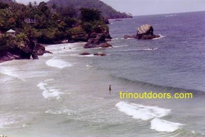
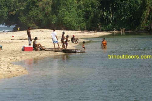
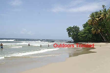
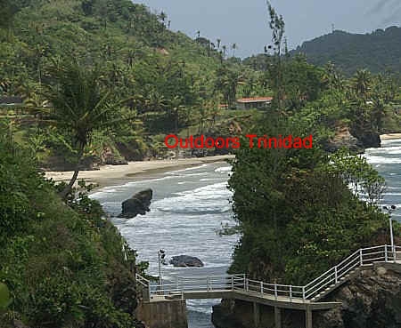
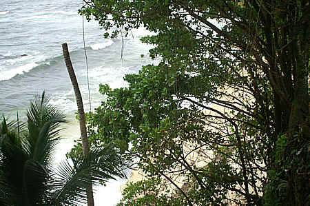
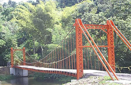
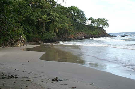
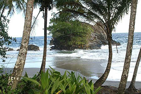
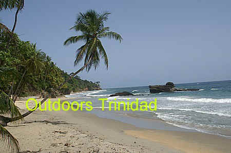
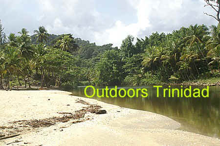
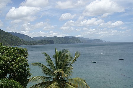
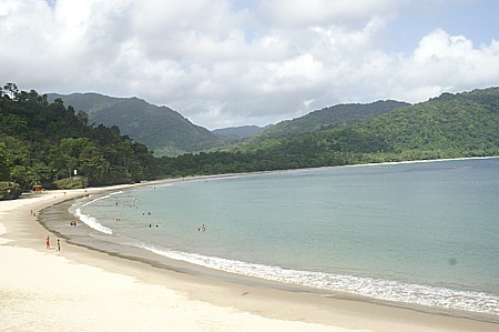
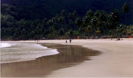
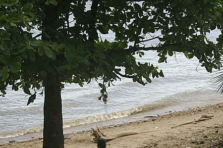
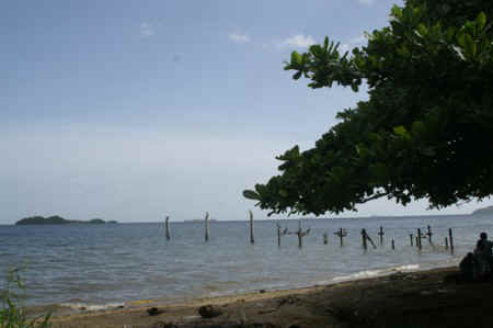
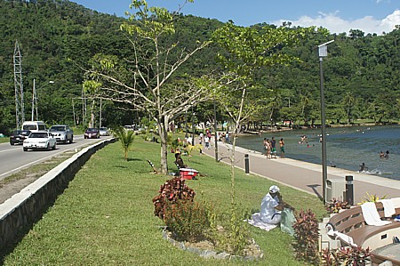
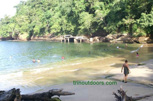
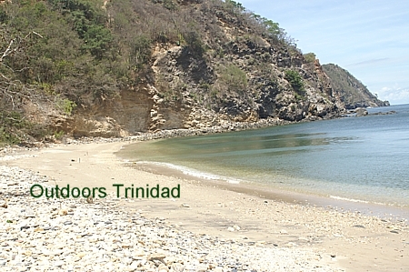
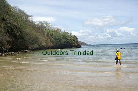
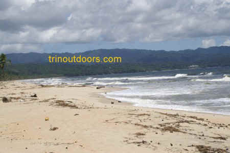
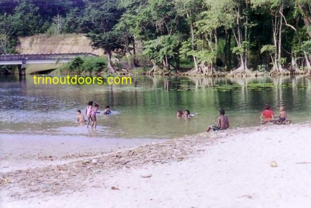
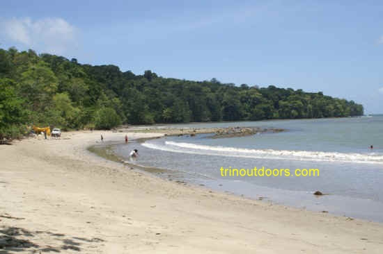
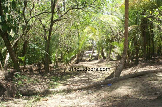
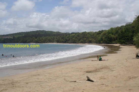
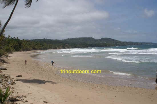
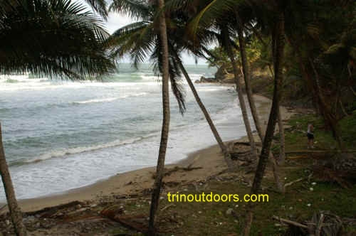
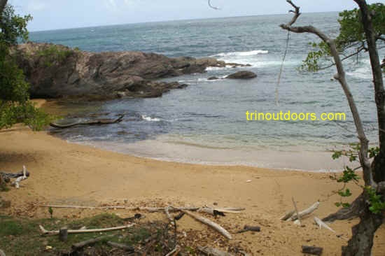
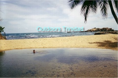
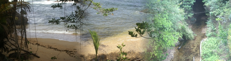
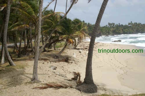
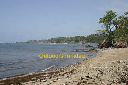
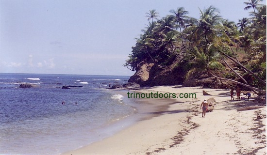
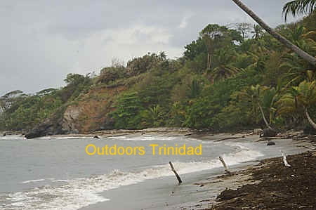
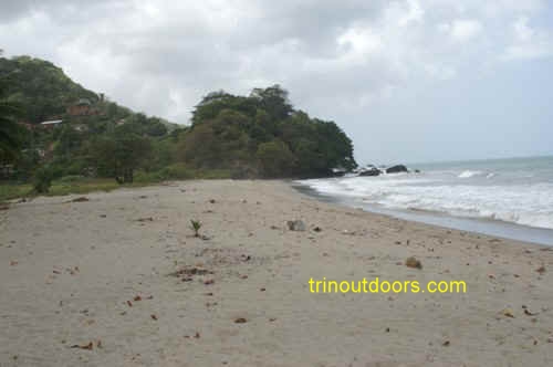
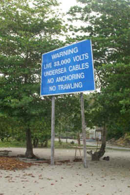
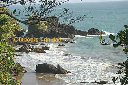
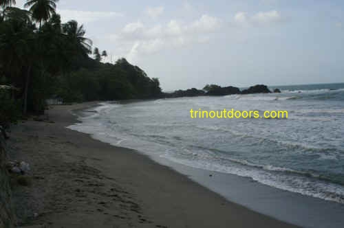
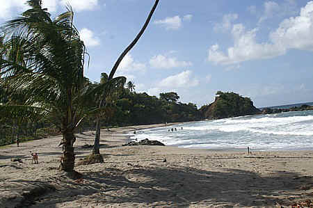
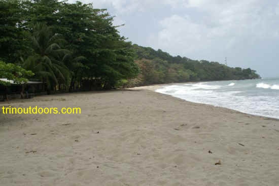
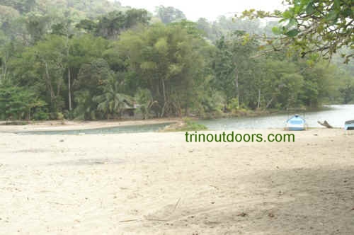
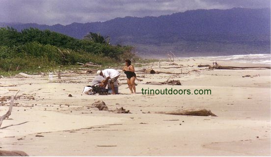
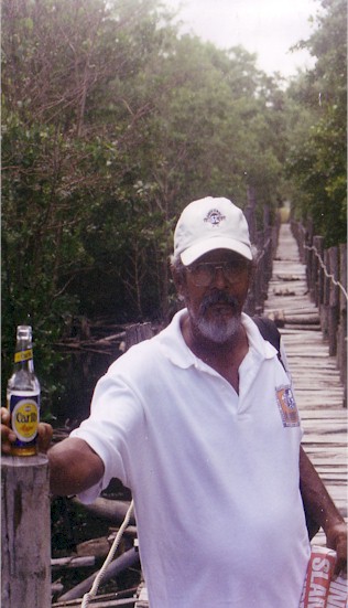
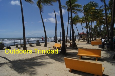
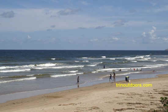
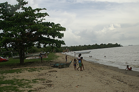
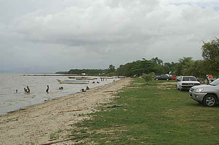
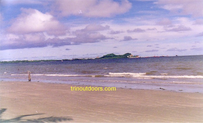
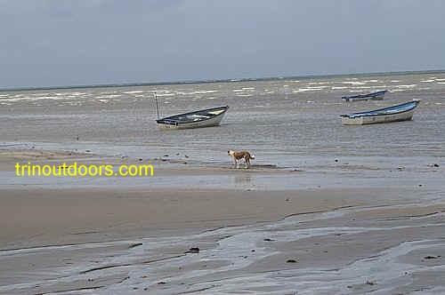
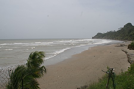
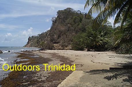
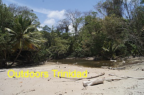
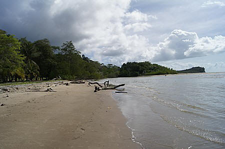
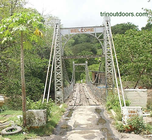
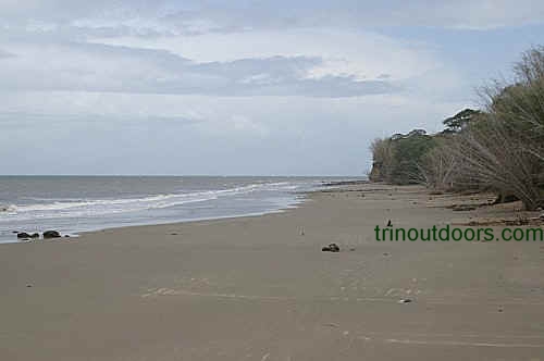
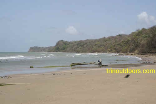
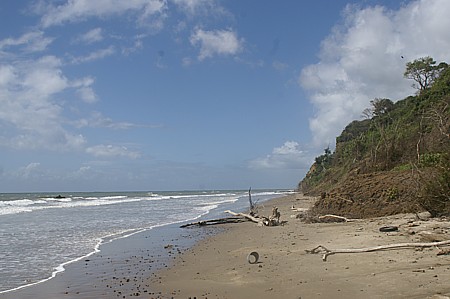
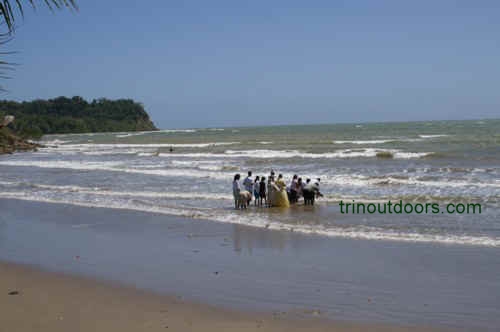
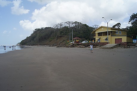
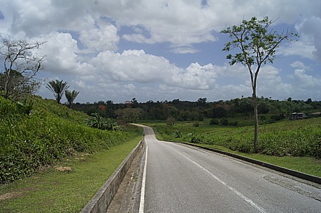
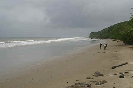
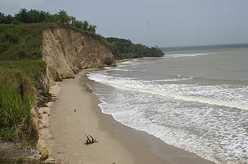
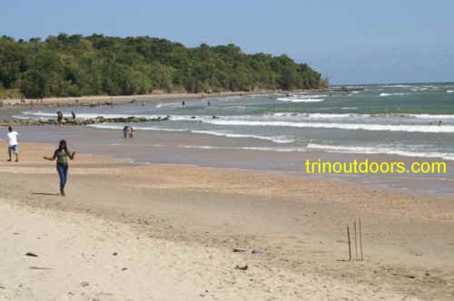
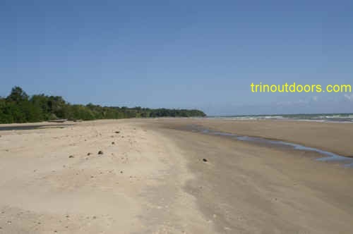
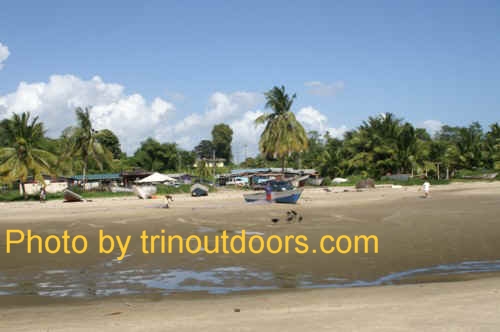
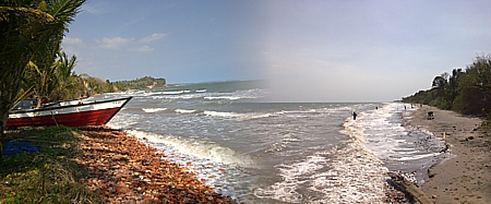
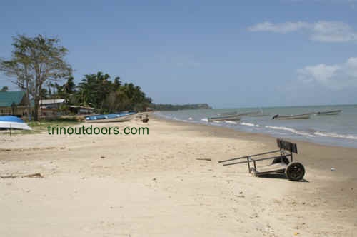
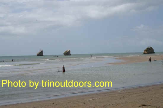
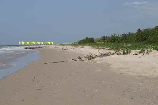
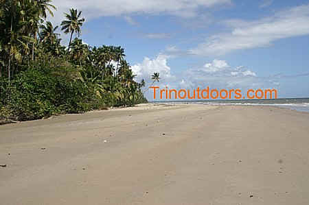
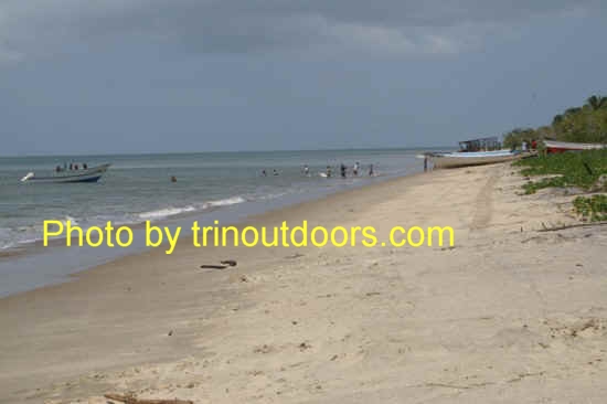
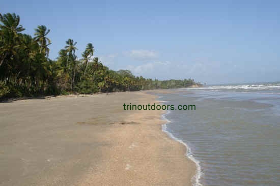
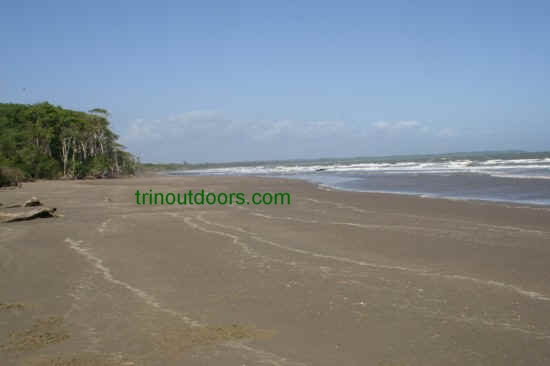
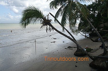
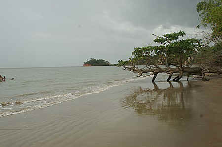
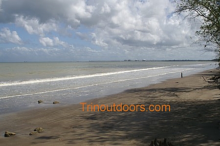
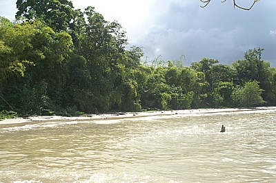
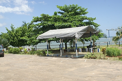
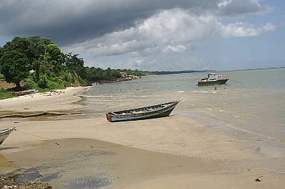
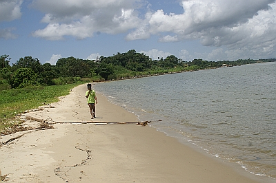
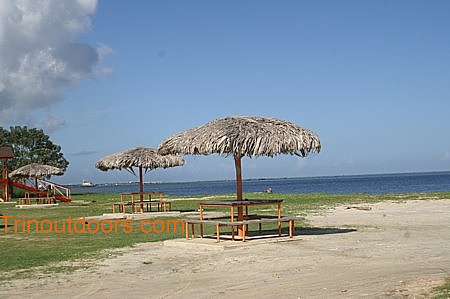
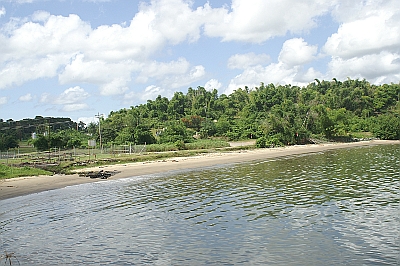
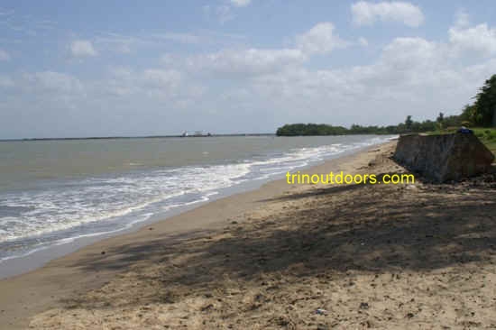
.jpg)