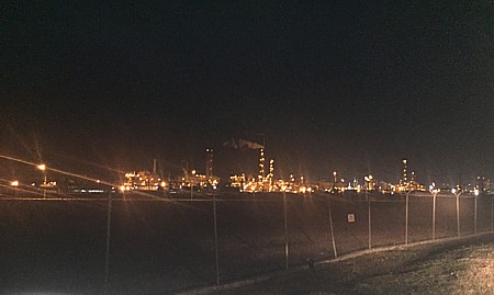
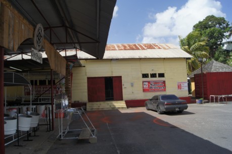
Trinidad has a wide variety of places to visit
that are of interest either because of their historical, geological or ecological
importance. Below we provide information on some of these places of interest. Clicking on
the place name in the listing will take you directly to the information on that place of
interest. Location information is provided for each place.
To find Natural Attractions
such as caves, mud volcanos, savannahs and the Pitch Lake, go to our Natural Attractions Page. Information on the various
waterfalls can be found on the Waterfalls Page, while the
Beaches Page provides information on the beaches of Trinidad.
To find the locations referred to on this page in the overall geographic space of
Trinidad, see the Trinidad Map.
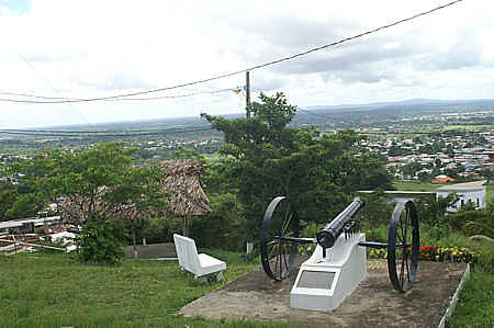
At the north eastern tip of Trinidad, east of
Toco, Galera Point is a rocky outcrop where the Caribbean meets the Atlantic Ocean. Thick
beds of quartzitic grits, which are very hard coarsely crystalline rocks, are intercalated
among the schists to form a conspicuous headland. It is said that in the 17th century
Amerindians threw themselves to their deaths from Galera Point rather than be captured by
the Spanish. It is the destination for Orisha devotees, celebrating the Olukun Festival
(Celebration of the Ocean), who on February 21 every year, start their pilgrimage from the
Port of Spain lighthouse. On December 7th 1941, in
the waters off Galera Point, two merchant ships carrying bauxite from Suriname were sunk
by torpedoes from a German U boat.
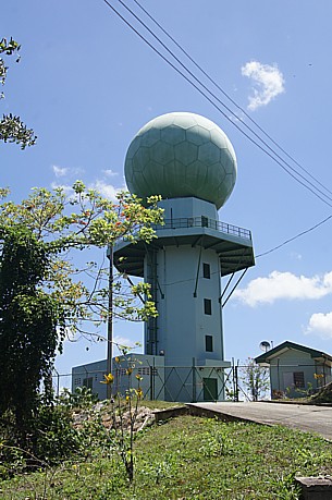
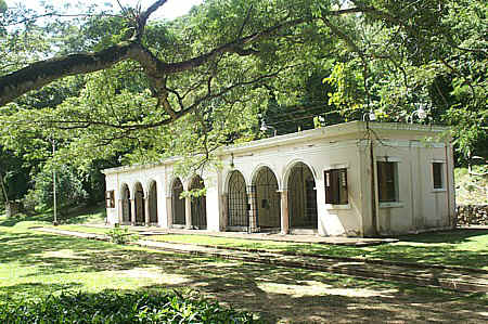
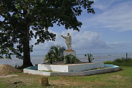
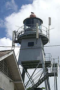
The Toco lighthouse, built in 1897, stands tall on a promontory
overlooking crashing waves. This lighthouse is a twin in design to the Chacachacare Lighthouse. On the Galera Lighthouse are the letters
VR and J which commemorate the 50th jubilee of Victoria Regina. At certain times the
lighthouse is open and with the permission of the lighthouse keeper you can ascend the
steps. A park and picnic area have been developed around the lighthouse. There are
numerous benches and picnic tables shaded by the spreading branches of almond and sea
grape trees. As a result of the constant northeast trade winds the vegetation like
chaparral is permanently bent to the south west.
The area around Galera Point is also significantly
historically as it is the area of the first English settlement in Trinidad.
In 1632, an English settlement was established in this area under Sir Henry
Colt. At the time Trinidad was a Spanish colony and they forbade other
nations from settling in their islands, so in March 1633, the Spanish
attacked and destroyed the settlement. This area was also the site of the
second English attempt to settle in Trinidad as in 1640 another group
established a settlement in the area. Despite surviving Spanish attacks in
1641 and 1643, the settlement was abandoned in 1645.
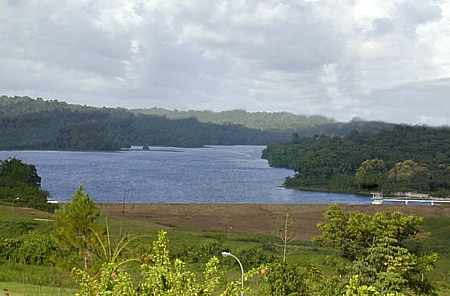
Chacachacare Island was named Chacachacare
by the Amerindians and is the westernmost of the Bocas Islands which belong to
Trinidad and Tobago. It lies in the Bocas del Dragón (Dragons' Mouth)
between Trinidad and Venezuela. Originally named El Caracol (the Snail) by
Christopher Columbus because of its shape, at various times Chacachacare has served as a
cotton plantation, a whaling station and a leper colony. Between the period 1777 and 1794,
cotton was the major agricultural export of Trinidad with Chacachacare being the largest
producer. Up until 1810 cotton was still the major crop being produced on the island but a
fall in prices and the boll weevil pest led to a decline in production.
The closeness of the island to Venezuela, being only seven miles from the mainland,
meant that there was frequent movement between Venezuela and Chacachacare, particularly to
the Venezuelan port of Guira. Venezuelan revolutionary Santiago
Marińo who was educated in Port of Spain and whose family lived on Chacachacare, used
the island as a base for his 1813 invasion of Venezuela.
By 1920, several hundred persons lived on Chacachacare, a school had been established
with approximately 60 students and a church existed at La Chapelle Bay. In 1921, the
government decided to establish a leper colony and appropriated all the land, forcing the
inhabitants to leave. All persons with leprosy were required to live at Chacachacare.
These patients were cared for by the Dominican Sisters and from 1945 by the U.S. Sisters
of Mercy. Ten sisters died during their time on the island and are buried in a cemetery at
Marine Bay on Chacachacare. The leprosarium lasted until the last patient left in 1984.
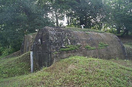
In 1943, part of the island was given to the US armed forces and a battalion of 600 men
was based on the island. They built nine military barracks, installed coastal defense guns
and built a road to the top of the 865-foot (260-meter) main peak. See our article on Former US Army Bases for more information.
This 900 acre island is 10 miles long (15
kilometers) and two miles wide at its widest. It comprises of eight beaches, a light
house, a saltwater pond and dramatic cliffs. At present the island is uninhabited and used
for camping and picnics with the most popular beach
being La Tinta Bay. The island is often visited by
yachts and there is a company that organizes day trips to the island plus water taxis will
transport persons to the island. Chacachacare Island has good anchorage at
Chacachacare Bay and La Tinta Bay on the west side.
If you land at Chapelle Bay there's a leisurely walk to the Salt Pond with lovely views of
the Caribbean Sea and Gulf of Paria. The Salt Pond made up of hypersaline water has marshy
fringes which promote the growth of peculiar trees like the campecho - the bread and
cheese tree.
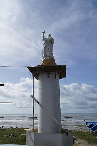
One of the attractions on Chacachacare is the Lighthouse, which is
identical to the lighthouse at Galera Point in Toco. The walk to the lighthouse is an uphill
hike along a paved road. It is possible to visit the buildings of the former leper colony
and from Perruquier Bay one takes the road to the Lighthouse and then turns right
immediately on the first bend as the road climbs uphill. The track to the former Leper
colony is narrow and proceeds along the side of the hill.
Various parts of the leper colony are still standing and as you enter Perruquier Bay,
the former doctor's house can been seen on the northern side in Rust Bay while the remains
of the nun's quarters can be seen on the southern side climbing the hills of La Chapelle
Bay.
These islands which are sometimes referred to simply as the Diego Islands, comprise of
two islets that lie between the Bocas Islands and the Five Islands.
Cronstadt (Kronstadt)
Carrera
These islands are composed of limestone being the remnants of a reef. They are a mile
west of the Five Islands and directly opposite Point Gourde in Chaguaramas. At the change
of the tides and when the there is a prevailing east wind, the currents between the
islands and Point Gourde is strong.
Kronstadt Island is eleven and three quarter acres and was previously
known as Begorrat Island. During the period 1850 to 1970, limestone was mined from the
island and it was also used as a holiday resort. Today the island is a Wild Life Refuge
and part is used for the processing of barytes for the oil industry.
It is believed that from approximately 1854 to 1875, Carrera Island was used as a
convict depot with the prisoners being used to quarry limestone
on Carrera Island and Kronstadt Island, that was used for road
building.In 1877 construction of a permanent prison was begun
which was completed in 1880. Carrera Island remains
today a prison island.
The Five Islands are a group of actually six small islands lying west of Port of Spain
in the Gulf of Paria. They are also known as Las Cotorras.
Caledonia Island
Craig Island (Craig and Caledonia are joined by a narrow reef)
Lenagan Island
Nelson Island
Pelican Island
Rock Island
These islands are the remnants of a raised reef and composed of limestone.
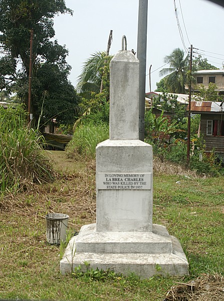
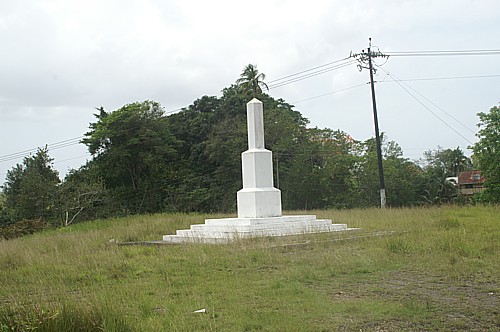
Nelson Island was used as a stop over poinnt by Amerindians from South America on their
way to trade in Trinidad at Mucurapo. Nelson Island is
however most famous as the disembarkation point and quarantine station for indentured
immigrants to Trinidad and Tobago during the period 1866 to 1917. During this period
2,645 Chinese immigrants and 114,000 Indian immigrants were processed through the island.
It is Trinidad and Tobago's equivalent of Ellis Island in New York. Those who had
contagious diseases were transferred to Lenagan island. The first buildings on Nelson
Island were actually constructed by the British in 1802 using slave labour. The buildings
formed part of a military facility and were the first buildings in Trinidad constructed of
brick and mortar.
During World War I, a gun emplacement was built at the eastern end of the island and a
causeway to Rock Island to the west. In the 1930s Nelson Island was used as a detention
center for prisoners, among them Tubal
Uriah Butler. During the Second Wold War, all persons with Austrian or German
passports, who were mainly refugee Jews,
were interred on the five Islands with the men being kept on Nelson Island and the women
on Caledonia Island. In the 1960's Nelson IIsland was used by the University of the West
Indies as a research station for marine biology. Nelson Island became a detention center
again in 1970 following the Black Power Revolution when 50 Black Power activists were
housed there. The former detention centers are still standing on Nelson Island. The name
Nelson Island actrually arose because at one point the island was owned by a Dr. Neilson
who practised medicine in Port of Spain.
Caledonia Island was an officially designated place for performing marriage ceremonies.
In 1840 Lord Harris spent his honeymoon on the island with his Trinidadian bride. On
November 13th 1957, Dr. Eric Williams (the first Prime Minister of Trinidad and Tobago)
married Dr Mayleen Mook Sang on Caledonia island.
In the early 19th century
Rock Island was used as a holiday home. It was first leased to T.F.
Johnston who subsequently sold it to Doctor R. Mercer. Dr. Mercer then gave
the lease as a present to Master Thomas Laughlin. During these times, a
house was built on the island and rented out to the public. By
1888, the island was being used as a quarantine depot for first-class
passengers of ships that may have highly contagious diseases. A flagpole was
placed on the island, which when raised with a yellow flag warned that the
inhabitants had a certifiable contagious disease, which barred public
communication with the island.
Gaspar Grande, also known as Gasparee Island is a mile and a half long by half mile in
width, totaling 129 hectares (319 acres) and reaches a height of 339 feet (103 metres).
The island is approximately three-quarters of a mile south of the Coast Guard station at
Staubles Bay. The island was granted to Gaspar de Percin la Roque in 1783 by Governor
Chacon and over time became known as Gaspar Grande. The island is today primarily a
vacation spot with numerous holiday homes
and its most famous attraction are the Gasparee
Caves.
Gaspar Grande has had an interesting past and the remnants of its past are other
reasons to visit. During the period 1826 to 1864, the island had a whaling industry with
Point Baleine, located on the western end, being a whaling station. The translation of the
French name "Point Baleine" means whaling point. At the top of the island are
the remnants of a Spanish fort constructed in 1796. During World War I, a 4.7 inch cannon
was installed on the ridge overlooking Point Baleine. During World war II another cannon
was installed on the ridge. At the end of the war, two 6 inch guns replaced the original
4.7 inch cannons. These guns are still present on the island and are a 25 minute walk from
Point Baleine.
Gasparee is a very dry limestone island with average annual rainfall of under 40
inches. It nevertheless has interesting flora and fauna. On the island can be seen
Saltfishwood and Naked Indian trees along with Silk Cotton and wild Balata trees.
Throughout the island cactus are found. There are a dozen species of lizards including the
Twenty-four hours, Turnip-tailed Gecko and Iguana. There are several species of insect and
fruit eating bats. There is also the Noctilio leporinus (fishing bat) which emerge at dusk
to skim the surface of the water to capture sardines. The bird population includes
Yellow-headed Parrots, Rufous-necked Wood-rails, White-tipped Doves, Golden Orioles,
Tropical Mockingbirds, Palm Tanagers, White-lined Tanagers, Copper-rumped Hummingbirds,
Rufous Night Jars and Pigmy Owls.
On some maps the road to Macqueripe Bay is shown
as the Macqueripe Mail Road and that is because prior to the British conquest, the mail
for Trinidad was landed at Macqueripe Bay, to avoid sailing through the Bocas, and then
brought overland along this road. On the Macqueripe Road can be seen the remains of St Chad's Anglican Church which
was built in 1850 and then rebuilt in 1875 and again rebuilt in 1915. Near to St Chad's is
the former village of Mount Pleasant which was created by the former slaves after
Emancipation. Throughout the village are various trees including mango, coconut,
breadfruit, citrus, sapodilla, banana and avocado. This must indeed have been a pleasant
place with all these fruit bearing trees and the La Cuesa River nearby.
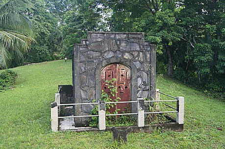
Throughout Chaguaramas can also be seen many of the buildings that were built by the US
Army when Chaguaramas was a military base during World War Two. In particular there are
numerous bunkers that are built into the earth. See our article on Former US Army Bases for more information.
Just off the Western Main Road in Chaguaramas, immediately after the Convention Center
and immediately before the Coastguard heliport lies the Chaguaramas Military History and
Aerospace Museum. Consisting of 12,000 square feet of indoor displays along with outdoor
items and memorials on a 4-acre site, the museum traces the military history of Trinidad.
Beginning with the Amerindians and coming up to the present day, this museum chronicles
both the raids and battles that took place in Trinidad along with the involvement of
Trinidadians in wars that took place in other parts of the world. The use of Trinidad as a
planning or staging area for attacks on other countries is also highlighted.
There is an extensive section devoted to the Conquistadors and the three hundred years
of Spanish rule, culminating in the British capture of the island in 1797. The exhibits
examine the British Colonial period of the Napoleonic Wars and its effect on South America
leading the visitor up to the end of the 19th century, tracing racing the History of
Military affairs on the island. The period of the First World War, through the Second
World War and up to Operation Desert Storm are showcased.
Within the museum are samples of the weapons used in each era and the
uniforms of the various military units. There are artifacts, models, photographs,
documents and vehicles on display. There are articles giving extensive coverage of each
period and personal mementos giving insights into the life and feelings of the
men-at-arms. The coverage is so wide and interesting that it is possible to spend
most of the day reading the articles.
Two of the highlights of a visit to the Chaguaramas Military History
Museum are the recreation of a pirate raid on St Joseph (the
former capital) and the recreation of the trenches of the First World War. As the visitor
walks through these recreations you can almost feel as though you are present in the
actual battle.
The Museum opens daily from 9am to 5pm and can be contacted at 634-4391.
There is a small admission fee.
This museum is located in the Diego Martin Valley which is named after the river that
flows through the valley and was discovered by the Spaniard Don Diego Martin de Baena. The
museum traces the history of the river and as a consequence the history of the valley. In
particular it looks at the history of agriculture in the valley and the diverse races that
were attracted to the valley. On its grounds still exists the original Water Wheel used for grinding sugar cane and some of
the cast-iron kettles used for boiling the sugar. There are numerous photographs showing
the importance of coffee and cocoa to the development of Diego Martin. The museum is at
the northern end of the valley on the Diego Martin Main Road, shortly after the
intersection with St. Lucien Road.
Just across from the River Estate Museum
is probably the only remaining complete water wheel in Trinidad.
Built of cast iron and installed around 1835, this wheel powered the
rollers that crushed the sugar canes from the River Estate lands. The water for turning
the wheel came from the Diego Martin River which flowed nearby. The water wheel at Diego
Martin is the undershot type where the water would flow under the wheel and in striking
the blades at the bottom of the wheel cause the wheel to turn. With many undershot water
wheels a flowing stream was often dammed in order to maintain a steady supply of
water for the mill; the dammed water would form a mill pond.
Today the river still flows nearby and the original walls for the water
retention pond are still standing, with the mill pond now an area for relaxation.
Bamboo_Cathedral
Along the Macqueripe Road in Tucker Valley Chaguaramas is an area that has been
given the name the Bamboo Cathedral. Here towering stands of bamboo gracefully arc over
the roadway to create an area that is almost cathedral in its ambiance. To find this
beautiful gift of nature, one takes the Macqueripe Road and just before the entrance to Macqueripe Beach there is a road on the right (eastern
side) that leads to the cathedral. There is a metal barrier that is usually closed but it
is easy to walk around either side of the barrier. Once around the barrier you are on the
road to the Cathedral. The Bamboo Cathedral has been in existence for over 150 years. Michel Jean Cazabon (b.1813 d.1888), Trinidad's great
nineteenth century artist and National Hero painted several watercolours of this area and
in honour of him the route has been named the Cazabon Trail.
The bamboo arcs over an old road that leads to a satellite tracking station on
the hill overlooking both Tucker Valley and the North Coast. The walk up the hill provides
an opportunity for vigorous exercise in the midst of a pristine natural setting. Some
persons eschew the uphill portion and visit the area simply to stroll with their children
or cycle along the lower portion and enjoy the sights and sounds of nature. Running
through the area and under the road are some dry river beds (dry for most of the year),
while on either side of the road behind the main bamboo arches there is a mixture of
bamboo and forest trees. Anyone who ventures off the roadway and among the trees is
rewarded by the sights of various birds and can sometimes be especially fortunate to see
the Trinidad Euphonia.
The walk up Morne
Catherine or to use its English name, Mount St Catherine, is a walk through
nature and history. Morne Catherine is the highest peak in the Chaguaramas
area at 539 metres (1,768 feet) and at the peak is a radar installation that
was used by the US Air Force to track the early space missions.
The route to the
top is along an old paved road known as the Cano Ventura Road and you can
walk the entire length or just a part and turn back at any time. One
enjoyable aspect of this walk is that coming back is downhill and easy. You
can ascend this hill at a rapid pace for serious exercise or take a measured
walk with little side trips whenever something catches your eye. Along the
route to the top are several World War II bunkers that are embedded into the
hillside. As you progress along the walk it is possible to see rock outcrops
that include some of the oldest rocks on Trinidad from the Jurassic,
Cretaceous and Miocene periods as well as limestone reef remnants from the
period when this area was under the ocean. There is a stream that descends
the mountain which is visible at various points along the route and at
certain locations it is possible to descend to the stream bed.
The walk up Morne
Catherine takes you through tropical evergreen forest and all around are
specimens of Trinidad's wildlife that are easily seen once you are quiet.
Indeed Mount St. Catherine is a birding hotspot with a wide variety of bird
life. At times it is possible to see Green-rumped Parrotlets (parakeets) at
the very start of the walk, while along the way you may spot Trogons,
Toucans, Turquoise and Blue-headed Tanagers, Blue Dacnis. An interesting
side trip is the trail into Crestt Lands (Center for the Rescue of
Endangered Species of Trinidad and Tobago) that is on a bend on the left and
is reached after approximately 15 minutes walking. This trail is
approximately 0.5 miles long and venturing into this area where the forest
presses closer in can sometimes give you the opportunity to see the Squirrel
Cuckoo and Blue-crowned Motmots and almost always allows you to see a Ruby
Topaz Hummingbird. In the evenings Orange-Winged Parrots are easily visible
overhead. Another highlight of the Morne Catherine area are the monkeys that
roam above in the bamboo and treetops. White-faced Capuchin Monkeys are
sometimes seen in the early morning hours and Howler Monkeys if not seen are
certainly heard in the area.
For some
individuals the most enjoyable aspect of Morne Catherine is at the top,
where apart from exploring the old radar installation there are panoramic
views of Tucker Valley, the Gulf of Paria and the offshore islands, and
Trinidad’s north coast.
The route
to Morne Catherine is easily found as you simply take the second street on
the right after the Chaguaramas Convention Center (just opposite the
Chaguaramas Military History
Museum). There is a gate at the start of the hill that is sometimes
locked to prevent vehicles accessing the route but walkers can simply walk
around the side of the gate.
Many individuals who visit the Diego Martin Valley never realise that the ocean is
literally just around the corner. However the northern end of the valley overlooks the
Caribbean Sea and ships approaching Trinidad from the north can be clearly seen from its
ridges. The Spanish governors recognised the strategic importance of this and established
an observation post on a 741 foot ridge that has come to be called North Post. After the
British capture of Trinidad in 1797 they were concerned about attempts to retake the
island and also about attacks by the French. As a result in 1804, the
British Governor, Brigadier-General Sir Thomas Hislop began creating a series of
fortifications around Trinidad that included Fort Abercromby,
Fort George and on Cumberland Hill. North Post was made into a
signal station, which through the use of flags could send signals to Fort George, which in
turn would relay the message to the officials in Port of Spain. With the passage of time,
the defensive role of North Post subsided and eventually it became the site for a marine
radio installation that allowed ships at sea to communicate with Trinidad. The
communications role of North Post continues to this day with TSTT having an installation
on the site of the original observation post.
In addition to being a place of interest through its historic
significance, North Post provides magnificent views of the Caribbean Sea and the rugged
coastline of our North Coast. During the annual Great Race (powerboat race from Trinidad
to Tobago), crowds gather on the ridge to see the boats as they race along the coast. On a
clear day the island of Grenada can be seen from North Post. This location is also the
start of a hike to Macqueripe. To get to North
Post you proceed along the Diego Martin Main Road, going past the River Estate Museum to the end of the road.
Just off the Western Main Road opposite Westmall sits an old roofless
building in the midst of several acres of land.
This building is all that is left of the pump house that
was situated on
what was known as the Cocorite Farm. This pump house was the work of Charles
Arthur Richards Farrell who was the first local city engineer. According to
Rosemary Stone, his grand-daughter, Farrell was “the fifth child of an Irish
army officer and a half Carib girl from the Hazel family. Farrell was a
brilliant student of Queen’s Royal College (QRC), winning the Island
Scholarship twice. The first time he was 16 and it was found the scholarship
could not be awarded to him as he was too young. The next year he came first
again and chose to study engineering at Edinburgh University. On his return
to Trinidad he worked for a short period as a land surveyor until he was
appointed Port of Spain city engineer. He was the first local to hold that
post”.
Running the entire length of the Diego Martin Valley is a large natural
underground water aquifer known as the Diego Martin Gravels. It is this
aquifer that Charles Farrell drilled to obtain potable water. According to
Issa Hosein, in the early 1900’s the area at the southern end of the aquifer
was swamp land and there was a 33 acre parcel of land that was known as the
Cocorite Farm. The Cocorite Farm was owned and operated by the predecessors
of the Corporation. Income from the Cocorite Farm came by means of the sale
of copra and grass, rents, other miscellaneous receipts, and, the major
revenue earner was from “waterworks”, namely the water wells and the pump
house on the farm. In 1965 WASA took over the water production function of
the Corporation and continued to operate wells and the pump house on the
Cocorite Farm till around 1980. By then, due to the urbanisation and
development of the area and its proximity to the sea, salt water intrusion
caused the water from the aquifer in the area of the Cocorite Farm to become
brackish and unfit for use as potable water. WASA then ceased all water
production from the Cocorite Farm.
Commanding the heights overlooking St James lies Fort George. Built by the
British in 1804 as part of a series of fortifications that included Fort Abercromby, North Post and
fortifications on Cumberland Hill, Fort George was considered the last major defense
before the Port of Spain Harbour. From its height of 1,200 feet, artillery shells could be
lobbed onto ships attempting to enter Port of Spain Harbour or land at Mucurapo. The
British understood the importance or preventing a landing at Mucarapo as that was their
landing point for their invasion in 1797. Mucurapo was also the landing point for the Spanish conquistador Sedeno in his invasions of Trinidad in 1531. The
British constructed several batteries for their cannon rising up the hill. Today there is
an apartment complex on the hill that is called The Battery as a result. The ordinances
(ammunition) for Fort George were kept at Cocorite during the 1820’s and would have
given rise to the name, Powder Magazine, now bestowed on part of the area.
According to the historian, Michael Anthony, the construction of Fort George was
overseen by a Mandingo Muslim, Jonas Mohammed Bath. Before building the fort he had to
construct a road up the hill and it is believed that the present road called Fort George
Road was the route used. When constructed the fort was originally called Fort Vigie and
the name later changed to Fort George in honour of King George III.
Fort George never experienced any military action and ceased to be a military
establishment in 1846. It was then converted into a signal station.
The design of the signal station was done by Prince Kofi Nti, son of King Kofi Calcali of
Ashantee, West Africa. He arrived in Trinidad on July 1, 1881, having become a ward of the
British Government after a war against the Ashantees in 1872 and was assigned to the Works
Department. In 1964 Fort George ceased operating as a signal station.
With cannons framing the entrance driveway and a row of
Royal Palms along the center, the Trinidad
Military Cemetery is peaceful and quiet giving true meaning to the term Rest
in Peace. Located in the St. James area of Trinidad on Meerut Street, just
off Long Circular Road, the Military Cemetery is between Long Circular Mall
and the Crematorium, immediately before Camp Ogden.
The Military Cemetery was consecrated in 1828 and contains graves from the
1800's to the present time. As would be expected the cemetery contains the
bodies of local military personnel and given that it was created in 1828 it
also has English military personnel as a result of Trinidad's colonization
by England. There are however also English servicemen from World War II and
among them are ALGAR, ROBERT HENLEY, GREGORY, MAURICE WILLIAM, THOMSON,
JAMES and WHITFORD, ALAN. All four died on 25th January 1945 when their
Reliant aircraft crashed in Brasso Seco. American military staff who
were based in Trinidad during World
War II are also buried there. Interestingly there is the tomb of Sergeant
Bispo dos Santos Segundo of the Brazilian Navy who was killed during World
War II. The
Brazilian navy had ships based in Trinidad for escort duty between Trinidad
and Rio de Janeiro during World War 2. There are also three
Australian service men who rest in the cemetery, PLTOFF Alan Arthur Morris,
FLGOFF Geoffrey Thomas Risbey and FLGOFF Jack Walker. At the time of their
death all three Australians were members of the Royal Air Force’s (RAF) 53
Squadron, a squadron flying anti-submarine patrols from Trinidad to protect
the eastern seaboard of the United States from German U-boats following the
entry of the United States into the war.
The cemetery opening hours are Monday to Friday from 09:00 to 13:00. The
cemetery is locked at all other times, including weekends.
Out of hours opening can be arranged by contacting Robert Agie of the
Trinidad and Tobago Defence Force well in advance of the intended visit on
Tel: +1868 771 4223 or E-Mail: donagie@hotmail.co.uk
Located in the Port of Spain suburb of St James is a compound fondly known as The
St James Barracks or more simply as The Barracks. To most people the St James Barracks is
associated with the Police Service as it houses the Police Training School and every
police officer certainly from the 1930’s to the present (2008) has attended that
institution in order to join the Police Service.
The St James Barracks however was not always a police institution. Governor Woodford
purchased the land on which The Barracks sits in 1819 for 3,133 pounds. This compound was
constructed between 1824 and 1827, when the British colonial government spent 80,000
pounds to build St James barracks. It was built to house the York and Lancaster Regiment
that had been stationed in Trinidad since the time of the British conquest in 1797. In the
beginning the troops were stationed at the Orange Grove Barracks, which was located in the
area that is now occupied by the Port of Spain General Hospital. In 1827 these troops were
moved to the newly constructed St James Barracks. The compound was named after the
colonial office in London, which at the time was known, as the Court of St James. On 10th
January 1888 at 8.55am in an earthquake that lasted about 40 seconds and was felt
throughout the Caribbean, the structures at the St James Barracks were damaged. For a
short while the troops pitched tents and camped outside. Eventually however repairs were
conducted and the troops returned to the Barracks. In 1890 the York and Lancaster Regiment
departed from Trinidad and The Barracks was handed over to the Trinidad government. The
Police Service then established a training school at the Barracks to train police officers
in the use of firearms. By 1903 the Police Force had moved part of its operations from its
headquarters on St Vincent Street to the St
James Barracks, thus beginning the long association between the Police and this compound.
One of the features of Police life is that the head of the Police Force lived at the
headquarters and so when the police moved to St James Barracks, the residence of the
Commissioner of Police moved to the Barracks.
Today the construction within and around the Barracks does
not allow more than a glimpse of the original buildings. The Commissioner’s residence
however can be clearly seen and provides a lovely external view of colonial (Georgian)
architecture.
The building
known as Roxy graces the eastern entrance to the Port of Spain suburb of St
James. The Roxy was constructed by Timothy Roodal and opened in October
1934. The building was primarily constructed as a cinema with a seating
capacity of nine hundred but also served as a theater and concert hall.
Prior to the building of the Queen’s Hall, Roxy Theatre in St James was the
venue for the Music Festival, as it was for many other events that required
the use of a theatre/concert hall, with the first Music Festival being held
at the Roxy. Another historical music festival that was held at Roxy cinema
occurred in the 1950s where Dixieland won the competition, playing 'Agnus
Dei' and outplaying Invaders steel orchestra who played 'In a Monastery
Garden'.
The beauty of
the architecture of the Roxy and what makes the building stand out is its
entrance of double columns of the Corinthian order. In the 1980's the Roxy
ceased to function as a cinema and was sold to Prestige Holdings Inc. and
now houses the largest Pizza Hut branch in the Caribbean. Although it has
been converted to a Pizza restaurant the exterior of the building still
exhibits the beauty of its original creation.
At the corner of Murray Street and Baden-Powell Street in
Woodbrook is a building that serves to remind us that the area known as Woodbrook was not
always the combination residential and commercial area that we know today. Indeed at the
time of the British conquest of Trinidad in 1797, Woodbrook was a sugar cane estate of 367
acres owned by Henry Murray (after whom Murray Street is named).
In 1838 Murray advertised the estate for sale and in 1840 it was bought by
the Scottish company W.F. Burnley of Glasgow. W.F. Burnley & Company went into
liquidation in 1899 and Woodbrook Estate was put up for sale. In 1875 the three Siegert
brothers, Carlos Damaso, Alfredo Cornelio and Luis del Carmen, moved their business, Dr
J.G.B. y Hijo, from the town of Angostura (now Cuidad Bolivar) in Venezuela to Port of
Spain. That business was the manufacture of Angostura Bitters. At the time the business
was prosperous and the Siegert brothers purchased the entire Woodbrook Estate for
Ł50,000. The Siegert brothers then began to develop the estate as a housing development,
naming many of the streets after themselves and their children. Streets like Alfredo, Ana,
Alberto, Cornelio, Carlos, Gallus, Luis, Petra and Rosalino. Carlos died in 1903 and the
firm passed to Alfredo. Unfortunately Alfredo made many bad investments and in 1911 he was
forced to sell Woodbrook Estate to the Government for Ł85,000, and also to give his
Angostura share-holding as security for the loans he had incurred. When Alfredo died in
1919, he owned nothing. All his family's wealth had been lost.
The building which now stands at Number 44 Murray Street, at the corner of
Murray and Baden-Powell Street is a reminder of the days when Woodbrook was a sugar cane
estate being converted into a residential area. It has been said that the building was a
tax collection centre for the payment of land taxes. There is some doubt however as to
whether the original intent of the building was for the collection of taxes as the
building was constructed in 1907 when Woodbrook was still owned by the Siegerts. When the
Siegerts began the development, the land was given to prospective homeowners on leases
varying from 30 years to 99 years. Indeed most of Woodbrook is still leased land. It is
therefore likely that the building was originally used for the collection of land rents
from the persons who had constructed homes in Woodbrook. At a later date it may have been
converted to the collection of land taxes, which were paid at that office until 1998.
Behind the building is the Augustus Williams Playground (formerly known as Siegert Square)
which was named in honour of Augustus Williams who was a former mayor of Port of Spain.
According to Lynne Macedo in her paper. "The Impact of Indian Film in
Trinidad", an advertisement appeared in The Mirror newspaper during February 1900
that promoted a nightly programme of live entertainment in the Princes Building, Port of
Spain, that included moving pictures. By 1905, there were regular exhibitions of moving
pictures in Princes Building. The Princes Building however was host to all the major
theatrical and operatic productions that took place in Trinidad, so exhibitions of moving
pictures were a sideline activity. The demand for moving pictures was so great that on 2nd
February 1911, the first full time cinema was opened in Trinidad by Marcus and Reginald
Davis in partnership with Lanky Belasco. These first moving pictures were really still
photographs that were flashed across the screen and they were silent pictures with musical
accompaniment being provided by Lanky Belasco on a piano.
That first cinema was called the London Electric Theater and it was located
at the corner of French Street and Baden-Powell Street in Woodbrook. Over time the name of
the cinema was changed to the Astor Cinema and it became one of the most popular cinemas
in Trinidad. Unfortunately changing tastes in the population led to the decline of the
Astor and in 1995 it was closed down and converted into a church. Although converted to a
church, the building still stands today.
The Queen’s Park Oval is the Mecca for cricket in Trinidad and Tobago and is
situated in Port of Spain on a property bounded by Tragarete Road, St Clair Avenue,
Elizabeth Street and Havelock Street. It is one of the largest cricket grounds in the West
Indies with a capacity for 25,000 spectators and is the most picturesque of the West
Indian cricket grounds. The Oval, as it is fondly called, is owned by the Queen’s
Park Cricket Club which was founded in 1891 and which played cricket at the Queens Park Savannah. In 1896, the club applied for and
was granted a lease for the property that has become the Queen’s Park Oval. By 1897,
the Oval was hosting international cricket with an English team under Lord Hawke. In
addition to cricket, the Oval has also hosted numerous international football matches.
Aside from
sporting activities, the Queen’s Park Oval has now become one of the best places for
viewing art by Trinidad and Tobago artists. Along the exterior walls of the Oval are hung,
huge paintings depicting scenes and re-creations of Trinidad and Tobago life. The Oval
walls are now like a giant free outdoor art gallery. Lighted at night, these paintings can
be viewed at any time. To get the full effect of each painting, they are best viewed from
across the street.
In the Western Cemetery of Port of Spain (also called the Mucurapo Cemetery) on the
eastern side of the cemetery are a series of graves lying side by side each other, that
are neatly kept. At any time of the year that you visit this cemetery these graves are
well maintained, with all the head stones having a constant coat of white paint. On
examining the head stones you will note that the individuals were buried between 1931 to
1950, with a few more recently. You will also note that the persons interred in these
grave came from Romania, Poland, Jerusalem, Germany, Czechoslovakia, Moscow, Austria and
Croatia.
If you ever visit this section of the cemetery you will notice another aspect of these
graves, all the deceased are Jewish. These are the graves of the "Calypso
Shtetl" and "The Calypso Jews".
Trinidad’s first major Jewish immigration was in the late 1700's,
however through intermarriage and emigration this Jewish population died
out. In the late 1800's, another group of mostly Portuguese Jews and some
from Curacao came to the Trinidad and again through intermarriage and
emigration this Jewish population died out. Then from 1936, with the rise of
Nazism and its attendant Anti-Semitism in Germany and Eastern Europe an
influx began. By 1938, 125 Jewish immigrants had arrived and by 1940 it was
6,000
Jews. Developing a life for themselves in Trinidad they began calling themselves
"Calypso Shtetl" and "The Calypso Jews".
Shortly after Britain’s entry into the war in 1939, all Germans and Austrians were
considered enemy aliens, and these Jews who had fled from Hitler but were Germans and
Austrians were rounded up and interned. At first they were placed in camps on Nelson and Caledonia islands and the later in camps at what would
become Federation Park and Ellerslie Park.
It is these individuals, refugees from Hitler, who are buried in the Mucurapo
Cemetery, in an area reserved for Jews, known as the Bet Olam section. The
Religious Committee of the Jewish Association purchased and consecrated a
section of the Mucurapo Cemetery in 1939 and the first burial took place on
30th May 1940. The deceased, Eva Gandelman, was born in Roumania and arrived
in Trinidad in the early 1930s.
Having a separate section of the cemetery for Jewish persons was not
easily gained. Several of the councilors of the Port of Spain City Council
had objected to the application on the grounds that it would create
segregation in the society. The Religious Committee had responded stating
that they did not want segregation especially given the discrimination and
persecution that they had escaped from but rather it was to allow them to
follow the religious rites laid down by their religion. Their request was
eventually granted that they were allowed to purchase a section that catered
for 250 graves.
And the maintenance of the graves?
Trinidad’s only surviving member of this 1930’s refugee influx, Mr. Hans
Stecher, who came to Trinidad as a refugee child, did it until his death at
90 in 2014.
The Museum of the Trinidad and Tobago Police Service chronicles
the history of the police service from its formation in 1859 to the present day. The
development of the various arms of the service, biographies of past Commissioners of
Police, changes in uniforms over the years and significant moments in Police history are
all outlined in this small museum. There is even a diary recording the apprehension of
various criminals in the 1800's.
The Museum is located in the former
Police Headquarters building on St Vincent Street, Port of Spain and is open on
Tuesdays from 10am to 6pm and on Saturdays, from 10 am to 3 pm. Admission is free and
guided tours are available.
The Central Bank Money Museum is located on the ground floor of the Eric
Williams Financial Complex, Independence Square, Port of Spain (known locally as the Twin
Towers), and is open from Tuesday to Friday. Guided tours take place twice a day, at 9.30
am and 2 pm. Special tours can be arranged. Admission and tours are free. For more
information, call 625-2601 ext. 2400 or 2120.
The Eric Williams Financial Complex
was officially opened on March 29th, 1986. As the Twin Towers are located on
reclaimed land and Trinidad is susceptible to earthquakes, special architectural designs
had to be done for these two, twenty-two story towers. Dr Rollin Betrand in an article
called A GEOLOGICAL WALK AROUND INDEPENDENCE SQUARE PORT OF SPAIN, TRINIDAD outlined the
measures. "1900 piles were driven to an
average depth of 80' with 560 below each tower. The pile cap under each tower is a
cellular raft' which is a combination of 9' x 6' beams and an 18" slab. All columns
on the towers are tied to this as water storage for the building is also located in the
basement for additional dead weight. The cross braces and the core walls in each of the
towers were designed to resist earthquake forces with the former taking 15% of the forces
and the latter taking 80-85%".
Nestled on the southern side of Port of Spain is a small museum that traces the history
of the city of Port of Spain. Located on South Quay, this museum is housed on the grounds
of the former Fort San Andres. Early records indicate that Fort San Andres was established
some time before 1777 as a gun battery on an island in the Port of Spain harbour. During
the reclamation work of 1832 that portion of the harbour was filled to create solid land
and causing Fort San Andres to be landlocked.
The Museum is open between 9am to 5pm from Tuesday to Friday. The history of Port of
Spain is outlined from its beginnings as the Amerindian (Arawak) village that Walter
Raleigh saw in March 1595 to the present day. Through the use of storyboards with numerous
photographs, significant events are brought to life. Individuals who were prominent in the
life of the city are featured and there are several artifacts from the city. On the
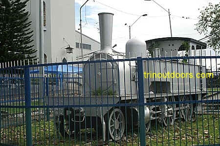
grounds of the museum is the boat used by Harold and Kwailan La Borde,
two Trinidadians who circumnavigated the globe during 1969 to 1973. There is also one of
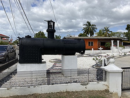
the locomotive engines from the days when Trinidad operated a rail system. Across from the
museum is Citigate the site of Trinidad's first rail station.
Established in 1892 as the Royal Victoria Institute, the National Museum and Art
Gallery is situated at the top of Frederick Street in Port of Spain, opposite Memorial Park and just south of the Queen's Park Savannah. The building was called the
Victoria Institute in honour of Queen Victoria.
The Institute was used for drama
and musical entertainment.It was destroyed by fire in 1920 and
rebuilt in 1923. In 1958 the
Institute was used for the first sitting of the Federal Court of the
Federation of the West Indies. In 1965 it became the National Museum and Art
Gallery. The Museum is open to the public Tuesday to Saturday 10 a.m. to 6 p.m.,
and Sunday 2 p.m. to 6 p.m.
The Museum manages a collection of some 10,000 items, including a collection of
paintings by Michel-Jean Cazabon. Among the many items on display in seven major
galleries are petroleum and geological exhibits, the permanent national art collection,
and a small gallery on Trinidad's Carnival arts. Periodically the museum hosts exhibitions
by visiting artists. On its grounds is a pillar erected in January 1918 to mark the site
of the Toll Gate which was discontinued in 1878.
One section of the Museum is
devoted to Calypso and Soca. There are photographs, newspaper articles, snippets of
calypso history, vinyl records, stage clothes of famous calypsonians and other calypso
memorabilia. This section of the museum lists all the Road March winners from 1932 to the
present and all the Calypso Monarch winners frm 1939 to the present. You can also see a
listing of the winners of the International Soca Monarch crown from 1993 to today and the
winners of the Chutney Soca Monarch competition from 1996 to today.
Another section of the museum is devoted to painting by Jean
Michael Cazabon who has been declared the National Painter. Jean Michael Cazabon was
born on September 20, 1813 on Corynth Estate, North Naparima, on the outskirts of San
Fernando. His parents, owners of a sugar plantation, were "free coloured"
immigrants from Martinique, who came to Trinidad following the Cedula of population of
1783. In 1826 at the age 13 he was sent to be educated at St. Edmund's College, Ware,
Hertfordshire, England and returned to Trinidad in 1830. In 1837 his mother sent him to
France to study art. In 1848 he returned to Trinidad with his wife and two children.
Cazabon soon became popular as a society painter, not only with his paintings of Trinidad
scenery, but also with his portraits of the planters and merchants of Port of Spain and
their families. He taught art, and provided illustrations of local events for English
newspapers. In 1851 he published a series of eighteen lithographs, "Views of
Trinidad, 1851". In 1857 he published a second series of eighteen lithographs of
local scenes, "Album of Trinidad". In addition to these lithographs Cazabon
painted numerous other scenes of Trinidad. In 1888 while painting he suffered a heart
attack and died. It is through Cazabon's paintings that we get a clear picture of Trinidad
in the 1800's.
Beginning in 1846 the Eastern Main Road was converted to a Toll Road and anyone
desirous of travelling from Port of Spain to Arima had to
pay a toll for using the road. At the time it was the main mode of transportation for
travelling to the east of Trinidad and remained so until the opening of the railway in 1876. Even after the railway it held a pre-eminent
position, as it was the only road route for eastern travel, until the construction of the Churchill-Roosevelt Highway.
The tolls on travel on the Eastern Main Road remained until 1878. In 1918, a Toll Gate
Monument was erected to commemorate the Toll Gate. Today that monument can be seen on the
grounds of the National Museum.
Memorial Park was created to honour those individuals from Trinidad and
Tobago who died in the First World War from 1914 - 1918.
The sculpture was unveiled to the public in June 1924 and in its foundation
was placed documentary records of those who had died. After the Second World
War 1939 - 1945, the names of those soldiers were
added to the memorial.
Located between
Frederick and Charlotte Streets, just below the Queen’s
Park Savannah and across the street from the National
Museum, the park is a peaceful place on most days with the four walkways leading
to the Cenotaph at the center.
At the base of the cenotaph inscribed on bronze plaques are the names of
those who died in the wars and the branch of the armed forces in which they served. Also
inscribed are the names of those who served in the British West India Regiment. The park
is an ideal setting to sit and reflect on the fortunate circumstances in our lives as
there are benches along the walkways and flowering trees around the perimeter.
The Queen's Park Savannah is the oldest recreation ground in the West
Indies. The history of the Queen's Park Savannah is that
this site was formerly the St. Ann's Estate which was purchased from the Peschier
family by the City Council in 1817 for 6,000 pounds. A small section of the site was reserved by the Peschier family as a
burial ground for family members and remains so to this day. In the
early 1800s the Savannah was not envisioned as an area for recreational pursuits but was
purchased as part of the estate for the governor's official residence and as a public
pasture for grazing domestic stock. The Governor's residence
was never constructed on the land but eventually on property to the north of the Savannah.
Eventually the land was converted into a park for recreation at a cost of
10,363 pounds.
During the early 1900's an electric tramway
provided a "scenic tour" (4 km) around the perimeter of the park at 2 cents per
trip and it was not until 1950 that this facility was removed due to the protests from
citizens who claimed that the tram added unnecessary noise and congestion to the otherwise
peaceful ambience.
The area known today as the "Hollows" was in 1841 a reservoir
that had been dug for the purpose of supplying Port of Spain with water. The water was run
from the St Ann's River through a channel in the Botanic Gardens that is now known as
Nutmeg Ravine.
In
the midst of the Queens Park Savannah there sits in quiet solitude a stone
walled enclosure framed by the hills and the rising corporate structures.
That
quiet solitude, broken only by the sound of steel bands and revelers at
Carnival time, is indeed fitting as this enclosure is a cemetery where
hopefully the souls of those interred there rest in peace.
The Peschier family were Hugenots who originally lived in the south of
France. Huguenots were French Protestants who were inspired by the writings
of John Calvin and endorsed the Reformed tradition of Protestantism. As a
result of religious persecution from Catholics the family moved to
Switzerland. Eventually one of the sons, Jean, migrated to Grenada and was
later joined by another brother, Henry. Together they owned an estate called
Bon Chance and also became merchants in the capital, St Georges. According
to Father Anthony De Verteuil in the book Trinidad's French Legacy, "due to
the unsettled political situation in Grenada and the scourge of ants and
encouraged by his wife's cousin who was a friend of Roume de St Laurent,
Henry decided to emigrate to Trinidad".
Thus in 1781 Henry arrived in Trinidad and was granted 179 acres at the
entrance to the valley of St Anns under the Cedula de Populacion. Henry's
mother in law was granted 53 acres north of Henry's and his wife was given
40 acres north-east of her mother. In 1785 a further grant of 33 acres was
given to Henry. Together these grants were call Paradise Estate and planted
in sugar cane. Henry's brother Jean was granted 523 acres in Naparima along
the Guaracara River in the Pointe-a-Pierre area and Henry also bought land
in Naparima.
In 1786, Henry's two oldest sons died of yellow fever and then Henry died in
1791. The estates were then managed by two of Henry's nephews. By the
beginning of the 1800's the price of sugar fell and the estates ran into
financial difficulties. In 1817, Henry's wife, Celeste died and the family
decided to sell the estate. Governor Ralph Woodford had been had looking at
the location of the estate and considered its location to be a healthy
locale and so convinced the Cabildo, the colony’s governing body, to
purchase the estate which was done by Registered Deed no. 1219 of August 18,
1817 for the sum of Ł6,000, to be paid in three installments of 2,000
pounds.
The sale of the 232 acres excluded a small portion of 6,600 square feet,
which is to this day a walled-in area in the middle of the
Queen's Park
Savannah in which descendants of the Peschier family are interred.
Along with individuals having the Peschier name, other descendants of the
family are buried there including Pantins, Zurchers, Dick and Bennet.
The Queen's Park Hotel was in its heyday considered the
finest hotel in Trinidad and Tobago. Today all that remains to remind us of
the hotel is the reconstruction of the art deco central block that is now
the headquarters for BPTT. The Queen's Park hotel opened to the public on
January 16th 1895 and at the time it was a wooden two level building. When
the hotel opened it was one of only two buildings in Trinidad that had
electricity, all other buildings used kerosene and gas for lighting. The
fact that the hotel had electricity was largely due to the fact that the
major investor in the hotel was Edward Tripp who had set up the first
electricity generating plant in Trinidad and had begun stringing the
overhead lines for providing electricity to Port of Spain. The hotel was
considered among the very best because of all of its modern conveniences,
large, airy rooms and first-class cuisine plus what were in 1895 considered
reasonable rates of an inclusive rate of $2 to $5 per night. The hotel
catered mainly to American and English tourists who came to Trinidad by
steamships sailing from New York, Halifax, Southampton, London, Liverpool,
Marseilles.
In 1938 it was planned to demolish the entire hotel and rebuild it as a 4
story concrete structure. However only the central portion was rebuilt as
the 4 story concrete and the wings remained as the original wooden building.
Then in 1955 both the Trinidad Country Club and the Queen’s Park Hotel were
purchased by J.B. Fernandes under the Fernandes Group of Companies. Joseph
Bento Fernandes was the grandson of Manuel Fernandes who had arrived in
Trinidad in 1880 from the Portuguese island of Madeira and who first
established an import export business and then developed a rum blending
business. On the death of his father Joseph Gregorio Fernandes in 1930 JB
Fernandes assumed control of the business. Two years later JB Fernandes
seized an opportunity that he saw when a fire destroyed the Government Rum
Bond and he was able to acquire the stocks of rum in their fire charred
barrels at fire sale prices. He discovered that the spirit had been
distilled thirteen years earlier and so he called it '1919' AGED RUM, it was
the forerunner of the most successful of the Fernandes brands for thirty
years with the named changed to Vat 19 when the original stocks ran out. The
Fernandes Group of Companies eventually sold the Queen's Park Hotel to RGM
Limited a commercial real estate development company, who rebuilt the
structure in 1996 but retained the appearance of the 1938 central block with
its art deco style.
While the hotel no longer exists you can still visit
this building on the southern side of
Queen's Park Savannah and see the elegance of the building from its days
as Trinidad's premier hotel.
The George Brown House is an example of
what can be achieved when sufficient members of the public raise their
voices in a united action. The George Brown House sits on the southern side
of the Queen's Park Savannah at the corner of Victoria Avenue. In 1985 this
house was slated for demolition to create space for an office complex and
the public outcry was so great that the demolition plans were shelved and
instead the house was restored. The public outcry arose because this house
is representative of a style of building that was popular in Trinidad in the
1800's and is a fine example of the work of one man who transformed much of
Port of Spain and was responsible for the design of
Mille Fleurs, Hayes Court, the Archbishop's Houseand the building now known as
Jenny's on the Boulevard.
George Brown came to Trinidad in 1883 from Scotland to join the firm of
Turnbull Stewart & Company which is now known as the Furness Group. At the
time, Turnbull Stewart & Company were engaged in shipping and trading,
having interests in various sugar plantations, the most notable of which was
Brechin Castle, and by 1854 Turnbull Stewart & Company had established local
coastal shipping and services for passengers and cargo. With the arrival of
George Brown, who was a Scottish trained architect/builder, Turnbull Stewart
& Company extended its activities into the area of hardware and
construction. In 1895, the "Great Fire of Port of Spain" devastated much of
Marine Square (later called Independence Square and now known as
Brian Lara Promenade) and lower
Frederick Street, Port of Spain's central square and main commercial street.
The rebuilding from this fire resulted in George Brown transforming much of
this part of Port of Spain.
In 1883, the Siegert family, the original
owners of Angostura Bitters,
commissioned George Brown to design a residence for them. The area they had
chosen for the house, the southern side of the
Queen's Park Savannah, had
previously been Tranquility Estate and in 1880 the Government had acquired
it to allow Port of Spain to expand. As Trinidad was a British colony at the
time, the street on which the house was located was later named Victoria
Avenue in honour of Queen Victoria who had celebrated her Diamond Jubilee in
1887. George Brown's design for the house incorporated many of the features
that are representative of his style of building; decorative fretwork on the
gables and eaves of the buildings, a lantern roof which provided cooling
cross-ventilation and light to the interior of the buildings, decorative
cast-iron railings, jalousie windows that allowed ventilation. As much of
the social life and entertaining was done outside of the house in that era,
the house had two porches, one which faced the Savannah and one which faced
Victoria Avenue. To allow guests to disembark from their carriages in
comfort there was an extended roof across the circular driveway. The house
was later bought by the Prado family and then in 1941 they sold it
to Jessie
Simpson (the daughter of George Brown) and her husband Kenneth Simpson. Mrs.
Simpson lived in the house until her death in 1959 and her sister Jane
continued living in the house until her death in 1980. As a result of the
length of time that the Simpsons lived in the house it is known by some as
the Simpson House.
George Brown returned to Scotland in 1920 where he retired to cultivate
vegetables and flowers until his death in 1936.
Situated on the Queen's Park Savannah
at 12 Queen's Park West, immediately before All Saints Church, is Boissiere House,
which is also known as the Gingerbread House. Built in 1904 by Mr. Charles Boissiere as a
token of his love for Alice his wife, this house has developed its alternate name of
Gingerbread House because of the style of fretwork that adorns the lower edge of the roof.
On the western side of the Queen's Park
Savannah are several buildings that are collectively called the Magnificent Seven.
Built during a time of economic prosperity when cocoa was king, these historic buildings
are lovely examples of colonial architecture. In 1988 the Magnificent Seven buildings at
Queen's Park West were listed by the Organisation of American States as a historic
district on the Register of Monuments of the Greater Caribbean.
The Northernmost of the six buildings along Maraval Road
and Queen's Park West is Stollmeyer's Castle. Construction began in 1902 and was completed
in 1904. A Scottish architect Robert Gillies, from the firm of Taylor and Gillies designed
it and the Scottish influence was predominant in the design. It is said that the structure
of the house was patterned after a wing of Balmoral Castle in Scotland. The limestone in
the walls was obtained from the Laventille
quarries.
The house was built by Charles Fourier Stollmeyer. However, Mrs. Stollmeyer, who
had simple taste, found the building much too elaborate for her fancy, and she and her
husband did not move into it. The house was given to their son, Conrad C. Stollmeyer, who
was about to be married and who moved into the house in 1904. The building was acquired
from Mr. Mahabir by the Trinidad and Tobago Government in 1979.
The Archbishop's House found at 27 Maraval Road, is the official
residence of the Roman Catholic Archbishop of Port of Spain. The structure was built in
1903 by the fifth Archbishop of Port of Spain, Patrick Vincent Flood and is influenced
mainly by Byzantine style. There is also a touch of early Renaissance architecture in the
building as evidenced by the elaborate crenellation on the top of the tower that bears
medieval connotations. The marble and red granite used in the building came from Ireland
and the cedar and greenheart used for the paneling, staircase and floors were obtained
locally. At the time of its construction the Archbishop thought that in keeping with the
dignity of his office, he would build a palatial residence. In the four points of
the square tower, Archbishop Flood tried to symbolize the four-square authority of the
Church: one, holy, catholic and apostolic.
In 1968 extensive renovations were carried out on the building by
architect Sonny Sellier, and contractor Rev. Father Kevin Devenish. After its completion
in 1969, Monsignor Anthony Pantin, the first Trinidad-born Archbishop, took up residence
there. Since renovation, as one approaches the entrance, there is a Coat of Arms - the
Spirit of the Holy Ghost looking down on the Three Hills of Trinidad. Underneath a cross
is the motto: Omnia Omnibus (All things to all men).
The most modest of the Magnificent Seven, Hayes Court was constructed in
1910 and named after
Bishop Thomas Hayes, who was the second Bishop of the Anglican
Diocese of Trinidad and Tobago. It is said that the building was designed to reflect a
combination of the quiet graciousness of the French and English country house design, with
high ceilings, mahogany staircase, wrought-iron fretwork, and wood paneling.
What do Buenos Ayres, the Manjack mine in Vistabella and the fourth lot of
land on Queens Park West have in common? They were all owned by
Lucien Francois Ambard.
Designed by a French architect in the French Baroque Colonial style with marble from Italy
and tiles from France, Lucien R Ambard constructed his home at the Queen's Park Savannah.
Because of financial failure and the inability to meet the mortgage payments to Gordon
Grant & Company, the Ambard family lost the house in 1919. It was subsequently sold to
a Pointz Mackenzie, who also lost it in 1923 under circumstances similar to that of
Ambard. Again the property fell back in the hands of Gordon Grant.
An American businessman, William Pelligrew, and his family rented the house from Gordon
Grant and lived there until 1940. In that year, the house was sold to Mr. Timothy Roodal
for $24,000. The building has since been named Roomor - an abbreviated version of two
family names - Roodal and Morgan.
Built in 1904, "Mille Fleurs" is situated at No. 23 Maraval
Road. "Mille Fleurs" is in the style of a typical town-house of the period, and
its architecture may be referred to as early French Renaissance, with wrought iron
fretwork. The house was apparently built for Mrs. Enrique Prada, who gave it the name
"Mille Fleurs", which suggests it may have been surrounded by flowers. The house
is presently owned by the Government and undergoing restoration.
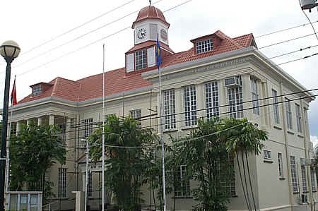
The foundation stone for Queen’s
Royal College was laid on November 11, 1902 by Sir Courtenay Knollys, the then Acting
Governor. The College was opened on March 25, 1904. The building was designed by DM Hahn,
chief draughtsman in the Department of Public Works, who was himself a QRC old boy and the
father of QRC boys. The original school formed in 1859 was called Queen's Collegiate
School and was located opposite Lord Harris Square. In 1870, the school became the Queen's
Royal College and was housed in the supper room of the Prince's Building.
The Main Block is in German Renaissance-style architecture, as is very
evident by its solidness and ornateness. The clock in the building was presented to
the school by William Gordon Gordon in 1913. The Science Block was opened in 1939, the
North Block in 1940 and the West Block in 1956.
Whitehall was designed by its
first owner in Corsican style with Venetian influence and built by James
Moore a builder from Barbados. Moore used natural white sandstone imported
from Barbados, in the construction. The first owner was Joseph Leon Agostini,
who through is marriage to Marie Josephine, the daughter of Andre Ambard who
owned the firm Ambard and Son, entered the cocoa industry with lands in the
Caura valley. His cocoa estates prospered and in 1903, Joseph León Agostini
purchased the lot on 29 Maraval Road, St. Clair for Ł1000 and with a lease
of 199 years. The building took from 1902 to 1904 at a cost of $80,000. In
1905 Joseph León Agostini found himself in financial difficulties because of
the high cost of construction and the decline of the cacao industry, he had
to forfeit the property to Gordon Grant and Company to repay his debts. It
was then sold to the Henderson family.
During the Second World War, with the arrival of the United States Forces
to Trinidad, White Hall was commandeered from the Seigert family, heirs of
Robert Henderson, as the headquarters of the US Forces in Trinidad. In 1954
the government of Trinidad and Tobago purchased White Hall on October 7th,
1954 for $123,000. In 1957 Whitehall was occupied by the Pre-Federal Interim
Government prior to the establishment of the West Indies Federation in 1958.
In 1963, it became the Office of the Prime Minister occupied by the Hon. Dr.
Eric Williams, Trinidad and Tobago’s first Prime Minister after
Independence.
The Magnificent Seven are not the only surviving examples of colonial
architecture to be found in Trinidad. In addition to the President's
House, Knowlsey and the Red House
shown below, the section Other Colonial
Architecture provides some samples of the architecture of that period.
Easily passed
every day without notice as people traverse the Saddle Road in and out of
Maraval, lying on the banks of the Maraval River and shielded by stands of
bamboo is a man made waterworks that is more than 150 years old. If while
driving you quickly glance to the western side of the valley after passing
xxx hotel while heading north you will see the water retention pools and
buildings of the Maraval Water Works. On this bend of the river the water
flows serenely along winding through the clumps of bamboo and various fruit
trees that have been planted and then plunges approximately 30 feet in a
series of cascades at the side of the facility to then continue its serene
flow downriver. On this bend of the river Kingfishers sometimes perch
themselves on overhanging branches scanning the water for signs of small
fish and then dive into the water after their prey. This peaceful often
times idyllic scene arose out of calamity and strong legal battle.
In the 1850's sanitation levels in Trinidad and especially Port of Spain
were extremely low and these low levels were largely the result of lack of
knowledge by the general public on how disease spreads. Most building did
not have indoor toilets and the majority of the population used cesspits. At
the same time water for daily use was either drawn from wells or rivers and
often cesspits and wells were dug in close proximity to each other. In 1854,
a cholera epidemic swept through Trinidad killing thousands of persons. The
Governor, Sir Charles Elliott, recognizing that the poor sanitation was a
major cause of the cholera sought to improve the situation by having pipe
borne water supplied to Port of Spain. The plan was to tap water from the
Maraval River and pipe it to Port of Spain. In the 1850's the Maraval Valley
was not heavily populated and so the water from the river would have been
pure, uncontaminated by human activity.
The idea of tapping water from a river and piping it to Port of Spain had
already been done as under the previous Governor, Lord Harris, a dam was
built on the St Anns River and the water piped through the
Botanic Gardensto an area of the
Queen's Park Savannah where another dam
had been dug and the water collected there and then piped to lower Port of
Spain. The area in the Queen's Park Savannah where the dam was located is
today known as The Hollows. The water from the Hollows however was not
sufficient to supply all of Port of Spain and so the supply from the Maraval
River was needed. Most of the Maraval valley at the time was an estate
called Champs Elysees owned by the De Boissiere family who did not want to
lose any of their land and so filed legal objections. Eventually legislation
was passed that gave Government access to up to 30 feet from the river bank
which ended the legal battles.
With the end of the legal wrangling the Government was able to proceed with
the Maraval Water Works and two reservoirs were built along with a filter
system and the water transported by pipe to Port of Spain.
pic
In 1854 a cholera epidemic struck Trinidad which left thousands of
Trinidadians dead, with Port-of-Spain being the worst hit. The primary cause
was the abysmal sanitation conditions, which saw cesspits and wells being
dug alongside each other, with no pipeborne
supply. Sir Charles Elliott, the governor, made immediate attempts to
acquire lands for a reservoir. The upper reaches of the Maraval River were
chosen as the place for the construction of a dam and filtration system.
Pipes would be laid alongside the river, but this was met with stiff
opposition from the De Boissieres, who owned the Champs Elysees estate,
which was along the banks.
After a bitter legal battle, the Governor passed an ordinance allowing the
government leeway on all riversides to a maximum of 30 feet, which ended the
matter. The Maraval Waterworks were an extensive project, guided by JE
Tanner, who would later become one of the founders of the Trinidad
Government Railway in 1876. The nearly-completed waterworks were described
thus in 1857: “The Port-of-Spain water-works are now nearly completed; the
general outlay will have been about 26,000 sterling. The town is supplied
with water from the Maraval river; two reservoirs and a filter having been
built in that valley, at about three miles from town, from which a main
pipe, of 12 inches bore, reduced to ten inches, brings the water to the
lower end of the town about three miles and three quarters.
The Maraval Reservoir was transferred to the Port-of-Spain Water Authority
in 1912. The Maraval Reservoir is now the property of the Water and Sewerage
Authority and is still a place of beauty and serenity, although it is no
longer freely open to the public.
Trinidad has always been a melting pot with the mixing of persons of different
ethnicities through sexual liaisons. This was especially the case in the 18th and 19th
century when European males often had sexual encounters with African women resulting in
mixed race children. Although this was frowned upon by many in the wider European society
in Trinidad, the practice was widespread. Those Europeans of French descent often went
further in their sexual liaisons and married their partners or installed their African or
mixed race female partners in houses. One of the areas that owe its name to the sexual
escapades of one man is the property known as Rookery Nook on Long Circular Road in
Maraval.
In the late 1700's Trinidad was considered under populated and there was a desire to
attract immigrants to Trinidad. The Spanish as a result issued what was known as the
Cedula of Population of 1783. Under the terms of the Cedula, the Spanish Crown granted 32
acres (129,000 m˛) of land and half as much for each slave that they brought, to each
Roman Catholic of any country who settled in Trinidad and Tobago and swore loyalty to the
Spanish Crown. Each Free Coloured or Free Person of Colour, (as they were
later known), were given, 16 acres (65,000 m˛) and half as much for each slave they
brought, once they were Roman Catholic and swore loyalty to the Spanish Crown. The
Cedula dramatically increased Trinidad's population moving it from 1,000 persons in 1773
to 18,627 by 1797.
Many of the individuals who came to Trinidad were of French origin, migrating from the
French Caribbean islands and also directly from France. One of the families that came to
Trinidad under the terms of the Cedula of Population of 1783 was the Valleton de
Boissičre family, which had originated in Bergerac in Southern France and then
settled on the island of Grenada. According to Gerard Besson in a paper given to the
Society of Caribbean Historians in 1990, John Nicholas Boissiere in 1860 married a
mixed race woman, Marie Aurile Soully and they lived in a house in Champs Elysees in
Maraval. Prior to his marriage John Nicholas had two children (a son and a daughter)
with a back woman. John Nicholas had both his illegitimate children and the offspring of
his marriage living in the house in Maraval. Those members of society who disapproved of
the marriage and the dark skinned offspring began to say that there were so many crows
(black birds) around the house that it resembled a rookery (a breeding place for crows).
Boissiere in a response, that symbolically thumbed his nose at society, then named his
house, Rookery Nook.
Although the house no longer exists in the form when John Nicholas Boissiere lived there
and is today known as Kent House, the entire area is still known as Rookery Nook.
The Royal Botanic Gardens are located in Port of Spain on the northern side of the Queen's Park Savannah. The
Trinidad Royal Botanic Gardens were established in
1818 by Governor Woodford and his gardener David Lockhart was assigned to fill it with
specimens from around the world. Plants were collected
from every continent including India, Africa, the Far East as well as from
other Caribbean islands. These gardens occupy 25 hectares of landscaped grounds
with 700 trees of which 13% are indigenous to Trinidad
and Tobago. The Botanic Gardens are open everyday from 6am to 6pm
and entry is free. During Christmas there are extended opening hours to allow visitors to
wander among the lighted trees.
Within the Trinidad Royal Botanical Gardens is a small cemetery that was reserved for Trinidad's governors, with
the earliest burial record being from 1819 of William Souper. The cemetery also
contains the grave of the wife of the Bristish Governor Sir George
Fitzgerald Hill, who died in November 1836 and asked to be buried in the Botanic Gardens.
When Sir George died in March 1839, he was buried beside his wife.
Also buried in this cemetery is Sir Solomon Hochoy who
was the last British Governor of Trinidad and
Tobago and the first non-white Governor. Upon the attainment of Independence in 1962, he
was appointed as Governor-General, a post he held until 1972. Sir Solomon Hochoy was born
on 20 April 1905 in Jamaica, and arrived in Trinidad at the age of 2. He grew up in the
village of Blanchisseuse and after retirement he
returned to Blanchisseuse where he spent the remainder of his life. He died on 15 November
1983.
The Emperor Valley Zoo most commonly simply called The Zoo has been in
existence since 1952. Located in Port of Spain on the
Queens Park Savannah, adjacent to the
Botanical Gardens this exhibition of
animals offers a simple easy way to relax, get in tune with nature and learn
some things about the other inhabitants of this twin island nation. As
Trinidad is a tropical island the majority of the animals, fish, birds and
reptiles on exhibition are tropical species, drawn primarily from Trinidad
and Tobago and neighboring South America.
The Zoo is located in a natural valley and was named after the Emperor or
Morpho butterfly that previously frequented this area. The layout of the Zoo
makes it easy to traverse the entire area and see all the exhibits and while
strolling along the pathways is not particularly tiring there are benches
strategically placed to allow you to stop and sit and look at the displays.
There are two refreshment areas so it is easy to get a cool drink or snack.
Each of the exhibits has signs explaining what is on display, where it is
from and its habits so that essentially a visit to the zoo is a self guided
tour. However if you want a guided tour those are available for a fee and
can be arranged by calling the Emperor Valley Zoo.
Throughout the zoo efforts have been made to present the exhibits in
settings that resemble their natural habitat. While some of the displays
still consist of basic steel cages increasingly these are being changed to
more open natural looking display areas.
Many persons think of a visit to the zoo as something for children but
adults will also find an afternoon at the zoo to be a relaxing experience.
The Emperor Valley Zoo is open every day from 8.30am to 5pm.
The President's House is located on the northern side of the Queen's Park Savannah, adjacent to the Botanic Gardens. During the period when Trinidad was a
British Crown Colony it was the home of the Governor. During the period 1st May 1958 to
31st May 1962, it was the residence of the Governor-General of the
Federated West Indies, Lord Hailes. From 4th September 1962, the building was
used as a Museum and Art Gallery until December 1965, at which time the first Governor of
an independent Trinidad and Tobago, Sir Solomon Hochoy,
moved into the residence. On 1st August 1976, when Trinidad and Tobago became a
Republic, (the occasion is observed on 24th September), the Governor-General's
House (subsequently designated "The President's House") became the residence of
the President of the Republic of Trinidad and Tobago with President Ellis Clarke as the
first President.
The grounds on which the President's House is located were formerly the
Hollandais Estate and in 1819 the Governor, Sir Ralph Woodford bought the property on
behalf of the Cabildo. He renovated the existing estate house, which was located slightly
in front of the site of the present house, and called it "St Ann's Cottage". In
1873 Governor James Robert Longden began construction of the present President's House and
it was completed in 1876 by Governor Sir Henry Turner Irving. It is believed that Longden
designed the building in an "L" shape as a remembrance to himself.
Built on a super structure of iron
and steel, the elegant stonework of the facade is local blue limestone from the Picadilly and Laventille quarries.
In December 2019 after years of extensive renovations,
including adding earthquake resistance, the President's House was reopened
as suitable living accommodation for the President of the Republic of
Trinidad and Tobago.
Knowlsey Building on Queen's Park West on the eastern end of the Queen's
Park Savannah, presently houses the Ministry of Foreign Affairs.
Built in 1904, this building occupies the entire block from Queen's Park
West to Albion Street, between Chancery Lane and Dundonald Street. It was designed and
constructed in 1904 by Taylor Gillies, at a cost of $100,000 for William Gordon Gordon, a
Scotsman who grew wealthy by operating businesses in Trinidad. It has been recorded that
the building might have been named after the residence of Gordon's friend in Cheshire,
Lord Derby.
The building is predominantly Italian and German in architecture, and has been referred
to as a "sandwich of blue stone and brick". When originally constructed the
marble on the gallery which surrounds the ground floor was imported from Italy, and the
wood for the beautiful staircase of purple heart came from Guyana. The ceilings on the
ground floor are of plaster of Paris and the gesso work is that of an Italian craftsman
who did the work on the ceiling in the Council Chamber in the Red
House, and in the Stollmeyer's house.
Everyone alive today would have grown up with the sight of the Port of Spain Genera
Hospital on Charlotte Street and most would assume that this is the only hospital that
Port of Spain has ever had. However, according to Historical Sketches by Dr.K.S. Wise, the
earliest hospital in Port of Spain was located on Nelson Street on Lots 49 - 55. In 1794,
the Spanish abandoned these buildings and leased the Hospital that existed on Ariapita
Estate which was owned by Charles Melville and covered 120 acres extending up to the
present Woodford Square.
In the 1800's however, because of the frequent epidemics that ravaged Port of Spain, the
colonial Government decided that a new hospital was required for Port of Spain. The
Government decided that the most suitable space would be the land that had been occupied
since 1797 by the British troops that had invaded Trinidad and was known as Orange Grove
Barracks. Thus in 1821, the land at the Orange Grove barracks was sold to the Colonial
Government as the site for a hospital. Construction of the hospital however did not
commence until 1855 when the foundation stone was laid by Governor Sir C Elliot. At the
time of laying the foundation stone, Port of Spain was once again the midst of a cholera
epidemic. The hospital was completed in 1858 and opened by Governor Keate on 1st September
1858.
The Port of Spain Hospital had been built by a Trinidadian
engineer, L. W. Samuels, as a two storey hospital building and was Georgian in style with
Palladian arches. It was 390 feet long and 64 feet wide with open galleries of 10 feet
wide on both sides of the first floor and cost Ł30,000 sterling. At the time it was
capable of holding 200 patients. Over the years the Port of Spain General Hospital has
been expanded significantly, however the original hospital can still be seen as the front
of the hospital, visible from Charlotte Street.
The building at #6 Cipriani Boulevard, known as Jenny's on the Boulevard
houses a popular restaurant in Port of Spain but this building is also a
historic home. This building was actually the first building that
George Brown designed when he came to
Trinidad and it was the home of the Boos family. Some of Brown's notable
features are seen on the house such as the lantern that allows light and air
into the house and decorative cast iron. This building however does not have
the decorative fretwork that is seen in many of his later buildings.
Karl George Boos came to Trinidad in 1873 from Germany by 1883 he had become prosperous
enough to purchase a plot in the area that the Government had recently
acquired from Tranquility Estate. As a result of the part that he had played
in the lighting of the city of Port of Spain and in the laying out of
Tranquility, the major thoroughfare of the area, Cipriani Boulevard, was
named after José Emmanuel Cipriani. Karl Boos was able to purchase the plot
in this newly established area of Port of Spain because of his wealth and
that wealth arose because of Boos ownership of
J.N. Harriman and Company Limited.
The previous owners of the company, the Gerolds, had opened a branch of the
company in Venezuela in a town called Angostura (now called Cuidad Bolivar)
and they became friendly with Dr. J.G.B. Siegert the inventor of the world
famous Angostura Bitters. In 1875 the company, J.G.B. Siegert & Sons, moved
its business to the island of Trinidad and in 1878
Carlos Siegert came to George
Wupperman, one of the owners of J.N. Harriman and Company and they set up an
agency in New York for the sale of Angostura Bitters giving that agency the
sole worldwide rights for Angostura Bitters. Karl Boos had joined J.N.
Harriman and Company shortly after coming to Trinidad and by 1878 had become
head clerk. In 1885, Harriman and Company was sold to Carlos Siegert who a
few weeks later sold the company to Karl Boos. Boos therefore became the
owner of a successful business that had the worldwide rights to the sale of
Angostura Bitters. The business did so well under Boos that he was able to
repay his loans early. In 1892 however Karl Boos was trying to purchase two
cocoa estates and to get the money for the purchase he approached Carlos
Siegert who agreed to a loan but made it a condition of the loan that
Harriman and Company had to give up the worldwide rights for Angostura
Bitters.
Located at the corner of Elizabeth Street and Sweet Briar Road in Port of
Spain is a building known as Briarend or the Audrey Jeffers House.
This building on 22 Sweet Briar Road was built in 1908 by Henry Jeffers
(at the time an established lawyer and three term member of the Port of
Spain City Council) and was the Jeffers family home. His daughter Audrey
Jeffers (born 1898) was the first Afro-Trinidadian woman to be elected as
part of the Port of Spain City Council. She obtained her diploma in Social
Sciences at Alexander College, North London and founded the Union of
Students of African Descent (later became the League of Coloured Students).
After returning to Trinidad in 1920 from London, she used her family home
to start a Junior School. A year later, she established the Coterie of
Social Workers of Trinidad and Tobago – an organization that started off
giving free lunches to underprivileged children, and went on to building
homes for the blind, elderly and homeless.
She was honored with the title Mother of Philanthropy, and was
posthumously honored with the Chaconia Gold Medal for Social Service in
1969, the year after she died.
The above information was obtained from the National Trust of Trinidad
and Tobago.
Briarend House has the qualities of a late Victorian home. It is
constructed with a balloon frame and has large upper floor timber framed
with jalousies and sash windows on each elevation, a gable roof with large
dormers, and gable end windows. At the top of each end of the gable roof and
on the dormer windows are tall finials. The exterior of the house was
painted in a mixture of blue and gray with yellow and red awnings.
On the ground floor is a wraparound verandah with geometrical diamond
railings and ornamental brackets, large double panel doors and windows made
from polished mahogany. The double panel doors contain ruby red and amber
colored glass that brought a lot of warmth into the interior with the
evening sunlight. The excellent craftsmanship and the streamlined design of
the house is also characteristic of the Arts and Craft movement that
rejected the manufactured and needless complexity.
All the doors, floors, architraves fretwork details, spindle staircase
and wainscoting were all polished mahogany as well. The rooms were painted
in Victorian colours like hunter green, deep rich creams and rose pink. The
garden was originally planted with fruit and shade trees and an abundance of
ginger lilies and other flora.
Many persons have heard of New Orlean's city of the dead with its daily
tours of tourists. Lapeyrouse cemetery is Trinidad's city of the dead
and a city it is indeed with buildings, alleys, streets in a grid pattern
and residents, albeit most of the residents are not moving but each official
resident has a fixed address. At Lapeyrouse, it is almost possible to trace
the entire economic life of Trinidad and who made the money, for the rich
bury their dead in grandiose style and here can be seen more than just fancy
headstones but raised tombs, crypts, mausoleums and statues.
Lapeyrouse cemetery is on the western edge of Port of Spain but with the
enlarged metropolitan area that Port of Spain has become it really can be
considered more in the center of the city. This burial ground is bounded by
Tragarete Road on the north, Park Street on the south, Colville Street on
the west and Phillip Street on the east. At the southern entrance to the
cemetery there is an inscription intended to remind all of us that our days
are numbered and it reads "Stop, traveler, e’er you go by, So are you now,
so once was I,As I am now, soon you will be".
The cemetery is laid out in an almost rectangular pattern with numbered
streets running through the area. As you wander through this final resting
place of Trinidad's prominent and not so prominent citizens, certain
structures catch your eye as some are designed to look like churches, some
like mini homes and others simply as solid resting places. Among the larger
structures are the tomb of the Famille Agostini, the Herrera family tomb,
the resting place of Carlos Robertson from 1886, the De
Souza tomb, the Cabral family vault and the church like structure for
Famille Comte L.A.A. de Verteuil. Another interesting family tomb is that of
the Jodhan family which has chairs, candles, statutes, chaplets and pictures
all inside and laid out as if for family members to come and sit and
remember the deceased or possibly converse with them.
After the British conquest in 1797, Port of Spain was in need of a new
burial ground and so land was acquired in a small area bordered by Tragarete
Road, Richmond Street and Fraser Street. A wall was erected around it, and
by 1813 it was referred to as the ‘Old Cemetery’. As the town grew, more
land was needed and so the land was acquired from Picot de la Peyrouse, a
French nobleman who had come to Trinidad in 1778 under the Cedula de
Populacion and established a sugar cane estate on the outskirts of Trinidad
and built the first factory for the production of Muscovado sugar (brown
sugar). Picot de la Peyrouse had allocated 20 acres for the creation of a
cemetery and had a dedication ceremony in 1823. By 1831, this cemetery had
acquired the name Lapeyrouse because it was on the old estate lands. Within
just a few years, the cemetery was again enlarged, this time buying lands
from the Shine family. Over the next few years, more land was acquired from
the Dert family (pronounced Der), who had started the first coffee estate in
an area between Queen’s Park south and Tragarete Road in the 1770s (they are
remembered through the street with their name just north of the cemetery).
The northern entrance to Lapeyrouse cemetry is called the Perry Gate and is
named after American Commodore Oliver Hazard Perry died near Trinidad on
August 23, 1819; he was buried at Lapeyrouse Cemetery, Port of Spain. He
died aboard the US schooner Nonsuch when he contracted yellow fever after a
successful mission to the Orinoco River, Venezuela, where he held
discussions with Venezuela's President, Simon Bolivar, over piracy in the
Caribbean. The then British rulers failed to recognise him as a hero because
Perry, at 27, was responsible for leading a decisive naval battle at Lake
Erie, which defeated a British squadron. It was a battle that ensured
control by the Americans of Lake Erie for the remainder of the war. Seven
years later, the US Navy sent its officers to remove Perry's body from
Lapeyrouse and they took it to his homeland — Rhode Island, USA. By 1866,
the relationship between Britain and the United States had improved and when
Arthur Hamilton Gordon was appointed Governor of Trinidad, he collaborated
with members of the Cabildo to erect a monument at Lapeyrouse in honour of
Perry. The monument consisted of two concrete columns, 15 feet apart, and
adorned with historical details concerning the incident. The metal gate
leading into the cemetery was decorated with silver-coated coats of arms of
Britain and the United States. The site was named Perry Memorial Gateway.
The monument was completed and opened on April 11, 1870, in the presence of
the governor and Mayor John Bell-Smythe. In April 2012, The Perry Gate was
refurbished by the US Government.
Globe Cinema at the comer of Park Street and St Vincent Streets in Port
of Spain is one of the buildings in Port of Spain that is still identifiable
as a former single screen cinema. All the other single screen cinemas have
succumbed to the financial pressures caused by cable television, DVDs,
multiplex cinemas and been converted to other uses. Although Globe Cinema
was purchased in 2015 by an individual who stated that he intends to
continue operating it as a cinema that has not materialized. The Globe is a
historic cinema.
The Globe was established in 1933 on the very location that it presently
operates which at the time was called Green Corner. It has been said that
the location got the name Green Corner because there was a store on that
corner which was painted a very bright green color. In 1933 the cinema that
Meah opened however was not called Globe but was known as the Metro Cinema.
Haji Gokool Meah started the cinema in conjunction with MGM. It was an
ornate faux classical-style building, with plush red-carpeted walls, could
seat over 1,000 people in balcony and pit, and cost over $80,000 to
construct. The public loved it. Eventually Meah and MGM began to disagree as
MGM insisted that only their films could be shown in the cinema. Meah then
split from MGM and renamed the cinema the Globe. As the years rolled by,
cinemas because even more popular and by 1986 there were 56 cinemas
operating in Trinidad. With the popularity of cinemas Gokool Meah expanded
his cinema holdings and opened Globe Cinemas in Princes Town, Chaguanas and
ultimately had 5 cinemas in Trinidad. The Globe expansion however did not
end with Trinidad, in 1952 Globe Guyana opened showing David and Bathsheba
and in 1956, Globe Barbados was opened.
Globe's historic standing does not however rest simply on its longevity
but also on what it showed and who appeared at the cinema on Green Corner.
In 1935, Ranjit Kumar came to Trinidad with the first Indian movie, Bala
Joban, and it was shown at Globe. In 1937, Marcus Garvey got permission from
the Government of Trinidad and Tobago to come to Trinidad and he spoke at
Globe to a big crowd. Nat King Cole appeared in Trinidad and his show was at
Globe Cinema. Globe is also historic for who did not appear there. In the
1950's Valmond "Fatman" Jones advertised that he was having a show at Globe
Cinema and he was bringing the American singer Sam Cooke to Trinidad to
appear in the show. Needless to say, with the popularity of Sam Cooke, the
show was sold out and people lined up on the night in anticipation of the
show. The only problem was that Sam Cooke knew nothing about the show; he
was never contracted by Valmond Jones. When people began looking for Valmond
Jones they discovered that he had taken all the money and scampered off to
England where he lived for the next 20 years.
So the next time you are in Port of Spain, go by the Globe Cinema and
look at a piece of our surviving history.
Tucked away on St Vincent Street, Port of Spain between Park Street and Duke Street is
a small red brick building. The building is easily passed without notice because it is set
back from the street. This building is the home of the Bruce Stevens Trust and was erected
in 1940.
IIn 1896, Bruce Stevens came to Trinidad from what was then British
Guiana and started a store on Frederick Street that was known as Stevens
Limited and operated firstly at No. 10 Frederick Street and later at No. 12
Frederick Street. In 1953 Stevens Limited acquired Davidson and Todd Limited
and then in 1958 they acquired William Fogarty and Company. Then in 1968
they acquired J.T. Johnson and Company.
Bruce Stevens had prospered as a result of the store but was moved by the
conditions that affected children in Port of Spain during that era. As a
result, he became actively involved in social work. When Bruce Stevens died
his brother, J.W. Stevens, took over the running of the business. Before his
death in 1940, J.W. Stephens wanted to ensure that the social work started
by his brother continued and so he created the Bruce Stevens Trust.
The building known as the Red House is the site of the the Parliament of
Trinidad and Tobago. It is located opposite Woodford Square
and bounded by Abercromby, Knox, Hart Streets. Construction of this building began in 1844
and the southern wing was completed in 1848. During the British colonial period they were
known as the Government Offices. The building was burnt in 1849 when citizens objected to
a clause that was being debated by the Cabildo that would have required debtors to have
their heads shaved and wear prison clothes. In 1903 these offices were completely
destroyed by fire in what were known as the Water Riots. The rebuilding began in 1904 and
was completed in 1907. On 27th July 1990, the Prime Minister and other members of
parliament were held hostage in the building during a short-lived coup-d-etat.
In 1897 in honour of the diamond jubilee of Queen Victoria, the building
was painted red and has been painted that colour ever since. The design of the building
was done by Daniel M Hahn, chief draughtsman in the Department of Public Works, who was a
past student of Queen's Royal College. The
design of the building reflects a Corinthian order in its columns and half columns.
Located across the street from the Red House on
St. Vincent Street in Port of Spain is the former Police Headquarters. Constructed in
1876, at a cost of 90,000 pounds, on the site of the barracks of the West India Regiment,
it served as police headquarters for over 100 years. It contained a residence for the head
of the force as well as quarters for the volunteer fire brigade and the volunteer corps.
At one time, the stipendiary magistrate of Port of Spain held his daily court there.
Built of local limestone from the Piccadilly Quarries in Laventille it was burnt
in 1882 as a result of a mishap in the lamp room and rebuilt in 1884. It was again gutted
by fire in 1990 as a result of an attempted coup and rebuilt in 2003. The building is in
the form of a square designed around a central courtyard. In the rebuilding an effort was
made to ensure that those parts that are new matched the other sections that were still of
the original construction.
The building is still in use at the present and houses several police
departments as well as the Police
Service Museum.
While the Magnificent Seven are the best
known examples of colonial architecture in Trinidad, throughout the country there survives
many historic buildings from earlier periods in our history. Several of these buildings
originally constructed as residences have been converted to offices but the exteriors have
been maintained with the original design.
The streets around Lord Harris Square in
Port of Spain are one area where you can see several examples of earlier buildings. In the
immediate vicinity of the square on Abercromby, New and Pembroke Streets are several
buildings dating to earlier in our history. While smaller in scale than the other mansions
at Queen's Park West, they survive and continue to
exhibit their splendor.
Other examples found in Port of Spain are on Victoria Avenue, Keate Street
and Queen's Park South. Even as 21st century edifices of concrete and steel begin to tower
above them, these buildings retain their beauty.
Victoria Square in Port of Spain is also bordered by buildings that
reflect the colonial style of construction. During early morning and early evening
periods, visitors to Victoria Square are blessed by the sight and sound of wild Orange
Winged Amazon Parrots and wild Yellow Fronted Parrots.
A beautiful example of the French style of building during the late 1800's
and early 1900's can be found on the corner of Sweet Briar Road and Elizabeth Street in
Port of Spain.
It has been said that unlike the wealthy of English extraction, those of
French heritage chose to keep their wealth in Trinidad and constructed buildings where
they could freely entertain their friends. One feature of these buildings is the large
verandah that usually spans the entire house.
The former capital of Trinidad, St Joseph, is
another location where older buildings dating back to colonial times can be seen.
The seat of Municipal
Government for the City of Port of Spain was also the location
of the old Town Hall which was unfortunately destroyed by fire
on the 16th April, 1948.
In its historical past, it was
a Plantation House owned by Don Ramon Garcia, a Lawyer and said
to be member of the Spanish Royal Family during Spain’s Colonial
Rule in Trinidad. The House and property
which contained a small chapel was bought over by Mr. Leon
Agostini, a cocoa magnate who in turn sold it to the Port of
Spain City Council in 1889.
In the
aftermath of the fire, the Town Hall was temporarily relocated at
the Prince’s Building south of the Queen’s Park Savannah for next
the thirteen (13) years. On the 24th
April, 1958 the foundation stone for the new Town Hall was laid
by H.R.H Princess Margaret of the United Kingdom at a ceremony
held at the site of the old Town Hall Building.
The modern building was
designed by the architectural firm Prior Lourenco & Nothnagel and
built by the Arthur Brothers Company. It was officially opened to
the public in 1961 with Councilor E.C. Taylor being the first
Mayor to occupy the new office.
The Mural in the forecourt of
the main entrance at Knox Street was done by Trinidad’s well
known artist, Carlisle Chang and its name ‘Conquerabia’ was the
original title for the city of Port of Spain.
It was founded on the site
of a legendary Indian battle in the Pre-Columbian times.
The new City Hall has been the
site for numerous civic and officials events and theatrical
performances and in 1971 the Army Mutiny Trials were held in its
auditorium for a period of several months.
On 1st February 1851, Governor Lord Harris laid an ordinance for the
establishment of the first public library in Trinidad. This library which went into
operation in June of that year was housed in the Government Building (known today as the Red House). The library moved to several buildings over the years
until finally in 1901 a dedicated building was constructed for the library and opened in
1902. The site used was once the home of the first British governor in Trinidad, Sir
Thomas Picton.
This building on Knox Street, opposite Woodford Square,
served as the main library for Port of Spain for over 100 years until in 2003 a new
National Library complex was opened. Today the building is still part of the National
Library System and houses the Heritage Library.
On Sackville Street in Port of Spain, sandwiched between the Police Headquarters
building and the office of the Attorney General is a small building called the Cabildo
Building. The Cabildo was an institution established during the time when Trinidad was a
Spanish colony. It was in fact the earliest semblance of Local Government in Trinidad.
Seven of the twelve members of the Cabildo were elected by the taxpayers. The Cabildo had
wide executive powers, performing a wide range of functions with ecclesiastical,
executive, judicial, fiscal, economic and military powers. The Cabildo appointed chief
judges on the island, supervised markets, scavenged and repaired streets, controlled the
police, the Royal Goal, the admission of physicians and surgeons, and levied duties and
taxes on grog shops.
There is a widely held belief that this building
was the office of the Royal Cabildo. We know however that up to 1808, the Cabildo Building
was situated on Charlotte Street, a short distance from Queen Street, on the right as you
walk north. In 1808 the Great Fire of Port-of-Spain completely destroyed the town
including the Cabildo Building. We also know that in 1815, the Cabildo purchased a house
on the corner of Brunswick Square (now Woodford Square)
which eventually became the Cabildo Building (Town Hall). It is therefore likely that this
building either housed some of the functions of the Cabildo or was the meeting place of
the Cabildo during the period between 1808 and 1815. We also know that in 1845 the
building housed the Registrar of Deeds.
In 1895 a huge fire swept through the downtown district of Port of Spain. Fortunately
most people were at the Queen’s Park Oval watching a
cricket match between a Trinidad team and the first English cricket team to visit
Trinidad. This fire however had followed another fire in 1808 that had destroyed much of
Port of Spain. As a result of the 1895 fire it was thought that to enable Port of Spain to
better deal with fires a dedicated building was required. As a result this building on
Abercromby Street was erected. Previously the volunteer Fire Brigade was housed in the Police Headquarters building on St Vincent Street.
Although the Fire Brigade was housed in its own building, it remained part of the Police
Service until 1951 when the Trinidad and Tobago Fire Service was established. In 1951,
this building became the Headquarters for the Fire Service until more modern premises were
constructed on Wrightson Road. For the present the building is part of the National
Library complex.
Situated in the
heart of the city, Woodford Square is bordered by Frederick Street on the East, Abercromby
Street on the West, Hart Street on the South and Knox Street on the North.
Woodford Square was first known as the Place ofSouls by
the Amerindians who fought a bloody battle on this open space. The St Ann's River ran
through this open space and down to the sea. The course of the river was later changed to
what is today called The Dry River and the riverbed in the Place of Souls was filled up.
With the coming of the French settlers to the island, they called the Place of Souls -
Place Des Ames. Place Des Ames means place of souls.
Place Des Ames later became known as Brunswick Square. It is believed
that because Brunswick Square was used as a parade ground by the soldiers many of whom
were Germans that the square was named after the German soldiers.
In 1813 Governor Sir Ralph Woodford arrived in Trinidad and he
immediately began rebuilding the town and laid out the square. He commissioned the German
botanist, Baron Schack, to fill the square with flowering trees. In 1866 a fountain was
put in the center of the Square as a gift from George Gregor Turnbull of Glasgow,
Scotland. In 1892 new heavy railings were put up around the square. These are the ones we
see today. In 1917 a bandstand was built and opened by Dr E. Prada, the then Mayor of Port
of Spain. At the opening of the bandstand the name of the square was changed from
Brunswick Square to Woodford Square for patrotic reasons (Brunswick being a German name
and World War I was in progress) and to honour the Governor Sir Ralph Woodford.
On November 7th 2007, Woodford Square was used for the swearing-in
ceremony for the Prime Minister, Patrick Manning. This was the first time that the
ceremony had been held in public.
Over the years, people have called Woodford Square by different names:
'The University of Woodford Square', 'The People's Parliament'. It has been and continues
to be a place where lively debate takes place everyday.
A building is much more than a physical structure. In
some instances it represents the hopes, dreams, aspirations and life stories
of the people who lived or worked in the building. In some instance a
building can represent the aspirations of a nation. The former headquarters
of the Trinidad Cooperative Bank at the corner of Duke and Charlotte Streets
in Port of Spain is such a building.
The Trinidad Co-operative Bank (TCB) was incorporated in 1914 as a savings
institution with the vision “to inculcate in the people virtue of thrift…and
to provide a quick, easy, safe means for children and poor people to save …”
The major driving force behind the establishment of the bank was Charles
Augustin Petioni, who encouraged the other coloureds at that time to get
together and form a bank to call their own because at that time a large
section of the population had no banking relationships. Petioni who was born
in Trinidad in 1883 was at the time a young journalist and he later went to
Howard University in the United States and studied medicine. Charles
Petioni who was a friend of the father of Eric Williams later became a
pioneer of Marcus Garvey’s (1887–1940) Universal Negro Improvement
Association and a leader of the Caribbean independence movement in the
United States. He died in 1951.
When the Bank was established in May 1914 it began operating at 42 Henry
Street. Unlike the other Banks which accepted no less than a shilling (24
cents) to open an account, the Bank encouraged depositors to open accounts
with as little as one penny. In this way, the bank became known as the Penny
Bank. The Bank's deposits in the first year of trading, 1914 – 1915, were
$83.31. As the Bank grew, it was able in 1923 to move to larger premises at
the corner of Duke and Charlotte Streets. Written into the concrete were the
words Thrift, Save and Cents.
One of the best known individuals associated with the
Bank was Dr Arthur Hutton McShine who in 1919 was made president of the bank
and served until his death in 1948; he was also the 5th mayor of Port of
Spain from 1921 to 1922. Dr McShine was born “Behind the Bridge,” then as
now, not the most respectable area of Port-of-Spain. He was the fourth and
last child of John and Caroline McShine, immigrants from St Vincent.
Arthur Hutton McShine attended Eastern Boys’ Government Primary School and
won the exhibition (at the time this was a scholarship that allowed you to
attend high school), and so he went to
Queen's Royal College and eventually won the Island Scholarship to study
at a University abroad, going to Howard University where he studied medicine
and later specialized in ophthalmology.
The Trinidad Co-operative Bank also has the distinction of employing the
first female banker in the history of Trinidad and Tobago. Rose Liris Mc
Shine Monsantowas born on February 24,
1908. She was the daughter of Dr Arthur Hutton Mc Shine and was the fifth
child in a family of 12 other siblings. Apart from being the first
female banker, another of her major life accomplishments was being the first
female banker to be appointed to the board of directors. Her role with the
bank was highlighted in a book published by First Citizens Bank. She worked
in the banking industry for more than 16 years before being named a director
of the Bank in 1943. She died January 13th 2009.
From its inception the Trinidad Co-operative Bank grew, however in 1986 the
Central Bank took control of the Penny Bank as it had an adverse audit the
previous year. With a new management team the Bank showed some recovery
however in 1991 the Central Bank told the Co-operative Bank that it was in
violation of Section 16 of the Banking Act, which stipulates that no bank
should incur deposit liabilities of an amount exceeding 20 times its paid-up
capital and reserve fund. Eventually in 1993 the Co-operative Bank was
merged with the Workers Bank and the National Commercial Bank to form the
First Citizen's Bank. The building now houses the
Trinidad Carnival Museum.
The Trinidad Carnival Museum is located
at the corner of Duke Street and Charlotte Street in Port of Spain. The
building in which the museum operates is the former headquarters of the
Trinidad Cooperative Bank, which was
fondly called The Penny Bank.
In the 1800's it was very
difficult for persons who were employed in low or middle level jobs to
access financing for home ownership. The first commercial bank targeting
lower income people, Trinidad Cooperative Bank, did not open until
1914. Thus it was being very far-sighted when in 1890, three local
businessmen got together to discuss forming an association to provide
mortgage financing for home ownership and credit facilities. These three
individuals had gotten the idea from observing the first British Building
Societies. The three individuals were Mr. J. S. Toppin, Mr. G. Creagh and
Mr. E. A. Robinson.
Mr. E.A. Robinson was born in Barbados and at 16 went to Guyana to work on a
sugar estate. After saving his money he went to England to study law and
then came to Trinidad and opened a law practice in Arima. With the money
earned as a lawyer he developed the 1,200 acre Non Pareil cocoa estate near
Sangre Grande. In 1920 he acquired the Woodford Lodge sugar estate.
So in 1890, the Trinidad Building and Loan Association was registered under
the prevailing Building Societies Ordinance Chap. 111 of 1890. The first
Board of Directors comprised the following: Mr. H. E. Rapsey, President; Mr.
J. S. Toppin, vice-President; Messrs. Hugo Hoffman; George Muir; W. S.
Robertson; J. C. Dade; J. H. Archer; E. A. Robinson (Counsel); A. V. M.
Thavenot (Solicitor); and G. Creagh-Creagh, Secretary and Treasurer. Shares
were issued and at first, dues were paid directly to the Colonial Bank for
credit to the Association's account. Actual operations were commenced on
January 14th, 1891, at the office of Mr. J. S. Toppin, situated at No. 4A
Almond Walk (now Broadway), Port-of-Spain. Although the Association
commenced business in January 1891, no loans were made until June of that
year, as the first four months of its existence were directed towards the
accumulation of funds for the purpose of investment..
In 1893 The Association moved from Almond Walk to No.1 Marine Square -now
Independence Square. In 1899, the TBLA moved once more, this time to No. 52
King Street. The continued growth of the Association required it to move
again so No. 18 Chacon Street was acquired. Finally in 1932 the property at
90 Chacon Street, which is the corner of Chacon and Queen Street was
acquired and the building that we see today was erected.
Capildeo House at 36A Edward Street incorporates an old gingerbread style house into
the design of a multi-storey building.
Number 36A Edward Street Port of Spain was the home of Miss Juliana Jacobs who lived there
with her mother Ms Alice Jacobs. In 1956 Ms Juliana Jacobs married George Chambers who
went on to become the second Prime Minister of Trinidad and Tobago in 1981, on the death
of Dr. Eric Williams.
In 2009, Capildeo House was erected on the lot at 36A Edward Street. In constructing
this building the owners very cleverly incorporated the original house in which Mrs
Chambers lived into their design. The old style of Port of Spain residential architecture
from the 1940's has therefore been preserved, retaining a place of historical interest.
On Richmond Street Port of Spain, just before the intersection with Duke Street is a
building with a sign that reads "Associaçăo Portuguesa".
This unimposing structure is a place of interest because it is one of the few remaining
buildings that gives a hint of the immigration of a group of individuals that have
significantly impacted the business life of Trinidad and our culinary traditions.
In 1834 with the abolition of slavery, the sugar planters were desperate
for labour and a group of twenty-five Portuguese labourers was brought from the Azores.
These individuals did not last in Trinidad and either died or returned to their native
land within two years. In 1846, the planters again tried Portuguese labourers and brought
219 persons from Madeira. It is possible that the planters chose Madeira because it is an
island archipelago off the west coast of Morocco in Africa and they may have thought that
being so close to Africa these Portuguese could endure Trinidad's climatic conditions.
During this period Madeira was undergoing economic hardship and these individuals
volunteered to go to Trinidad in the hope of a better life. During 1846 and 1847,
additional Portuguese labourers were brought to Trinidad from Madeira. The majority of the
Portuguese did not remain working on the sugar estates for very long as, (fortunately for
them) they had not signed any indentureship papers (unlike the later Indian laborers). Most of the Portuguese
immigrants either died, became small shopkeepers (especially of rum shops) or became
involved in cocoa.
Two other significant groups of Portuguese came to Trinidad. In 1846 a
group of Portuguese
Presbyterians fled to Trinidad from Madeira to escape persecution from Catholic
Portuguese. More detail is provided on this group on the Religious Sites Page.
According to Jo-Anne S. Ferreira in her work The Portuguese of Trinidad, between 1856 and
1858, there was immigration to Trinidad from the Cape Verde Islands of approximately 100
Portuguese who were of Negroid origin rather than Caucasian.
Through hard work, these Portuguese immigrants developed their small
shops into large commercial enterprises and also introduced Trinidad to olive oil and
garlic pork.
Although many individuals now find shopping at malls easier, Frederick Street,
Port of Spain, is still considered the main shopping center in Trinidad. As you
walk along Frederick Street, one can still see vestiges of shopping in the late
1800's and early 1900's. One of the locations that is passed by hundreds of
individuals everyday with most not recognizing the historical significance of
the building is Excellent Mall at the southern end of Frederick Street.
The site occupied by Excellent City Centre has had retail establishments since
the late 1800's. Frederick Street from Marine Square (today known as
Independence Square) to Park Street was shaded by overhanging, elaborately
designed galleries and hanging awnings for even more shade. The beautiful
wrought iron balcony at Excellent City Centre has survived to the present from
that time, with the style having been introduced by the architect,
George
Brown, after the fire of 1895 that swept through Port of Spain.
The Excellent City Centre is also of historical significance because it was the
foundation of one of Trinidad's first black successful businessmen. Michael P.
Maillard was born in 1860 in east Port of Spain and started working at The
Bonanza Store. In 1893 he opened hos own store and then in 1900 he purchased 1
Frederick Street. Maillard built his business on the basis of cash, no credit
accounts for customers and he introduced a new method of having fixed prices
with the prices displayed next to the goods. His store was known as El Popular
and survived until the 1920's when it became J. Glendining and Company Limited,
which name can still be seen under the wrought iron balcony.
The Treasury Building is located on the western end of the Brian Lara Promenade (formerly called Independence
Square). It was previously the site of the Central Bank, which is now located across the
Promenade at the Twin Towers. In 1831, the
original Treasury Building was constructed under the direction of the British Governor Sir
Lewis Grant. For many years it was also the residence of the British Governors and a rum
bond.
On August 1st 1834, the Emancipation Proclamation was read from the steps
of the Treasury Building by Governor Sir George Fitzgerald Hill, announcing the beginning
of the end of slavery in Trinidad. Slavery legally ended on August 1st 1838 with the
reading of the Abolition Proclamation from this building by the same governor.
On 25th June 1932, the Treasury Building was destroyed by fire and in
1936, construction of the present building commenced with completion being in 1938.
On 2nd February 1911, the first cinema opened in Trinidad in a building on
the corner of French Street and Baden-Powell Street in Woodbrook. This building which
still exists today was known as the London Electric Theatre. Over time, cinema became the
most popular form of entertainment so that by the 1970’s there was a cinema in almost
every neighbourhood in Trinidad.
One of the magnates of the cinema industry was William Pettigrew Humphrey who had come
to Trinidad in the 1920’s from British Guiana and established the Colonial Film
Exchange in partnership with George Rosenthal. Eventually Humphrey bought out Rosenthal
and created a chain of cinemas that included the De Luxe Cinema on Keate Street in Port of
Spain (now Zen Nightclub). To store the films for the cinema, Humphrey constructed the
small vault like building that is at the intersection of Charles Street and Wrightson Road
in Port of Spain, opposite the Fire Station.
At the time this area was known as Corbeaux Town. This section of
Port of Spain was a deeply indented bay with fishing boats and fishermen huts along the
shore. There was a fish market and the citizens of Port of Spain came daily to the area to
purchase fresh fish. The sea came all the way to the end of London Street and so
Humphrey’s vault was actually on the waterfront, which made sense at the time because
the principal means of international transport was by boat. Because of the fish market and
the common habit of tossing the fish entrails on the beach, the area attracted numerous
Corbeaux, hence the name. By 1938, the reclamation of land along this part of Port of
Spain, had eliminated the bay, ending the use of this part of the city as a fish market
and placing Humphrey’s vault in an inland position.
The
Brian Lara Promenade runs for ľ of a mile along the southern end of Port of
Spain through Independence Square. Constructed on reclaimed land that up to
1803 was next to the waterfront with the sea literally rolling up to its
edges, this square was originally called Plaza de la Marina. When the
British captured Trinidad in 1797 they translated the name to Marine Square.
In 1803,1850,1906 and 1935, land was reclaimed from the sea to extend that
portion of Port of Spain southward. In the 1700’s Marine Square was the
administrative heart of the country with public buildings such as the
treasury, the court house, the military barracks, the prison, and the
residence of the governor in the area. In strolling through this area, one
can still find businesses that were established during that early period
such as J.N Harriman and Trinidad Import & Export plus
the Treasury Building. At the corner of
Independence Square South and Abercrombie Street, one can still see imbedded
in the wall the original rings that were used for tying horses and the
original street sign from 1822 on the wall, plus see the street sign that
bears the original name that the British gave the street, King Street”.
In
1962, in honor of Trinidad and Tobago's independence from the United Kingdom
Marine Square was renamed Independence Square.
In
the middle of Independence Square is a statue of Captain Arthur Andrew
Cipriani who was born in 1875 and fought in World War One in the British
West India Regiment. After the war he led the first important industrial
strike in Trinidad and, in 1921, he was elected to a seat on the City
Council of Port-of-Spain. In 1923, he became President of the Trinidad
Workingmen’s Association, which at that time was the Country’s leading
workers’ organization, and in 1925, Captain Cipriani became Mayor of
Port-of-Spain, and then he won a seat on the Legislative Council in
Trinidad’s first general elections. In the Legislative Council, he fought on
such key issues as “old age” pension, women’s rights, a minimum wage
and compulsory education. He served as the Mayor of Port of Spain for a
record eight terms.
The
Brian Lara Promenade runs through the center of Independence Square. It was
designed by Trinidad architect Colin Laird, and the promenade was laid out
between 1993 and 1995. Along the tree lined length of the Promenade can
usually be found individuals playing chess or engaging in that unique
Trinidadian activity of "liming". The placement of benches and flowering
shrubbery gives the entire area a relaxed laid-back atmosphere.
The
promenade was named after Brian Lara for his world record 400 runs in a
cricket Test match. Brian Lara also holds the record for the highest
individual score in first-class cricket, 501 not out. He is the only batsman
to have ever scored a hundred, a double century, a triple century, a
quadruple century and a quintuple century in first class or test cricket.
The Brian Lara Promenade runs from the sea to the Cathedral of the
Immaculate Conception and provides a scenic anchor to downtown Port of
Spain. At the western end of the promenade is a bronze statue of Brian Lara
astride the globe in one of his signature run scoring poses.
The IFC Esplanade is a place to see works of art by Trinidad's
renowned painters on the wharf or at least what used to be the wharf.
The creation of a deep water habour for Port of Spain started in 1935 and
was completed in 1939. To construct this harbour a retaining wall was built that was
3,300 feet long and ran from Mucurapo Point to the former St Vincent Street Jetty. In
addition, the seabed was dredged for 3 miles out to create the deep water for the
ships to come alongside. This project changed the look of the Port of Spain sea front as
previously the sea front had been a deeply indented Bay. With the construction of
the wall all the area behind the wall was filled to reclaim land, adding
approximately 100 acres to the city of Port of Spain. The construction of the harbour also
cut the citizens of Port of Spain off from the sea at the edge of the city.
Now the face of the waterfront has been changed again.
The removal of part of the former wharf and the establishment of an esplanade at the base
of the International Financial Centre has once again exposed the city of Port of Spain to
the sea. As a western extension of the Brian
Lara Promenade this esplanade has created a delightful space at the edge of the city
that is ideal for relaxing with family and friends. With large scale paintings by
Trinidadian artists lining the outside of the ground floor walls of the International
Financial Centre, this is a location to stroll along the pavement and admire the
works of art. The esplanade is especially enjoyable in the cool of the evenings and
beautiful at nights, with a backdrop of the sea and the ships in the channel on one side
and the lights of the high rise towers on the other plus the fountain in the center with
its alternating water jets.
Right next to the hustle and bustle of Wrightson Road, that major artery
that flows alongside the city of Port of Spain, is a series of high rise
buildings housing a variety of Government offices. Each day hundreds
of employees surge in and out of those buildings while thousands of vehicles
thunder past along the road. It is an unlikely setting for the contemplation
of the history of Trinidad and Tobago through visual art yet on the walls of
one of those buildings the country's history is laid out in murals.
Beginning in 2009 a series of murals were constructed on the walls of the
building known as Tower D. Eventually these murals stretched to 10 panels
with each panel commemorating an element of the history of Trinidad.
A history of a country is really a history of people and Trinidad has
developed as a multi-ethnic society because of the variety of people who
have settled here. So there are panels devoted to the Amerindians, The
Chinese, The Europeans, the Africans, the East Indians, and the Syrians &
Lebanese. More than just depicting the people the panels also depict the
industries that have led to the development of the country, the culture and
beauty of Tobago and of course the Carnival. While the murals are intended
to depict the country's history they are also intended to evoke a sense of
patriotism and so running as a thread to connect each mural are the
words Trinidad and Tobago. One Nation. Discipline. Production. Tolerance.
Together we aspire. Together we Achieve.
The mural were conceptualized by artist, Brian Mac Farlane, and sculpted
by Ben Gayah. Made of Styrofoam each mural is coated with a resin that makes
them look like pewter.
In a small country like Trinidad and Tobago sporting achievements on the
international stage are significant events for the country and the biggest
international stage is the Olympics. As a distinct part of the mural project
but yet separate from it is a mural depicting every Olympic medalist from
Trinidad and Tobago beginning with the 1948 weightlifter Rodney Wilkes. As
part of this mural is a listing of the names of the medalists, the medal
that they won, they year and city they won it in and the sport.
The J.N. Harriman building, on the southern side of
Brian Lara Promenade on Lower Chacon
Street in Port of Spain, with its upper floor wrought iron balconies
overlooking the street gives the feeling of the French Quarter of New
Orleans especially during the early morning and late afternoon hours. This
French feeling about the building is not surprising when one considers that
between 1782 and 1797, Trinidad's population had moved from around 2,700 to
around 17,100 with the majority being French speaking inhabitants and
Harriman's traces its corporate history back to those early days of
Trinidad's development.
The original business that eventually became J.N.
Harriman and Company was opened by a Frenchman named Charles Hugon who had
sailed from the French port of Bordeaux in 1803 and arrived in Port of Spain
by accident as he had intended to go to Canada. The captain of the sailing
ship put him ashore in Port of Spain and then sailed away and Hugon after
some time decided to stay in Trinidad.
When Hugon arrived in Port of Spain the sea reached up
to the southern side of what was then called
Marine Square but beginning in 1803 under Governor Chacon and continuing
up to 1832 the land on that side of the Square was reclaimed from the sea.
According to the Newsday Historical Digest of June 2000, when Hugon first
rented the space on Chacon Street to open his hardware store the area was
bush with naked Caribs camping in the area and Hugon slept in the business
place to keep away thieves. Hugon had no children and upon his retirement he
handed the business to two young men that he had taken in and they changed
the name to C&A Gerold. In 1841 the business failed but was rescued by
George Wupperman who renamed it J.N. Harriman and Company after his
son-in-law John Neilson Harriman. In 1885, the business was sold to Karl
Boos. J.N. Harriman and Company Limited is therefore probably the oldest
surviving business in Trinidad.
Sitting at the foot of Port of Spain in Number 1 Abercromby Street, at the
intersection of Abercromby Street and South Quay is a building that although
modern in appearance is at the same time reminiscent of buildings from a
long gone era. That building is the home of Trinidad Import and Export
Company Limited, one of Trinidad's oldest indigenous companies. Today we are
able to drive past and look at the building but that was not always so.
Indeed until land reclamation took place beginning in 1803 using fill from
the Laventille hills until in 1906, this area was part of the sea. The ocean
came up along what is now St Vincent Street as far as the Central Bank and
ran up to what is now called Independence Square North, The area was called
Stinking Corner and schooners came alongside to offload cargoes in the
warehouses of various business places.
Trinidad Import and Export Company Limited was founded by two German
brothers, Ludwig and August Schoener Von Stroben Hardt as a partnership,
trading as Schoener and Company. In the 1860's the economy of Trinidad was
improving and German businessmen invited other Germans to come to Trinidad
to help them operate their businesses. Ludwig was working for Ulrich and
Company in Paris and came to Trinidad to work for the company. He wrote to
his younger brother August and according to Father Anthony De Verteuil in
his book, Germans in Trinidad, he told his brother of life in Trinidad, of
outings to Blue Basin, the
need to learn French and to beware of the women saying "here in Trinidad
there are devilishly beautiful ones but you must preserve your manhood".
Shortly after, August joined Ludwig in Trinidad. In December 1885, while in
the store, August was shot and killed by a lunatic who also wounded two
other persons.
In
1914 at the outbreak of World War 1 with Germany and Britain being on
opposing sides and Trinidad being a British colony, it was decided that it
would be beneficial to change the partnership to a limited liability company
and to change the name of the firm. Thus the name of the firm was changed
from Schoener and Company to Trinidad Import and Export Company Limited. As
a result of the war and the attitudes against Germans, according to Father
Anthony De Verteuil in his book, Germans in Trinidad one branch of the
Schoener family changed its name to Scott and the other branch changed to
Arrindell.
Since its foundation in 1868, almost 150 years ago, Trinidad Import & Export
Company Limited has been a family business. It remains so, with the present
Board of Directors who are descendants of the original founders.
Just across the street from the Port
of Spain City Museum and along South Quay is the complex known as City Gate. This bus
terminus complex is indeed the transport gateway to the city of Port of Spain with
thousands of commuters passing through its hallways everyday.
The design of the building
reflects a Tuscan order in its columns.
According to Glen Beadon, construction of the main two story office
building started in 1895 and was completed in December 1897. This building
was the offices of the Trinidad Government Railways and replaced an earlier
timber structure. Today it is the main office block for the Public Transport
Service Corporation. The actual railway station was constructed of wood and
in 1914 it was decided that this needed to be replaced however the start of
World War 1 caused construction work to be halted. In 1921 with World War 1
having ended construction resumed and the new railway station was completed
in October 1924. With the closure of the Trinidad Government Railways, the
station became the hub for the Government buses. Later with the expansion of
private operated buses known as “maxi taxis” the owners of these vehicles
were also allowed to use part of the compound that is today called City Gate
or Citigate.
The Port of Spain Lighthouse is on Wrightson Road, literally at the
entrance to the city. To fully understand the significance of the Lighthouse one has to
briefly look at the history of Port of Spain.
The Spanish established a garrison near the foot of the Laventille Hills in 1560. To
the west of the fort were several mud walled huts and ajoupas. For the next two hundred
years, there was little growth in Port of Spain. Then in 1757 Don Pedro de la Moneda
arrived as Governor and refused to go to the capital, San Jose.
His remaining in Port of Spain began the process that led to Port of Spain becoming the
capital. In 1784 Don José Maria Chacón arrived as Governor and his coming along with the
Cedula of Population, which encouraged the settlement of French Catholics in the island,
led to a rapid increase in the town's population and its geographical extension westwards.
From the small cluster of buildings at the foot of the Laventille Hills, eleven streets
were laid out west to the area bounded by the St. Ann's River. At
the time the St Ann's River (East Dry River) ran through Port of Spain along the street
that is now called Chacon Street. The sea shore was at the area known as Marine Square and in the sea was a small island on which
a fort was constructed called Fort San Andres.
Realizing that the St. Ann's River, prone to flooding, was impeding the expansion of the
town, Chacón had its course diverted in 1787 so that it ran to the east of the city,
along the foot of the Laventille Hills. In 1803, using fill from the Laventille Hills the
mudflats along the seashore were reclaimed beginning in the east in the area called Sea
Lots. The land reclamation continued westward filling the area to the south of Marine
Square. During the 1840's and 1870's the reclamation continued until in the 1880's the
area now known as South Quay was truly what its name implies, a quayside on the south of
the town at which ships could anchor.
During the 1880's in the area now known as Citigate, a jetty
was constructed called the St. Vincent Jetty. On the inner end of the jetty the present
lighthouse was constructed called the St Vincent Jetty Light. It is reported that the
light from the lighthouse was visible for up to 10 miles at sea. The continuing land
reclamation in 1906 and 1935 eventually resulted in the lighthouse becoming landlocked and
the construction of Wrightson Road in 1935 gave us the present position of the lighthouse.
Masonic Lodges always invoke a sense of wonder when viewed by non-members -
what goes on behind those closed doors? There are several Masonic Lodges in
Trinidad but we often do not think of them as historical buildings or
historic organizations. Yet there is one Masonic Lodge in Trinidad that has
a very long history, going back more than 200 years. Many persons are aware
of the Cedula de la Populacion in 1783 that resulted in a great influx of
people to Trinidad and we are aware of how these immigrants influenced
Trinidad food, manner of speaking, words used in dialect and many other
facets of life. Free Masonry was also one of the things that these
immigrants brought.
In 1783, the island of St Lucia was ceded by Britain back to France and many
of the French soldiers who came to St Lucia were members of different
Masonic orders. As a result several Free Mason Lodges were formed in St
Lucia and among these was Les Freres Unis in 1788 established in the town of
Micoud in the south of St Lucia. By 1789 they had erected the lodge and
installed officers among who was an officer in the French Militia called
Benoit Dert who had been born in Martinique in 1752. By 1795 the French
Revolution was in progress and a Free Coloured called Victor Hughues
traveled from France to the French West Indian islands to foment revolution
in those islands. In St Lucia he caused the Les Freres Unis Lodge to be
destroyed by fire and several of the Lodge members to be killed by
guillotine. Benoit Dert fled St Lucia fearing for his life but in fleeing he
made sure to take the Charter of Les Freres Unis with him to Trinidad.
Once in Trinidad, Benoit Dert, met individuals from other French West Indian
islands and in 1795 he organized a meeting in a building at the corner of
Duncan and Upper Prince Street in Port of Spain and Les Freres Unis was
reborn in Trinidad. They applied for a charter from the Grand Orient Order
in France but while waiting, Britain seized Trinidad in 1797 and fearing
that the British would view them as traitors they switched their application
to the Grand Lodge of Pennsylvania. On the 28th October 1798, Les Freres
Unis was inaugurated under the Grand Lodge of Pennsylvania, after a meeting
of the 20th October when the acceptance by the Grand Lodge of Pennsylvania
was communicated. In 1803 the temple was erected at Mount Moriah and
dedicated in 1804. In 1813 however Britain and America were at war with each
other and fearing that the British Governor, Sir Ralph Woodford would view
them as once again being traitorous they applied to the Grand Lodge of
Scotland for a Charter. Upon acceptance they became the first Scottish
Masonic lodge to be formed outside of Scotland.
One of the interesting aspects of Scottish lodges is that they had a more
liberal outlook and so were more willing to accept black and coloured
members. Indeed in the first Masonic book ever printed and published in
Trinidad, called "The Freemason's Sure Guide and Pocket Companion" written
in 1819 by Seth Diggs it refers to the different races embracing each other
as brothers in Masonry. This is particularly significant because at the time
the various races were sharply separated.
As to the name United Brothers Lodge, well that is simply the English
translation of the name Les Freres Unis. Today United Brothers Lodge 251 SC
is still strong and active and still located at Mount Moriah on the eastern
side of the East Dry River (St Anns River) which is 46 Picadilly Street just
across from Prince Street in Port of Spain.
When one hears the word "Fort" in a place name one immediately thinks of a
place that has military significance. The creation of Fort Chacon undoubtedly had some
military reason and it was the location to which Governor Chacon retreated when the
British invaded in 1797, however it is for geographic reasons that Fort Chacon is
remembered.
Trinidad’s last Spanish Governor Don Jose Chacon built Fort Chacon in 1792, in the
Laventille hills overlooking Port of Spain. Around that time an expedition led by Don
Cosmo Damian Churruca had set out from Spain to
accurately map Spanish possessions in the New World. Churruca arrived in Trinidad in June
1792 and developed a detailed map of Trinidad. On 2nd January 1793 while using
Fort Chacon as an observatory, Don Churruca fixed for the first time an accurate meridian
of longitude in the New World. While in Trinidad, Churruca had fallen doubly in love, with
a young lady and with the country. As a result he later married the niece of Admiral
Apodaca and settled in Chaguaramas in 1797. Although Churruca had settled in Trinidad, he
was still a Spanish naval officer and so had to serve the king. While doing so he died at
the age of 46 at the battle of Trafalgar in 1805.
In order to get to the fort, a road had to be built and this road is today known as
Observatory Street. A quarter of a mile to the west of Fort Chacon is another structure
that had definitely been constructed for military reasons and that is Fort Picton.
Unfortunately most Trinidadians do not feel safe entering Laventille and so if you plan
to visit Fort Chacon, it is best to go with someone from the area.
On the Eastern Main Road on the outskirts of Port of Spain, just below the Success
Laventille Government school, exists a historical landmark. Most persons who pass this
landmark probably do not notice it or if they do, do not think of its historical
significance. Indeed to the present generation the Eastern Main Road has always been
there.
However in the 16th, 17th and early 18th century there
was no Eastern Main Road. The main modes of transportation were the rivers and the sea.
Rivers such as the Arouca River in Lopinot, the Tacarigua River in Cauraand the St Joseph River in St Joseph
were used to get agricultural produce and people to the ocean and thence to Port of Spain.
Produce was transported down the rivers in small boats and where those rivers connected to
the Caroni River such as the Arouca River and the St Joseph River, they continued on the
Caroni River. In other cases the produce from the estates was brought to the confluence of
the St Joseph River and the Caroni River (which was known as Puerto Grande) and then
transported by boat along the Caroni River to the Gulf of Paria and thence to Port of
Spain. Thus when the beginnings of the Eastern Main Road were laid in 1785 by Governor
Jose Chacon in the form of an earthen road from Port of Spain to San Juan and later extended to Arima at the end of the 18th century it was the
beginning of a transportation revolution.
Even with the existence of the Camino Real as the Eastern Main Road was called in the
late 18th century, travel to Port of Spain from the eastern parts of the island
was an arduous affair. Travel was on horseback or by horse or mule drawn carts. Parts of
the road were rough and there were rivers to cross with no bridges.
On reaching Port of Spain both animals and people would have been exhausted from the
travel. So in 1853, during the period that Lord Harris was the British governor of
Trinidad, a horse trough was constructed along the Eastern Main Road to allow animals to
be refreshed from their tiring journey. This trough, although no longer used for providing
water for animals, still exists today and in the midst of "modern development"
is a link to our past.
CARMEL_ESTATENestled in the foothills of the Northern Range in the Maraval Valley
lies a small agricultural estate that helps us remember when the wealth of Trinidad came
not from below the ground but from what grew on it. Set deep in the valley with the hills
surrounding and a cool breeze sweeping down from the hills is Carmel Valley Estate. So
deep and hidden is this estate that you sometimes wonder if you are on the right road.
However, after a drive through the golf course and across a small stream you enter Carmel
Valley Estate.
Carmel Valley Estate produces cocoa and the owners
conduct tours through the estate explaining how cocoa is grown, harvested and ultimately
converted into chocolate. The tour includes a video on cocoa and at the end of the tour
actual hot chocolate from the estate is served. The Carmel Estate however is not a one
crop operation as the estate also produces a premium honey and includes a tour of the
apiary along with an explanation of honey production. Rabbits are reared on the estate and
you can therefore also visit the rabbit hutches. Tours of the Carmel Valley Estate must be
arranged in advance.
The north coast road leading to Maracas Bay, Las
Cuevas and Blanchissuesse is a very scenic route providing ocean views and luxuriant
tropical rain forest. It is a route that is enjoyed by most and provides easy access to
the lovely beaches and bays of Trinidad’s north coast. At the western end of this
road are two pillars that have become a convenient meeting point for groups on their way
to the north coast. These pillars were placed at this location by the U.S. military to
mark the fact that they had constructed the road.
The original lease agreement that gave the US military the right to establish a base in
Chaguaramas did not include the upper section of Tucker Valley and Macqueripe Bay. The
U.S. government however wanted the whole of Tucker Valley, as they believed that without
it the security of the base was threatened. Giving the U.S. military the exclusive use of
Tucker Valley would however deprive Trinidadians of the use of Macqueripe Bay which in the 1930’s (and even today)
was a popular sea bathing location because of its clear waters. As a result, in a
supplemental lease consummated in December 1942, the Tucker Valley was included in the
original 99-year lease and the United States agreed to build a road on the north coast
that would enable Trinidadians to have access to the beach at Maracas Bay.
At the time the north coast was virgin forest, indeed even today much of the north
coast is still virgin forest. It was an extremely difficult task because of the
mountainous terrain with the land rising from sea level and within two miles reaching an
elevation of 1,335 feet. Construction of the road started in March 1943 and was completed
in April 1944. In building the 7 ˝ mile highway to Maracas Bay, 1,000,000 cubic yards of
material was removed. Interestingly, it was not until the late 1970’s that this road
was extended from Maracas Bay to Blanchisseuse.
Maracas_Bay_Agri-Tourism_Park
The Maracas Bay Agri Tourism Park is an adventure in tropical
agriculture. The park has a wide range of tropical fruits and vegetables with varieties of
fruits that are not commonly seen in Trinidad and Tobago. Interspersed among the fruit
trees are ornamental plants, particularly orchids. Visitors can wander through the park
and see the different variety of trees. They even have varieties of bamboo rarely seen in
Trinidad, such as the Buddha Bamboo and the Black Bamboo. The Maracas Bay Agri Tourism
Park however offers more than just experiencing tropical agriculture. Throughout the
property are sheds laid out for fireside cooking with earthen chulas. Visitors can bring
their food to cook with the park supplying the wood. If you want an outdoor cooking
experience but do not want to do the actual cooking the park can arrange to have the food
prepared for you on site.
There is a small pond with spectacled caiman and another pond for fishing by visitors, while a
third has ornamental fish. The Maracas Bay Agri Tourism Park has a miniature nine hole
golf course where visitors can play a round of golf. A small stream runs through the
property and while it is too shallow for bathing you can dip your feet in the cool waters.
The park has a children’s area with a small swimming pool and playhouse.
The Maracas
Bay Agri Tourism Park is a beautiful setting with rows of fruit trees and the sheds
dotting the property while the hills of the Northern Range carpeted in forest green
enclose the entire area. With the abundance of fruit trees a wide variety of birds dart
through the park. The Park is approximately one minute from Maracas
Beach on Grand Fond Road (the road before Sam’s Bar) on the left. The Park is
open from 10.30 am to 6pm Wednesday to Sunday.
Situated to the immediate north of Las
Cuevas Bay on a promontory overlooking the bay are the remnants of Fort Abercromby.
Built by the British in 1804 as part of the fortification of Trinidad that included
Fort
George and North Post, this was a lonely posting. In 1797 there
were only 64 persons in the Las Cuevas area and even by 1810, the population had only
grown to 114 persons. The British were concerned however about attacks from the French and
knew all too well that Las Cuevas Bay made a good place for landing ships as they had
landed there in 1750 when Trinidad was still in Spanish hands. The British also intended
that Fort Abercromby would be a place of last defense in case they lost Port of Spain,
retreating with their forces through St Joseph and over the
mountains to Las Cuevas.
The road over the mountains from St Joseph still exists, although
in its present state would be considered more of an agricultural trace and is a popular
hiking route. Fort Abercromby never experienced any military action, however on 7th June
1805 an officer standing on the fort saw a large fleet approaching and
raised an alarm. A decision was taken to burn the huts, spike the guns and the entire
garrison of three officers and 50 soldiers retreated over the hills to St Joseph. The
fleet turned out to be that of the British Lord Nelson on its way to take part in the
Battle of Trafalgar in which the combined fleets of France and Spain were defeated.
The fort was never repaired after the retreat. Today Fort
Abercromby is a place of interest because of its historical significance and the fantastic
ocean views. Only two of the cannons remain and remnants of the stone walls. It is also a
popular fishing location.
One of the attractions in the village of
Blanchissuesse on Trinidad's north coast is the suspension bridge across the
Marianne River, popularly known as the Spring Bridge. This bridge has been
in existence for over 110 years and provided the only vehicle route across
the Marianne River for access to the houses and beaches that lie
beyond Blanchissuesse. The bridge consists
of four suspending cables which are fastened onto four iron pillars, two on
either side of the Marianne River. These pillars are anchored into two
columns on the river’s banks. The cables are paired one over the other and
iron rods are placed vertically between them. The top cables are loosely
stretched across the river while the bottom cables are tightly pulled and
fastened into the pillars. The iron rods anchor the top cable to the bottom
cable. The floor of the bridge is made of hard woods such as Balata.
Many people visitedBlanchisseuse simply to drive
across the bridge for the rolling motion that the bridge gives as you move
across and enjoy the ambiance of the river. That
rolling motion was a deliberate structural feature of the bridge's design
which is is intended that there be no rigidity, causing rupture in the metal.The bridge is designed to move in an undulating
motion with any weight upon it, thereby shedding and distributing the
weight, while suspended as if on springs, held up by the cables attached to
the massive pillars. That motion as if on springs is also why the bridge is
sometimes called the Spring Bridge.
The bridge was installed in Blanchissuesse
in 1956 with construction starting in 1955. Although this bridge has been
associated with Blanchissuesse it was not originally placed in
Blanchissuesse but in fact came to Trinidad in 1898 to cross the Ortoire
River and provide access to the village of Mayaro. After serving the Mayaro
community for over 50 years the bridge was dismantled and transported to the
Blanchissuesse. This bridge is one of only two such suspension bridges in
Trinidad with the other being on the La
Ruffin River in Moruga.
In February 2012, the Government of
Trinidad and Tobago closed the bridge to vehicle traffic as they indicated
that the bridge was in need of repairs, although pedestrian crossings
were
still allowed. A Bailey bridge has been
installed next to the Spring Bridge to enable vehicles to cross the
Marianne River. The Spring bridge has been retained for
its historic value and used for pedestrian traffic.
Along the Santa Cruz Old Road, on the northern edges of San Juan, is a
statue of a male Amerindian with the words La Venezuela inscribed around the pedestal on
which the statue stands. The statue has long been a landmark in the area and a housing
development has been created in the area, taking its name, La Venezuela Gardens, from the
inscription. Although most of the residents of San Juan are familiar with the statue,
discovering its origins has been difficult.
According to one resident of La Venezuela Gardens, oral tradition
indicates that there was a Spanish settlement in the area and these settlers had developed
friendly relations with the Amerindians who inhabited the Santa Cruz valley. Unfortunately
this relationship deteriorated and the Amerindians planned an attack on the settlement.
The settlers were warned of the attack by a male Amerindian and so either managed to
escape or ward off the attack. In gratitude for the warning the settlers erected the
statue which still stands today.
The veracity of this account is difficult to verify, however there are
certain facts that we know. The Santa Cruz valley was inhabited by Amerindians of the
Nepuyo sub-tribe and in 1790 when Governor Jose Maria Chacon established the settlement of
San Juan the area was known by the Amerindian name of Aricagua. Indicators of Amerindian
and Spanish settlement were found in the area when the La Venezuela Gardens houses were
being constructed with Amerindian artifacts being found when the foundations were dug and
also Spanish artifacts including a musket.
We also know that the Amerindians in Trinidad were not all happy with the
invasion of their island by foreigners and certainly attacked the Spanish to drive them
from Trinidad. In 1531 when the Spanish conquistador Sedeno attempted
to settle in Trinidad, he was attacked and repulsed at Mucarapo Bay. Two more attempts by
Sedeno were repulsed by the natives and it was only on the fourth attempt, when Sedeno
brought horses that he succeeded. In 1595, the Amerindians joined forces with Walther
Raleigh to attack St. Joseph. This resistance by the Amerindians continued with an attack
on St Joseph in 1637 by Hyarima, a
cacique of the Nepuyo sub-tribe. There was also the killing of the Capuchin priests in
1699 by the Amerindians in the event that has become known as the Arena massacre. As such
the possibility of an Amerindian attack in the la Venezuela area is likely. We can also
surmise that any attack was likely to have taken place before 1785, as in that year the
first land grants in Santa Cruz was made by Chacon and also we know that the Amerindians
were rounded up in 1785, especially from Arouca and Tacarigua, and moved to Arima. Should any additional information be available about
this statue, this web site would be happy to receive it.
The statue is not the only mystery item or place of interest at La
Venezuela Gardens as there are also a old gazebo and concrete structure.
The concrete structure looks as though it may have been a large table but
also looks as if it may have been a large bath.
Standing across the street from the Mount Hope Secondary School and
surrounded by a Housing Development Corporation construction site is a solid
concrete structure with crenellated walls that give the structure an almost
castle like appearance. The structure has existed at this location for over
100 years and for the last 25 years has been hidden from view and lost from
memory.
At the beginning of the 19th century the main prison in Trinidad was
located on George Street in Port of Spain, however that prison was destroyed
in a fire in March 1808. As a result a new prison was built along Frederick
Street in Port of Spain. At the time that part of Frederick Street was out
of the city and considered countryside. Construction was completed in 1812.
and the name given to this prison was the Royal Jail. In 1854 a decision was
made that special accommodation had to be made for female prisoners and so
female prisoners were sent to the St James Barracks. Then in 1886, 28 cells
were reserved for female prisoners at the Royal Jail on Frederick Street.
During this period the colonial Government also operated what were called
convict depots. In these depots prisoners were assigned hard manual labor on
tasks that were considered good for the colony. So at both Longdenville and
Los Irois depots were operated where prisoners felled trees in the forests
for timber. On Carrera and Krondstadt island convict depots were also
operated where prisoners quarried limestone that was used in road
construction. During this period it was apparently decided to operate an
agriculture farm prison at Mount Hope where gangs of prisoners would grow
and tend to the crops. At some point a decision was made to convert the
Mount Hope farm prison to a prison for female prisoners. Thus the structure
that exists today was constructed on the site with 16 inch walls and two
foot doorways and construction being completed in the early 1900. According
to Louis B. Homer however although constructed to house female prisoners the
prison was never used for such.
You can obtain a view of this structure by turning off the Eastern Main
Road on Gordon Street and then turning right (east) on Maingot Street and
directly opposite the entrance to the Mount Hope Secondary School the
structure is visible.
On 15th May 1592 a Spanish conquistador Domingo de Vera,
under orders from the Governor Don Antonio de Berrio y Oruna, established the first town,
San Jose de Oruna in the area now known as St Joseph. Four buildings were erected, a
Government House (Casa Real), a Town Hall (Cabildo), a prison and a catholic church. The Catholic Church still stands on
the site of the first church. St. Joseph remained the capital of Trinidad until 1784, when
Governor Jose Maria Chacon declared Port of Spain, the capital of Trinidad.
San Jose was twice completely destroyed and rebuilt. In 1595 Walter
Raleigh in an alliance with the Amerindians, which included the Chaguanese tribe, attacked
and burnt the town. The town was destroyed again in a Dutch raid in 1649, when the Dutch
allied themselves with Chief Hyarima. The Chaguaramas Military History Museum has a
reenactment of the sacking of San Jose in 1595.
Two other notable events in the history of St Joseph occurred in 1797
and 1837. When Trinidad fell to the British in 1797, Governor Chacon fled to St Joseph and
the Capitulation agreement was signed in the great house of Valsayn estate. In 1837 there
was a mutiny by members of the Third West India Regiment led by a former slave Daaga. The
mutiny was quickly put down and the leaders, Daaga, Ogson and Coffin were tried, condemned
and executed on 16th August 1837.
St. Joseph today is a quiet, mainly residential, area on many of whose
streets can still be seen old homes from the colonial era. These old buildings, while not
as expansive as the Port of Spain mansions are lovely
examples of colonial architecture.
First National Park
St Joseph is the first capital of Trinidad and so it is understandable that
it would have the oldest park in Trinidad and Tobago. Located on the Maracas
Royal Road, just as one enters St Joseph, this park has had several names
being called Barracks Square, George Earle Park and now First National
Park. In the creation of St Joseph the Spanish colonizers laid out an open
plaza and then built the town around that open square. The plaza was used
for the recreation of the inhabitants of St Joseph and during important
military celebrations Spanish troops paraded on it.
After the British occupation of Trinidad, the area continued to function as
a park with troops parading in the square, indeed there was an army garrison
stationed opposite the square and events at that garrison led to another
significant historical event. The British had established what was called
the West India Regiments and they were comprised of men who were
formerly African slaves. After the abolition of slavery in 1834 the British
had ships patrolling off the coast of Africa and in the West Indies to
enforce the abolition and they adopted a position that when they captured
ships of other nations that contained slaves, those enslaved persons would
be made to join the army in the West India Regiments. In 1837 the British
laid claim to over 300 of such men and 280 of them were assigned to the
First West India Regiment at St Joseph. On June 18th 1837, three weeks after
being made to join the Regiment, the men mutinied and set off on foot, it is
said in an attempt to return to Africa. Some were immediately recaptured
while the majority was held in Arima. After their trial the individuals who were
determined to be the ringleaders, Donald Stewart also known as Daaga, Edward
Coffin, Maurice Ogston and Henry Torrens, were executed by firing squad at
Barracks Square.
In the 1800's the park was also used a burial ground for soldiers and today
on the eastern section of the park there are the tombs of two English
soldiers, Captain Thomas Riddeler and Lieutenant Charles Grasslin, which are
maintained by the British High Commission up to the present.
Today First National Park continues as a place of recreation with a
children's play area, an exercise area, benches and a central band stand,
all under the spreading limbs of large Saaman trees. The sound of children's
voices fill the air on evenings and weekends, while during the Christmas
season the sound of parang emanates from the square. On some weekends,
couples can be seen having their wedding photos taken.
The name brings to mind the dam that never was. Caura is an adaptation of
the Arawak word 'Cuara' that meant heavily wooded valley. It is a valley that lies along
the Northern Range, five miles north of Tacarigua, accessed from the Eastern Main Road via
the Caura Royal Road. Records from 1750 show this valley was populated by the Arawaks. After the Cedula of 1783, Governor José Maria
Chacon granted land in this valley, to the mainly French Catholic incoming settlers with
their African slaves. With the British capture of Trinidad in 1797, nineteen lots were
marked out, representing a strip which began from the entrance of the Caura Valley and
leading right up to the headwaters of the Tacarigua River, which from this point became
the Caura River. The richness of the land, the coolness of the valley and the ability to
use the river caused Caura to prosper with the growth of cocoa and coffee. It was an
enclave in which the principal languages were French and Spanish.
In 1943, the government, under Governor Sir Bede Clifford, acquired all the land in and
around the village of Caura for thepurpose of building a dam to supply the entire
north of Trinidad with water. The plan included the damming of the Caura River to create a
300-acre lake in the area that was the village. All the inhabitants were relocated with
the majority going to Lopinot. On August 15th 1945 during the last
mass at the parish church the priest called on the wrath of God and declared that the dam
would never be constructed. On November 14th 1945, the church was dynamited by the
Government and construction started on the dam. The construction was plagued with
controversy and conflict, with charges of graft, bribery and corruption. Randolph Miles,
the father of Gene Miles was the individual who exposed the corruption. In April 1947, the
new governor, Sir John Shaw expressed reservation about the project and had a Jesuit
priest, who was a dam expert, review the project. The review showed that the substratum
could not support the dam and the project was cancelled.
Today Caura is a valley relatively empty of human habitation, with a crystal clear
river running through it and natural vegetation on the hillsides. In the area that was
formerly Caura Village can be seen the unfinished pump house and water sluices. The entire
length of the Caura River is now used for camping and recreational bathing.
Twenty minutes drive from the Eastern Main Road in Arouca is a small
museum and park dedicated to the memory of Charles Joseph Count de Lopinot. Count de
Lopinot arrived in Trinidad in 1800 after fighting alongside the British in an attempt to
stop the Haitian Revolution under Toussaint L'Ouverture. Some time between 1804 and 1805
the Count was given permission to select a parcel of land and set out up the Arouca River.
After 5 miles up the river he discovered a wide flat plain in the midst of the narrow
steep sided heavily forested valley. We now know that the flat plain is caused by
extensive beds of limestone that run through the Northern Range from Diego Martin almost
to Toco and cause the flat areas in many of the Northern Range valleys. The Count was
granted land in the valley and established a cocoa estate. Over time the valley came to be
referred to as Lopinot.
The museum is located on the grounds of the former estate and is in the
style of the 1800's. At the side of the museum is an
original dirt oven that can still be used today for the baking of bread and
meat.
The residents of Lopinot are
predominantly a blend of Spanish/Amerindian/African/Indian heritage and the
majority are Roman Catholic. A staple of their lives is the singing of
parang which is a blend of Spanish Venezuelan music and Trinidad rhythms
with many of the songs sung in Spanish based on Catholic Christmas themes.
While for most parts of Trinidad parang is primarily sung at Christmas, in
Lopinot they extend that singing through the year. In Lopinot the
residents hold a Cruz de Mayo (May Cross) ceremony which celebrates the
month of Mary and parang is sung. As part of the museum complex is a small
annex that highlights the famed paranderos of the valley and other
historical artifacts.
Around the museum are large shady Samaan trees with picnic benches
underneath. Nearby is a small cemetery in which the Count and his wife are buried. Across
from the museum is the Lopinot Community Center where local handicraft items can be
purchased on some days. The Arouca River runs alongside the property and a
short walk takes you to the river bank where large bamboo clumps provide
shade. The river bank in this area is a lovely
spot for picnics.
Also to be visited in the Lopinot area are the La Pastora Chapel with its La
Divina Pastora statue and the La
Veronica church for which many of the items were transferred from Caura.
The Lopinot valley still retains much of the natural forest cover and there are several hiking trails through the valley.
While many of our museums have Amerindian artifacts, the
Museum at Cleaver Woods is dedicated to Amerindian culture. This small museum contains
tools that the Amerindians would have used in their every day life and shows how many of
our present practices are derived from Amerindian culture.
The museum also has a modified version of a
clay oven. At
the museum one can learn that our Amerindian forefathers were much more than the simple
subdivision between Caribs and Arawaks. In Trinidad there were several sub-tribes
consisting of Nepuyo, Lokono (also called Aruaca), Kalinago, Yaio, Chaima, Warao
(Warrahoon, Guaraunos, Guarahoon), Kalipuna, Carinepogoto, Garini, and the Chaguanes.
Situated on the Arima Old Road between D’Abadie
and Arima
, the museum is set in a
pine forest with picnic tables and ajoupas throughout the property. There are short trails
for cool walks through the forest. On the museum grounds, in addition to the pine trees,
there are other local trees that have labels to allow visitors to be able to identify
them. Across the road from the museum grounds is also a pine forest where tables and
benches have been placed allowing more people to picnic and enjoy nature.
To learn about the places in Trinidad that are named after the Amerindians, visit the Area Summary Page. The Arima section has information about one of the great Nepuyo chiefs, while the Gran Chemin section of the
Beaches Page has information on the route used by
the Guarahoon Indians. The San
Fernando Hill section has brief information on Amerindian worship.
Arima, in eastern Trinidad, has traditionally been associated with
Amerindian culture in Trinidad and the name is believed to be an Amerindian word. The
exact meaning of the word however has been open to debate. The traditional view was that
the "Arima" means place with plenty water. It has also been expounded that name
is taken from a particular plant used by the Amerindians to stun fish while in the water
and this plant was plentiful in the Arima district.
In 1757, the Capuchin priests founded a mission at Arima and in 1786, the
Spanish Governor Don Jose Chacon transferred all the Nepuyo Amerindians from Tacarigua and
Arouca to the mission at Arima. At the time of the transfer it was decreed that the lands
around Arima would be given to the Amerindians in perpetuity. With the British conquest of
Trinidad in 1797, Governor Ralph Woodford continued the decree that the lands around Arima
were Amerindian property and non-Amerindians were not to live at the mission.
Unfortunately after the death of Woodford in 1828, the subsequent governors were not
concerned about preserving that decree.
Today, one of the reminders of Arima's Amerindian heritage is the statue
of Chief Hyarima (also called Hierryma) that is at the western
entrance to the town along the Eastern Main Road and opposite to the Arima Hospital.
Hyarima was a cacique of the Nepuyo sub-tribe who allied himself with the Dutch who were
based in Tobago and had established forts on the northeast and south coasts of Trinidad.
In 1637, Hyarima along with the Dutch attacked St Joseph, the
capital at the time, in an attempt to force the Spanish out of Trinidad. The date of
Hyarima's attack was 14th October and that day is now celebrated each year in Trinidad as
Amerindian Heritage Day.
Other reminders of the Amerindian heritage are the Ajoupas on Calvary Hill
and the Santa Rosa Festival.
The most well known landmark in Arima is a clock called The Dial. It was
given as gift to the citizens of Arima and the Borough in 1898 by the Mayor
John Francis Wallen. When the Dial was originally installed a stream that ran through the
town powered its machinery. Over the years the internal mechanisms have been updated and
the present Dial is electrically operated.
It is well known that Arima started life as an Amerindian Mission
in 1757 and the land at the Mission was supposed to remain in Amerindian possession for
eternity. Now almost 300 years later the city of Arima has grown tremendously and most
individuals would not know where the city started from or what was the land that had been
given to the Amerindians. To find the starting point for Arima, one has to remember that
the Mission was founded by Spanish Capuchin priests and as was their custom the Spanish
laid out their towns around a central plaza that usually had the church as the focal
point. In 1786, Governor Don Jose Chacon organised the rebuilding of the church, now known
as the Santa Rosa Catholic Church, and
placed Manuel Sorzano in charge of laying out the streets of the Mission.
The Santa Rosa Church was therefore the focal point of the Mission and the church fronted
onto a plaza. In 1846 after the British capture of Trinidad, Lord George Francis Robert
Harris was appointed Governor of Trinidad. Lord Harris, developed a "special"
relationship with the Amerindians, patronizing the Santa Rosa Festival, providing them
with small gifts and he had trees planted to beautify the square in front of the church.
The Amerindians developed a liking for Lord Harris and decided to name the park after him.
At the time, this central square dominated the Mission, with the Church located on the
eastern side and the homes of the Amerindians located along the other sides, along with
orchards, a small market, and later schools. The land which had been given to the
Amerindians on the Mission of Arima, in part as compensation for the lands that were taken
from them when they were moved out of Caura, Arouca, and Tacarigua amounted to 1,000 acres
bordering on Lord Harris Square and another 320 acres on the southern slope of Calvary Hill, facing Lord Harris Square.
Today, Lord Harris Square in Arima is bounded by Sanchez Street, Church Street, Woodford
Street and Queen Street. It is directly facing the Santa Rosa Roman Catholic Church and
now hemmed in by the Arima Boys RC Primary School, the Arima Girls RC Primary School and
the Arima Government Primary School. The Lord Harris Square in Arima is one of several
places in Trinidad that have been named after Lord Harris. Other such places are Harris Promenade in San Fernando and Lord Harris Square in Port of Spain.
Calvary Hill begins from the Santa Rosa
Catholic Church at Lord Harris Square and
ascends to the north of Arima. The fact that the church is at the base of the hill, seems
to suggest that the name was drawn from the Bible and that suggestion is enhanced by the
fact that there are 14 stations of the cross on the road leading up the hill. On Good
Friday many Catholics perform devotions by moving from station to station and performing
prayers at each station.
The top of Calvary Hill provides a magnificent view. To the north are the green clothed
mountains of the Northern Range. To the east one has an unimpeded view of the coast, while
to the south and west, there is the city of Arima and then views of the plains all the way
to the Central Range. The area on the top of the hill has been made into a small park with
two carat roofed ajoupas, benches and a cannon.
The cannon on Calvary Hill has special significance to people of
Amerindian descent. During the first period that Lord Harris was Governor of Trinidad
(1846 to 1854), he gave a cannon to the Amerindians to be placed on Calvary Hill. The
cannon was used to announce the start of the Santa Rosa Festival at 6:00am on August 1st
of each year. The existing cannon which was manufactured in 1794 is a replacement for the
original cannon given by Lord Harris. The blasting of the cannon continues to this day as
part of the Santa Rosa festival. The Amerindian community also holds a Smoke Ceremony on
Calvary Hill, which is a ritual designed to praise the earth, the ancestors, family,
friends and St Rose.
Within the Arena forest, not far from the Arena Dam is the site of a confrontation
that occurred in 1699 between the Amerindians and Spanish settlers. This event over the
years has been called the Arena Massacre, however more modern thought is beginning to view
this as an uprising against oppression and cultural imperialism.
What is known is that on December 1, 1699, the Amerindians who worked the
encomienda (state farm) for the Catholic mission church at Arena, while being required to
build a new church at a site in the Arena forest, killed the priests in charge, desecrated
the church and mutilated the ornaments of the church. The bodies of the priests Father
Marco, Father Estevan and Brother Ramon were thrown in a ditch and the Indians fled to the
bush. Along the way they met the governor of the colony, Don Jose (not Don Jose Chacon)
who had come to visit the mission that day and killed him and his party.
The Indians took to the bush, ambushing the governor of the colony who had
come to visit the mission that day. They killed him and his party and escaped into the Nariva Swamp. The Spanish authorities hunted down
the Amerindians. While in the Nariva Swamp 20 of them were tracked down and killed. The
Amerindians were eventually cornered on the east coast of the island and it is believed
that some of them jumped to their death at Galera Point
rather than be captured. Eighty four of the Amerindians were taken prisoner and brought
back to St Joseph for trial. Twenty two of the adult men were hanged in the
public square at San Jose, the capital. The bodies were then
decapitated, dismembered and strewn on the roadside to serve as a deterrent to other
Amerindians who wanted to resist. The women and children were given as slaves to Spanish
inhabitants of the colony.
Sixteen months after burial the bodies of the priests were
dug up from the graves at Arena and transferred to St Joseph Catholic Church. It is
said that the bodies were still intact and had not decomposed. In 1989 the burial spot at
the St Joseph church was excavated and the remains transferred to the Catholic church at
San Rafael.
Today it is possible to visit the site at Arena and while
there is not much to see at the site, it is historically significant. When you visit the
site with the forest surrounding you and birds chirping in the trees plus parrots flying
overhead, there is a feeling of being transported back to an earlier age, whether you
cheer for the Amerindians as tragic figures resisting Spanish colonialism or pray for the
priests as martyrs.
To visit the site you turn south off the Churchill
Roosevelt Highway onto Tumpuna Road and drive for 2.1 kilometers and turn right on the
road that runs along the side of the warehouse complex. You then drive for 2.0 kilometers
and turn left at the San Rafael Catholic Church. You proceed for 1.2 kilometers to a Y
junction and go on the right for 2 kilometers to Barker Trace. From the time you turn off
the Churchill-Roosevelt Highway there are signs directing you to Arena Dam and you simply
have to follow the Arena Dam signs until you reach to Barker Trace. At Barker Trace there
is a sign pointing to the Arena Historical site. You go along Barker Trace for 0.2
kilometers and you will encounter a track on the left that leads up a slight incline.
There is a Rotary Club sign at the start of the tract identifying the site.
A short distance after Sangre Grande in the village of Sangre Chiquito on
the southern side of the Eastern Main Road on a slight incline lies the
Sangre Chiquito Great House.
There are some historical differences about the
origin of the name Sangre Chiquito with some claiming that the name is linked to
the killing by the Spaniards of part of the group of Amerindians who had
revolted at Arena. Another and more likely origin of the name is that the
village got its name from the tributary which crosses the Eastern Main Road
to the south of the village. This stream, which was a little river at the
time, was so called by two surveyors who were sent to Trinidad by the
Spanish government in 1777. While operating in the area they came upon a
little river with water as red as blood. As the rainy season had set in,
this tributary of the Oropouche River was heavily tinted by the red sands of
the quarry — a place they themselves had called Quaré. The water resembled
blood, and deciding to give it that colorful name, they wrote on their map
"Sangre Chiquito," literally meaning "Blood
Little," as opposed to another
and bigger tributary of the Oropouche River which they called Sangre Grande,
meaning "Blood, Big."
The Sangre Chiquito Great House is somewhat weathered and showing its age
but still graceful in appearance. This almost 100 year old home holds the
story of an indentured immigrant family who succeeded in making Trinidad a
prosperous place for them. The house is owned by the Dial family who are
descended from a family who came to Trinidad during the period of Indian
indentureship.
The family originally came to Trinidad in 1856 to work on the Mon Plasir
Estate in Cunupia and in 1878, the father, Mandary, took the family back to
India. However in 1880, the four children along with their mother returned
to Trinidad and one of these was Prabhudial Maharaj, who acquired lands in
east Trinidad and planted cocoa. Prabhudial Maharaj became rich from the
cocoa estates and in 1918 began construction of the Great House completing
it in 1920.
The house was clearly designed to reflect the financial stability that he
and his family had acquired. The house sits on masonry piers with the front
foundation wall scored like large blocks to match the front walls which are
rendered to look like masonry blocks. There is a masonry staircase with
heavy classical balusters and top rail that is covered by a delicate
exquisitely graceful wooden porte cochere. The handmade fretwork is
reminiscent of Mughal architecture detailing from Northern India. Flowers
and vines intertwining carved into stone or inlaid as at the Taj Mahal in
India are on the walls. Another design feature at the front is a sunburst in
the doorway consisting of rays or “beams” radiating out from a central disk
in the manner of sunbeams.
Hidden in the folds of the Northern Range lies the eco-tourism gem of
Brasso Seco. To get to Brasso Seco you head east on the Churchill-Roosevelt Highway and
just after the Santa Rosa housing development you turn onto Demerara Road and then across
the Eastern Main Road and onto the Arima Bye Pass Road. The Arima Bye Pass Road merges
onto the Blanchisseuse-Arima Road. Asa
Wright Nature Center is reached after 13 kilometers (20 minutes driving time). It is a
twisting mountain road and as you ascend, it becomes distinctly cooler and fern growth
increases. At particular sections along the road, dependent upon the weather, you are
immersed in clouds. Brasso Seco Junction is reached approximately 40 minutes after
crossing the Eastern Main Road (19.3 kilometers). An alternate route is to begin the drive
along the Blanchisseuse-Arima Road from the village of Blanchisseuse and the Brasso Seco Junction is
reached after 45 minutes driving. At the Brasso Seco Junction you turn onto the Brasso
Seco Road and descend in a twenty minute drive to the village of Brasso Seco.
The name Brasso Seco means dry branch and this referred to the fact that
prior to the 1900's the area was virgin forest with little agricultural produce. The
introduction of cocoa and coffee changed the area with numerous estates being developed.
The region has one of the highest precipitation levels in Trinidad with over 100 inches of
rainfall each year. As you descend to the village there are numerous rivulets of crystal
clear water flowing down the mountainside in tiny caverns etched from the rock face by
eons of flowing water.
In the 1960's the fall of cocoa prices caused many cocoa estates to be
abandoned. Today, some estates are being revived with cocoa, coffee, banana, citrus and
christophene. Brasso Seco is a small village with an estimated 200 houses scattered
throughout the valley. The forest descends down the hillsides, with the estates
interspersed throughout the valley. This blend of virgin rainforest with estates of mainly
tree crops creates a haven for tropical birds making Brasso Seco into a birdwatching
paradise. The numerous agricultural roads and trails makes it easy to wander along the
roads and spot many species. The area is home to the only endemic bird species in
Trinidad, the Trinidad Piping Guan (Pawi) and rare species such as the Little Tinamou and
Large-billed Seedfinch are also seen. Many of the hummingbird species are seen in the
area, along with Toucans, Orioles,
Oropendolas and Manakins.
Brasso Seco is known in Trinidad as the start of the hike to Paria Bay and
the Paria Waterfall, with some hikers
continuing along the North Coast
Trail to Matelot. The area however has 11 waterfalls and three of the largest caverns in Trinidad. Interested persons
can call 669 6218 to speak to any member of the Brasso Seco Tourism
Action Committee to arrange hikes to the numerous attractions that the area offers. The
area is at the head of the Marianne and Paria valleys and leads to the wonders of the
Madamas valley.
A major activity in Brasso Seco is the Harvest Festival which is held annually in May.
Many of the villagers from along Trinidad's North coast gather in the village and
agricultural produce is brought from all around. To learn more about Brasso Seco and its
attractions, visit the Brasso
Seco Paria Eco Tourism Web Site.
The video below provides clips of the drive to Brasso
Seco from Blanchissuesse.
The Valencia Visitor Center is located on the western
outskirts of the village of Valencia along the Eastern Main Road. A simple
squat building that from the exterior does not divulge what lies inside.
This visitor center is one of the best projects conceived by the Ministry of
Tourism and is devoted to eco-tourism in Trinidad. Sited at what can be
considered the gateway to the Trinidad's eastern and north-eastern coasts
this centre seeks to encourage respect for the natural environment,
development of eco-tourism and information about Trinidad's natural
attractions.
Within the Center there is presently a refreshment area, toilets, a meeting
hall, craft shop and a visitor information office. The information office as
the name implies provides information on the attractions in Trinidad and
Tobago. As the eastern and north-eastern coasts of Trinidad are the sites
for the nesting of a variety
of sea turtles the center provides information brochures on these
turtles in Trinidad and also on the
nesting of the turtles in Tobago and seeks to encourage measures for the
protection of the turtles along with the appropriate viewing procedures. One
of the highlights of a visit to the Valencia Visitor Center is the
photographic collage that adorns three walls of the visitor information
office. This collage depicts many of the eco-tourism attractions in Trinidad
and an enjoyable time can be had simply trying to identify the places
and fauna in the collage.
Throughout the Center there are replicas of Trinidad's wildlife and it takes
close examination to realize that these are not real stuffed animals nor are
they plastic reproductions. Indeed these depictions of wildlife are either
wood carvings or created by assembling and painting wood to produce an image
of our fauna.
The visitor center is open every day of the week from 9am each day. While
the Center in its present form is an attraction for anyone traveling to the
east there is even more development slated with a local food court being
constructed plus a picnic area for the grounds around the Center and along
the banks of the river that runs behind the Center.
Up to the 1940’s the only road linking Port of Spain to the eastern parts of the
island was the Eastern Main Road, that had begun life in 1785 under Governor Jose Chacon
as the Camino Real (Royal Road) linking Port of Spain with San Jose (St
Joseph). The road was later extended to Arima when the
Amerindian mission was established there. This narrow road was often congested as all
traffic from the eastern estates and towns flowed along this route.
The advent of World War II led to the lend lease agreement between Britain and the
United States of America under which Britain granted land in Trinidad to the U.S. for the
establishment of U. S. military bases. In 1941, U.S. forces arrived in Trinidad and
proceeded to establish bases at Chaguaramas
and Cumuto plus construct an airstrip at Piarco and develop a deep-water harbour at the
port of Port of Spain. The additional traffic that the Americans added to the Eastern Main
Road made travel on this road a tortuous affair. Thus the Americans decided to construct a
road that led from Port of Spain to their base at Cumuto, which was called Fort Read.
Construction started in December 1941 and the road was completed in May 1942. From the
completion of its construction until the end of the war in 1945, this road was only for
the use of the American military and Trinidadian vehicles were not allowed on the road.
The road was called the Churchill Roosevelt Highway to commemorate the conference in
August 1941 that had taken place between the British leader Winston Churchill and the
American leader Franklin Roosevelt. The road began on the western edge of Barataria and
went up to the area of the present Santa Rosa housing development. As a memorial the
Americans constructed the two pillars that are seen opposite Santa Rosa.
While that explains the pillars at the Arima (western) end, what is the reason for the
pillars at Valencia? One now often forgotten fact was that the American forces also has a
base in Manzanilla, in the area that is now called North
Manzanilla. This base was a jungle warfare training camp and indeed was the first
Jungle Warfare School established by the U.S. Army. The Americans therefore extended the
eastern end of their highway to connect with the Eastern Main Road at Valencia and so
ultimately provide a land communication route with their Manzanilla base and other bases
on the east coast. To mark their road they constructed the two pillars that are today seen
at Valencia Junction. To learn more about the American military presence in Trinidad
during World War II see our section on Former U.S.
Army Bases.
Along the Valencia Road, shortly after the popular
camping and river lime location, is the Pius Holdings
Park. It is on the southern side of the road, with a small sign on
the gate announcing its presence. Mining regulations in
Trinidad and Tobago require that when licensees cease their quarrying
operations they must rehabilitate the land. The Pius Holdings Park is an
excellent example of an owner restoring the land after completing quarrying
activities.
The area is a former gravel quarry that has been converted
into a park. The center piece of the property is an
area that has been created for groups to cook, picnic and relax. There
is a large hut with grills for cooking and there are benches with
picnic tables interspersed around this central area. The
central relaxation area fronts onto a small lake and there are foot paths throughout for leisurely walks
. At the southern end of the property a clear river runs
through the land, allowing those who desire the opportunity for a river
bath. The rest of the property has been converted
into a mixed farm, where horses are stabled, chickens and ducks reared and
some fruit trees grown. The property
is open everyday from 7am to 3pm and can be contacted at 667-9484.
The
Hollis Reservoir is a man-made lake and is the oldest such lake in Trinidad.
The reservoir was constructed between 1934 and 1936 during the
administration of Governor Sir Claud Hollis and so named after him. It was
formed by damming the Quare River and flooding the surrounding countryside.
The resulting lake is in the Valencia region of east Trinidad and this
region has retained its natural vegetation in most areas. The Hollis
Reservoir sitting in the middle of this natural vegetation is a beautiful
site.
Photo
courtesy the Water & Sewerage Authority
The
reservoir is owned and controlled by the Water and Sewerage Authority which
allows individuals to visit the lake for the purpose of having picnics and
admiring the beauty of nature but swimming, hunting and fishing are not
allowed. As the reservoir sits in the middle of natural vegetative cover
there is an abundance of wildlife in the surroundings. Over 90 species of
birds have been recorded in the area and a wide range of animal life such as
lappe, agouti, tattoo, howler monkeys, caiman, deer, and wild hog make their
home around the lake.
As the Hollis Reservoir is owned by the Water and Sewerage Authority
permission must be granted by the Authority for any visit. In order to
obtain permission to visit one must:
Address your request in writing to the Assistant Manager, Corporate
Communications, Public Education Unit.
At least two (2) weeks notice must be given in advance of intended visit
Include the following information:
The facility you wish to visit
Date and time of the proposed visit
The number of persons in the group
The purpose of the visit
A contact name and phone number
Signature of sender.
After your Request
You will be contacted regarding the status of your request
If approved, you will be required to make your payment and collect the
necessary tickets/ passes.
Tickets/ passes cost $10.00 per adult i.e. $8.69 +VAT and $5.00 for
children under 12, i.e. $4.35 + VAT.
Passes to reservoirs and treatment plants must be presented at the gate
To get to the Hollis Reservoir one proceeds along the Eastern Main Road to
the village of Valencia and then takes the Valencia Road. This road runs
through rolling countryside that is dotted with the fields of small farmers
interspersed with secondary forest. Eventually one comes to a road on your
left (northern side) with a sign indicating the reservoir. This road
continues through that rolling countryside with the natural vegetation on
either side and there is the sight of the water treatment plant on your
right. After the treatment plant there is one more hill to be driven and
then the lake comes into view.
Some individuals choose to visit the Hollis Reservoir not by driving but by
hiking to the lake. The most common route used by hiking groups begins on
the Morne Poui Road in Aripo. The initial part of the hike is an uphill
journey to the top of Aripo Ridge after which the hike continues along the
ridge for approximately one hour after which you descend through the forest
to a road that leads to the lake. This hike takes approximately 2 hours and
has been classified as strenuous.
Upon the abolition of slavery, planters in the West Indies sought a source of cheap
labour and as a result developed the system of indentured labour. During the period 1837
to 1917, approximately 100,000 labourers were transported from India to the West Indies.
In the case of Trinidad, the first Indian indentured laborers, 217 individuals, arrived on
30th May 1845 aboard the ship, Fatel Rozack. Although the first group landed at the Port
of Spain Harbour, subsequent groups were first interned at Nelson
Island.
The Indian Caribbean Museum is dedicated to the preservation of the history of these
labourers. Housed in a former primary school, the first impression gained on entering the
museum is an abundance of photographs. These photographs not only show the early laborers
in all aspects of their daily lives but also provide a glimpse into the physical makeup of
Trinidad in the late 19th and early 20th centuries. Other exhibits include
musical instruments, agricultural tools, cooking utensils, clothing and books. The museum
also has an art gallery, reference library and genealogical database.
Located on Orange Field Road in Waterloo, the museum is just after
the Hanuman Mandir and just before the Temple in the Sea. It is open from
Wednesday to Sunday between 10 am and 5 pm and admission is free.
The El Socorro Center for the Conservation of Wildlife is not a zoo,
although wild animals can be seen at its facility. The Center is dedicated
to the rescuing and rehabilitation of all wildlife along with their
reintroduction into the wild. A key part of the Center's mission is also
educating the public about wildlife and the need for conservation of all
species. Any visit to the El Socorro Center starts with an informative
lecture about wildlife in Trinidad and Tobago and in dispelling some of the
myths that abound about wild creatures.
Often people acquire wild animals as babies and then as these animals
grow they are unable to either care for them or control them. At which point
they sometimes release these animals into the wild who having been reared as
babies are unable to look after themselves. Other times the owners call the
Center for assistance as they cannot control their "pet". At other times the
Center gets calls because someone has found an injured animal.
Although it is not a zoo, some wild animals can be seen at the facility.
Most of these are wildlife that are being rehabilitated and once cured they
are released back into the forest if they are able to survive on their own.
Unfortunately, there are times when some animals cannot be released and must
be kept permanently at the Center.
Much of the work done by the El Socorro Center for the Conservation of
Wildlife involves snakes. These creatures are very misunderstood in Trinidad
and people automatically assume every snake is venomous, although the only
venomous snakes in Trinidad are the coral snake and the mapepire (fer de
lance). So, the Centre assists with the relocation of snakes from near homes
and also with educating the public about snakes.
The work of the Centre is supported through donations from the public and
is done by volunteers who freely give of their time. Because of limited
space some of the rehabilitation work is done at the home of various
volunteers. If you want to learn more about the work of the El Socorro
Center for Wildlife Conservation you can visit their website www.wildliferescuett.org
Many individuals believe that the only vestiges of Trinidad and Tobago's
part in World War 2 are in Chaguaramas. However scattered around
Trinidad, often unrecognized, are items from the last World War. The entry
of the United States into the war in 1942 made shipping a target for German
submarines. Between April and September 1942, German submarines had sunk
five ships with cargo intended for Trinidad. German submarines attacked
ships throughout the Caribbean and even slipped into harbors to shell shore
targets and to sink cargo ships at anchor. By the end of 1942 U-boats
operating in the Caribbean had sunk 336 ships. Protecting the ships that
passed through Trinidad's waters was therefore of critical importance. The
Gulf of Paria is the largest natural harbour in the Western Hemisphere, so
it was the terminus of the North Atlantic convoy route. Bauxite brought
bauxite from Surinam and Guyana for shipment to the U.S. for making aluminum
for the war effort passed through the Gulf of Paria. In addition, during
World War II, Pointe-A-Pierre had the largest oil refinery in the British
Empire. It was therefore important to protect this source of refined
petroleum products to ensure continued supplies for the war effort.
As
part of the defense effort for Trinidad, a series of watch towers were
constructed around the country. These towers were placed near the coast line
to provide locations to spot the presence of enemy ships or submarines.
Another of their roles was to try to prevent the entry of German spies. With
Trinidad being so close to the South American mainland and having US bases
plus a history of persons clandestinely traveling between Trinidad and
Venezuela it was believed that German spies often came to Trinidad. Indeed
there is one story of Germans slipping into Trinidad during the war to
attend a movie in Port of Spain. In all 178 watch towers were constructed
around Trinidad. One group, which today we might find surprising, but which
played a role as coastal watchers operating from the watch towers were the
Boy Scouts. The British MI5 trained Boy Scouts to watch from the towers and
to function as signalers.
One of the remaining watch towers is found on the former Perseverance Estate
that now forms part of the Point Lisas Industrial Estate. Today the tower is
dwarfed by the piping and towers of the various petrochemical plants on the
industrial estate but at the time of its construction it would have been the
tallest building in the immediate vicinity with an unobstructed view of the
sea coast.
The Perseverance Watch Tower is located on the Farmland Road in the Point
Lisas Industrial Estate just before the Point Lisas Nitogen Limited plant.
You can learn more about Trinidad's involvement in World War 2 in our
section, US Army Bases in Trinidad.
It can be considered strange to see an industrial estate featured on a web
site devoted to outdoor recreation and places of interest; yet, the Point
Lisas Industrial Estate is definitely a place of interest in Trinidad as a
major driving force of the nation's economy. At night the estate is a
beautiful sight with the lights of the various industrial plants
illuminating the sky.
As
described by the Point Lisas Industrial Development Company, "The Point
Lisas Industrial Estate is the heart of Trinidad and Tobago's petrochemical
sector. The Estate is a world-class facility, covering 860 hectares and
represents an investment of over US $2 billion. Today, the Estate is home
to approximately 103 companies involved in a range of activities. The
petrochemical sector is dominant, however, with many
multi-national production plants operating on the estate" . The Point Lisas
Industrial Estate is home to a majority of the heavy industry in Trinidad
and Tobago particularly in the downstream energy sector. Industries located
there include numerous ammonia plants and methanol plants, melamine
manufacturing plants, a urea manufacturing plant; a natural gas to liquids
processing facility and it is the site of two power stations and a large
reverse osmosis water desalination plant. Most of the industry located at
Point Lisas is dependent on natural gas which is produced off the east coast
of Trinidad and transported by pipeline across the island.
In
1966 however the land on which the estate exists was planted in sugar cane
but members of the South Trinidad Chamber of Industry and Commerce, now
called the Energy Chamber had a vision of what could be created. Their
vision encouraged the Government to undertake a feasibility study after
which the then Prime Minister, Dr. Eric Williams, decided to press ahead
with the project and appointed Dr. Ken Julien as the Energy Czar to get the
investment off the ground. At that time the Trinidad and Tobago Government
was considered the biggest risk-taker in the Americas for undertaking this
project. It is said that "Between 1975 and 1985, the Trinidad and Tobago
government, using surplus capital resources and loans, spent between US $2
billion and US$3.3 billion to lay down the infrastructure at Point Lisas,
run a pipeline from the east coast to the west coast and establish the first
group of methanol, ammonia and steel industries."
There is some dispute as to the origin of the name "Couva" with some persons
saying that it is an Amerindian place name. The more widely held view
however is that when the British conquered Trinidad in 1797, the Spanish Map
showed a river in the area that was called "Rio de Cuba". It is said that
because the Spanish pronunciation of the letter "B" sounds like the letter
"V" in English people began to say "Rio de Couva" and eventually the area
came to be called Couva. In 1797, there was very little to be found in Couva
and only with the establishment of the Exchange Estate was there any growth
and even with that it was said that "the village was little more than a
clearing in a sugarcane field". Part of the hindrance to growth was the
difficulty in getting to Couva. In the 1904 book, "Trinidad as I Found It,"
Dr. John Morton (the Canadian Missionary) in describing Couva in 1868 says "Couva.
. was reached by the Gulf steamer and a boat, and a push through the mud,
and, at very low tide, by a ride on a boatman's back".
Couva's fortunes however changed with the arrival of the railroad in 1880.
Michael Anthony says that "the population was mainly indentured workers of
Indian origin with a smaller number of former African slaves and numbered no
more than a few hundred. By 1921, it had grown to a population of 2,667".
The establishment of the Trinidad Government Railways in 1876 with the line
from Port of Spain to Arima led to a cry for a rail line to San Fernando. It
was argued that with the multiplicity of sugar cane estates in Central
Trinidad and around San Fernando and the difficulty of access the rail line
would be good for the economy. Certainly there were many sugar estates and
sugar factories all over this area, at Felicite and Woodford Lodge in
Chaguanas, and then there was Caroni, Brechin Castle, and Freeport with its
Friendship Estate, Couva with its Victoria, Exchange, and Forres Park.
So in November 1877 the Government agreed to extend the railway to San
Fernando. In 1878 work began on the new rail line with the line to run from
Curepe Junction with stops at Caroni – Cunupia – Jernigham Junction –
Chaguanas – Carapichaima, Couva, Claxton Bay and eventually extending on to
San Fernando and eventually to Siparia.
By January 1880 the rail line had reached Couva and was opened to the public
on 1st March 1880.
The train station at Couva was an important location because according to
Glen Beadon, “it was the point where engines would stop to take on water, a
very important ingredient in steam locomotive operations”.
The coming of the railway undoubtedly helped Couva to grow and what a
contrast we see when comparing John Morton's description of getting to Couva
in 1868 withJ.H. Collens description in 1886 plus the growth after
being described as a small clearing in a sugarcane field.
"From
Carapichaima, Mr. Cumming, who is the largest resident proprietor in the
island, and one of the most liberally disposed, owns a series of estates,
extending a distance of fully seven miles.Passing another of Mr. Cumming's
estate, Exchange, on the right, and crossing the road, we enter the Couva
station. Here in a cluster are the post office, warden's and savings bank
offices, Roman Catholic church and school, and police station. The last is a
creditable building of concrete, containing also the magistrate's court.
Couva is a fast-growing flourishing district, comprising four
villages—Exchange, California, Spring and Freeport. The eastern direction of
the road lately crossed leads to the new Presbyterian church and school now
in course of erection, near which is an excellent manse; the site for all
these have been generously given by Mr. Cumming from the lands of Camden
estate; then Spring village, Spring and Caracas estates (Mr. J. Henderson),
and finally Montserrat. It is proposed to lay a tramway between Couva
station and the junction of the two roads to Gran Couva and Mayo. This is
very much needed, as it will open up the way to what is practically an
unknown region to a great many even of the residents in Trinidad.
But the train has started again; rolling over the muddy Couva river by the
longest iron bridge in the island, you see on the right the fine works of
Brechin Castle estate (Mr. G. Turnbull) in the Savonetta part of Couva (Savonetta—little
savanna). These were the first vacuum pans worked erected in Trinidad, and
the fine crystals made here took the first prize at the local exhibition in
February this year (1886). On the left is Sevilla, worked in connection with
Brechin Castle. the first building is the estate hospital; a little further,
on the rising ground, is the residence of Mr. John S. Wilson, planting
attorney of Messrs. Turnbull, Stewart & Co. There is a telephonic
communication between Brechin castle and Sevilla, and from the former to the
shipping place. Behind Sevilla, in the direction of Montserrat, are Milton
estate (Messrs. C. Tennant, Son & Co.) and Rivulet (Mr. G. Turnbull)".
The Couva Railway Station can be found quite naturally on Railway Street in
Couva, opposite Joylanders Pan Yard. The present building based on the sign
that was erected over the doorway was constructed in 1916. The original railway station that was built in 1880 was constructed of wood.
According to Glen Beadon on 11th August 1915, the railway station
was destroyed in a fire and a new concrete rail station was built with
construction being completed in 1916.
After viewing the
station one can sit on the benches in the nearby Inshan Ali Park and think
back to a time that was.
History records that the Mayans invented chocolate and considered it so
important that they were said to sacrifice humans to ensure a rich harvest
of cocoa. The decline of the slave supported sugar industry in Trinidad
coincided with the growth of the cocoa industry. One of the areas that was
part of the cocoa boom was Gran Couva. Beginning around the 1830's
Venezuelan peons (cocoa panyol) running from political instability in
Venezuela, East Indians, Europeans (especially Corsicans), and Free
Coloureds settled in the areas of Gran Couva, Tortuga, and Montserrat.
Planters flocked to this area partly because there were Crown lands
available that could be converted to cocoa production. They also came
because the soil was virgin and rich. Finally they came because Gran Couva
is in the Central Range of Trinidad and those rolling hillsides provide a
cool climate in which cocoa thrives and in which it is pleasant to live.
These cocoa planters developed their own type of cocoa. The original type
of cocoa planted was Criollo which is known to have the finest flavor beans
and was the cocoa planted by the Mayans. Criollo however is not tolerant of
pests and diseases. It produces low yields but makes high quality
chocolate. As a result of the problems with Criollo where many of the trees
often died Trinidad planters brought in the Forastero cocoa which while not
having the flavor of Criollo is hardy, vigorous in growth, tolerant to pest
and diseases. The Forastero was inter-planted between the Criollo. Eureka, a
natural hybridization process occurred between the two types of cocoa and a
new cocoa variety was born called Trinitario.
From 1850 to 1870 cocoa became the profitable crop and production
averaged 5 million pounds. From 1870 to 1921 cocoa became king and Trinidad
became one of the world's major producers with production peaking at 75
million pounds (34,000 tons). By 1892 Trinidad was the third largest
producer of cocoa in the world. Among the estates that came into being
during that period were San Juan (732 acres) which was acquired in 1883 and
El Reposo (247 acres), owned by Francois Agostini and San Pablo owned by Mrs
M Cipriani. Unfortunately for Trinidad cocoa planters, in 1922 cocoa
from West Africa came onto the world market and cocoa prices declined plus
cocoa estates were affected by the Witches Broom disease and production
declined to 19,000 tons.
Not all cocoa estates large, some were only 5 or 10 acres. On the large
estates, planters lived in high style with large homes, fine cutlery, and
gardens. The large planters, the majority of whom were of the Roman Catholic
faith, decorated their homes to match their wealth.
Today cocoa still thrives in Gran Couva and there are estates still
existing such as San Salvador, San Juan, Santa Maria, Santiago, and San
Antonio. Some of these estates are still producing cocoa from the trees
originally planted in the 1800's. On driving through the Gran Couva area you
can in some areas see the cocoa trees alongside the road.
The cocoa from these trees commands a high price and is sold to prominent
chocolatiers in Europe to produce fine flavored chocolate. Some these
estates now offer tours of estates to show the process of cocoa production.
The cocoa trees in Gran Couva are not the only reminders of that era when
cocoa was king. Some of the accoutrements of that era when large planters
lived in high style still exist such as the statues at San Jose and San Coco
Road.
Many individuals think of La Vega Estate simply as a place to get beautiful
ornamental plants but this 250 acre estate nestled in the rolling hills of
Central Trinidad on the outskirts of Gran Couva is also a recreational
centre. The estate is a plant nursery and has orchards of exotic fruit, so
it is a working farm and yet the recreational areas have been so neatly
woven into the farm that when in those areas you do not realise that you are
on a farm.
La Vega Estate seeks to cater for a wide variety of interests. Those who
desire quiet relaxation in solitude can find it at the Bamboo Nursery and
Garden of Mediation. Here open sided carat huts have been placed amid bamboo
groves with a small stream winding its way through the area.
For those seeking a more active form of relaxation there is a sports field
and nature trails for hiking and mountain biking. The sections of the estate
however that draw the most people are the water areas. La Vega Estate has
three large water areas, Red Pond, Lousade Pond
and Lake George and these are definitely star attractions.
Around each of these areas, open sided carat huts have been tastefully
placed so that you can relax in comfort with a view of the water while you
picnic. There is fishing in all three water areas with poles that are rented
from the estate and you can also rent paddle boats for paddling on Lake
George.
While you can drive to the various areas, walking is much more pleasant. On
the estate you can feel the soft breeze caress your skin and hear the wind
whispering through the trees. La Vega has neatly landscaped grounds with
shade trees throughout and large boulders in places looking like sculptures.
La Vega is also a good place for bird watching. The varied habitat of
forest, fruit orchards, freshwater ponds encourages a variety of species. In
the quiet of the early morning there is a constant chirping from the trees,
with small birds zipping past. Lousade Pond and Lake George are good spots
for birding and between these two areas it is possible to see over 22
different species of birds including:
Kisskadee
Palm Tanager
Blue Tanager
Oropendola
King Fisher
Hummingbird
Great White Heron
Southern Lapwing
Purple Gallinule
Least Grebe
Bannanaquit
Tropical Kingbird
Spotted Sandpiper
Anhinga
White Tipped Dove
Ground Dove
Wattled Jacana
Yellow Rumped Cacique
White Winged Swallow
Grey Martin
Black Hawk
If you are lucky in the mornings you can also see Iguana and Taegu Lizards
on the grass.
La
Vega Estate is 10 kilometers or 20 minutes drive from the Gran Couva exit on
the Solomon Hochoy Highway and the road to the estate is well sign posted.
Every night on the television news we get the weather report and invariably
the forecaster mentions being able to see the weather patterns using Doppler
radar. Have you ever wondered what the Doppler Radar looks like? Well in
Trinidad it is very easy to see.
High in the hills of the Central Range in Trinidad lies the village of Los
Attajos. This tiny village, which is always cool from the winds that blow
through, commands great views of the hills and valleys of the Central Range.
A noticeable aspect of the village is that in the midst of the dry season
when so many parts of Trinidad are dry and brown, this area is lusciously
green. It is said that the name "atajos" means "shortcut" in Spanish and the
village is a shortcut to the village of Tamana that is 8 miles away.
This height above the central plains is what led to the village being chosen
as the site for the 101 foot Doppler weather radar tower, which can pick up
weather signals from across the Caribbean. The construction of the radar
system was financed by the European Union and implemented by the Caribbean
Meteorological Organization.
Part of the enjoyment of going to see something is often the journey getting
there and going to Los Attajos is no exception. One of the routes for
getting to Los Attajos is via Chaguanas where you proceed to Longdenville
and then turn onto the Brasso Caparo Road to go to Flanagin Town. As you go
past Caparo you drive through cocoa estates and secondary forest that
shields the road from the rays of the sun. At Flanagin Town you turn on the
Brasso Tamana Road and then turn on Telemaque Rad which is opposite the
Police Post. Telemaque Road is a well paved but narrow road that climbs
upward through more cocoa estates. Once in Los Attajos you simply look for
the ball in the sky and drive towards it. On a Sunday or Public Holiday the
drive from Port of Spain would take approximately 1.5 hours.
The radar is in an enclosed compound that you cannot enter but it is easily
seen from outside the compound. Another attraction at the radar site is that
you can walk along the outside of the chain-link fence and are rewarded with
a magnificent view of the eastern central plains with Mount Tamana rising in
the distance.
Mundo Nuevo means New World in English and even today it seems like a new
world when you go there. Situated at the geographical center of Trinidad,
this is fertile, undulating agricultural land in the Central Range with
coffee, cocoa, bananas, plantains and citrus crops. Located at the edge of
the village of Mundo Nuevo on the boundary with the village of Talparo is the Mundo Nuevo
Museum.
Housed in the home of the couple that run Tamana Mountain Chocolate, it
is easy to miss when driving past. At first glance, it looks like a house
with many old things scattered around the yard. It is only on closer
examination you realize that these are not merely old things scattered in a
yard or replicas for display but actual functional items.
So in the yard
there is a dirt oven that is capable of baking 24 loaves of bread and is
still used for baking, a cocoa drying house that is used to dry the cocoa
beans used by Tamana Mountain Chocolate in producing their products, an
earthen chula that is occasionally used for cooking. There is also an engine
from a World War II Bomber that crashed in Trinidad in 1942 and lay
undiscovered for decades until found by a farmer clearing his fields.
A visit to the Mundo Nuevo Museum is an opportunity to learn the history
of cocoa in Trinidad, how it is grown, how it is reaped and processed. Just
when you think that it is merely the items that are in the yard that are for
display, you are led to a steel door and the opening of the door makes you
feel like you are standing at the entrance to Aladdin's Cave. Beyond that
door are hundreds of items all carefully catalogued.
The items that are on display in this museum have been donated by the
villagers of the surrounding communities, Arima, Tamana, Talparo, Mundo
Nuevo and reflect mainly household items and agricultural implements that
were used in Trinidad in the past. Some of the items are hundreds of years
old. There is the stone bottle that was originally used for selling ginger
beer and led to the creation of the law of tort in English Law. The museum
has one of the original early record players that used cardboard records.
Many of the items will cause those of the older generation to reminisce
about their youth while younger persons will learn about what was used at
home, in school and in the fields in the past.
In visiting the Mundo Nuevo
Museum you do not simply look at the items, but you are given an explanation
of their use. In addition to historical manufactured items there are also
Amerindian stone tools that have been found by farmers tilling the
surrounding fields, plus woven Amerindian implements such as the sleeve used
for wringing the juice from bitter cassava.
The Mundo Nuevo Museum is associated with Tamana Mountain Chocolate, so a
visit to the museum is also an opportunity to see the drying sheds and
fermentation boxes used for preparing the cocoa beans and other products
like bay leaf. There is also the opportunity to sample and purchase the
products made by Tamana Mountain Chocolate that include dark chocolate, milk
chocolate, cocoa white wine, cocoa tea, cocoa ponche de crčme, cocoa butter
soaps, creams and oils
To learn more on the history of cocoa in Trinidad visit our
Gran Couva
Statues.
Along the road that runs from Flanagin Town to Tabaquite there is what
appears to be an enclosed grave at the side of the road. On ascending the
short hill there is a grave that carries only one name, Ramoutar and
indicates that the individual had been born in India in 1835 and died in
Trinidad in 1933.
Land for use as a cemetery was first set aside at around the time when
the settlement of Flanagin Town was being formalized in the early 1900’s.
Its use continued until the 1940’s when the Public Cemetery was relocated
several hundred feet further on. Prior to this people were often buried on
private land. This imposing tomb that is visible from the road is on private
land and is the resting place of Ramoutar Seetaram.
RAMOUTAR SEETARAM was born 1835 in the village of Gola Pura, Shahabad-Dhansai
in Uttar Pradesh, India. He and his dharam-patni (wife) RAMKESSIA departed
Calcutta, India on the 6th July 1888, aboard the SS RHINE. The ship took 89
days to reach its destination Trinidad on 2nd October 1888.
They were from the Koeri Caste which is a caste from Bihar and Uttar
Pradesh. They were a non-elite caste whose traditional occupation was
agriculture. They were followers of the Kabir Panth religion.
Ramoutar and Ramkessia left India with three children, GURA (born in
1871), GAJADHAR (born in 1885) and GAYA (born in 1887). Gaya was one year
old when she died on the ship soon before arrival. SANICHARIA (Sanichari)
was born in 1888 during the sea voyage. Upon arrival and the usual
screening/ Nelson Island procedure, Ramoutar and his family settled at
Chickland Road, Caparo. They were assigned to the San Jose Estate in Gran
Couva, Trinidad. It was during their indentureship that their other children
were born. Hence Sahadeo, Pulbassia, Gayadaye and Nankee were added to the
existing three children (siblings of Sanicharia).
Ramoutar Seetaram died on 4th April 1933 at the age of 98 years
(according to his tombstone). His coffin was purchased for one shilling at
Park Street, Port-of-Spain and transported by train to Chaguanas. Horse
carriage transported the coffin to Flanagin Town and a burial spot was
secured at the cost of one penny. Approval to create a fence around the
grave costed one shilling. Ramkessia died at Brasso on 21st September 1932.
Some of Ramoutar’s descendants still live in Flanagin Town and form part
of the Teemul family.
The
Navet Dam covers an area of 800 acres and was created by the damming of
three streams which flow from the nearby hillsides at Mt. Tamana, Brasso
Piedra and Chataigne (the latter so named after the chataigne trees that
grow in abundance on its slope). The dam is one of the major reservoirs
supplying potable water in Trinidad and Tobago. It was created in 1962 and
then expanded in 1966 and 1976. The reservoir stretches out in several
directions, to the foot of the distant hills and forms an intricate pattern
of inlets and coves, some as much as six kilometers (four miles) long. The
Navet Dam actually consists of two separate lakes with one being the main
lake and then a lower dam for the water prior to distribution.
The dam is a glorious spot with the calm clear water and the greenery of the
hills surrounding it. Much of the forest around the dam is dominated by
local trees such as Crappo, Guatacare, Carat, Cocorite, Mora and Debiassse,
and is home to local wildlife including manicou, lappe, armadillo (tattoo),
porcupine, red brocket deer, while the water hosts a wide range of
indigenous fresh water fish. This inland lake is an ideal spot for picnics
and hiking.
Photo courtesy the Water and Sewerage Authority
Being located in Tabaquite there are several routes for accessing the dam
depending upon the area in Trinidad from which you are coming. For those
traveling from north Trinidad the route traverses the undulating hills of
the Central Range, through the villages of Longdenville, Caparo and Flanagin
Town. While those coming from south Trinidad would encounter the villages of
Williamsville and Eccles Village. Apart from these villages, the way to the
reservoir passes through large estates of citrus, sugar cane, cocoa and
coffee, interspersed with kilometers of tropical forest and vegetation. The
route to the dam is on the Tabaquite Nariva Road and then there is a right
turn onto the Navet Dam Access Road which involves a journey of
approximately 15 minutes to arrive at the main entrance to the dam.
As the Navet Dam is owned by the Water and Sewerage Authority permission
must be granted by the Authority for any visit. In order to obtain
permission to visit one must:
Address your request in writing to the Assistant Manager, Corporate
Communications, Public Education Unit.
At least two (2) weeks notice must be given in advance of intended visit
Trinidadians love to provide stories of supernatural beings that lure the unsuspecting
or unwary. Several areas have a story of a headless horseman that is only seen at night.
Along the Solomon Hochoy Highway in the vicinity of the Claxton Bay Exit, tales are told
of motorists who see a young lady walking across the highway directly in front of them.
Providing an interesting addition to this story is the statue of a young lady that is
located immediately before the exit, on a low hill on the western side of the highway near
to the TSTT cell tower.
The legend behind the statue is that during the early 20th century, when
Indian indentured labour was still used in Trinidad, there was a plantation in the
vicinity operated by a Spanish family. The daughter of the plantation owner, Maria, had
fallen in love with an Indian labourer and the two lovers had planned to get married. It
is said that the father saw the two lovers together, realized the relationship and became
furious. That night the father beat his daughter and told her to end the relationship.
Maria refused and said that she would rather die. The father then told his other workers
to kill the labourer. Maria heard of her father’s plan and ran to tell her lover. On
crossing the road, she was bitten by a snake but driven by love she continued running.
Weakened however by the snake bite, she fell to her death from the hill next to the road.
Her father overcome by grief built a statue on the hill where she died. It is therefore
said that the apparition, seen crossing the highway at night, is Maria trying to reach her
lover.
The Lion House on the northern side of the Chaguanas Main Road, shortly after the
market is not only of architectural significance but also of historical and cultural
significance. This white, four storied, trapezoid shaped (a four sided figure with only
one pair of parralel sides) building is eye catching and has been a landmark in Chaguanas
for more than 8 decades. In 1894, at age 21, a man called Capildeo emigrated from the
state of Uttar Pradesh in India to Trinidad to work as an indentured labourer at
Woodford Lodge sugar estate in Chaguanas. Shortly after his arrival in Trinidad
an overseer pays for him to get out of his indentureship and he marries Soogee Gobin,
whose parents give them a wedding present of the land on which the house stands. In
1923, Pundit Capildeo begins construction of the house making the bricks himself.
Unfortunately Capildeo never lived to fully enjoy the completed building. In 1926,
Capildeo completed the house and left to visit India and died during that visit.
Capildeo based the design of the house on a style found in North India in the town of
Gorakpur. He made the walls one foot thick and adorned the inner walls with various
murtis. On completion of the building he called it Anand Bhavan, which translated
means the Mansion of Bliss. On the western and eastern sides of the first floor
Capildeo placed two concrete lions and it is these two lions that have given this house
its popular name "the Lion House".
Prior to constructing the house the Capildeo's operated a store on the land and then in
the 1940's the property was rented to the Patel's who operated a store on the ground floor
called the Lion Store. After the Lion Store ceased operation, a drug store was operated on
the premises. In 1961
Sir Vidiadhar Surajprasad Naipaul, the grandson of Capildeo, immortalized the Lion House in his Book "A House
for Mr Biswas" by using it as the building he called Hanuman House in which a store
is operated.
Central_Trinidad_Pottery
The art of pottery making has been practiced in Trinidad from its first
inhabitants. The Amerindians of the Saladoid people who migrated from Venezuela to
Trinidad between 250 BC and 600 AD were the first potters in Trinidad. It was however the
arrival of the Indian indentured laborers that led to the expansion of pottery making in
Trinidad. These East Indian indentured labourers made pottery for their daily use with
items such as bowls, cups, pitchers. Over time pottery making has reduced but is still a
vibrant industry and the heart of the pottery industry is along the Southern Main Road
between Chase Village and Chaguanas, especially in the village of Edinburgh.
In Edinburgh potters shops
are found at the side of the road with some of the shops having been in operation for over
100 years. The clay used by these potters is brought from varied parts of Trinidad
such as Carlsen Field, Valencia, Tabaquite and Rio Claro and then worked int a variety of
objects. While the designs continue to include everyday household items the range of items
has broadened to include wind chimes, ceiling lights, souvenirs, flower pots, candle
holders, deyas and other religious items. Apart from the pleasure of viewing and
purchasing items made from natural environmentally friendly materials a visit to these
pottery outlets gives you an opportunity to see the process of pottery making as in most
cases the objects are converted from clay to pottery on site.
Scattered around Trinidad are reminders of Trinidad's railway history.
These reminders are most often in the form of street names with many places
having streets called Railway Road or Station Road. Occasionally however one
is fortunate enough to find physical reminders of that railway history.
Among the few physical reminders are Glenroy
Tunnel, Couva Train Station,
Knolly's Tunnel, and the
engine at Harris Promenade. Another of the
physical reminders is the steam boiler at Mon Plaisir Road in Cunupia in
Central Trinidad. We have surmised that the street name was taken from the
name of the sugar estate that existed in that area in the past. J.H. Collens
writing in 1886 of a journey By Rail to San Fernando refers to "Mr. F.
Zurcher's Mon Plaisir Estate faces the Cunupia station." The steam boiler at
Mon Plaisir Road was once part of a steam locomotive that transported sugar
cane to the mill, although this locomotive probably did not work on the Mon
Plaisir estate.
According to Glen Beadon the train engine that this boiler was part of
was "originally built in Scotland by the firm of Andrew-Barclay and Sons of
Kilmarnock, which was first established in 1840. Our little engine was built
in 1921 for Bronte sugar estate in the Naparimas and was originally known as
“BRONTE No.2”, her Andrew Barclay serial number was 1727." The Bronte Estate
was created some time prior to 1830 but by 1876 it became part of the lands
owned by Gregor Turnbull. In 1895 these lands were acquired by The Trinidad
Shipping & Trading Company Limited. By 1931 the Bronte Estate had become
part of a larger land holding owned by Gordon Grant and Company and included
the estates of Jordan Hill and Cupar Grange. For transporting the sugar cane
these estates had their own railway line and the estate owners owned the
trains.
Based on research by Glen Beadon we know that there were three
locomotives built for the Bronte Group by Andrew-Barclay and they were
called “BRONTE”, “BRONTE No2” and “BRONTE No3”. All were small 0-4-0ST
(saddle tank) type locomotives with inside cylinders 8 ľ” X 14” and the
locomotive boiler today at Cunupia belonged to “BRONTE No2”. These trains
ran from the three estates that were on the outskirts of Princes Town up to
Esperanza Estate in California (also owned by Gordon Grant) where the canes
were taken for grinding. In 1956 Caroni bought Gordon Grant (Esperanza)
Sugar Estates, which included its original group of estates; Bronte, Cupar
Grange and Jordan Hill. Caroni used these steam locomotives to transport
sugar cane from California to Brechin Castle but eventually stopped using
them.
Bronte No. 2 was the last of the three engines to be built and after
Caroni stopped operating steam locomotives, they converted it to become a
mobile boiler mounted on a road vehicle. Eventually however that use
stopped. The boiler exists today as a result of its preservation by a local
businessman and although it is situated on private property it can be viewed
by all.
Standing
in the industrial park opposite Plaisance Park in South Trinidad is a
structure that has been described by one person as "a largish rock structure
with a squareish base and a flat roof with rounded sides". As is typical in
Trinidad, this structure simply sits there with no indication of its purpose
or past use and passed everyday by thousands of persons with no interest in
its significance. Yet this structure has historical significance as it is
part of the military infrastructure that was put in place during World War 2
along with other structures at Green Hill, Perseverance, La
Brea, Chaguaramas, and other locations.
It is said that there are two Fs that drive an army in war; food and fuel.
Trinidad was vital in World War 2 for the fuel. This fact had been
recognized as a result of the role that Trinidad played in supplying fuel
during World War 1. Indeed it was not only the British and Americans who saw
the importance of Trinidad but it has been reported that Adolf
Hitler in a speech to the Reichstag in March 1939 said "I WANT TRINIDAD as
part of the Greater German Reich" and this was said 6 months before the
start of World War 2.Thus when the United States entered the war
after the Japanese bombing of Pearly Harbour, according to Louis B Homer,
"The day after the bombing, US Secretary of the Interior, Harold L Ickes,
summoned top oil executives to his office in Washington to form the
Petroleum Wartime Industry Council, which effectively placed the entire
industry in the service of the US government. George Beeby Thompson was
appointed officer in charge of Trinidad’s operations, and the Department of
Mines was mandated to organize the production of fuel for World War II. The
refinery at Pointe-a-Pierre was then placed under military surveillance by
both local and foreign security officials".
The refinery at Pointe-a-Pierre while important was thought to not be
producing sufficient fuel and so in the space of 14 months a new refinery
was built that made the Trinidad refinery the largest producer of fuel in
the British Empire. Trinidad was also important because it was the gathering
place for the convoys that took fuel from Trinidad, Venezuela and Aruba and
bauxite from Guyana and Suriname. The German military recognized the
importance of disrupting these supplies and by January 1942 had 5 submarines
operating in the Caribbean (U-67, U-156, U-502, U-161 and U-129). U-161
entered the Gulf of Paria near Trinidad on 18 February 1942 and torpedoed
the Mokilhama and the British Consul oil tanker. In November 1942, the
American gunboat USS Erie was attacked by U-163 as she escorted the convoy
TAG-20 between Trinidad and the Bahia de Guantanamo. In all 62 vessels were
sunk by German and Italian submarines in what was known as the Battle of the
Caribbean.
Thus the military installations placed in Trinidad were vital for the
defense. The structure at Plaisance Park was actually an ammunition bunker.
It is said that the bunker was originally underground with a tunnel leading
to the sea so that ammunition could be moved to/from vessels without being
seen. It has also been reported that a Captain Hartman committed suicide
inside this bunker when he heard that he was being sent back to England and
would be demoted.
It was during excavations to construct the industrial estate that the bunker was
discovered.
Located within the Petrotrin complex at Pointe-a-Pierre is the
refurbished Pointe-a-Pierre train station. Situated in the midst of a grove of Samaan
trees, the refurbished train station is on the exact spot where the original station was
located. As you wander in and out of the rooms you can see exactly where the original
train line ran with the trains stopping directly in front of the station.
The railway line began going through this area in 1882 and would have
carried produce from the estates to the wharf in San Fernando. In 1885, the station was
built. The station would have reached its heyday in passenger traffic when the
Pointe-a-Pierre oil refinery was being built. The station closed in 1965 with the
"last train to San Fernando".
On the station grounds one can also find numerous items of oilfield
equipment from the 1950's. As you walk in the shade of the trees you can read the small
plaques on each item that explain what the item is and where it came from. Viewing these
pieces of heavy machinery provides further insight into the history of Trinidad's oil fields.
This small site is another link to Trinidad's
railway past. It makes a convenient addition to a visit to the Pointe-a-Pierre Wild Fowl
Trust, the entrance to which is just a few hundred metres to the north of the station.
In 1968, the railway service in Trinidad ended and as with so many other
historical things in Trinidad, it is becoming increasingly difficult to find
vestiges of the railway presence. In the late 1800's and early
1900's however, the railway was the prime mover of people and goods in
Trinidad. In 1901 there were three main railway lines connecting parts of
the country. There was a railway line from Port of Spain to Arima that had
been constructed in 1876 and extended to Sangre Grande in 1897. Another line
ran from St Joseph to San Fernando and a third line was the Caparo Valley
Line that ran from Cunupia to Tabaquite. To allow passenger interconnection
between these different rail lines there were three main interconnection
points.
Curepe Junction.
– Caroni – Cunupia – Jernigham Jn. – Chaguanas – Carapichaima – Couva
(1880) – California – Claxton Bay – Pointe-a-Pierre – Marabella Jcn. –
San Fernando (1882) – Corinth – Debe – Penal – Siparia (1913/14);
Jerningham Junction
– Longdenville – Todds Road – Caparo – Brasso Piedra – Flanagin Town –
Brasso Caparo – Tabaquite (1898) – Brothers Road – San Pedro – Rio Claro
(1914, Caparo Valley Line);
Marabella Junction
– Union – Reform – Williamsville – Princes Town (Guaracara line, 1884);
In 1886, the Trinidad Government Railway had inaugurated the Guaracara Railway
Line which linked San Fernando to Princes Town and at Marabella a transfer
Station was constructed. This transfer station caused Marabella to become a
busy place as people switched from one line to another to get to various
parts of the country. As a general rule the trains ran on time and on a very
precise schedule. So a train left Port of Spain at 7.10 am and was in
Marabella at 9.15 am, another left Port of Spain at 4pm and was in Marabella
at 6.05 pm. Going from Marabella to Port of Spain, one left Marabella at
9.15am and was in Princes Town by 10.08am or left Marabella at 7.09am and
was in Port of Spain by 9.13am.
Today one can hardly find evidence of the role that the railway played in
the development of Marabella and indeed all of Trinidad. At times the
remnants of the railway history are present but there is nothing to mark
that history and inform the observer. Such is the case with the Marabella
railway station. Near the Manny Ramjohn Stadium at the intersection of Old
Race Course Road and Union Park Private Road lies three wooden buildings,
adjacent to each other. These wooden buildings are the former rail station,
office and station master's house. People now live in each of these
buildings and have built structures around or attached to each and if one
did not know their historical significance you pass them by without a
glance. Indeed one of the few clues to these buildings is that the name of
the road changes to become called The Line.
Existing on Royal Road in San Fernando is a building with a striking
front facade that some may think are angel wings. This building is the Ansa
McAl Centre for south Trinidad. ANSA McAL Limited is one of Trinidad and
Tobago's largest conglomerates, with several diversified companies in the
Caribbean, Europe and North America. The conglomerate was created through a
series of partnerships, mergers and acquisitions that began as early as
1891. The "Mc" in the company's name comes from one of those mergers; the
merger of McEnearney and Company with Alston and Company in 1969.
Charles McEnearney was born in 1887 in Rathfriland, Ireland and migrated
to Trinidad. According to the historian Angelo Bissesarsingh, Charles was
orig i nal ly a purchasing agent sourcing coconuts for the Schweppes
beverage company and saw the rapid industrialization of the island with its
oil economy as an op por tu ni ty. In 1919 Charles McEnearney acquired the
dealership for Ford motor cars from J.N. Harriman and Company. He began
selling cars from an office on Rich mond Street in Port-of-Spain and in 1922
opened a single-car showroom on Mu cu rapo Street in San Fernando. In 1923
he expanded to San gre Grande in partnership with George De No bri ga. The
business boomed and in 1936 a grand showroom was opened on Royal Road in San
Fernando.
The building has been described as "one of the finest surviving example of
art-deco design in Trinidad". It was designed in 1931 by John Guppy.
According to Bissesarsingh "the facade incorporates the V8 logo which was
the flagship engine of the Ford line at the point, although some argue that
it was so designed to commemorate the coronation of King Edward VIII".
Automobiles are everywhere in Trinidad and Tobago, so that the population
constantly complains about excessive delays because of traffic conditions.
However have you ever wondered what was the first car in Trinidad and did
you ever want to be able to see actual vintage cars that were used in
Trinidad?
Well the first car to appear on the streets of Trinidad was an 1899
Locomobile Runabout. This was a two seater horseless carriage powered by a
small steam engine. This car was first driven in Port of Spain on March 24th
1900 and was owned by Messers. Gardner and Khun. In an article on March 27th
1900 in The Mirror newspaper it was said that the vehicle had a top speed of
15 miles per hour when climbing hills. After this first car more cars were
imported to Trinidad, but they were objects for the rich. In 1908 Henry Ford
developed the Model T Ford, often called the Tin Lizzie, which was intended
to be a cheap car that could be owned by the masses. In 1912 the first of
these Model T Fords was imported into Trinidad when J.N. Harriman, owned by
the Boos Family imported a fleet of these vehicles for Yldefonso De Lima,
owner of the De Lima Jewelry Stores, to be used as taxis. In 1919 Charles
McEnearney acquired the Ford dealership from Harriman's and the sale of
motor cars expanded.
Although it is nice to read about vintage cars, it is even better to be
able to see these actual vehicles and now that is possible at the Brij
Maharaj Auto and Heritage Museum. There you can see a 1917 Model T Ford in
immaculate working condition, complete with the hand crank for starting the
engine. Indeed all the cars in the museum are in immaculate working
condition. Mr Maharaj personally works on each of these cars to ensure that
they are functional and seeks where possible to use only original parts.
When asked how you can find parts for vehicles that are over 100 years old,
his answer was that you search far and wide and if you cannot find it then
you have to make it.
The Model T is not the only rare car in the museum as there is a Chevrolet
Phaeton (just like those seen in the Prohibition era gangster movies) that
is one of only 4 remaining in the world. The collection also includes a 1928
Oakland, a 1930 Ford Model A, a 1958 Ford Cranbook, a 1938 Chevrolet, a 1958
Austin Healey plus 11 other vintage automobiles. Brij Maharaj has spent over
40 years assembling this collection, acquiring vehicles and restoring them.
If you have never seen a rumble seat in a car then this museum is the place
to go.
The museum does not only have cars but includes motorbikes such as an old
Harley and a British James motorcycle and scooters like the Italian made
Lambretta. There are old bicycles plus vintage
scale model cars and the walls are adorned with vintage automotive signs.
The museum is not open every day but has several days each year when it is
opened to the public and then reservations must be made in advance to visit.
You can learn which days the museum is open by visiting their Facebook page.
Walking to the top of San Fernando Hill has for hundreds of years been a
popular recreational pastime. It is said that the English Governor Lord
Harris who served in Trinidad from 1846 to 1854 was so enchanted with the
beauty (at that time) of San Fernando Hill that he often took visitors to
the Hill. He organized the construction of 400 steps from the base of the
hill to its summit. It is believed that these steps were on the southeastern
side of the hill in the vicinity of Marryat Street. Unfortunately during the
extensive quarrying that took place on San Fernando Hill for over 200 years
and only ended in 1980, those steps were bulldozed.
The name San Fernando
Hill causes most individuals to think of one solid Hill and indeed when
you approach San Fernando from the north you see the remnant of the highest
point standing singly in the air. San Fernando Hill however is much more
that the seeming spire piercing the sky. The quarrying plus the construction
of homes, streets, businesses on all sides of the slope hides the fact that
San Fernando Hill really extends from the apparent spire to the sea and
encompasses most of what we call the city of San Fernando.
On the western side of San Fernando Hill in the area of Vistabella along
Mount Moriah Road exists another series of steps leading to a summit. Named
100 Steps, these are really 145 steps to the top. Originally a shortcut for
residents in the area, these steps have become a recreation location for
persons interested in gaining or maintaining their fitness. These are
concrete steps with rails and lighting, where people assemble on mornings
and afternoons to walk/run the steps to improve their cardiovascular
fitness.
The reward for climbing these steps, apart from the improved physical
fitness, are views of the city of San Fernando and also views of the
northern part of the Gulf of Paria.
The Brahma Kumari’s Raj Yoga centre on Pointe-a-Pierre Road in San
Fernando occupies a location that provides a magnificent view of the
commercial section of San Fernando and the Gulf of Paria. Although situated
along a very busy road the property exudes a sense of peace and calm that
seems befitting of a Yoga center. Set back from the roadway it is not always
easy to fully view the building but if you do you recognize what a stately
structure the building is. If we consider the building to be stately in the
21st century, imagine what it must have been like almost 200 years ago.
According to the historian Angelo Bissessarsingh, William Capser Kelaart
was born on May 17th 1823 in Colombo, capital city of Ceylon (now Sri
Lanka). He qualified as a physician at London University in 1850 and
sometime after moved to Trinidad. By 1860, he had a seat on the Borough
Council and had a medical practice. In keeping with his standing, he built a
mansion on a terrace of the San Fernando Hill (also known at the time as
Morne Jalliet) overlooking Point-a-Pierre Road. This edifice also housed his
office on the first floor. The house was one of the most magnificent in San
Fernando, being three stories tall. The ground floor comprised kitchens,
servant quarters and other menial accommodations. The first floor, reached
by a short double-flight of concrete stairs boasted a wide gallery which
also doubled as a waiting room for patients. It opened the house to cool
breezes and a magnificent view of the Gulf of Paria. The upper floor was
mainly a series of bedrooms for Dr. Kelaart and his family. The structure
boasted ornate wrought iron balustrades on the top floor and the staircase.
Flooring was of durable mahogany.
It is believed that Dr. Kelaart called this place of abode, Colombo
House, because of his family history and childhood in Ceylon. He was married
to Edith Nye, an Englishwoman who died in 1863 after giving birth to five
daughters and in 1868 Dr. Kelaart put up the magnificent Colombo House for
rent. He purchased a plot of land on Carib Street, constructed an ornate
building of stone and wood in the style of a Chinese teahouse, with
apartments upstairs and a spacious hall downstairs next to the brand new
Susumachar CMI Church that was being built next door. Dr Kelaart a
staunch Presbyterian became a great benefactor to the new church. Dr.
Kelaart died on October 13th 1875 of yellow fever. He gave the building on
Carib Street to the Presbyterian Church while Colombo House was inherited by
his two surviving daughters.
Upon the death of the two daughters the house was owned by a succession
of owners until it was purchased by the Brahma Kumari’s Raj Yoga centre in
1987. Upon their purchase the house was restored, preserving its
attractive wrought iron and mahogany floors and also maintaining many of the
trees that graced the property.
"Last train to San Fernando" are the words to the chorus of a
popular calypso. During the period 1876 to
1968, train travel was a popular method of transportation used by all sections of the
population. Although train travel in Trinidad is no more, you can still see one of the
early steam locomotives displayed on Harris Promenade in San Fernando in south
Trinidad. The area in which the locomotive stands is actually the original location
of the starting point and terminus for the first railway established in Trinidad, called
the Cipero Tramway. This train line ran from San Fernando to Princes Town, with the
carriages being drawn by horses or mules. Below is a
video of that last train to San Fernando.
Harris Promenade is named after Lord Harris who was governor from 1846
to1856 and holds the distinction along with Woodford of being the only British Governors
who served two terms in Trinidad, as Woodford served from 1812 to 1828. Another public
place named after Governor Harris is Lord Harris Square
in Port of Spain. In 1846 Lord Harris gave land to the San Fernando Town Council for the
erection of public buildings and as a promenade for the people to enjoy. The individual
however that actually developed Harris Promenade was Robert Guppy who came from England in
1839. He was a lawyer and civil engineer and was the Mayor of San Fernando on nine
occasions. Guppy laid out a wide walkway in the centre of two carriage roads and planted
Samaan trees to provide shade.
In keeping with Lord Harris's dictum of use for public buildings, a
Roman Catholic Church was constructed on the Promenade, being completed in 1849. As French
was widely spoken at the time, the church was called "Notre Dame de Bons Secours".
(Our Lady of Good Help). A Town Hall was constructed in 1853 on the site of the present City Hall. In March 1874, a new Court House was inaugurated on Harris Promenade on
the site of the present San Fernando police headquarters. In July 1874, the foundation
stone of St Paul's Anglican Church was laid towards the Chancery Lane end of Harris
Promenade. This church, too, is on the same spot today. In January 1919, the Andrew
Carnegie - free library was opened at the eastern end of the Promenade.
The
intersection of Coffee, Mucurapo, High Streets, Harris Promenade and
Pointe-A-Pierre Road is considered by many to be the heart of San Fernando.
It is certainly the busiest location in the city with people present at
almost all hours of the day. Lovers rendezvous here to then stroll along Harris
Promenade, children congregate to go to
the Carnegie Library and travelers
gather to board taxis to take them to various parts of South Trinidad.
One
thing that travelers always want to know is the time; are they running late,
are they ahead of schedule, are they on time. To fill that need on 31st
August 1966 in commemoration of the 4th anniversary of the independence of
Trinidad and Tobago a San Fernando businessman, Carlton K Mack gave a gift
to the city of San Fernando. That gift was a cube-shaped, four sided clock
placed on a concrete pillar and stationed on the traffic island separating
Coffee Street and Mucurapo Road.
Carlton Mack migrated to Trinidad from the province of Guangdong China as a
young man in 1932. He had been orphaned at an early age and moved to Hong
Kong to work in the Allum family business. In 1932 they asked him to go to
Trinidad to work in their business there which was a small grocery store on
High Street, known as JT Allum and Company. He eventually became a partner
and in 1956 the main shareholder. Mack expanded the business establishing
modern supermarkets in Marabella, Couva and other parts of San Fernando. The
company changed its name to become Allum's Supermarket Ltd and eventually
JTA Supermarkets Ltd. He also developed new shopping malls at Carlton
Centre, Cross Crossing Shopping Complex and Allum Shopping Centre in
Marabella. Throughout his working life he was engaged in philanthropic
activities being affiliated with the Red Cross Society, the Boy
Scouts Association and the Family Planning Association. He died in 1995.
The
clock that Carlton Mack donated remained on the traffic island separating
Coffee Street and Mucurapo Road for 51 years and then in September 2017 it
was relocated to the traffic island separating High Street.
In 1852, the San Fernando Town Hall was near the corner of Chacon Street and High
Street but was in rented premises in a location that was subject to flooding. As a result
in 1852 the Town Council petitioned for and was granted Crown land on Harris Promenade at
the corner of Penitence Street. In 1853 construction was started and completed in 4 months
at a cost of $3,000
The original building was a wooden structure with a gable roof and by
1930 it was considered unsuitable. As a result the Mayor, Robert Vilian,
iniatied construction of a larger building. The wooden structure was
demolished and the present building erected on the same site. The building
was designed by HBW Brinsley and Son and constructed by Raymond Farfan and
Company. In the foyer of the City Hall is a brass bell. This bell was the
only item recovered from the Lady Mc Leod which sank off the coast of
Vistabella in 1854. The SS Lady Mc Leod had gone into service in the 1840's
and transported mail and passengers between Port of Spain and San Fernando.
In 1847 the owner, David Bryce began issuing stamps to cover the cost of the
postage, with the stamps showing an image of the ship. Today those stamps
are worth thousands of dollars more than their original five cents.
The Divisional Headquarters for the southern division of the Trinidad and Tobago Police
Service is located at the western end of Harris Promenade
across from St Paul’s Church and obliquely opposite the San Fernando Town Hall. Records indicate that as early
as 1853 there was a Police Post in San Fernando at that location on Harris Promenade.
Construction of the present building started in 1869 and was completed in 1877 at a cost
of 25,000 pounds. The building is constructed of local limestone and bears a resemblance
to the Former Police Headquarters located at the
corner of St Vincent and Sackville Streets in Port of Spain.
One feature of the building is the prominent tower in the center of the building. This
tower had its most famous use in 1884 at 1.30am on Monday February 25th. From
this tower a lookout spotted Canboulay masqueraders on Cipero Street and the Police moved
out from their headquarters to stop the masqueraders. A battle ensued between the
masqueraders and the police at the corner of Lower Hillside Street and Coffee Street.
San_Fernando_Court_House
On June 2nd 1870 at the corner of Harris Promenade and
Penitence Street, in San Fernando, Governor Arthur Gordon laid the foundation stone for a
court house. Due to stops and starts the court house was not opened until 1874. The first
person to be tried was Matthew Frederick who was found guilty of assault and sentenced to
two years hard labour. This courthouse is next to the San Fernando Police Station and although a very
modern court facility has been constructed to the rear of the building , the front portion
of the building has been retained as the original building.
Every town needs a hospital and prior to 1859 San Fernando had none. San
Fernando’s first Mayor (1853) was Dr. Robert Johnstone, a physician who
began to press for the construction of a proper hospital to be funded by the
rates and taxes of the Borough. A rickety building atop a hill opposite
Harris Promenade had served as a makeshift hospital during the cholera
epidemic of 1854 wherein 20 percent of the population of the island had
died. The Council wrote to the Governor Sir R.W Keate, for assistance and
half the cost of construction was borne for a hospital which was designed by
Samuel Lewis (who had designed the Colonial Hospital in POS in 1855) and
which was erected in 1859. Dr. Johnstone was its first medical
superintendent. The institution was a great boon to the sugar-rich Naparimas
and was well-staffed with nurses and dispensers. A closed cart served as an
ambulance. The patient intake was awesome. In San Fernando, where the
population in 1870 was 6,700 persons, over 3,000 admissions were made in the
course of the year. The building itself boasted handsome wrought iron
columns and a slate roof and was cooled by breezes from the Gulf Of Paria
which it overlooked. The hospital had its fair share of tests when in 1872
typhoid ravaged San Fernando and again in 1881 when there was a smallpox
epidemic. In the early 1880s, separate buildings were added for a morgue,
laboratory, quarters for the medical officer and nurses. It was also
self-sufficient in water which was a big deal in San Fernando which suffered
horribly in the dry season, it not having a pipe-borne supply until 1899.
Dr. James Eakin, who was Mayor in 1900 and himself a former medical
superintendent of the hospital, made several improvements to the
accommodation and sanitation of the building. In 1912 a historic surgery
occurred wherein Dr. E. DeVerteuil stitched up a gaping wound in the left
ventricle of a young boy’s heart which had been inflicted by the boy falling
with an open pocket knife. The lad survived and lived to old age, this being
a very early example of invasive cardiology.
The facility began to show its limitations in the 1930s when the
population of San Fernando had grown to almost 14,000. The oilfields of the
island had their own clinics as did Usine Ste. Madeline, which was the
largest employer in the island, but San Fernando’s Colonial Hospital was
beginning to be overburdened. Since 1924, it had left the jurisdiction of
the Borough and was now under the Department of Health. In 1952,
construction began on a new hospital. It was completed and opened in 1955 by
Princess Margaret and was the largest medical center in the British
Caribbean. It is the present-day San Fernando General Hospital. The old
hospital was used as a training facility for medical staff in the 1970s and
1980sThe structure has worn well for a building its age and is currently
unoccupied.
The information above was obtained from the deceased Historian &
Researcher Angelo Bissessarsingh.
The Carnegie
Library, which is at the eastern end of Harris
Promenade, has become a well know institution in San Fernando and the
corner upon which it stands has become known as Library Corner and is an
established meeting point for friends. In the early 1900's however this
location was a market and the residents of San Fernando had been clamoring
for the establishment of a library in San Fernando. In May 1909, the then
Mayor of San Fernando, Mr. J.D. Hobson, approached Mr. Andrew Carnegie,
Scottish-born American philanthropist, for aid in establishing a library. In
1911, Mr. Carnegie, who during that period was establishing libraries in
various parts of the world, gave the mayor 2,500 pounds to erect a library
building. One of the stipulations of the grant was that the library was to
be a free public library. This was an important stipulation because during
that period many libraries were subscription libraries in that persons had
to pay a monthly or annual fee to use a library, which denied many persons
in Trinidad of the opportunity to use a library because they could not
afford the fee.
Upon receipt of Carnegie's
donation, the San Fernando Borough Council agreed to move the market to
Prince Street so that the site could be used to construct the library and by
1912 the market was moved. In August 912, Mr. E.R. Gammon, the architect,
attached to the Public Works Department, was appointed to prepare the
building drawings. On completion of the drawings, Mr. Henry Sabbath Adams
was given the contract to construct the building for the sum of 2,300
pounds. This construction was completed in 1918 and in 1919 the library
opened its doors to the public.
The library building was
constructed in the Victorian style and retains its original exterior style
to the present. In 1925, electricity was provided to the building which
allowed the library to remain open until 9pm. The library continued to
operate at this site at the corner of Mucurapo Street and Harris Promenade
until 1977 when the building was declared unsafe. It took six years for the
Ministry of Works to renovate the building and finally in 1984, the building
was reopened to the public.
Presentation College at the corner of Coffee Street andCarib Street is a landmark in San Fernando, however the school was
not always there and was not always known as Presentation College. In 1930,
in response to the requests of the Catholic population - as well as many
non-Catholic residents, the Archbishop of Port-of-Spain directed the
Benedictine Fathers of Mount St. Benedict to start a college in San
Fernando. So on March 31, 1930, a small school called St. Benedict's was
established in the basement beneath the San Fernando Presbytery on Harris
Promenade with a teaching staff of two (Mr. Vincent Ferrer and Mr.
Mitchell), and twenty-three students.
In November 1930 the Benedictine Fathers purchased a six acre site in the
foothills of San Fernando Hill. This property had formerly been
called "Mon Nid" the home of the Marryat family and then
the
residence of the Governor whenever he visited San Fernando.
The buildings on the site were refitted with
a recreation hall, a library, and eight classrooms capable of holding some
190 students. The college was then moved from the Presbytery to the site at
the foot of San Fernando Hill where is continues today at the corner of
Carib Street and Coffee Street. Part of the site was a quarry and in 1933,
Rev. Fr. Placide Ganteaumme, OSB, the then Principal decided that the
College needed a playing field for the students and the quarry would be the
location for that playing field. He armed himself with a pick and a shovel,
and began the grueling task of manually converting the quarry into a
playground fit for the students. In time he was joined by the other
staff and students in this task of creating a playing field. That playing
field continues to exist today and it is hard to imagine that it was
previously a quarry until you look beyond the field and see the rocky
hillside.
Although St Benedict's College was expanding, the Dominicans wanted to
return to pastoral work and expressed this desire to the Archbishop. As a
result in 1948, the Archbishop asked the Presentation Brothers to take over
the running of the college. With the entry of the new principal, Brother
Kelly, the name of the school was changed to Presentation College. In 1956
under Principal Bro. Bartholomew Browne a new wing, the New Block was
constructed - this is still the most imposing of all the buildings
constructed to date. It was officially opened on May 2, 1956, by His Grace,
the Archbishop Count Finbar Ryan, and the Governor of Trinidad and Tobago,
Sir Edward Betham. This building now a landmark in San Fernando, dominates
lower Coffee Street, and can be seen from a considerable distance.
On Carib Street in San Fernando, shortly after the
entrance to Presentation College, lies a
compound that is used as the transport yard for the San Fernando City
Corporation. The building has an art deco exterior and that exterior hints
at the historic significance of the building and the fact that it is a place
of interest, for this is the site of the original (and only) San Fernando
Power Station. In 1895, under Edgar Tripp the Electric Light and Power
Company installed the first set of electric lights in Trinidad in Port of
Spain. As the wonders of electricity began to be realised, the residents of
San Fernando began asking for electricity for their city but their requests
appeared to fall on deaf ears. Eventually the citizens of San Fernando
decided that in order for them to obtain electricity they had to act on
their own and so in 1921, The Mayor, Charles H Gopaul, mortgaged the town to
the Government to obtain funds to establish the San Fernando Municipal
Electric Lighting Works.
The Borough Council selected the site on Carib Street which was the location
of the water works and a steam generator was installed. By 1923, electric
lines had been set up through parts of the town and the Governor, Sir Hubert
Wilson, was invited to pull the switch to light the town with electricity.
With the growth in demand for the service, additional steam generators were
installed in 1927, 1931 and 1935 and this led to the need to expand the
building. So in 1939, the building was remodeled giving the exterior that is
seen today.
With the formation of the Trinidad and Tobago Electricity Company (T&TEC) in
1945, the Trinidad and Tobago Electricity Commission took over the
operations of the Port of Spain electricity company. In 1953, T&TEC
constructed the Penal Power Station to supply electricity in south Trinidad
and so in 1954, the San Fernando Municipal Electric Lighting Works was
closed with the generators being sold to T&TEC. One
however can still see the words "Power Station" written at the top of the
building.
Sitting on the corner of Carib Street and Upper Hillside Street in San Fernando is what
is believed to be the oldest surviving house in San Fernando. Built in 1832 by Samuel
Edwards a stone mason from Barbados, the house was the home of the Cadres family, among
whom was a member of the first Town Council of San Fernando in 1846. The house was built
in the Spanish style of architecture. Called the Carib House it is believed that the name
arises from the fact that it is located on Carib Street. The street name comes from San
Fernando’s link to the Amerindians who would travel to worship at the place they
called Anaparima. In present times, Anaparima is called San Fernando Hill or Naparima Hill.
The Guarahoon Indians (Warahoon, Juarro) were often called Caribs,
hence the name of the street.
Sadly, renovations have taken away the character of the old house in a very mistaken
attempt at modernising the structure. Rather than restoring items that were damaged or
unservicable they have been replaced with steel. Thus we have lost the delicate,
hand-carved windows and the elegantly carved and patterned staircase at the back of the
building. The columns at base are really the only aspect of the house that retains its
original Spanish character.
At the intersection of Coffee Street and Cipero Street San
Fernando is a statue in honor of Trinidad and Tobago's steelband pioneers.
The intersection of Coffee Street and Cipero Street San Fernando is a
fitting location because for many years it was the epicenter of Carnival
celebrations in San Fernando and the crowds that came to view the "mas" was
usually thickest around this intersection.
The location of the statue is also fitting because of the
many steel bands that were formed over the years in close proximity to this
intersection. these steelbands included Antillean All Stars of Carib
Street, Fonclaire of Fonrose and Claire Streets, Battan of Upper Marryat
Street, Dixiecola Pentagons of Short Street, Free French, Skiffle Bunch of
Coffee Street and Southern All Stars of Carib Street.
The statue was created by Samuel Waldron
who was primarily a sculptor using concrete on wire forms worked with
hand-made tools. This statue and others that he created such as Marcus
Garvey at Harris Promenade, and Tubal
Uriah "Buzz" Butler in Fyzabad were done as his hobby as he worked full
time as a machinist at United British Oilfields of Trinidad (UBOT) which
then became Shell Trinidad, until his retirement
at age 64. Unfortunately, in 2014 Samuel Waldron died at the age of 95 but
we can still see his work in this and other statues.
Kings_Wharf San Fernando
Most people think of the heart of San Fernando as
being Harris Promenade or High Street, however the real
heart of San Fernando can be considered as the Kings Wharf area. It is Kings Wharf that
gave San Fernando its real reason for being and caused the town to develop. When Governor
Chacon established the town and called it San Fernando de Naparima in honour of the infant
Prince Ferdinand of Asturias, who later became King Ferdinand VII of Spain, the centre of
the town was Plaza de San Carlos. This plaza was in the wharf area and from it ran four
streets-St. Vincent, Chacon, Penitence and Quenca.
In the 1700's and early 1800's the majority of transportation was by sea because Trinidad
was still a heavily forested island with few roads. To travel to other parts of the
island, sailboats were used and all travel and trade with other parts of the world was by
sail. To increase San Fernando's contact with the rest, Governor Woodford granted a loan
of $40,000 for the construction of a jetty at Kings Wharf in 1817. Making use of this port
were several steamships which were used to transport goods and passengers from Port of
Spain and San Fernando with the first Steamship being the SS Woodford which made its first
voyage on 18th December 1818. By 1846 this wharf had reached 300 feet and by 1886 the
jetty was at 100 feet.
In the late 1700's and early 1800's sugar was the heart of Trinidad's economy and the
Naparima plains were the most fertile sugar cane lands. Sugar was transported from the
estates by boats using the Cipero and Guaracara Rivers. On the Cipero River an Embarcadere
was built near the mouth of the Cipero River with storage shed and wharfs, even today the
area is called Embarcadere. Although the majority of sugar was transported on these
rivers, sugar was also shipped from King's Wharf because there were sugar estates on the
then outskirts of San Fernando such as Mon Chagrin, Les Efforts and Mon Repos. In
addition, goods were brought into San Fernando via the King's Wharf port for the merchants
who were establishing themselves in the town.
The King's Wharf area received another boost as San Fernando's transport hub in 1859 when
the Cipero Tramway was established by William Eccles as Trinidad's first railway. It was
used primarily to transport produce from the remote estates of the Naparimas out to Kings
Wharf to waiting ships. The Tramway began from what is now Tramway Avenue in Princes Town,
ran roughly along the banks of the Cipero River, then crossing at Cross Crossing, it
continued to the San Fernando wharf along the path known now as the Kirton-Rienzi Highway,
formerly Lady Hailes Avenue. After a short while this tramway began transporting
passengers in addition to sugar and other produce. With the establishment of the Trinidad
Government Railway there was great demand for rail travel and in April 1882, the railway
which had begun in Port of Spain was extended to San Fernando with
the terminus being on the Kings Wharf. In 1884 the rail service was extended from San
Fernando to Princes Town.
In 1913 when oil began to flow, the San Fernando line was
extended from Kings Wharf through the oil regions to
Siparia. Although rail travel was
extensively used by the public, Government also operated a sailing service. In 1923, the
government operated a round-the-island sailing service operating what was called the Icacos Service and the Bocas Service. The Icacos Service stopped at San Fernando, La Brea, Guapo, Cap-de-Ville, Irois Forest, Granville and Cedros,
with the San Fernando stop being at Kings Wharf.
All of these transport activities made Kings Wharf the heart of San Fernando as it
funneled people and commerce from all surrounding areas into San Fernando.
Today the Kings Wharf area continues to function as a transport hub with the waiting area
for the Public Transport Service buses being located here. This is also the location for
obtaining maxi-taxis to many areas in South Trinidad. The launch of the Water Taxi service
transporting passengers between San Fernando and Port of Spain is reminiscent of the
former Government round-the-island sailing service and the San Fernando hub is at Kings
Wharf.
On a visit to Kings Wharf you can still see many of the
buildings constructed in the early 1900's and it is pleasing to note that there are
efforts to refurbish these buildings.
This spot (1 High St. before the re-numbering of 1938) has had a house of
entertainment on it at least since 1870 when it was owned by one of San
Fernando’s grande dames, Ms. Elvira Glassen. Elvira was a coloured woman of
reduced means who had emigrated to San Fernando in the 1860’s. She began her
climb to the top of the town’s business community by selling her delicious
mauby and beef pies from a tray on her head at major town festivals. From
the proceeds of this , she was able to purchase 1 High St. where she
proceeded to open a restaurant and a (real) hotel.
Called the Royal Hotel ( no relation to the present San Fernando hostelry
of that name), it soon became THE place to chill and to entertain
dignitaries. The establishment of the Royal Hotel coincided nicely with the
first New Year’s Day regatta at King’s Wharf which also began in 1870. After
the regatta it became customary for the elites to repair to the hotel dining
room to be regaled with a good supper and iced cocktails, since Mrs. Glassen
kept an icebox on the premises and had the cold stuff delivered by steamer
thrice a week from the Ice House in Port of Spain. In addition to the Mayors
, councilors and wealthy merchants of San Fernando and the Naparimas, Mrs.
Glassen hosted several governors and colonial administrators including Sir
James R. Longden (1872), Sir Henry T. Irving (1875) , Sir Sanford Freeling
(1884) and Sir William Robinson (1890). Colonial Secretary and sometimes
acting Governor, Sir C.C Knollys, was a particularly avid patron.
Elvira died in 1892. She passed on a very wealthy woman without any
heirs. It is recorded that her personal effects were very costly, ranging
from choice furniture to fine jewelry. What was not stolen was sold at
public auction. The hotel remained open, but its glory days had passed. It
changed ownership several times, being known as the Black Cat Bar in the
1920’s, name it bore until the 1960;s when it was changed to the less
sinister Happy Corner Hotel and Bar. By this time, the classy establishment
of Elvira Glassen had long since been forgotten , and the building had
changed appearance. Initially a somber quasi-Georgian townhouse, it became
elaborately decorated with wooden fretwork , a style brought to Trinidad by
architect George Brown in the 1880s. The cheerful appearance belied the less
than civil nature of the premises. Make no mistake, this is still a hotel,
but not the sort that caters to tourists. The upstairs bedrooms cannot be
entered from the bar. One pays at the bar and a key is given to the patron
who then exits on to Chacon St. to be either a) mugged or b) led through ah
formidable ironclad door set in a thick stone wall and up a narrow, unlit
stairway to whatever awaits in the dark. Note that the upper story is
protected by a BRC wire cage, so escaping over the banister is not an
option.
Information provided by historian, Angelo Bissessarsingh
These old commercial buildings near King’s Wharf in San Fernando have
been standing at least since the 1850s. They were constructed during the
glory days of the sugar industry in the Naparimas, when the Wharf was the
main depot for the exportation of sugar, rum and molasses, it also being the
focal point for estate owners wishing to purchase tools and hardware .
This set of buildings once housed several businesses , including the
Naparima Dispensary which was owned by the prominent coloured Wharton family
who were intricately involved in the political affairs of the town from the
1860s well into the 1940s. Another establishment located in this row was the
general store of Alston and Co. which is now part of the Ansa McAl group. In
a part of the row, long since demolished, stood the Colonial Bank,
predecessor of Barclay’s and Republic Bank. This was demolished around 1995
to make way for a new building.
Today, most of the complex is derelict, the plaster having fallen away in
some places, exposing to view the Glasgow ballast-bricks so ubiquitous in
construction of the 19th century sugar era. The section of the buildings
which remains intact houses an old-fashioned general store which supplies
the needs of the fishermen of King’s Wharf.
Credit to Researcher and author Angelo Bissessarsingh.
From the 1840’s until well into the 1950’s, the sugar holdings of Wm.
Tennant and Co. were formidable. The greater part of their estates were in
the Naparimas, ranging from Woodland on the fringe of the Oropouche Lagoon
to as far away as Matilda Estate near Princes Town. A large number of these
acquisitions were made on foreclosure. Tennant’s also operated a mercantile
establishment at King’s Wharf in San Fernando which exported rum, sugar and
molasses and imported hardware for the estates as diverse as nails to
complete steam boiler engines for usines. In hard times, especially when the
price of sugar began to decline in the early 1880’s planters would mortgage
their estates to the Tennant store in return for supplies. This was how
Tennant’s mainly acquired the large holdings they owned by 1890.
The company prospered exceedingly and was able to erect a large residence
for its managers in San Fernando in 1883. This building later became the St.
Joseph Convent. See link :
http://www.facebook.com/photo.php…
Tennant’s store in particular, adapted to change. They were among the
first to import tractors, beginning with Holt crawlers ( which later became
the famous Caterpillar brand) and International Titans which were the first
affordable drawbar wheel tractors. With the coming of the motor age and the
discovery of oil in the South in the pre-WWI era, they expanded their stock
to include motor parts and oilfield equipment. The store and the holdings
were sold piecemeal to Tate and Lyle which later was to be nationalized as
Caroni 1975 Ltd. The store was closed in the 1950’s.
Palmiste Park is a large park of 40 acres on the outskirts of San Fernando just after
Duncan Village, lying along the San Fernando Siparia Erin Road. The park has undulating
land with wide open spaces that are perfect for picnics and little children playing. There
are large spreading Samaan trees throughout and benches scattered around the property.
There is a paved lighted jogging track and an area set aside for cricket.
Palmiste Park is the last remaining open space from the former Palmiste Estate. This
estate was formed in 1808 when Governor Thomas Hislop granted 360 acres to Major General
Sir Charles Shipley who had been part of the invasion of Trinidad by the British in 1797.
The estate was acquired by James Lamont in 1869 and eventually grew to 2,328 acres. The
name Palmiste was given to the estate because of the Palmiste palms that were plentiful in
the area. The area that is today Palmiste National Park was once called Palmiste Pasture
and was the area used for grazing the cattle used as beasts of burden on the estate. By
the 1930’s the area was used for livestock breeding.
It seems as if Trinidad in the 21st century has little connection to its slave owning
past. There are no memorials to these slaves and there are very few physical relics of
slavery in Trinidad. The estates on which these slaves toiled are rapidly being forgotten.
The names of some of these estates survive to this day but the fact that they were estates
is little remembered. Some have become high end residential areas such as Bel Air, Palmiste and Phillipine on the outskirts of San Fernando, others
have become entire communities such as River Estate,
Champs Fluers, La Romain and Mon Repos, yet others have have remained agricultural but
developed into villages such as Aranjuez, Golconda and Woodland, while some exist only as
a road name such as Dumfries and Mathilda Junction.
One tangible but little known link lies in the man Louis Bicaise. Louis Bicaise was a
French creole mulatto (in Trinidad parlance, "a red man") who migrated from St
Vincent to Trinidad around 1811. In time, through marriage and purchases he became one of
the largest landowners in South Trinidad owning La Resource Estate and Trafalgar Estate.
In Trinidad he married Marie Rose Rambert from
Scotland and together they purchased the 250 acre La
Resource Estate.
According to Professor Brinsley Samaroo, Louis Bicaise developed as a slave dealer,
traveling the islands to purchase slaves that he brought to Trinidad. We also know from
Anthony de Verteuil's book, "The Black Earth of South Naparima", that his son
John Nelson Bicaise became the largest slave dealer in Africa operating on the coast of
what is today Guinea.
At the time of Emancipation in 1834 Louis Bicaise had 55 slaves on his estates. When he
died in 1838 at the age of 62, his grave was placed on the top of one of the hills of his
estate, near the present Rambert Village. The hill on which the grave is located has a
magnificent view of the surrounding countryside. The marble slab that was placed on top
the grave with the inscription has survived to this day. In 1868 when his wife Marie died,
she was buried next to him. The grave is located on a branch road off Dumfries Road, just
a short distance off the road. Unfortunately bamboo has begun to root in the grave
breaking up the concrete and marble and partly obscuring the site of the grave.
Apart from being a link to Trinidad's slave owning past, the burial of this couple and
the fact that their graves have survived for almost 200 years has given rise to an
interesting myth. It is said (in an article by Al Ramsawack in the Trinidad Guardian of
21/3/09) that on the night of the full moon, Mrs Bicaise rises from her grave and she and
her husband talk to each other in French Patois. Whether that conversation is about
business or terms of endearment we do not know.
Another historical grave that exists in Rambert Village is the burial site of John
Augustus, which is at the side of Pond Street just after its intersection with Dumfries
Road. John Augustus lived from 1882 to 1969 and during the period 1904 to 1914, he was the
manager of the estate at River Estate in Diego Martin plus the of the Royal Botanical
Gardens in Port of Spain. From 1915 to 1956, he was the manager of the Palmiste Estates.
A large deal of the success, of Palmiste Estates is asribed to John
Augustus who held this position for fifty (50) years.
On John Augustus tomb is inscribed the words "Oyez
traveller, stop ere you go by, remember as you are now so once were we, as
we are now, so you will be, prepare yourself to follow us in good faith".
Next to John Augustus lies his wife Maude who died in 1943.
In the 1800's in Trinidad it was permissible when a person died to bury
that person on their own property and so scattered around Trinidad are
graves on private property often long forgotten except by those who live in
close proximity to the site and sometimes not even known by those. One such
grave exists on a slight hillock near the intersection of the M2 Ring Road
and Ghandi Village Road on the outskirts of the village of Debe. Lying
underneath high tension electricity lines and surrounded by the fields of
small farmers with a small tree growing in the center and kissed by cooling
breezes is such a grave. It is said that those who visit the area at night
run the risk of being visited by a white man on a white horse yet there are
those who go there to ask this very spirit for help with their problems.
So who lies in this grave and why would they go there? Within this grave
lies Dumfries Baba and who was he? Well Dumfries Baba was certainly not his
real name but anyone with an understanding of the history of Trinidad during
the period of Indian indentureship can begin to find the threads of
understanding of why people would visit this grave.
Dumfries is an area in Scotland and Baba is a term used to denote father or
wise man or saint.
In the sugarcane fields of 19th century Trinidad, especially in south
Trinidad, the vast majority of overseers were Scottish. They were largely
young men of little or no formal education who would normally have few
prospects in the UK, and so were sent out to the colonies to act as the
intermediary between the labourers and the owners of these estates who were
largely absentee British landlords. Many of these Scottish overseers treated
the workers cruelly but is seems that one overseer on the Hermitage estate
was different. It is said that in the 1860s, Hermitage Estate was under the
stewardship of a Scotsman out of Dumfries shire who was kind and benevolent
to the workers and that his charity towards the Indian indentured immigrants
endured long after his death in the early 1870s.
So who was this man and why was he so kind? Unfortunately while we know
his real name which was William Boyes, we will never know the real reason
for his kindness. The historian Angelo Bisseesarsingh has however put
forward one theory. According to Angelo, "William
Boyes Esquire died on August 13, 1870, at Dumfries Estate, South Naparima,
Western Ward, of marsh fever (dengue) aged 29 years, formerly of
Dumfriesshire, Scotland. He could have come to the colony as a teenager and
thus would have had at least a decade in which to establish a sterling
reputation among the indentured immigrants. It is also likely that a
youthful overseer with no preconceived notions about managing native labour
would have had more benign employee relations than his older, more seasoned
counterparts."
Most people wish to be remembered after their death. We hope that someone
will periodically tend to our grave and maybe occasionally place some
flowers on the grave, while our descendants remember us and speak of our
exploits whether they be big or small. Unfortunately the majority of
individuals are not so fortunate. One former resident of Trinidad however
has had such good fortune and the persons who care for this tomb are not
even descendants.
At Boodhai Trace which is located off La Fortune Road in La Romain the
Chinsammy family has been maintaining a tomb that is located at the side of
their house and is in the roadway. Located on the brink of a hill which
gives a beautiful view of the undulating land surrounding this area is the
tomb smack in the middle of the road, immediately as the road begins a
downward slope. When driving if you are not familiar with the area, as was
the case with me, or not paying close attention you run the risk of running
into the tomb.
So how did this tomb come to be in the middle of the road?
The land in
this area was once part of the Bien Venue Sugar Estate and was sold to a
developer. The prospective homeowners in the area pressured the developer to
leave the tomb intact and so the road was constructed around the tomb.
But who is interred in this tomb?
According to the historian Angelo Bissessarsingh "research shows that the uninscribed tomb belongs to Mary
Haynes, wife of Charles Haynes (Manager of Bien Venue Estate) and the
youngest daughter of Henry Brown Esq., a merchant of Grenada. She died in
childbirth in 1871 which was a fairly common occurrence and was buried on
the plantation". Burial on the plantation was a common occurrence in the
1700's and 1800's and indeed this part of south Trinidad was full of sugar
plantations as chronicled by Father Anthony Deverteuil in his book "Black
Earth of South Naparaima". Not far from this tomb on former sugar cane
estates can be found the graves of Louis Bicaise and Dumfries
Baba.
Mary Haynes tomb is composed of limestone which crumbles over time and
every year the Chinsammy family cleans around the tomb
and applies cement to maintain the tomb.
Trinidad and Tobago had a history of slavery and indeed almost 40 percent of
the population would not be in Trinidad if there had been no slavery. Yet it
is very difficult in Trinidad to find any monuments or physical relics to
remind one that slavery existed. It may be that the idea of slavery is too
painful for some persons and so there is an unspoken but pervasive approach
of trying to blot it out of memory by not having any reminders that it
occurred. One place where a different approach has been taken is at St
Clements Anglican Church in St Madeline in south Trinidad. Within the church
yard there is a small tastefully structured park called the African
Holocaust Park. Within the park is a monument dedicated to the memory of the
600 million African slaves who died during the transatlantic slave trade
from 1671 to 1834.
The park and monument was created in July 1997 by Pastor Clive Griffith who
subsequently changed his name to Kwame Mohlabani which means born on a
Friday and Warrior of God. During Emancipation Day celebrations each year in
Trinidad, the park plays an integral part of the celebrations. The St
Clements Church is on the Naparima Mayaro Road that runs from San Fernando
through Princes Town to Mayaro. To find the church, persons coming from
north Trinidad along the Sir Solomon Hochoy Highway can take the first exit
leading to San Fernando and make a left turn off the highway and then at the
first junction can take a right turn and at the next junction it is a left
turn onto the Naparima Mayaro Road.
For train buffs,
St Madeleine provides another area to see parts of Trinidad' train history.
Unfortunately, this remnant of railroad history is not being maintained and
so is showing the effects of the deterioration that comes with time. Many
persons in Trinidad today when faced with the constant traffic pileups think
of the railways as a possible solution and refer to our past railways as
efficient movers of people. Indeed the railway served a purpose of opening
up the country to many people and certainly enabled many persons to reach to
work on time. Many persons except maybe those who grew up in Southern
Trinidad do not remember that the railway was first and foremost a mover of
goods. In fact the first railway in Trinidad, the Cipero Tramway, was
created for moving sugar from the estates in the Naparima plains to the
King's Wharf in San Fernando.
One of those
estates on the Naparima plains was at Ste. Madeline. In the 1800s the
smaller sugar estates were bought over by other estates and merged to create
larger estates. The factory at Ste. Madeline was built in 1870 by George
Fletcher & Co. of Derby, England, for the Colonial Company. On these larger
estates the sugar factory came to be called by the French word "usine" and
so the factory was called Usine Ste Madeline. The Cipero Tramway and what
eventually became called the Cipero Line ran past St Madeline and so it
became a stop along the line with the route being Princess Town - Jordan
Hill Junction. – Sainte Madeleine – Corinth – San Fernando. The Cipero Line
eventually transported both goods and people.
On 28th December
1968, the last passenger train in Trinidad made its final run from San Juan
to Port of Spain but that was not the end of the railway in Trinidad. The
trains continued to operate but now only transporting sugar cane and during
the harvest period which was from December to May these trains ran 24 hours
a day. It was not until May 15th 1998 that trains finally stopped running in
Trinidad when the last train rolled into Usine Ste. Madeline which at this
time was operated by Caroni Limited.
Today, in
searching for train heritage in Ste Madeline among the few items that can be
found is the house that the Signal Man lived in and the lever used for
switching the rails. This lever was used to move the rails so that the train
could then go in a different direction. The lever at St Madeline allowed the
train coming from San Fernando to be sent on the line to Malgretoute,
Princes Town where the Glenroy Tunnel is
located or be sent to the south.
The lever and
house are located in an area called Stanleyville or Stanley Village, which
is just off the M1 Tasker Road also called the Usine Road. The area gets its
name from Millington Stanley who was born in 1911and was the foreman who
lived in the house and operated the signal box and the lever.
The St Madelline Pond is located on the Manahambre Road in the village of
St Madelline. The pond was originally created to provide water for the St
Madelline sugar factory. According to the National Trust of Trinidad and
Tobago, the village of Ste. Madeleine is named after the
sugar estate Usine Ste. Madeleine. Ste. Madeleine estate was owned by
Mary Madeleine in 1838. The estate benefited from the Cipero River which
passed through the estate, giving it a considerable advantage over other
estates. The River was the main way to transport sugar from the estates to
the sea. By 1850 the Ste. Madeleine estate was doing well. The estate was
later taken over by the Colonial Company which led the way in the joining of
estates and modernization of the sugar production process at Ste. Madeleine.
Around 1870-1872 the Usine or factory was built on the estate by George
Fletcher & Co. of Derby, England, for the Colonial Company. The Company at
the point in time was investing in upgrading machinery and transport
facilities in British Guiana and Trinidad. It spent Ł213,000 on the
construction of the Usine at Ste. Madeleine (Besson, 2018).
In 1859 the Cipero Tramway was established. This was an agricultural line
connecting the Cipero Wharf in San Fernando to Usine Ste. Madeleine. It
initially used mules for transportation but in 1861 the line was extended
east to Princes Town and in 1864 the first steam locomotive was introduced (Kautzor,
2014). A railway was set up to transport cane from the estates to the Usine.
This was also the first central sugar factory in Trinidad and Tobago, which
meant that cane from surrounding estates were sent there for processing. It
was the largest sugar factory at the point in time in the British Empire. In
the 1950s Tayte and Lyle purchased Usine Ste. Madeleine, making it the
colony’s and later nation’s largest producer of sugar, molasses, rum and
bagasse.
The sugar factory is no longer in operation but the video below shows you
the pond that was created for the factory.
There is the common belief in Trinidad that the only tunnel created in
Trinidad during the era of the railway was
Knolly's Tunnel in Tabaquite. This however is incorrect because there
was another railway tunnel and it exists even to today on the outskirts of
Princes Town.
Established in 1687 and originally called Mission until 1880 with the
visit of the two
grandsons of Queen Victoria, Princes Town developed into the focal point
of the surrounding areas. In the 1880's it was surrounded by large sugar
cane estates such as Cedar Hill, Bronte, Malgretoute and others. At Usine
Ste Madeline there was a sugar factory and the difficulties of transporting
the sugar from the factory to wharf in Dan Fernando led in 1859 to
the formation of the Naparima Harbour, Land and Tramway Company which
constructed the island's first railway. This line was actually a tramway
along which wagons loaded with processed sugar were drawn by mules to the
Queen's Wharf in San Fernando. By 1861, the line
was extended eastward to Princes Town because of heavy public demand for a
facility to transport goods which by this time also included cocoa beans
coming from the estates in Moruga and other eastern areas. Eventually the
line began to carry passengers and was known as the Cipero Tramway because
it crossed the Cipero River, and ran from San Fernando to Corinth to Ste
Madeline to Jordan Hill and thence to Princes Town. At the time the fare to
ride on the Tramway was 36 cents. This however was not the line that caused
the tunnel to be built.
The
Trinidad Government Railways which began operating in 1876 and which had
acquired the Cipero Tramway also had another railway line to Princes Town
and the western terminus of this line was at
Marabella Junction. This train line,
called the Guaracara line, ran from Marabella to Union to Reform to
Williamsville and thence to Princes Town. However on the outskirts of
Princes Town, engineers encountered a hill which was too steep for the train
locomotive to climb and so in 1887 they built a tunnel through the hill at
Malgretoute. The tunnel was called the Glenroy Tunnel because it bordered on
the Glenroy Estate.
Now
125 years later the tunnel still exists though many persons do not know of
its existence although hundreds drive over it every day. Just off the
intersection of the M1 Tasker Road and the Naparima Mayaro Road at the side
of the Wasa Booster Station is the western entrance to the tunnel. The
eastern entrance lies across the Naparima Mayaro Road between two private
homes.
The Moruga Road passes through a series of villages known as Third, Fifth and Sixth
Company. These names are the result of the settlement in Trinidad in 1815 and 1816 of six
companies of negro soldiers who had fought alongside the British in the American war of
1812. These men had been slaves on American plantations and the British had offered them
freedom if they would defect and fight for the British. At the end of the war the British
brought them to Trinidad. In 1815, 50 men were brought to Trinidad, then in 1816, 34 men,
15 women and 7 children were brought.
The soldiers were each given 16 acres of virgin land for married men and 8 acres for
single men. They were settled together in the companies under which they had fought in the
war, hence the names of the villages and their being called The Company Villages. This
area was chosen because it was remote country and far from the plantations. The planters
did not want these men with a military past to be near their slaves for fear that they
might lead the slaves in revolt.
The other soldiers from the companies were settled in other parts of Trinidad: the
First Company was settled in Hindustan; part of the Third Company was settled in North Manzanilla. The Fourth Company was settled
near to Hindustan in an area that came to be called HardBargain. The soldiers protested
about the poor soil conditions in the area and said that they had been given a "hard
bargain". After the protestations about the land condition part of the company was
moved to an area that was called New Grant because these soldiers had been given a new
grant of land.
According to Besson and Brereton in the Book of Trinidad, part of the Second Company
was shipwrecked off the coast of Tobago and swam ashore and settled in Tobago.
There are however another group of Company Villages that are not as well known as those
in the Moruga and Hindustan areas.
In October 1818 it was decided to disband part of the Third British West India Regiment
which was comprised of Negro soldiers. According to Professor Brereton these were "
free Africans who had served in the West India Regiments created by the British to defend
the colonies during the long period when Britain and France were at war (1793-1815)".
The British had intended to send these men back to Africa however the soldiers made it
clear that they did not want to be repatriated to Africa. Thus in 1819 these soldiers were
settled along the Cuare River in the companies they had fought in. The area in which they
were settled became known as the Cuare Village and is today called Valencia.
The remainder of the Third British West India Regiment was disbanded in 1825 and 376
men, 35 women and 34 children were settled in Trinidad. These soldiers were again settled
in companies and they were placed in four groups in a line from the Cuare River pointing
in the direction of Manzanilla. The Cuare River (shown as Quare on some maps) in the area
these soldiers were settled runs parallel to what is now known as the "Valencia
Stretch" of the Eastern Main Road. One of the other areas where these groups were
settled was known as Turure and another is the area now called Cumuto.
Part of the reason for settling these men in this area was again to keep them away from
the slaves on the plantations. The other reason for this area was that they were expected
to create and maintain a road that would run from Arima
through Cuare (Valencia) to Manzanilla.
All of these soldiers were expected to remain in the villages in which they were
settled. One group however ran away from Manzanilla and went to live in Fifth Company.
This group was comprised of Mandingos and the area they settled in was and is still called
Mandingo Road.
Trinidadians in their 40's, 50's and 60's would be familiar with the phrase
"a real mandingo". It was used to describe someone of African descent who
was tall, broad shouldered and well proportioned. Now in the 21st century we
may ask, who were these people?, did they really exist?, were they a
separate group of Africans?
The term Mandingo would be properly used to describe Mande speaking Africans
from the regions of Senegal and Gambia in West Africa. This group were
Muslims who were captured and sold into slavery. Over time Mandingo became
a generic term used to describe African Muslims of non-ethnic Mande stock
including Fulani, Hausa and Yoruba. As these were tall, broad shouldered,
well proportioned individuals, the term by the early 20th century was used
to describe all African descendants with those dimensions.
The African Muslims formed an interesting segment of Trinidad society. This
group, although enslaved and brought into a Christian society retained their
faith and formed a cohesive community that worked and saved their money in
order to purchase their freedom and then purchase the freedom of others of
their faith. One of the individuals who was considered a leader of this
group is Jonas Mohammed Bath who arrived in Trinidad in 1807 and was bought
by the Government to work on the construction of Fort
George. After some time he was placed in charge of all construction
activity by Governor Hislop. Bath was a member of the Free Mandingo Society
which up to 1834 would board any slave ship that came to Trinidad and seek
to purchase any Mandingos on board and set them free. These freed Mandingos
then had to work for the Association to repay the purchase price and provide
funds so that others could be freed. This group petitioned the British
Government in 1832 and 1838 to repatriate them back to Africa. It is known
that one family of Mohammadu Sise was eventually sent to Gambia in 1838 but
it is not known if others were also repatriated.
The geographic heart of this Mandingo community was in the Port of Spain
suburb of Belmont. There were however other areas with some Mandingo
concentration. One of these areas, according to Professor Brinsley Samaroo,
was the African American settlement on the Hondo River in Valencia, just
before the river joins the Cuare River. The majority of persons in this
settlement were Muslims and a few were Baptists and their leader was Abu
Bakr (named after the first successor to the Prophet Mohammed). This
settlement existed from 1819 to 1840 and was started by members of the 3rd
West India Regiment. It is believed that this group introduced rice
cultivation to Trinidad. The settlement diminished in the 1840's because
there was no bridge over the river. Another group of these African Muslims
was located in the area now known as
North Manzanilla and were from the West India Regiment.
The
growth of the Belmont group led over time to their extending to other parts
of Trinidad and by 1870 had founded the settlement that is today called
Mandingo Road which begins on the outskirts of Princes Town and runs through
Third and Fifth Company in Moruga.
Nestled in the village of Gran Chemin, is the Moruga Museum. To many
persons Moruga simply represents an area of countryside that is remote. Some
persons may know it as the place where Christopher Columbus supposedly
came ashore in Trinidad and others associate it with the Trinity Hills
after which Columbus named Trinidad. The Moruga area however has a much more
extensive history than simply Columbus.
Located on the western side of the road just before the intersection of the
Moruga Road and the road to
La Lune
and Marac is an old building that was once used by the Public Transport
Corporation and has been converted into a museum dedicated to historical
artifacts found in the Moruga area. The museum is largely the result of the
work of one man, Eric Lewis, a school teacher from the Moruga area, who is
also the person responsible for the statues found in Moruga. The
majority of the items in the museum's collection come from Mr Lewis
collection but others have been donated by the people of Moruga.
Within its two floors the museum
contains Fossils, Amerindian Artifacts, European items from the early
eighteen century, East Indian artifacts that were brought to Trinidad by
Indian indentured laborers and African Items from the first freed
African American slaves. There is the jaw bone of a sperm whale,a conch that
was blown as a signal for cocoa estate workers to come in from the fields a
century ago, tools used by early estate workers. Among
the Amerindian artifacts are stone axes and arrow heads, grinding stones and flints, objects
formed into the shape of a bat and pig.
The various historical items all come from the Moruga area with the
Amerindian artifacts coming from eight archeological sites that were
discovered by Eric Lewis around the villages of La Lune, Marac,
La Ruffin
and at Canary Point.Presently there is no fee for entry to the museum
but visitors are encouraged to make a donation so that this work of
preserving history can continue. The museum is open from Monday to Friday
but thought is being given to opening on Saturdays.
Certainly one of the things that you would not expect to find when going to
Moruga is an ammunition bunker. We have become accustomed to seeing such
items in Chaguaramas because of the former use of that area as a US
naval base, but not Moruga, although the Moruga district had a US Army
installation on a hill in the village of Marac during World War 2. However
along the Moruga road in Gopher Village is an ammunition bunker that has
remained solid and intact despite being more than 100 years old. This bunker
was built in 1910 and used to store dynamite and other explosives during
various construction activities in Moruga. The use of the bunker ceased in
1948.
Shortly after the bunker is the Edward's Quarry Spring. This spring was used
by villagers to obtain water for over 60 years. To this day the spring still
has water. The area around the spring is nicely maintained with shrubbery.
It is a good picnic spot when visiting
Moruga's beaches or exploring
other historical sites in Moruga.
There has been a debate as to whether it is appropriate to say that
Christopher Columbus discovered Trinidad with the argument being that how
could one "discover" a place where people were already living, namely the
Amerindians. Certainly however Columbus identified for Europeans the
existence of Trinidad and the other Caribbean islands. Moruga is one village
in Trinidad that has always marked that occasion with an annual reenactment
of Columbus' arrival in Trinidad. Previously that reenactment took place on
what was a public holiday known as Discovery Day on 1st August and although
the holiday no longer exists, having been replaced by the Emancipation Day
Holiday, the reenactment is still done in the village of Gran Chemin. The
villagers have now gone a step further by erecting a seven and a half foot
tall Christopher Columbus statue at the end of
Gran Chemin beach.
According to historical records, the crew of Columbus ship came ashore in
Moruga on July 31, 1498 to collect water and just around the headland at the
end of Gran Chemin beach is another beach known as Punta del Playa where the
River of Hope empties into the sea. The statue is at the side of the
road with the beach as its background and is easily reached by turning left
at the Gran Chemin junction onto the street that has the Health Centre.
Another statue that has been erected in Moruga is the 10 foot St Peter
statue that sits atop a 20 foot column. This statue is directly at the end
of the road on the Gran Chemin beach, just after the
St Vincent Ferrer
Catholic Church. The choice of St Peter is appropriate as St Peter is
the patron saint of fishermen and Gran Chemin is a fishing village.
A third statue that has been erected in the area is a six foot tall Virgin
Mary Statue on a rock at Canari Point. This statue has been installed on a
10-foot high rock 15 feet off the shore at an area where there was once a
settlement called Canari Village.
All three statues are the work of Eric Lewis who is a School teacher in the
area.
Located in the village of Tabaquite is what was once
thought of as the only man-made tunnel found in Trinidad. This
tunnel was constructed in 1898 to facilitate the train line that had been extended from Cunupia to Tabaquite. During this period, "Cocoa was King" and the Tabaquite
region including the Caparo valley, Brasso and Longdenville were heavy producers. As a
result the railway system was extended to allow cocoa estates to be able to move their
produce from this region. During construction it was found that a ridge of high ground was
barring the way. Consequently the tunnel was constructed through the ridge. The tunnel was
named Knolly's Tunnel after Acting Governor Courtney Knolly and the new train line was
opened on 20th August 1898. This train line operated until 30th
August 1965. During its time this tunnel was an attraction and many people rode the train
to Tabaquite simply to experience going through the tunnel.
In 1991, recognizing the historic importance of this tunnel, the Government under
Minister Lincoln Myers cleared the tunnel and beautified the area. As a result, today,
Knolly's Tunnel is still an attraction. Around the tunnel entrance the grounds have been
landscaped and there are two ajoupas for relaxing in.
In August 2017 additional enhancements were done to
the area with the creation of a walkway to make it easier to get to the
ajoupas above the tunnel. To encourage visitors to relax and enjoy the
overall ambiance of the surroundings two additional huts have also been
constructed along the roadway leading to the tunnel.
To get to the tunnel, you take
either the Guaracara Tabaquite Road or the Tabaquite Rio Claro Road to Tabaquite and then
turn onto John William Trace. As you turn onto John William Trace, you turn left on the
first road and follow this road direct to the tunnel entrance. The train tracks have been
filled in and the road is a gravel road.
Although it is commonly believed that Knolly's Tunnel
is the only railroad tunnel in Trinidad, there is another railway tunnel in Trinidad and it is
called the Glenroy Tunnel on the outskirts of
Princes Town.
Mention the word train and immediately a locomotive pulling a line of
railroad cars comes to mind. The next thought is usually about the station.
Called a train station or a railway station or railroad station or depot
this would be a facility where the trains would stop to take on or offload
passengers and freight. The station would have an area where you could
wait on your train and also purchase tickets for your journey. The station
at the end of the railway line would be called the terminus or terminal
because this was the terminal point of any journey. The best example of a
railway terminal in Trinidad is Citigate while other
examples are Kings Wharf San Fernando and the Siparia
Train station.
The railway system when first introduced in Trinidad in 1876 was heavily
used as a means to transport people and goods around the country. However
not everyone lived close to the established train stations, so using the
train would mean traveling to the station and then having to use to some
other method of transport to get from the station to the end of one's
journey. This situation however was not unique to Trinidad and so at
specific locations the train would stop and the location was called a
railway stop. According to Wikipedia "a railway stop is a spot along a
railway line, usually between stations or at a seldom-used station, where
passengers can board and exit the train". In the British Commonwealth this
stop was called a Halt and is a small station, usually unstaffed or with
very few staff, and with few or no facilities. In some cases, trains stop
only on request, when passengers on the platform indicate that they wish to
board, or passengers on the train inform the crew that they wish to
alight. In the United States such stations are traditionally referred to as
flag stops while in Germany, the term is Haltepunkt (Hp).
In Trinidad there were a few of these railway stops and one such stop was
called Jeffers Halt located on the Rio Claro rail line. In 1897 the Trinidad
Government Railway began construction of a railway line from Jerningham
Junction through the Caparo valley because of demand for transport by cocoa
planters. In January 1898 the line was opened to passengers and the train
ran from Jerningham Junction to Brasso, a distance of 12 1/4 miles.
During 1898 work continued on the rail line and by August 1898 an extension
was completed from Brasso to Tabaquite passing through what came to be
called Knolly's Tunnel. Cocoa planters who
were located further east continued to press for transport from their area
and certainly the citizenry wanted it. So in September 1911 work began on an
extension of the railway from Tabaquite and in October 1914 the railway
reached Rio Claro. According to Glen Beadon "Trains ran three times a day to
Rio Claro from Port of Spain via a connecting train at Jerningham Junction.
Monday to Saturday, at 6.36 a.m., noon and 5.04 p.m. and from Rio Claro to
Port of Spain at 5.25 a.m., 10.45 a.m. and 3.50 p.m. There were two trains
in both directions on Sundays and public holidays".
According to the information provided by the National Trust, Jeffers Halt
was a train stop along the Rio Claro railway line requested by Mr. Jeffers
to facilitate people who wished to stop between San Pedro and Brothers Road
to go to other villages. Located on the Tabaquite Rio Claro Road in Jeffers
Village the location of Jeffers Halt is marked by a sign that was erected by
the National Trust. The spot is easy to find because it is close to the
aptly name Trainline Recreation Club. Apart from the sign and the name of
the recreation club there are no other remnants of the railroad in the
immediate vicinity.
Not too far from the Jeffers Halt location however, to the west of that
spot, is another reminder of Trinidad's railroad past. This one is called
Jeffers Bridge. Again our ability to know of this historical item is because
of the National Trust who erected a sign at the location. According to the
sign this bridge is one of the few locations where the railroad passed under
the road. The bridge is constructed of the ballast bricks that came
from Europe in the hold of ships providing weight to balance the ships as
they sailed to the West Indies.
Jeffers Bridge is also easy to find as it is on the Tabaquite Rio Claro
Road very close to the entrance to Harry's Water Park.
Along the Eastern Main Road to Manzanilla, shortly before the Trace leading
to the Manzanilla Secondary School, the road climbs a hill and at the brink
of the hill on the eastern side are two concave concrete structures. Most
persons traversing this road would hardly give these two structures a second
look. Yet these structures are part of the history of the area.
For most of the inhabitants of Trinidad, the Manzanilla area is considered
rural countryside. Well if now in the 21st century we consider this area to
be rural one can only imagine what it was considered in the late 18th & 19th
century. The area in the general vicinity of these two structures is called
Comparo and was populated by persons whose livelihoods were derived from
agricultural pursuits, predominantly the cultivation of cocoa. One of the
disadvantages from which they suffered was the lack of a pipe borne water
supply. In the 1800's pipe borne water was only supplied to buildings in the
towns and managed by the various borough councils, the distribution of water
in the rest of Trinidad was handled by the Central Water Distribution
Authority (CWDA).
The residents of Comparo made numerous petitions to the District Warden and
finally in the 1800's the Central Water Distribution Authority (CWDA)
constructed at Comparo one of the earliest reservoirs in Trinidad in the
form of the two concrete structures. Water was stored in the two tanks and
trucks would come to be filled with the water and then transport the water
to the homes in the Manzanilla area. Eventually in the 20th
century pipes were laid to carry water to the homes in the area and the use
of these two tanks ceased. In 1965 the Central Water Distribution Authority
was merged into the Water and Sewerage Authority (WASA).
The area of Manzanilla is mainly known for its coastline and the
sea
bathing that takes place there. Manzanilla also however has a historical
side with the US Army establishing its
first Jungle Warfare School in North Manzanilla during World War II.
Much of Manzanilla's history is however tied to cocoa with
part of the Third Company of soldiers
from the American war of 1812 being settled in Manzanilla in 1815 and they
began to grow cocoa and coffee in 1841.
One of the men who really expanded the cocoa industry in Manzanilla is
George Johnson, formerly called George Boodhoo. It is not known why he
changed his name from Boodhoo to Johnson but he was an Indian indentured
labourer who chose to remain in Trinidad at the end of his contract of
indenture. He used his money to purchase forest land and converted it to
cocoa production eventually acquiring 300 acres that became known as the
Santa Rita Estate and became the "biggest man" in the area of Comparo. He
constructed a great house that can still be seen today as your drive along
the Eastern Main Road in Upper Manzanilla. Today the estate is abandoned
with no descendants alive to continue its production.
Although dead, George Johnson still continues to be the "biggest man" in the
area of Comparo. At the time of his death in April 1937 at the age of 71,
his daughter Mariquita constructed a mausoleum for her father at the Cedar
Hill Trace Cemetery. That tomb is still the largest structure in any of the
cemeteries in the area. The mausoleum is constructed of stone with steel
doors. The inside is tiled with a marble cross bearing the words "Sacred to
the memory of our dear father".
To
find the tomb you proceed along the Eastern Main Road to Manzanilla and turn
on Cedar Hill Trace at the sign for the Manzanilla Secondary School and then
turn left, proceed up a short incline and the cemetery is on the right. the
tomb is at the front of the cemetery.
The confluence of the Nariva River and the Atlantic Ocean has long been a
scenic spot for both tourists and locals. The waters of the river flowing
past the narrow spit of land dotted with coconut palms bordering the ocean
and then flowing into the sea creates a beautiful view. Many persons come to
the river, especially the bridge spanning the river, to cast their lines and
fish, hoping especially to catch the tarpon (grande ecaiile) that swim into
the river on the high tide. Others come to this location to swim in the
river while still others come to picnic and enjoy the ocean breeze.
The Atlantic is a restless ocean and at certain times of the year the sea
invades the land. When combined with a period of heavy rainfall that can
cause the river to overflow its banks, the combination of the sea and river
can flood the roadway and even denude the road. To protect this part of the
Manzanilla coastline the Government has been installing large boulders above
the high tide mark to break the force of the waves during periods of unusual
high tides.
In the vicinity of the mouth of the Nariva River the Government has also
constructed a concrete walkway behind the boulders providing a lovely area
for families and couples to stroll along and enjoy the vista of the ocean
and the river.
The tomb can be seen from the road shortly after you leave Ortoire
Village heading to St Anns Mayaro. It is on the bend of the road just after
the cemetery but is not part of the cemetery. The tomb is the grave of
Francois Alphonse Ganteaume who died in 1904. The year of death can still
seen on the marble that covered the tomb although the rest of the writing is
no longer discernible because of the breaking of the marble.
The Ganteaume family came to Mayaro from Martinque in 1793 fleeing from
the effects of the French Revolution. They became the owners of the Saint
Joseph Estate which was the land that is visible from the road to the sea
and included the land on the western side of the road on which the tomb is
located. The estate has now been divided up and sold for vacation homes.
Near the tomb are two small marble headstones for two members of the de
Meillac family. One of Francois's daughters had married Louis de Meillac.
Undoubtedly the delivery of mail and the development of a postal system plays a major
role in the development of an area and so it was in the development of the Mayaro region.
At the present Mayaro is best known for its beach and is
a popular vacation area. In the 1700's however Mayaro was an isolated region, cut off from
the rest of Trinidad by thick forests and the lack of a bridge across the Ortoire River. In 1818, a steamer
service that sailed around the island was started and a postal service was inaugurated in
1851, with Mayaro being one of the first 20 postal destinations. At that time the Post
Office was located at Radix village which was the main settlement and the point at which
the steamer stopped, with the mail being brought by the steamer.
During the 1860's the Governor, Lord Harris, cut a trace from Princes Town to Mayaro
beach. Concerned that criminals would use the Mayaro Trace to flee to Mayaro to escape
justice, a police post was established at the end of the trace in Plaisance Village. In
1889 the police post was made into a Police Station. The post office however remained at
Radix Village. Some time between 1914 and 1917, there was a robbery at the post office and
it was decided to move the post office to Plaisance Village (Pierreville) and place it
next to the Police Station.
The building which was then constructed for the post office was however given to the
District Medical Officer, Dr. Armand Pampellone, so that he could be close to the
emergency hospital that had been built at Plaisance. In 1921 the post office was finally
constructed by Phillip Xavier. It is believed that in order to please the postmistress,
Miss Best, the building was made as an exact replica of the District Medical Officer's
residence. It was designed with a wide verandah along the entire front. Just as the post
office was constructed, Miss Best was transferred and a new postmistress, Alice Cuffy was
appointed. In those days the postmistress would live at the post office. In 1931, Alice
Cuffy was transferred and her sister, Olga Cuffy was appointed as the postmistress. In
1948, Olga Cuffy retired and the post office was converted into a nurses hostel to enable
them to be near the hospital. The Mayaro Post Office has been placed on the National Trust
Register of historic buildings and is presently undergoing repairs to restore it.
Located on St Joseph estate in Mayaro is a statue
of St Joseph that is believed to have been erected in the 1860's. The statue is on the
edge of the beach facing the original estate great house that is still standing.
The St Joseph estate was created by the three Ganteaumes
de Monteau brothers who arrived in Trinidad in 1793, after fleeing from Martinique. The
estate was originally called Beausejour, which meant "Good Home" but in 1853 due
to bankruptcy, parts of the estate were sold and the remaining 618 acres was renamed St
Joseph estate.
The St Joseph statue was erected by Francois Alphonse Ganteaume, the
grandson of the original founders. According to Fr. Anthony de Verteuil in his book Great
Estates of Trinidad, there was a large storm one year and the statue was washed out to
sea. Several years later there was another storm and the statue reappeared on the beach.
As the statue is on private property, the permission of the owners should be obtained in
order to enter the estate. However because the statue is so close to the sea, it can be
seen from the beach. The St Joseph estate is next to Point Radix on the northern end of Mayaro Beach.
Another of the sites on St Joseph estate is a beautiful small cottage
that faces the sea. It is believed that this cottage was erected for Lord Harris who vacationed
in Mayaro at the estate. Lord Harris was the British Governor who oversaw the introduction
of Indian indentured labour to Trinidad in 1847. Several locations around Trinidad have
been named after him, such as Lord Harris Square in Port
of Spain and Harris Promenade in San Fernando.
Unfortunately both the cottage and the
statue are no more and the estate is being converted into a high-end
vacation complex.
Brigand Hill, the name evokes images of thieves, robbers, bandits
etc and that is certainly what Trinidad's slave owning European colonists called them. But
were the people who lived there really brigands? No, they were individuals who were no
longer prepared to live under the yoke of slavery. These were runaway slaves, Trinidad's
own Maroons. Prior to 1834, Brigand Hill was an area that slaves could escape to because
of the remoteness of the location and the heavy forest cover that existed both in the area
and between it and the other colonized locations such as Arima,
St Joseph and Port of Spain.
Brigand Hill is part of Trinidad's Central Range which runs diagonally across the island
with the tallest hills being Mount Tamana, Mount Harris and Brigand Hill. Nowadays,
Brigand Hill's attraction is the lighthouse that sits atop the hill and the stupendous
view. Built in 1958, the Brigand Hill Lighthouse, is one of three operating lighthouses in
Trinidad. The lighthouse shares the site with a large TV/radio transmission facility and
telecommunications towers. Although it is not possible to enter the lighthouse
itself, one can climb the 20 odd iron stairs that run up on the outside for a magnificent
view stretching all the way from Toco in the north to Galeota Point in the south, taking
in the Caroni Plains and the flatlands of the Nariva
Swamp. From the steps of the lighthouse one gets to truly see the expanse of the
Nariva Swamp.
To reach the lighthouse you take the Plum Mitan Road off the
Eastern Main Road at Upper Manzanilla and turn left (east) at the signpost to the
lighthouse. It is a steep 30 minute climb for those who want to walk from this point or a
steady 5 minute uphill drive. The drive along Plum Mitan Road is very cool as there are
cocoa estates on either side of the majority of the road interspersed with small houses,
some still standing from bygone eras.
In the 1700's and early 1800's if you wanted to travel from San Fernando
to areas further south such as La
Brea, Point Fortin and Cedros you
used a sailing boat or got a ride on the round-d-island steam boat. The
major impediment to land travel was the absence of good roads and a further
impediment was the Oropouche Lagoon, which was drained on two sides by the
Blazini River on the northern end and the South Oropouche River on the
southern end.
In 1791 at the age of 15 a young Corsican named Andrea Blasini came to
Trinidad to work in a store. By 1820 he had opened his own store in
partnership with another and then bought the bankrupt Beausejour estate in
south Trinidad. By 1835 Andrea Blasini owned Beausejour estate, Le Bien Venu
Estate and Ne Plus Ultra Estate, all in south Trinidad. Upon his retirement
he put his nephew Andre Blasini in charge and upon his death Andre inherited
the estates. From the returns filed in 1878 and 1824 showing the number of
enslaved persons on estates we see that Andre Blasini added to the estates
inherited from his uncle and also acquired La Bienvenue and Hermitage
Estates. Andre Blasini, was also known as Andrew Blasino and Andre Blazini. Beausejour
estate was 94 acres and according to Fr Anthony de Verteuil in his book, The
Black Earth of South Naparima he says "some estates in the south-west
shipped out sugar by the tidal Blasini River where the Beausejour estate
touched the Oropouche Lagoon". We can therefore surmise that the river at
the northern end of the Oropouche Lagoon was given the name Blazini River
because of the ownership of the adjoining Beausejour Estate.
At the southern end of the Oropouche Lagoon was the South Oropouche
River. Within the broad expanse of the Oropouche Lagoon was a sugar estate
known as St John's owned by a Jean Pierre Godineau. To get his sugar out
from the estate to the Embacadere in San Fernando from where it would be
shipped to England, Godineau needed a navigable body of water and in the
1830's according to Angelo Bissesarsingh "the dense mangroves of the
Oropouche Lagoon had made sailing on the lower part of this river almost
impossible". To overcome this challenge Godineau dug a navigable canal
to the sea and thus the lower reaches of the South Oropouche River came to
be called the Godineau River.
So these two rivers along with the mangroves of the Mosquito Creek
presented an obstacle to land transportation.
Consequently in 1851 the then Governor, Lord Harris, constructed a
corduroy road across the lagoon parallel to the seashore. Based on
information in the book 'Trinidad" by L.A.A. De Verteuil, the road was two
miles long and cost Ł1,855 sterling. A corduroy road is made by placing
logs, perpendicular to the direction of the road over a swampy area and then
covering the logs with a mixture of gravel and clay. The name "corduroy
road" comes from the road's ridged appearance similar to corduroy fabric. L.A.A.
De Verteuil also reported that Lord Harris placed bridges over the Blazini
and Godineau rivers, with the bridge over the Godineau River being an iron
structure. Harris paid for the bridge and other road works in the island by
levying a special land tax on all landowners according to Bridget Brereton
in A History of Modern Trinidad 1783 - 1962.
The historian, Angelo Bissesarsingh, said that in the construction of the
bridge ballast-brick foundations were used. The bridge facilitated internal
trade of plantains, red rice and ground provisions between Oropouche, La
Brea and San Fernando. It also allowed Lord Harris to promote the
exploitation of asphalt from the
Pitch
Lake. The Architect Magazine Volume IX of 1873 reported that
this bridge was replaced when a new iron bridge of
150 feet was placed over the Godineau River replacing the bridge that had
been constructed during Lord Harris tenure. Then in the 1930's that bridge
was replaced by a Bailey bridge.
With the widening of the Mosquito Creek Road as part of the Solomon
Hochoy Highway extension project it was feared that the picturesque and
historic Bailey bridge would be removed. Fortunately, in 2018 a decision was
taken to site the new bridges across the Godineau River to the east of the
Bailey bridge and to retain the Bailey bridge. Today the brick foundations
of the bridge can still be seen and the iron bridge across the Godineau is
a favored fishing location and
a safe location for viewing the waters of the Gulf of Paria.
Shore of Peace, such a calming name that even without seeing it creates
visions of a restful place alongside a body of water. The Shore of Peace is
indeed a calming place. Located along the South Trunk Road, Mosquito Creek
on a bluff overlooking the Gulf of Paria and the historic Godineau
Bridge, it is a picturesque site with green lawns and an abundance of
fruit trees. The name Shore of Peace certainly does not immediately suggest
that this is a site for the dead, a place for the cremation of bodies, yet
that is the function performed here.
Here on this green parcel of land there are 10 spots demarcated for the
construction of wooden pyres to be used for the cremation of bodies.
Although Indian indentured labor was imported into Trinidad from 1845
and Hinduism requires the cremation of the dead, cremations were not
legalized until 1953. Prior to that time individuals could be arrested for
conducting a cremation and indeed some persons were. Mosquito Creek was one
of the first locations where cremations were allowed although in the
beginning cremations were done on a small embankment that poked into the sea
on the eastern side of the Godineau Bridge. Over time that embankment was
eroded by the sea and a dedicated location was set aside at the present
location of the Shore of Peace.
Hinduism teaches that individuals are born, live, and die multiple times
and that this will happen as many times as it takes for the soul to finally
become perfected and unite with its Source. Hinduism also believes
that the soul is pure, but the body makes individuals prone to desires and
attachments that keep the soul bound to the mortal world and divided from
the Source. They therefore believe that the body is a prison for the soul
that prevents forward progress towards freedom. The role of cremation
is to sever the ties of the soul to the body that it is leaving, thus
freeing the soul to move toward mukti which is reuniting with the Source.
Cremation therefore destroys the body so the soul cannot look back to the
body as it is no longer there and so the soul must move forward.
According to Hindu and Sikh ritual, the ashes of cremated bodies must be
scattered in the sea, or in waters that flow to the sea, to transport them
to the next life. Hindus also believe that if a person's ashes are
scattered in rivers or the sea the person can be re born and get rid of the
past sins so that their next life will be improved. For this reason, this
cremation site and all other Hindu cremation sites in Trinidad are located
next to the sea or a river.
Although created originally for the cremation of Hindu believers the
Shore of Peace is not used exclusively by Hindus as other religions such as
Sikhs and some Christian religions also conduct cremations at the site.
A hidden gem that lies along the oilfield road connecting Palo Seco with
Fyzabad is the Fyzabad Heritage Park. This very peaceful area is kissed by
constant soft breezes. In the center of the park is a sizeable pond with a
foot path threading through the area, at times skirting the edge of the pond
and at other times veering away. The water attracts various species of birds
including white-headed marsh tyrants, sandpipers, egrets, blue and white
swallows, plovers, yellow-rumped caciques, crested oropendolas, doves. In
all it is said that 100 species of birds, including 6 species of
hummingbirds, visit this park making this a birdwatchers delight.
The park is however more than simply a birdwatcher’s haven and offers a
range of recreational activities. These activities include fishing, bird
watching, camping, horseback riding, kayaking and jet skiing on the lake.
While entry to the park is free and there is no charge for most activities
there is a small fee for the horseback riding, jet skis and kayaks. Included
in the park is a large sports field that various groups utilize to have
friendly football competition.
Throughout the park there are strategically placed benches giving views
of the water or the surrounding forest. There are open areas for picnics and
several carat sheds with seating plus facilities for outdoor cooking. A
large play area for children with swings is located at the front of the
property. Located to the rear of the property, away from the areas
frequented by those who visit for the day, is a country style
retreat/guesthouse that is very quiet and available for rent. There are also
other buildings that are available for hosting weddings and other functions.
As can be discerned the park is called a Heritage Park and scattered
around the park are functional oil jacks. In addition there is a building
called Butler Hall that houses memorabilia linked to the former labor
leader, Tubal Uriah “Buzz” Butler and a short distance from the park is
Charlie King Junction made famous in
police attempts to capture Butler.
The park is also called Sanderson Heritage Park because the former Member
of Parliament, Arthur Sanderson, was instrumental in the development of the
park.
Fyzabad in south Trinidad was founded in 1871 as a project of the Canadian Mission to
the Indians. Under an arrangement with the Presbyterian Church the government gave 10 acre
plots to former indentured labourers who had
converted to the Presbyterian faith. It is believed that the village was named after the
district of Faizabad in the Utter Pradesh state in India.
The discovery of oil in Fyzabad in 1917 led to the influx of
workers to the area, particularly immigrants from Grenada. These workers labored under
very difficult conditions and for very low pay. One of these workers was a man called
Tubal Uriah "Buzz" Butler who had come from Grenada in 1921. In 1936, Butler
founded his union and began agitating for improvements in the working conditions. On June
2nd 1937 the Government charged Butler with sedition and incitement to riot. When he
failed to appear in court, the Police attempted to arrest him at 3.00pm on June 19th 1937
while he was addressing a rally at Fyzabad Junction. The arrest attempt led to a riot by
the workers and in the riot English police officer Sub-Inspector William
Bradburn was shot to death and Trinidadian Police Corporal Charlie King was burnt alive.
Strikes and riots developed throughout the country. In next the eight months, 9 trade
unions were formed, including the Oilfield Workers Trade Union (OWTU) and the All Trinidad
Sugar Estates and Factory Workers Trade Union (ATSE & FTU).
Eventually as a result of Butler’s efforts working conditions were
improved and June 19th declared, a public holiday, Labour Day. At the
intersection where the incident occurred, there is a bust of Tubal Uriah Butler to
commemorate his efforts.
Whenever the name Fyzabad is mentioned and particularly in relation to the
Labour Riots of 1937, one name is invariably mentioned and that is Tubal
Uriah Buzz Butler. Definitely Mr. Butler deserves an honored place in the
history of Trinidad and Tobago and indeed within the Caribbean for it is as
a result of his leadership that working conditions were improved for the
vast majority of persons. What is now not often remembered is that several
persons were killed during these riots and when the deaths during the riots
are remembered, one generally only hears about English police officer
Sub-Inspector William Bradburn who was shot to death and Trinidadian Police
Corporal Charlie King who was burnt alive. There were however several other
persons who were killed during these riots and one of these was a man called
La Brea Charles.
On the morning of June 19th 1937, the workers at Apex Oilfields in Fyzabad
took strike action and Buzz Butler came to address them. The Government had
decided that Butler was dangerous and charged him with sedition and inciting
to riot. While Butler was addressing the striking workers Sub-Inspector
William Bradburn instructed a Corporal to arrest Butler, saying “Mr Butler,
I know that you will come quietly,”. Butler demanded that the warrant be
read to him, as was his right, and as this was being done, he cried out to
the striking workers: “Must they arrest me?” The workers shouted: “No!”. It
is said that Butler cried out three times and three times the crowd
shouted "No" and moved to form a human shield around Butler. In the midst of
all this Police Corporal Charlie King, who it has been said was neither
stationed in Fyzabad, nor on duty at the time, held on to Butler to arrest
him. In the ensuing melee William Bradburn was shot and according to some
reports, Corporal Charlie King fell to the ground, was drenched in oil and
burnt to death, while other reports state that he fled to a nearby building
which was then set on fire and King burned alive. Butler in the midst of
this went into hiding.
That night, some members of the Police went looking for Butler and
undoubtedly they were angered by the murder of Corporal Charlie King. In
their search they encountered a man called La Brea Charles who bore a strong
resemblance to Uriah Butler and mistakenly identified him as Butler and shot
him to death. Now on the southern side of the road, not far from the statue
of Butler at what is now called Charlie
King Junction, there is a small concrete memorial to enable us to
remember the death of La Brea Charles.
Fyzabad is one of the towns in Trinidad that oil built. In the very early
years of the 20th century geological surveys had shown that there was the
potential for oil in the area. In 1914, Trinidad Leaseholds Limited
discovered oil in its first well drilled in the area, known as the
Helena
Oil Well. This led to a flurry of companies establishing themselves in
the area, one of which was known as Apex Trinidad Oilfields. Apex was the
company against whom Tubal Uriah Buzz Butler began his fight for
higher wages in the oil industry. By 1932 it is said that there were eight
oil companies operating in the Fyzabad area and the demand for labour
brought hundreds of persons to live in the area, many of whom were recruited
from Grenada. Some of these individuals, including Uriah Butler, had
previously left Trinidad to serve in the British Army during World War One.
Many individuals are familiar with Memorial Park in Port of Spain and
the cenotaph that exists there plus the Memorial Day parade that
takes place every
year in Port of Spain. On the outskirts of Fyzabad however, just where the
road divides to bend to go to Forest Reserve or continues straight to go to
Palo Seco, there is also a large white War Memorial. This Cenotaph is on the
grounds of what was previously the office of Apex Trinidad Oilfields. On
11th November of each year the Southern branch of the Trinidad and Tobago
Legion of the Royal Commonwealth ex-Services League hosts a Remembrance Day
memorial service in honor of the veterans who served and heroes who fell
during World War 1 and 2. The celebrations include a memorial service, the
laying of wreaths at the cenotaph, a street parade by members of the
protective services and a civic reception. The 11th of November is the
selected date because during the First World War, on the 11th hour of the
11th day of the 11th month in 1918, the armistice was signed and the guns of
the Western Front fell silent after more than four years of continuous
warfare.
The
Helena Oil Well lies just inside the southern entrance gate to Petrotrin's
Forest Reserve compound and in a sense it is a historic oil well for two
reasons. In the second half of the 19th century and the early years of the
20th century, Trinidad was now becoming an oil
producing country. Oil had been found in 1857 and then in 1867 a
successful well had been drilled in Aripero, followed by another well in
Guayaguayare in 1902 and then in 1907 the first commercially viable well was
drilled at La Fortunee in Point Fortin. This
led to a rush of companies being formed to drill for oil. According to
Gerard Besson in "Black Gold, the Real El Dorado", between 1909 and 1912, 60
companies were registered. One of these companies was called Trinidad
Leaseholds and they selected an area on the outskirts of Fyzabad for their
exploration. At the time this area was covered in immense forests and in
April 1914 with its first well drilled in the area, the company struck oil
which came gushing out of the ground. Trinidad Leaseholds called the well
Helena-1 after the sister of the General Manager, Mr. Korkhaus. The success
of this well meant that the area had an oil reserve and because of the
forests, the oil field was named Forest Reserve. Trinidad Leaseholds was
ultimately bought over by Texaco Trinidad which in turn was bought by
Trintoc which ultimately became Petrotrin. The second reason that the Helena
Oil Well is historic is that this well holds the record for the longest
producing well on land in Trinidad. In 1917 the well was deepened and it
continued to produce oil until 1990.
The Mud House Museum located on Siparia Old Road on the outskirts of
Fyzabad is a true view back in time. One of the first things to understand
about this place is that it is a real mud house built completely of mud.
Many residents of Trinidad are familiar with Tapia houses which have a frame
of woven tree limbs on which a mixture of mud and grass are plastered over.
This house however was built completely of mud with no wooden frame and
instead the mud walls are simply built up and allowed to dry until they
become rock hard.
This particular house was built in 1885 by Taitree Chatoor an Indian
indentured labourer who after some time was able to acquire an estate that
produced cocoa and coffee and she constructed this house on it. An
interesting aspect of this house, apart from its mud construction, is that
unlike other mud houses at the time that would have had roofs made of carat
or timite palm leaves this house had a roof of tin that was imported from
England. The two story house was designed so that the ground floor was the
family sleeping and living quarters while the upper floor was used for
storing harvested crops. The restoration of this house was through the
efforts of Dr Ramcoomair Chatoor, (son of Taitree), his wife Prof. Irene
Chatoor, and Rajwantee Bullock.
Although it is interesting to be able to see a house constructed of mud
that has survived for over one hundred and thirty three (133) years, there
is a lot more to learn on a visit to this mud house. The museum has many of
the tools and utensils that were used in daily life 50, 75 and 100 years
ago. So on a visit you get a real insight into life in that bygone era.
Modern houses are constructed so that kitchens, bathrooms, toilets are
all located within the house. 100 years ago, in the era of cooking on wood
fires with the attendant smoke, the kitchen was always a separate structure
and at the Mud House Museum there is a replica kitchen complete with earthen
chulas, tawah, enamel pots and grinding stones.
Taitree had a cocoa estate and so the Mud House Museum also has a cocoa
shed with the rolling roof that was used for drying the cocoa beans.
The Mud House Museum is fairly easy to locate as it is approximately 6.68
kilometres from the Southern Main Road. After turning off the Southern Main
Road onto Oropouche Road you drive for 3.29 kilometers to the Siparia Old
Road and then proceed for 2.39 kilometers and the Museum is on the right.
Located just off the Siparia Erin Road, between Penal and Siparia on Water Well Road is
what we call the Penal Island Park. This park was formerly called the Jovi Island Park and
the sign on the Siparia Erin Road still has that name. We are advised that the park is now
owned by the Hindu Credit Union.
The park is centred around a large lake that has a small island in the middle. The area
around the park teems with bird life, especially egrets which use the bamboo stands as
nesting sites. If you are looking for a place for a relaxing picnic in south Trinidad,
this park is a good location as there is ample open land around the lake. Those who seek a
location for an open area event such as a family reunion or departmental get-together will
also find this location suitable as there is a covered area with sinks, cutting surfaces
and cooking area.
A wooden walkway surrounds approximately three quarter of the lake allowing you to take
a casual stroll along the water’s edge. Freshwater recreational fishermen will also
appreciate the walkway as it allows them to try their hand at catching local species such
as guabine, coscorob and cascadura. If you like being on the water, this lake is good for
a gentle paddle. There are a few cycle kayaks on the compound but these are not in good
condition so it would be best if you brought your own kayak, canoe or inflatable boat.
There is presently no cover charge for using the facility. Swimming in the lake is not
advised.
Sitting quietly just off the Penal Rock Road, about 4 minutes from the
heart of Penal in South Trinidad is Samsara Nature Park. Originally started
as a place for old race horses to live out their retirement, Samsara has
evolved to more than that. Immediately as you enter the park you begin to
realize the difference. On your right loud squawking noises can be heard and
a peek over the curtain reveals numerous cages with birds which you discover
is a breeding area. Darrin Ramoutar and Kerry Latchman, the owners of
Samsara Nature Park, have already bred more than
100 blue and gold macaws, scarlet macaws and dozens of yellow-headed
parrots, all of which have been released into the forests.
As you proceed up the hill further into the park you encounter another
group of cages and there to your surprise are other members of the parrot
family that are found throughout South & Central
America. In these cages can be seen the black-headed parrot, also known as
the Black-headed Caique,
or Black-capped Parrot,
the Jandaya Conure also
known as the Jandaya Parakeet, or Yellow-headed Parakeet and Sun Parakeets.
On reaching the top of the hill, the difference is now very clear; this
place is much more than just horses. Samsara has a
collection of animal and bird species that include guinea fowl, peacocks,
quail, ducks, geese, parrots, macaws, ocelots, peccaries (wild hog),
capybara, turtles.
Not many people realize that Trinidad has raccoons, however there is a
raccoon species called the crab-eating raccoon or South American raccoon and
locally called the Mangrove Dog that is native to marshy and jungle areas of
Central and South America (including Trinidad and Tobago) and at the Samsara
Nature Park you can see several.
Never seen Trinidad wild hog, except on a plate, the Samsara Nature Park
has several and they are not destined for anyone’s plate.
Interested in snakes, well at this park you can see and pet an albino
python or a tree boa constrictor.
About those horses that were the impetus for the Nature Park, they are
there and for a fee you can ride one at the park. Their collection of equine
animals however also includes donkeys and mules.
If after viewing the varied birds and animals on display you want to stay
longer in this peaceful venue, you can also spend the day picnicking at the
park because away from the animal & bird enclosures there are areas set
aside for family picnics where you can relax among bamboo groves.
Samsara Nature Park is open from 10 to 5pm everyday but appointments are
required when visiting during Monday to Thursday. The park is on Coqueran
Drive off the Penal Rock Road.
Unlike many of the
other locations where train stations were established, such asCouva,
Rio Claro, Sangre Grande, it was not sugar or cocoa that caused the Siparia
Train station to be established. Certainly there were abundant cocoa estates
in Siparia but that was not the driving force. While Siparia started life as a mission for Amerindians by the
Capuchin monks in the same manner asPrinces
Town, it was the Venezuelan War of Independence in 1813 that gave it a
population boost. Many of the individuals who supported the Spanish King
fled to Trinidad and Governor Ralph Woodford granted land in Siparia to
these refugees who developed cocoa and coffee estates in the area. Rather it
was "black gold" that created the push for theGovernment to
extendthe railway to Siparia.
Theoil
industryhad begun in earnest
in Trinidad in 1907 and by 1912 the prospecting for oil had reached the
Siparia area. This led to large numbers of persons and equipment having to
be transported to and from Siparia and so in 1912 theGovernment began
construction of the train line to Siparia with construction being completed
in 1913.
On 14th November 1913,
the Siparia line began transporting people. The Siparia train line ran from
the San Fernando Train Station atKings
Wharfand passed through the
villages of Penal and Debe. Part of the train line ran along a man made
embankment in the Oropouche Lagoon. The first train station was a temporary
one at Coora Road and in 1914 the actual Siparia Train Station was opened.
"San Fernando to Siparia was a distance of 16 1/4 miles. Trains ran three
times a day to Siparia from Port of Spain. Monday through Saturday, at 6.36
a.m., noon and 5.04 p.m. and from Siparia to Port of Spain at 5.01a.m.,
10.42 a.m. and 3.40 p.m. There were two trains in both directions on
Sundays".
The Siparia line had a
great deal of passenger traffic with volume being especially high at Easter
during the Feast ofLa Divina
Pastora. During that period the Trinidad Government Railways ran extra
trains to cater for the large number of persons who wanted to travel to
Siparia. However on 12th March 1953, the Government announced the closure of
the train line from San Fernando to Siparia. This closure would have created
problems for the oil companies because the heavy equipment that was needed
in the Siparia area could not readily be transported by road. So in 1953,
only passenger service was stopped and the trains continued to run
transporting goods. However on 30th August 1965, the train line was closed
permanently.
The buildings that
comprised the Siparia Train Station would have been lost to the mists of
time like so many other historic buildings in Trinidad but for the formation
of the Siparia Deltones Steel Band byEllis
Knights. The band was formed in 1962 and after the closure of the train
station they moved into the compound in 1971. The band has tried to prevent
the destruction of as many elements of the old train station as possible.
However only part of the station administration
building is recognizable on the compound while the buildings that served as accommodation for the
station master and the engine crews are no longer to be
found. Portions of the turntable on which the locomotive was turned
to have it facing north for its journey out of Siparia
still exist just outside the compound.
As
is common with many of the other locations where train stations were
located, this compound can be found on Railway Road just outside the main
heart of Siparia heading south.
Approximately 2 minutes drive from the
Pitch Lake at La Brea, on the
road alongside the Pitch Lake that leads into the village of La Brea, stands
an empty five story concrete structure on an empty parcel of land. This
seemingly neglected structure looks like a building that someone began and
stopped but this structure played an important role in Trinidad's past. It
was one of a chain of such structures that were constructed around Trinidad.
During wars, armies run on three main ingredients, food for the troops,
ammunition for the weapons and fuel for the vehicles; stop any one of these
and you have stopped the army. Trinidad with its reserves of petroleum was a
vital source of petrol during World War 2, in addition fuel from South
America traveled along the sea lanes past Trinidad. German U-boats operated
in the Caribbean during World War 2 seeking to destroy ships carrying
supplies and also to destroy sources of supply. During the war there were
oil installations at Brighton, Point Fortin and Pointe-a-Pierre. As part
therefore of the defense of Trinidad a chain of coastal watch towers was
erected around Trinidad. The site at La Brea was chosen because from La Brea
you can see Pointe-a-Pierre and Point Fortin with their refineries and
Brighton with the oil installations so La Brea was a vital part of guarding
the approaches to both refineries.
The 200 foot tower at La Brea was built in 1942 by the Royal Engineers of
the British Army and used by coastal watchers to detect enemy ships. After
the war it was used as housing for bachelors who were employed by the
Trinidad Lake Asphalt company which mines the asphalt at the Pitch Lake.
Anyone
traveling from La Brea to Point Fortin and areas
further south cannot help but observe the area of rubber trees just after
Vessigny in Union Village. This stretch of roadway has always provided a
cool almost tunnel like appearance as the tops of the trees curve over the
road shading the asphalt. Although Government's proposed industrialization
in this area has destroyed the majority of the rubber trees, sufficient
trees exist along the roadway to show that a rubber plantation existed here.
Simon Paul
Vessiny, after whom the village of Vessigny was named, migrated to Trinidad
from Corsica in 1788 at the age of 13. Eventually after working for his
uncle for several years he was able to purchase an estate on the outskirts
of La Brea and the area
eventually came to be named after him. The estate was planted in sugar but
in later years rubber trees were planted there.
Trinidad's
experimentation with rubber began in the 1800's when the price of sugar in
the world market fell and cocoa, coconut and rubber became alternative crops
cultivated for export. Rubber trees were grown in the
Botanical Gardens from seeds brought from
Brazil and experimental tapping of these trees to obtain the latex for the
rubber had started in 1898. Although Trinidad had a preference for Balata
which is a native plant and which also yields latex that produces rubber it
is a non-elastic rubber and so did not have the range of uses as natural
rubber. To cope with the demand for labour to care for the rubber trees, a
few hundred Indians were indentured on rubberestates in Trinidad. By
1910, about 3,000 acres of land were under cultivation with Castilloa rubber
mainly in Rio Claro. Later, the planters switched to cultivating the Para
[Hevea Brasiliensis] variety as it had a better flow of latex and rubber
estates were in operation in Talparo, Ecclesville, Phoenix, Guayabe,
Vessigny, Biche, Matura and Sangre Grande. In 1927 production of rubber in
Trinidad reached 74,000 kilograms. Unfortunately Parasitic leaf blight
affected these early efforts as the blight caused the leaves to fall from
the trees.
The advent of
World War Two however caused Trinidad to renew its efforts at rubber
production. The sinking of cargo vessels by German U Boats and the diversion
of ships to other aspects of the war effort meant that supplies from Asia
could not be imported resulting in a shortfall of rubber and tyres had to be
rationed as a wartime measure. This rubber shortage then led to renewed
interest in planting rubber trees in Trinidad. The Government imported
Rubber trees from Ceylon and these were planted at Non Pareil Estate in
Sangre Grande and at Vessigny. Eventually Rubber was harvested and exported
from the rubber forest at Union Village. Unfortunately rubber production
eventually ceased but the rubber forest plantation remained.
The La Fortunee oil well in Point Fortin can be
considered the first commercially viable oil well drilled in Trinidad. There
were other oil wells that were drilled in Trinidad at earlier periods with
the earliest being recorded in 1857 and while some of the earlier oil wells
such as in the Aripero area in 1867 and in Guayaguayare in 1902 struck oil,
this well can be considered the first where there was a viable means of
moving the oil from the well head. The La Fortunee oil well changed the
history of Point Fortin and indeed the entire
history of Trinidad and Tobago by starting the development of anoil industry.
As a result of the earlier oil finds, the Government
in 1904 brought a geologist, Mr. Cunningham-Craig to Trinidad to map the
geology of Trinidad. As a result of Cunningham-Craig's work, Arthur
Beeby-Thompson began looking at the Point Fortin area. At the time, although
there were estates in the area, much of the land was forest and Thompson
literally had to hack his way through the bush to explore the area. Although
Thompson had decided on this area because of the signs of oil and because it
was near the sea with good anchorage the area was also unhealthy. Staff and
employees suffered severely from malaria and in April 1907 there was a
serious outbreak of Yellow Fever. Nevertheless drilling commenced and in May
1907, oil was struck at the shallow depth of 700 feet.
The well is known as the La Fortunee well because it
was located on the former La Fortunee estate. Although over 100 years
have passed since this well was drilled you can still visit the site of this
the first commercially viable oil well in Trinidad and Tobago.
To find the well you proceed along the Southern Main
Road to Point Fortin and just after passing Egypt Village you turn left onto
Reid Road. Shortly after you pass the Point Fortin West Secondary School you
turn right onto a road which has the Point Fortin London (Evangelical)
Baptist Church. You proceed to the end of this short road and the oil well
is on your left. Although the area around the well is overgrown with bushes,
the immediate area around the well is fenced and there is a sign indicating
that this was the first commercially successful well in Trinidad.
The economic prosperity of Trinidad and Tobago has for a long time been based on the
petrochemical sector and petroleum or oil has had a colorful history in Trinidad. The
history of oil exploration in Trinidad begins in 1857 with the drilling by the Merimac
company of an oil well in La Brea. That first producing well went to a depth of 280 feet.
It is interesting to note that the first producing well in Trinidad was drilled two years
before Drake's well in Pennsylvania in the United States of America. The Merimac company
however went into liquidation and production of oil lapsed. That however was not the end
of oil exploration. Indeed it is reported that in 1858 - 1859 when cutting the Cipero Tramway between San Fernando and Princes Town, oil was
found. This discovery led Walter Darwent to form the Paria Oil Company and drill two wells
in San Fernando. Unfortunately both wells were dry holes. Darwent then switched to
drilling in the Aripero area and in 1867 at a depth of 160 feet completed a successful
well, approximately 4 miles east of the Pitch
Lake. Darwent unfortunately contracted malaria and died in 1868. He is buried in La
Brea. Exploration activity temporarily died with Darwent.
In 1870, a hunter took a sample of a black substance to a Chinese shop keeper, Mr. Lee
Lum, in Guyaguyare. The hunter recounted that
there were areas in the Guayaguayare forest where gas escaped from the ground and they
would light the gas to cook their meals. Lee Lum sent the substance to London for analysis
and it was confirmed as high quality petroleum. Thus in 1901, Randolph Rust in partnership
with Lee Lum and with Canadian financial backing began prospecting for oil in
Guayaguayare. In 1902 at a depth of 1,015 feet oil was found and the well produced at a
rate of 100 barrels per day. Eight additional producing wells were drilled but by 1907 the
company folded, being unable to transport the oil out of the Guayaguayare forests.
In 1907, Arthur Beeby-Thompson struck oil in Point Fortin.
Thompson's company, Trinidad Oilfields Limited then drilled several more wells in the
Point Fortin area, with one in 1912 in the Parry Lands area flowing at a rate of 10,000
barrels per day from 1,400 feet. Other companies were then formed and began drilling in
the areas around Point Fortin. In 1909, the Trinidad Lake Petroleum Company drilled a
successful well in La Brea and in 1912 successfully drilled in Vessigny. In 1912,
Stollmeyer struck oil at 250 feet in Guapo. These developments in the Point Fortin area led to the successful development of the
petroleum industry in Trinidad. In 1913, Trinidad Leaseholds Limited was formed and
drilled the first producing well in Forest Reserve in 1914. Trinidad Central Oilfields
began successfully prospecting for oil in Tabaquite.
Today, although the majority of the petroleum and gas is found offshore, there is still
oil production on land in Trinidad. As you drive through areas of south Trinidad, you can
still see many of the old oil fields releasing the black gold that has driven the Trinidad
economy for over 100 years. In areas such as Penal, Moruga, Palo Seco, Forest Reserve, Tabaquite, Point Fortin, Erin, Fyzabad, Siparia,
pumping jacks still work up and down and pipelines snake across the
countryside.
Point Fortin can be considered the town that oil
created. The area that is today called Point Fortin was originally named
Punta del Guapo after the river that was called Rio Guapo. Although the
river does not look so today, this was a beautiful area in Spanish times as
Guapo means beautiful or handsome. We know that in the late 1700's and early
1800's there were several sugar estates in the Point Fortin area, however
the establishment and ownership of these estates seems to be clouded in some
uncertainty.
According to Michael Anthony, under the Cedula de
Populacion in 1783, land was granted to a Messier. Fortin for the
establishment of a sugar cane estate which he called La Fortunee and it is
from Messier Fortin the town derives its name. According to the historian
Gerald Besson, in his book "The Cult of the Will" in 1788 Honore Tardieu
received a grant of land in the Point Fortin area from Governor Chacon of 80
quarrees. In 1796, in order to purchase an estate on Monos island, Honore
Tardieu apparently sold the land to Francois Besson who had come to Trinidad
under the Cedula de Populacion. Besson bought the land and began to clear
the forest to plant sugar cane and create La Fortunee estate of 256 acres.
According to Anthony de Verteuil however, in his book "The Corsicans in
Trinidad", in 1810 Simon Paul Vessiny obtained a grant of land from the
government of 256 acres and began clearing the forest to create a sugar
estate. In 1811 he received another grant of 224 next to his original grant
and named the combined property La Fortunee. Father de Verteuil further
states that in 1812 Simon Paul Vessiny bought 480 acres from Monsieur Fortin
and in 1813 bought another 240 acres from Monsieur Fortin to add to La
Fortunee estate.
Some of the other estates in the area were Clifton
Hill Estate which in 1826 was bought by John Lamont and then sold to Messrs
Eccles and Company. Adventure Estate was another estate that by 1906 was
owned by the Waith family. The abolition of slavery led to a decline in the
sugar estates. In the early 1900's however the estates prospered again with
cocoa production. The names of these former estates survive today as names
for areas or roads in Point Fortin, so we have Adventure Road from Adventure
Estate, Clifton Hill from Clifton Hill Estate, and La Fortunee Dam. Point
Fortin in the early 1900's was still a remote area and it is recorded that
even in 1931, the population was less than 500 persons.
It was the coming of Arthur Beeby-Thompson and his
discovery of oil in 1907 that led to the development of the area. The
first oil well was sunk on La Fortunee
Estate. At this time Point Fortin was surrounded by thick forests and
workers suffered from malaria and yellow fever. The drilling however
continued and continuing discovery of producing wells led to the growth of
Point Fortin and indeed the
development of the oil industry for all of Trinidad. In 1910 a small
unit was established in Point Fortin to refine crude oil. In 1916, UBOT
established a larger refinery in Point Fortin. With the growth of oil
exploration in Point Fortin there were insufficient workers as Trinidadians
were not attracted to Point Fortin because of the lack of amenities in the
area. In order to obtain workers, in the 1920's the company brought workers
from Grenada, many of whom remained in Point Fortin and their descendants
still live in the area. In order however to attract more workers the company
began to develop the areas around Point Fortin and so built houses in
Techier, Mahaica and Clifton Hill. In addition other areas developed such as
Point Ligoure, Egypt Village and New Village. The growth of the area then
led to the establishment of a Post Office, Police Station and other
commercial enterprises.
Not only did Point Fortin lead in the development of
oil drilling in Trinidad but it led the world in the development of new
petroleum technology. The first well drilled completely using rotary
drilling was Parry Lands No. D4 in 1914 that went to a depth of 580 feet. In
1954, UBOT created Trinmar (an acronym for Trinidad Marine Areas) and began
drilling off shore of Point Fortin which was the first off shore oil
exploration in the world. In 1955, production from Trinmar's Soldado field
began. In 1958 the first well was started on a platform 1.2 miles offshore
from Brighton, La Brea. The platform was designed to accommodate 36 wells
which was a world record for this type of platform.
Thompson's company Trinidad Oilfields Limited, became
United British Oilfields of Trinidad (UBOT) in 1913 and then Shell Trinidad
Limited in 1957 and in 1974 was acquired by the Government and became
Trintoc and then Petrotrin.
As you drive through Point Fortin today you can
reflect on the determination and hardiness of the men who labored to
discover oil in the area and the impact those discoveries had on the
fortunes of Trinidad and Tobago.
In a yard now partly overgrown with grass lies
some of the works of Trinidad's most prolific sculptor. Samuel Waldron grew
up in St Madeline and in a 2012 newspaper interview he said that at the age
of 10 he began making figurines because although he had no formal training
he felt "like a fairy struck me with that. All along my life, I have been
making my creations. I cannot be at peace". Eventually as he grew older, he
obtained employment with United British Oilfields of Trinidad (UBOT) and
moved to Point Fortin settling in the area called New Village. When UBOT was
acquired by Shell Trinidad Waldron continued being employed as a machinist
and continued creating sculptures because as he said he could not stop.
Most of Samuel Waldron's statues were made using concrete and wire with
tools that he had made himself. Although Waldron died in 2014 at the age of
95 the house in which he lived still stands and within the yard are several
of his larger statues. There one can see statues of parang queen Daisy
Voisin, Olympic 100 meters gold medal winner Hasely Crawford, Trinidad's
first Prime Minister Dr. Eric Williams, US President Ronald Reagan, Trinidad
calypsonian Lord Kitchener and others. Waldron did not only make sculptures
of people but also created works of animal life like dogs, chickens, monkeys
as well as of local folklore characters such as the soucoyant.
Unfortunately, Waldron did not receive much of the acclaim that many feel
he deserved in his lifetime and even now his statues are uncared for with
the paint fading on most of them. There are however a few of Waldron's
statues that received public notice such as the Pan
Man Statue at the intersection of Coffee and Cipero Streets in San
Fernando, the Marcus Garvey Statue on Harris
Promenade in San Fernando and the statue of
Tubal Uriah Buzz Butler in Fyzabad.
Icacos
Village is the southwesternmost village in Trinidad and from its shores, on
most days, you can clearly see Venezuela and the South American mainland.
That sea shore is both a good location for sea
bathing and also fishing,whilethe drive to Icacos takes you past a good
birdwatching location and the site of a
mud volcano at which
Hindu prayers are held annually. Apart from its natural attractions,
Icacos also is of historical significance to Trinidad.
Icacos Village
originally got its name from Trinidad’s earliest inhabitants, the
Arawaks due to the natural vegetation that covered its region. In
conforming to their tribal traditions, the Arawaks were consistent
linking places containing vital resources or things that were
pre-dominate at the time.
Theplant or shrub vegetation which was omnipresent was a species of the
rosaceous plant family called the “Icaco”, which bears a plum
like fruit, purplish in colour which we now call the “Fat Pork”. The
Icacos still grows conspicuously on the tip of the South Western
Peninsula.
The
area was one of
the landing spots for Italian Explorer Christopher Columbus
accompanied by his Spanish setters on the 3rd voyage on
the 31st July, 1498. Columbus came ashore in this area to
obtain water; later that night a huge wave caused the ship to lose its
anchor. Three hundred and fifty years later workers digging a drain on
Constance Estate discovered an anchor that tests subsequently confirmed was
the anchor from Columbus’s ship. The anchor was eventually sent to the
National Museum.
In 1797 when
Trinidad was captured by the British, the area was carefully
surveyed and mapped out by Surveyor Captain Frederick Mallet who
called the district, “Marsh of Icaque” (French term describing its
natural flora, lagoons and swamps.)
The village itself
developed an Agricultural and Fishing sector where most of the
population involve themselves in various methods of fishing as a
lucrative occupation.
There is the drift
net or fillet fishing, banking which consists of a Boat at anchor
plying a fishing line of eight or ten hooks, the floating method
of deep sea fishing and the long line fishing technique using
300 to 400 hooks.
Night time fishing
also takes place mainly for Shrimp in beds that lie within the
vicinity of the Venezuelan waters.
Many persons can identify the forts built around Trinidad during
colonization, the growth of the island because of sugar cane cultivation,
the economic rise due to petroleum but they never associate these items with
the Cedros peninsula.
Early petroleum exploration is associated with Point
Fortin and Fyzabad but never with the
Cedros area, yet the oil fever that gripped Trinidad in the early 1900's did
not exclude Cedros. According to the Annual Administration Report of the
Inspector of Mines 1910 - 1911 a company called the Trinidad Cedros Oil
Company Limited obtained a prospecting license in 1911 and began drilling on
private lands. It is reported that the Bonasse oil field was discovered in
1911 however there were problems with production and producibility. According
to the Annual Administration Report of the Inspector of Mines 1913 - 1914,
the Trinidad Cedros Oil Company ceased operations and their license expired.
According to the same report, the Icacos (Trinidad) Development Company,
Limited, and the Trinidad Petroleum Developments Limited (TPD), started
drilling on Private lands in Cedros during 1912 - 1913. Then in 1936 UBOT
which became Shell and then Petrotrin got a license for Cedros land and
in 1938 geological survey work was carried out by UBOT (Shell) in Cedros but
subsequent drilling was unsuccessful, and the lease was given up. In 1954
Dominion Oil & TPD got leases for oil land in Cedros. TPD became BP then
Tesoro and ultimately became part of Petrotrin. In 1960 oil began flowing in
the Cedros area from two main oil fields, the Bonasse Field and the Icacos
Field.
Today there are several oil wells still in operation in the Cedros
peninsula, small producers but oil producers nevertheless.
According to the historian, Angelo Bissessarsingh, in 1802 a fort was built
in Cedros for the garrison of British soldiers stationed in this remote
seaside town, this building later served as the local police station, jail
house and magistrate's court until 1881. It was built of Glasgow red brick
which was imported in the holds of ships out of England, trading in sugar,
cocoa, and coconuts in 19th century Trinidad. Located behind the
current Police Station in Bonasse Village, today only remnants of the fort
are visible with the former male and female Jail cells still exist
The British were not the only ones who placed fortifications in Cedros.
During World War 2, the U.S. Armed Forces created an outpost at Green Hill
in Cedros to protect the sea lanes in the area. The bunkers
at Green Hill still exist today.
In the 1800's most of Cedros was planted in sugar cane but the main
export from Cedros was not the sugar but rum produced from the sugarcane. By
1811, there were seven distilleries in Cedros that produced 2,260 gallons of
rum annually. Fluctuations in the price of sugar caused the planters to
experiment with other crops that included bananas, cocoa, coffee, cotton. In
1860 Francois Agostini acquired Constance which was planted in sugar and
began to convert the estate to coconuts. On 27th June 1933 a hurricane
struck Cedros with winds gusting up to 100 miles per hour and 75% of the
coconut trees were destroyed but Agostini persevered, travelling to other
Caribbean islands to get coconuts to restart planting. Following the example
of Agostini the other planters began converting to coconut so that according
to Father Anthony De Verteuil by 1950 there were 1,040 acres growing
coconuts. The preponderance of coconuts in Cedros led the Cedros planters in
1935 to form the association that became the Coconut Growers Association
which produces cooking oil, margarine, soap, detergent, and other products.
Up to the present time, much of the land in Cedros is planted in coconut.
Green Hill in Cedros is the
site of one of the 225 military outposts that the US Armed Forces created in
Trinidad during World War 2. Trinidad's importance during World War 2 rested
not only on its relation to the sea lanes, but also upon its suitability
both as a staging area for moving aircraft to eastern South America and as
an advanced base if ground warfare operations were to be carried out in the
southern continent. As a result the US military created numerous outposts
for the defense of Trinidad but ultimately for the defense of the
continental United States.
In the 1800's there was an estate in Cedros known as Green Hill which was
owned by French planters and which employed numerous East Indian labourers.
The majority of these labourers moved to the village of Bonasse as soon as
their contracts of indenture came to an end. With the scarcity of labour the
Green Hill estate was eventually abandoned. The Cedros peninsula however
provides a view of all sea traffic seeking to come around the south western
coast of Trinidad. While much of the Cedros area is relatively flat land the
Green Hill area as its name implies is a hill and so provided a raised
elevation and is the highest point in the peninsula. The hill gave a clear
view of Galfa Bay which is 1/4 mile away from the hill.
Thus in 1941 the US Army created an army reservation at Green Hill.
This Army fortification covered 300 acres and included a
hospital, cinema, stockade, and motor pool. As part
of their base they erected a tower to monitor activity in the sea, seven
concrete bunkers and gun emplacements. The base operated until 1049, after
which it was abandoned. In 2001 the tower was dismantled and in its place a
new tower was erected to form part of the Coastal Defence Radar network
around Trinidad and Tobago. Today one can still find the old bunkers and
some remnants of the gun emplacements.
To get to the former Green Hill army reservation, immediately as you enter
Bonasse Village you turn left onto St Marie Road. Readers should note
that there is a St Marie Road and a St Marie Street in Bonasse and the route
to the army base is on St Marie Road. One proceeds along this road for
approximately two miles. Almost at the end of the road, within sight of the
sea, there is a road on the right and one turns onto this road and proceed
to the top of the hill.
To learn more about Trinidad’s involvement in World War 2 visit our section,
US Army Bases in Trinidad.
Open air markets are a colorful, vibrant microcosm of West Indian life that can be
found in every town and village in Trinidad. All types of tropical fruits, vegetables and
spices are displayed and sold at these markets as well as freshly butchered meats and
fish. At these markets not only food items are sold but you can find clothes, shoes, home
utensils and even CDs or DVDs. An open-air market is a great place to shop or just wander
the aisles and soak in the atmosphere. The larger and more varied markets can be found at
Debe, Tunapuna and the Central Market on the Beetham Highway on the outskirts of Port of
Spain.
Very
often, we seek to honor those persons who have made a significant
contribution to the country or a specific community by naming a street or
building after them. When first named most people understand the
significance of the honor that has been accorded and remember aspects of the
individual's life. However with the passage of time people forget about the
individual and slowly the street or building name simply becomes just
another name. A more significant tribute is paid to an individual when a
statue or bust of the individual is erected because now there is a visual
representation of the person; something to constantly remind persons of what
that individual looked like and to remind them that the individual made a
contribution to the society that was considered so important to be deserving
of a permanent memorial.
Around Trinidad there are several statues and busts of persons who have made
those significant contributions to our society. While these statues include
persons who were born in Trinidad or lived in Trinidad, they also include
persons who lived in other parts of the world but whose contribution to
humanity was considered to have a significant impact on Trinidad life.
Aldwyn Roberts
was born in Arima on 18th April 1922 and from an early age was encouraged by
his father in the field of music. He developed into an internationally known
calypsonian and was called 'the grand master of calypso". Between 1965 and
1976, he won the calypso road march competition ten times. Fairly early in
his career he adopted the stage name of Lord Kitchener and until his death
on 11th February 2002 he was known by that name or its shortened version "Kitch".
In 1994, in recognition of his accomplishments, a statue of him was erected
along the Western Main Road in St James, opposite the Roxy Round-a-bout. The
statue depicts Lord Kitchener in one of his classic stage poses. More info
on Lord Kitchener can be found at https://en.wikipedia.org/wiki/Lord_Kitchener_(calypsonian)
Slinger Francisco
was born on July 9th 1935 in the village of Grand Roy in Grenada. In 1937
his father moved to Trinidad and shortly after he came to Trinidad with his
mother. Better known by his stage name of the Mighty Sparrow, he has been
called the Calypso King of the World and has entertained audiences in every
sphere of the world. he has won the Trinidad National Calypso Monarch title
11 times, won the road March title 8 times and won the Calypso King of Kings
title on two occasions. He has been awarded an Honorary Doctorate from the
University of the West Indies; he has received the Order of the British
Empire, the Chaconia Medal of Trinidad and Tobago and the Order of the
Republic of Trinidad and Tobago. He has been made an Honorary Chief of the
Yoruba tribe in Africa. In 2001, a life sized statue of the Mighty Sparrow
was erected at the St Ann's Round-a-bout at Queen's Park East. The statue
was created by the Indian sculptor Madan Gopal and financed by the CL
Financial Group. More info on the Might Sparrow can be found at
https://en.wikipedia.org/wiki/Mighty_Sparrow
Mahatma Gandhi
is recognized as the leader of the Indian independence movement and the
leading proponent of nonviolent civil disobedience. and in honor of him a
statue was created by Trinidadian artist, Pat Chu Foon and erected in 1969
at Kew Place in Port of Spain. Unfortunately some persons objected to the
statue stating that it did not look like Gandhi and it was later vandalized.
In 1983, Ramdeo Sampath-Meta brought a sculptor from India, accommodated him
at his home and after one month he created the statue of Gandhi that stands
today at Kew Place.
There is another statue of Mahatma Gandhi that was brought from India and
erected in 1952 at Harris Promenade, San Fernando.
This
is also a life-size statue of Mahatma Ghandi located at the corner of Ghandi
Village Road and Railway Road in Debe. More information on Mahatma Gandhi
can be found at
https://en.wikipedia.org/wiki/Mahatma_Gandhi
On 17th April 1959, a statue of Arthur Cipriani
was unveiled at the round-a-bout on Independence Square by Dr. Eric
Williams, who said "Captain Cipriani is the pioneer of the nationalist
movement of Trinidad and Tobago. With the unveiling of this statue we
commemorate our own historical development, our own positive action, our own
native history made by native hands, and the aspiration of our native
peoples.” Cipriani was born on 31st January 1875 and at the outbreak of
World War 1 he became involved in recruiting soldiers for the British. He
was made a Captain of the British West Indies Regiment and shipped to the
front in 1917, where he formed the view that based on the manner in which
West Indians adapted to dealing with the war that West Indians were capable
of self-government. On returning from the war in 1919 he was elected
President of the Soldiers and Sailors Union, an organization that promoted
the interests of the ex-servicemen. He also joined the Trinidad Workingmen’s
Association (TWA), of which he became president in 1923. From 1926 to 1941,
Cipriani was a Port of Spain City Councillor and was elected Mayor on eight
occasions. In 1925, he was elected as a representative to the Trinidad and
Tobago Legislative Council and served as a member for Port of Spain until
his death on 18th April 1945.
Brian Charles Lara
holds the world record of 400 runs in a cricket Test match and also the
record for the highest individual score in first-class cricket, 501 not out.
He is the only batsman to have ever scored a hundred, a double century, a
triple century, a quadruple century and a quintuple century in first class
or test cricket. Known by the nickname "the Prince of Port of Spain", his
statue stands seven feet tall atop a globe of the world on the
Brian Lara Promenade.
A
statue of Christopher Columbus
stands in Columbus Square at the eastern extremity of Independence Square.
In the 1800's this area was in a dilapidated condition being used as a
refuse dump. Hippolyte Borde who had come to Trinidad as a child from
Martinique in 1810 along with his father and two brothers and became a
wealthy cocoa planter decided that this area needed enhancement. He
therefore offered to landscape the area and erect a statue of Columbus, free
of charge. This offer was accepted and in 1881, Governor Young opened the
square. Another statue of Christopher Columbus
has been erected by Eric Lewis at Gran Chemin in Moruga.
Harris Promenadein
San Fernando has several statues and busts honoring those who have
contributed to Trinidad and Tobago society. On the Promenade there is a
bust of Rodney Wilkes who was the first
person from Trinidad and Tobago to win a medal at an Olympic Games. Born in
1925, Wilkes was a weightlifter with the nickname the Mighty Midget. In 1946
he won a gold medal at the Central America and Caribbean Games in Colombia.
In 1948, he was selected to participate in the Olympic Games in London and
won a silver medal in the featherweight division. In 1951, he won gold at
the Pan American Games in Argentina. In 1952 he won a bronze medal at the
Olympics in Finland. At the 1956 Olympics in Australia he placed fourth.
Marcus Garvey
is another of the persons commemorated on San Fernando's Harris Promenade.
Born in Jamaica in 1887, he experienced racism early in life and became a
proponent of Pan-Africanism. He founded the Universal
Negro Improvement Association and African Communities League
(UNIA-ACL).
He also founded the
Black Star Line
a shipping and passenger line which promoted the return of the African
diaspora to their ancestral lands. Garvey also established the business,
the
Negro Factories Corporation. He planned to develop the businesses to
manufacture every marketable commodity in every big U.S. industrial center,
as well as in Central America, the West Indies, and Africa. Related
endeavors included a grocery chain, restaurant, publishing house, and other
businesses. Garvey's actions inspired a movement that became global and was
known as Garveyism that in turn inspired the formation of the Nation of
Islam and influenced the Rastafarian movement who considered him a prophet.
More information on Marcus Garvey can be found at
https://en.wikipedia.org/wiki/Marcus_Garvey
Simon Bolivar was born in Venezuela in 1783
and named Simón José Antonio de la Santísima Trinidad Bolívar y Palacio.
He went to Europe as a young man to further his education. While in Europe
he became immersed in the political upheavals. Upon his return to South
America he became instrumental in the fight for South American independence
from Spain. His role in the independence fight led to the formation, as
independent states, of Venezuela, Bolivia, Columbia, Ecuador, Peru and
Panama. So crucial was his role that the country of Bolivia was named after
him. More information on Simon Bolivar can be found at
http://www.biography.com/people/simon-bolivar-241196 and at
https://en.wikipedia.org/wiki/Sim%C3%B3n_Bol%C3%ADvar
Tubal Uriah "Buzz" Butlerwas
born in St Georges Grenada on 21st January 1897. At the age of 17 he
volunteered to join the British West India Regiment to fight in World War 1
and was stationed in Egypt. In 1918 he returned to Grenada andformed
the Grenada Representative Government Movement [calling for universal adult
franchise] and the [GURS] Grenada Union of Returned Soldiers [seeking
benefits and employment]. In 1921 in search of better opportunities he
migrated to Trinidad and became a pipe Fitter at Roodal Oil Fields in
Fyzabad. He also became a preacher at the Moravian Baptist Church. In 1935
he led a hunger march from the oilfields to Port of Spain and in 1936, the
Trinidad Labour Party expelled him because they considered him extremist.
This led Butler to form the British Empire Citizens' and Workers' Home Rule
Party.
On 19th June 1937, a strike in protest of working conditions, wages,
racism and exploitation began in the oilfields in the southern Trinidad with
Butler being the leader. The Government issued an arrest warrant for him and
he went into hiding. In September 1937 through subterfuge the colonial
Government coaxed Butler out of hiding an imprisoned him until May 1939.
With the outbreak of World War 2 in September 1939, they imprisoned Butler
again for the duration of the war. After release from prison he formed the
Butler Home Rule Party, which later became the Butler Party, which went on
to capture the largest block of seats in the legislative Council, but the
Governor chose to exclude Butler and instead Albert Gomes became the first
Chief Minister. In the 1956 General Elections the Butler Party won two
seats. Tubal Butler died on 20th February 1977 and has been credited with
causing an improvement in the working conditions for all workers in Trinidad
and Tobago. At Charlie King Junction in
Fyzabad, a statue of Butler has been erected.
Sundar Popo is considered the father of
"Chutney" music in Trinidad. Born Sunilal Popo Bahora on 4th November 1943
in Monkey Town, Barrackpore, Sundar Popo was the first to popularize the
East Indian art form, Chutney, in Trinidad and Tobago with his 1970 hit,
'Nana and Nani'. This song propelled him into the commercial music arena and
over his career he recorded 15 albums. and appeared in shows in Europe,
Canada, United States of America, Suriname, Guyana and other parts of the
Caribbean. Afte his death in May 2000 his fans called for a memorial to him,
so popular was his music and so a statue was erected at the Corner of Debe
Trace and SS Erin Road in Debe. More information can be found at
https://en.wikipedia.org/wiki/Sundar_Popo
Daisy Voisin
was considered the Queen of Parang music is Trinidad. Born in Erin Trinidad
in 1924 she began singing in the Village Council and other local choirs and
in 1971 at a Best Village competition she became noticed by the national
community. She led a band called La Divina Pastora Serenaders that was
hugely popular and with her voice that was sweet but powerful they were
always in demand. Her signature songs "Sereno Sereno", "Hurray Hurrah" and "Alegría,
Alegría" have become Christmas classics. Part of the reason for her ability
to sing parang so well was that she was born of Spanish and French parentage
in a time when Spanish was more widely spoken in the community. Her mother,
Juliana Hospedales, came from Tocopita, Venezuela and her father, Mathias
Voisin, was of French origin. While she is renowned as a singer of parang
music a lesser known fact is that during her life she became a midwife and
is credited with over 300 successful births in the Siparia district. After
her death in 1991 and in remembrance of Daisy a statue of her has been
erected in Siparia, along Siparia High Street, in front of the Daisy Voisin
Hub. More information on Daisy Voisin can be found at
http://www.nalis.gov.tt/Research/SubjectGuide/Biographies/BiographiesSZ/tabid/292/Default.aspx?PageContentID=473
Ellis Knights
was born in 1928 on Nelson Street in Port of Spain. He began playing the
steelband with a group known as the John John Boys which later was renamed
Tokyo. However because of an incident in Port of Spain that caused him to
fear for his life he bought a train ticket to the furthest point which the
train would go and that was Siparia. He then settled in Siparia and in 1964
co-founded a steelband that came to be known as Siparia Deltones. Along with
founding the band he created an orchestral style of playing music that is
now used by all steelbands. In recognition of his contribution to the
community a statue was erected at High Street, Siparia near to the velodrome.
Mervyn Dymally grew up in Cedros on the
south-western tip of Trinidad. He attended Cedros Government Primary School
and St Benedict’s and Naparima Colleges. In 1946 he migrated to America and
in 1954 he earned a BA in education from California State University, Los
Angeles. He taught students with exceptional needs for six years in LA. He
earned an MA in Government from California State University, Sacramento in
1969and in 1969 a PhD in human behavior from the US International
University (now Alliant International University) in San Diego.In
1962 he was elected California’s first foreign-born, black state assemblyman
and in 1980 he became the first foreign-born, black Congressman in the U.S/
House of Representatives, serving there for 12 years. More info can be
found at
https://en.wikipedia.org/wiki/Mervyn_M._Dymally
One statue for which the name of the individual is unknown but undoubtedly
is of a Trinidadian, can be found on the Santa Cruz Old Road on the northern
edge of San Juan. This statue is of a male Amerindian and it is said that it
was erected in his honor for saving the lives of the Spanish settlers.
Known simply as the La Venezuela Statue,
our Other Places of Interest
page has more details on the statue.
At the western entrance to the town if Arima on Hollis Avenue is the statue
of Hyarima, which was unveiled on 25th May
1993. Hyarima is believed to have been a Nepuyo Amerindian from the Aarucan
tribe, who escaped from the Spanish encomenda system in 1625. he became
determined to rid Trinidad of the Spanish colonists and formed military
alliances with Amerindian groups in the neighbouring islands, as well as
with Dutch traders in Tobago. In 1636 and 1637, he joined with Dutch forces
based in Tobago to raid Spanish outposts in Trinidad and along the Orinoco.
On October 14th 1637 he attacked the town of St. Joseph, the main Spanish
settlement on the island. During the attack, the Church and town buildings
were looted and burned to the ground, with significant loss of life. The
destruction of the town forced the survivors to withdraw temporarily to the
main land.
Many people know of the US military bases at Chaguaramas and at Cumuto, but how many individuals realise that there
were numerous other US military bases in Trinidad.
The advent of World War II led to the Destroyer-Base Agreement (also called the
Lend-Lease agreement) on September 2nd 1940 between Britain and the United
States of America under which Britain granted land in Trinidad to the U.S. for the
establishment of U. S. military bases. Other territories in which land was granted for
bases under this agreement were Newfoundland, Bermuda, Bahamas, Jamaica, St. Lucia,
Antigua, and Guyana. At the time Trinidad was a British colony and so Britain was able to
grant the land. The first group of soldiers arrived in Trinidad on 24th April
1941 and set up a tent camp at Piarco Field, awaiting the planes which arrived on 28th
April. The third group arrived on 5th May 1941, at which time the majority of
men were moved to a tent camp on reclaimed land near the Port of Spain docks.
Although the original deal with Britain was for 2 bases (Chagaramas and Cumoto), in the
end there were 225 U. S. military bases in Trinidad. Some of these bases were very small
such as at the Verdant Vale quarry, which is located along the road between Arima and Blanchissuesse.
The area of Cumoto was one of the first locations for an army base and Fort Read was
established. Within Fort Read was constructed Waller Field airstrip at which two mile long
runways were built by June 1942. Other airfields that were constructed in Trinidad and
Tobago by the US military during World War II were Carlsen Field, Camden Field, Edinburgh
Field, Mucurapo Field, Crown Point Tobago, Toco, Mayaro,
Point Fortin and Union Park. At Edinburghthey built a 5,000 foot runway. The outline of the airfield at Toco can still be
seen and is located to the west of the Galera
Lighthouse. The old airfield at Point Fortin
is also still visible although heavily overgrown with brush.
One of the other bases established by the American military was the North Manzanilla
Jungle Warfare School. This was the first such school operated by the US Army and was
created to prepare troops to fight in South-east Asia. Originally it was located in the
Aripo foothills and today the only sign of that warfare school is the name etched on the
wall of a water installation.
Early in the war the school was moved to North Manzanilla. It extended from the sea for
a distance of 5 miles inland and was a restricted army base, where live ammunition was
used in the training. This warfare school operated throughout World War II and after the
war was transferred to Panama. Camp Road that leads from North
Manzanilla beach to Manzanilla Point was the site of the camp and still has World War
II ruins. Today the road is more of an agricultural trace but can be easily traversed on
foot or by a 4 wheel drive vehicle in the dry season. As you walk along this road, which
follows the contours of the land, there are points at which you can look over the
surrounding land and easily understand why it was chosen for a Jungle Warfare School.
The US military also had Gun Posts at Manzanilla Point, Radix Point, Pointe-a-Pierre,
Green Hill, Chacachacare, Monos, Gaspar Grande, Nelson
Island, Mucurapo Point, Laventille and Icacos.
During World War II a 4.7-inch cannon was installed on Gaspar Grande on the ridge overlooking Point Baleine to complement
another 4.7-inch cannon that had been placed there during World War I. At the end of the
war, two 6-inch guns replaced the original 4.7-inch cannons and these guns, which are a
25-minute walk from Point Baleine, are still present on the island. On Chacachacare, part of the island was given to the
US armed forces and a battalion of 600 men was based on the island. They built nine
military barracks, installed coastal defense guns and built a road to the top of the
865-foot (260-meter) main peak.
To supplement the island’s coastal defenses there were radar installations at
Morne Bleau, La Lune and Charlotteville
in Tobago.
Along with the airfields and gun posts that the Americans created around Port of Spain,
they also established Camp Ogden on Long Circular Road in St James. Camp Ogden continues
to be a military base and is now used by the Trinidad Defense Force. The headquarters for
the American military in Trinidad and Tobago was based in the historic Whitehall building on the western side of the
Queen’s Park Savannah in Port of Spain.
The reason for all these bases is that Trinidad was a strategic location during World
War II. It was part of the US defense chain for protecting the approaches to the southern
part of the United States of America from attack by the Germans. Trinidad’s location
made it suitable as a staging area for moving aircraft to eastern South America. In
addition, during World War II, Pointe-A-Pierre had the largest oil refinery in the British
Empire. It was therefore important to protect this source of refined petroleum products to
ensure continued supplies for the war effort. The geography of Trinidad and its separation
from Venezuela millions of years ago to create the Gulf of Paria, was also another reason
for the large military presence. The Gulf of Paria is the largest natural harbour in the
Western Hemisphere, so it was the terminus of the North Atlantic convoy route. Along with
the American military, the Brazilian navy had ships based in Trinidad for escort duty
between Trinidad and Rio de Janeiro. Yet another reason for the military presence was that
the Bauxite route bringing bauxite from Surinam and Guyana for shipment to the U.S. for
making aluminum also passed through the Gulf of Paria.
was designed by its first owner in Corsican style with Venetian influence
and built by James Moore a builder from Barbados. Moore used natural white
sandstone imported from Barbados, in the construction. The first owner
was Joseph Leon Agostini, who through is marriage to Marie Josephine, the
daughter of Andre Ambard who owned the firm Ambard and Son, entered the
cocoa industry with lands in the Caura valley. His cocoa estates prospered
and in 1903,
Joseph León Agostini purchased the lot on 29 Maraval Road, St. Clair for
Ł1000 and with a lease of 199 years. The
building took from 1902 to 1904 at a cost of $80,000. In 1905 Joseph León
Agostini found himself in financial difficulties because of the high cost of
construction and the decline of the cacao industry, he had to forfeit the
property to Gordon Grant and Company to repay his debts. It was then sold to
the Henderson family.
During the Second World War, with the arrival of the United States Forces to
Trinidad, White Hall was commandeered from the Seigert family, heirs of
Robert Henderson, as the headquarters of the US Forces in Trinidad. In 1954
the government
of Trinidad and Tobago purchased White Hall on October 7th, 1954 for
$123,000. In 1957 Whitehall was occupied by the Pre-Federal Interim
Government prior to the establishment of the West Indies Federation in 1958.
In 1963, it became the Office of the Prime Minister occupied by the Hon. Dr.
Eric Williams, Trinidad and Tobago’s first Prime Minister after
Independence.
All photographs (unless otherwise stated) are the property of Brian
Ramsey. None of the photographs may be reproduced without the express written
consent of Outdoor
Business Group Limited
and Brian Ramsey.


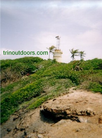
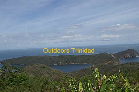
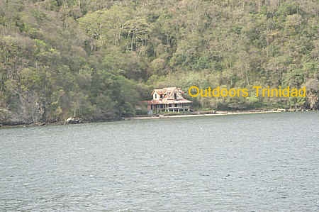
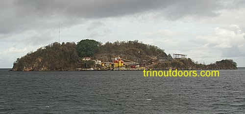
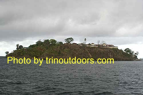
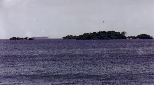
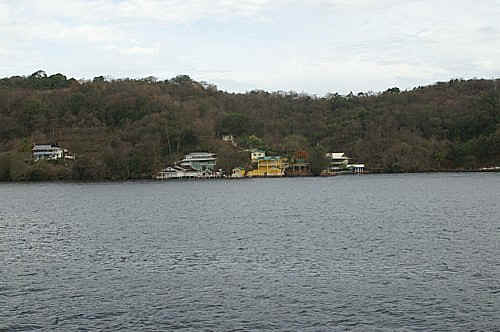
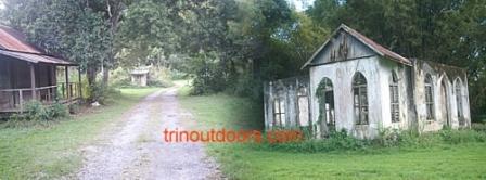
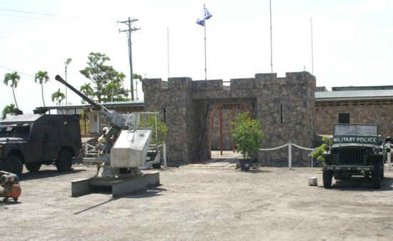
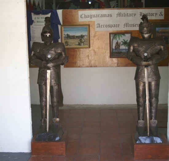
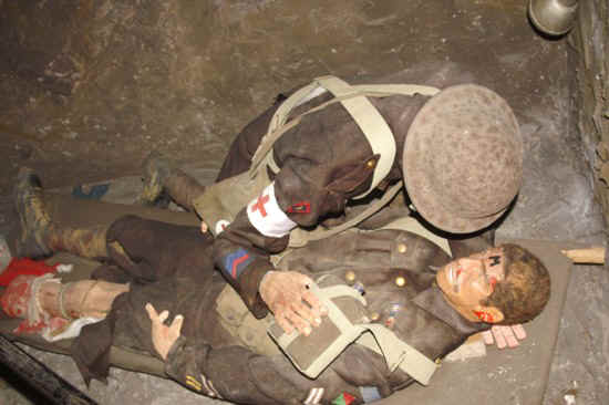
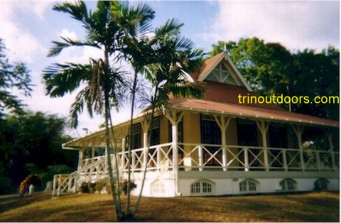
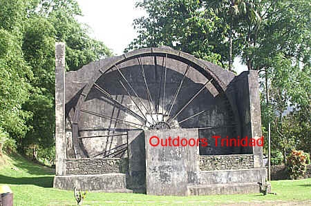
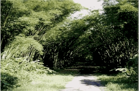
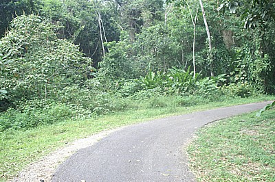
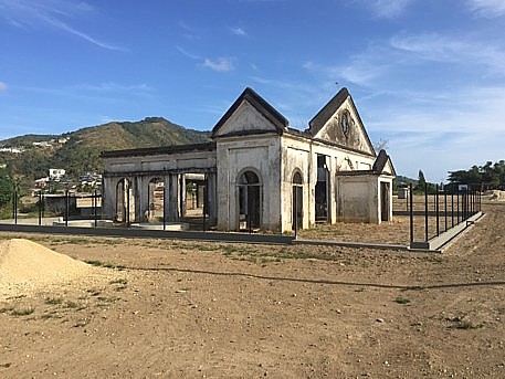
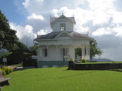
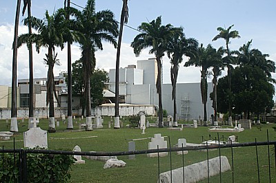
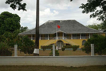
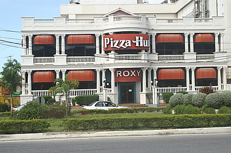
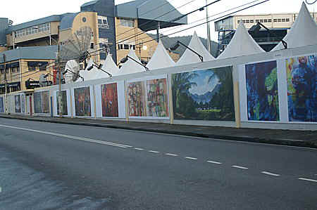
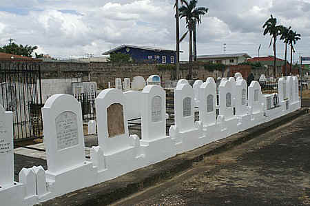
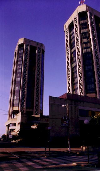
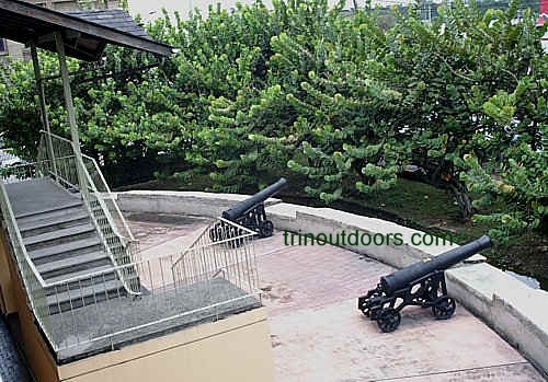
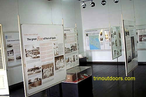
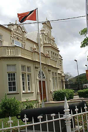
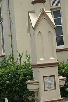
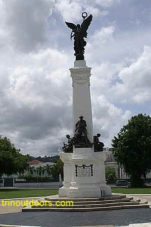
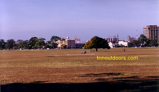
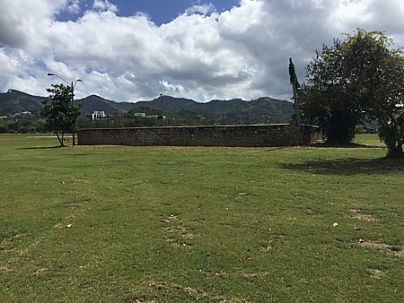
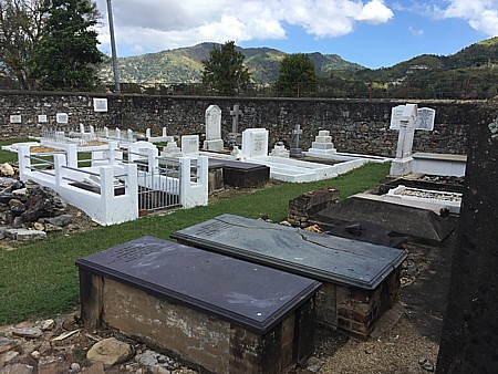
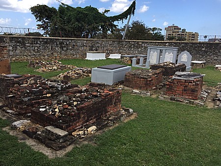
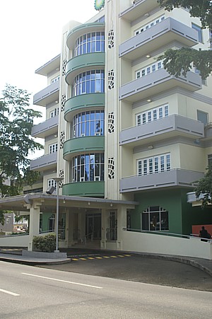
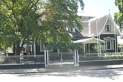
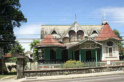
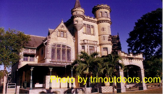
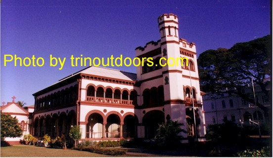
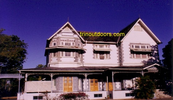
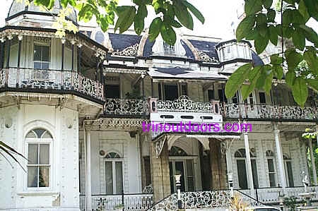
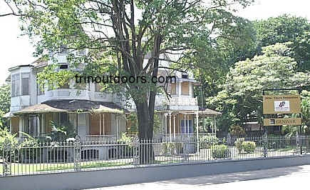
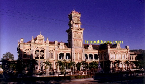
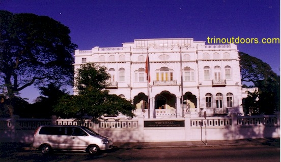
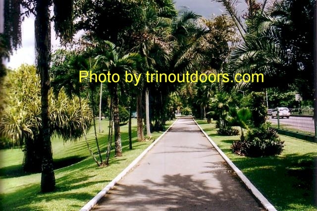
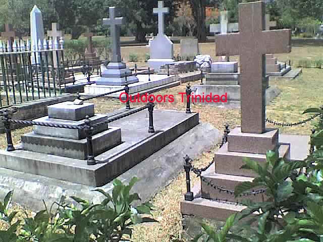
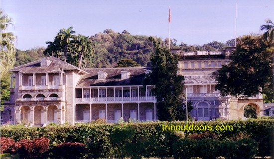
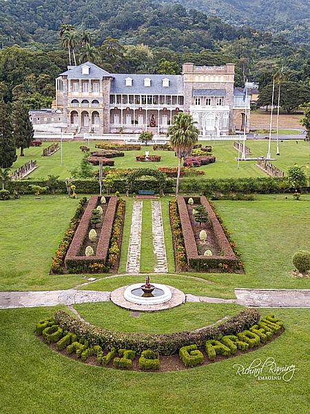
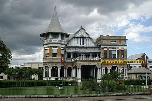
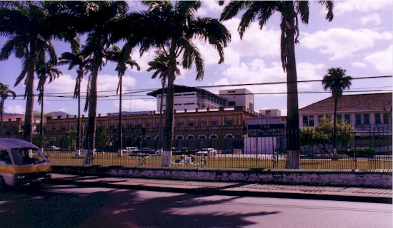
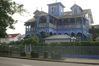
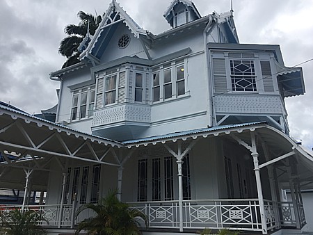
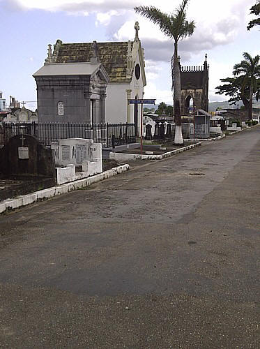
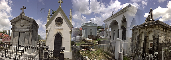
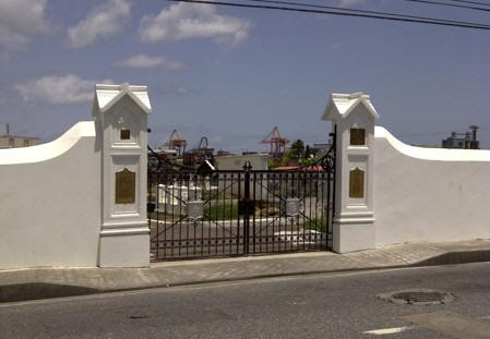
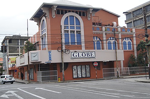
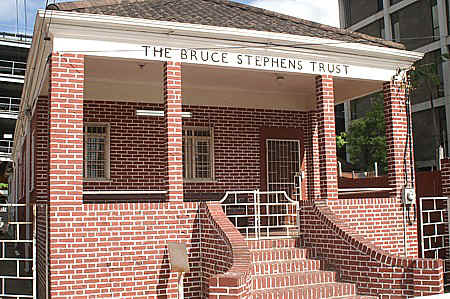
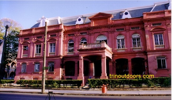
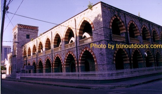
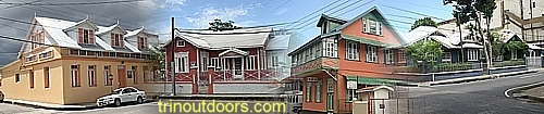
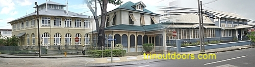
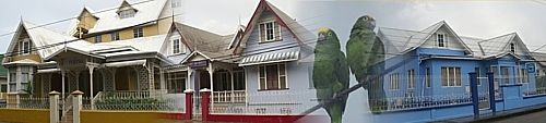
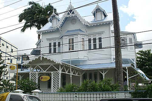
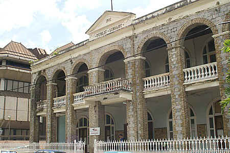
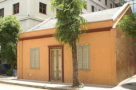
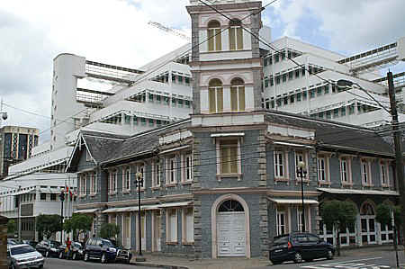
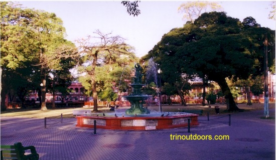
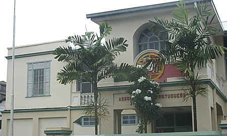
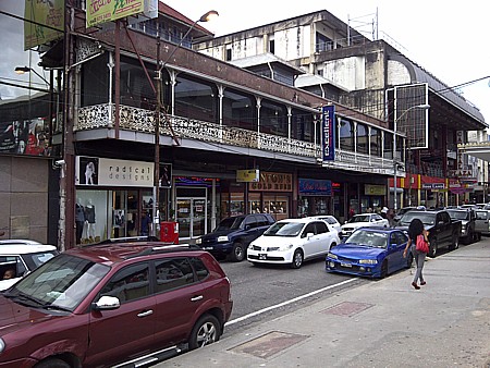
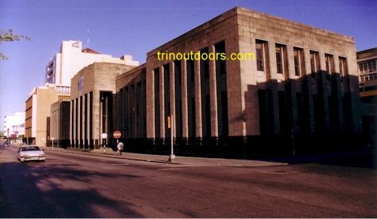
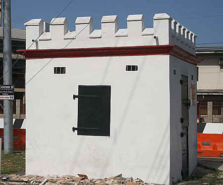
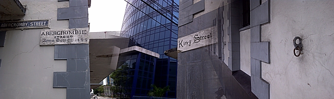
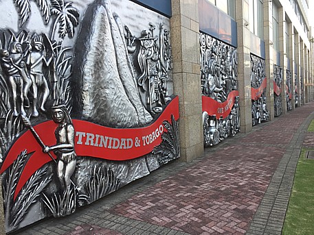
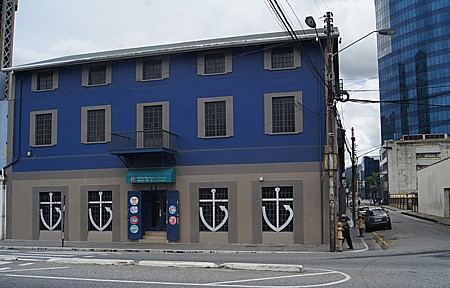
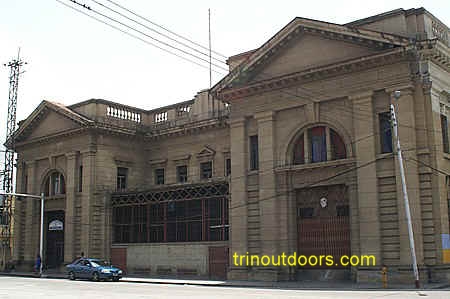
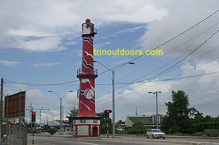
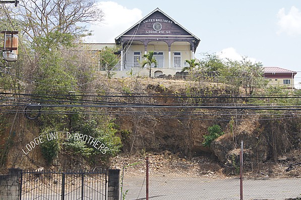
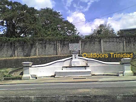
 The Maracas
Bay Agri Tourism Park is a beautiful setting with rows of fruit trees and the sheds
dotting the property while the hills of the Northern Range carpeted in forest green
enclose the entire area. With the abundance of fruit trees a wide variety of birds dart
through the park. The Park is approximately one minute from
The Maracas
Bay Agri Tourism Park is a beautiful setting with rows of fruit trees and the sheds
dotting the property while the hills of the Northern Range carpeted in forest green
enclose the entire area. With the abundance of fruit trees a wide variety of birds dart
through the park. The Park is approximately one minute from