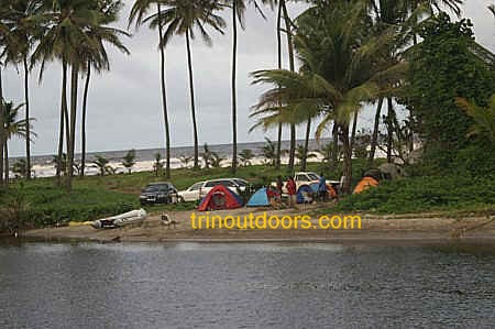
Trinidad does not have dedicated campgrounds that
would be found in many North American and European countries but camping is popular during
the dry season reaching a peak on the Carnival weekend
and on the Easter holiday weekend (Good Friday to Easter
Monday). During the Easter weekend it is advisable to secure your camp sites early (from
Thursday night) at the popular camping areas, as the best locations are quickly taken.
Part
of the popularity of camping at Easter time is the added security provided by the many
other campers in the same area. When going camping, it is a good practice to stop at the
Police Station in the area where you plan to camp and inform the police that you will be
camping in the area and where your campsite will be. At the end of your camping trip you
should also stop at the Police Station and advise them that your camping expedition is
over. For more advice on camping security see the article, Staying safe on remote camp
sites.
For advice on Choosing the Best Tent, Picking a Sleeping Bag, How to make a camp fire
and other camping advice see our articles
area.
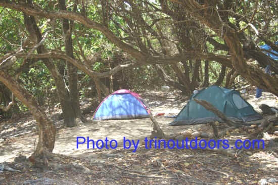
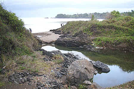
The most popular camping sites are located on beaches, as would be expected on a
Caribbean island, but some persons do camp in forested areas along rivers.
Camping at Chacachacare can at times be like camping on your own private island and if
you are at the right time of year you can see hawksbill turtle nesting. The fact
that this is the furthest of the offshore islands means that only those persons with
access to a boat can visit this island. The remoteness means that all camping supplies
must be brought with you, including water. Those individuals who use a water taxi from the
Island Property Owners Dock to get to Chacachacare must remember to carry a fully charged
cell phone (preferably two) in order to summon assistance in the event of an emergency as
there are no residents on the island other than the keeper of the lighthouse. A permit
from the Chaguaramas Development Authority is required in order to camp on the island.
Persons who are visiting the island for only one day do not require a permit and the most
popular beach on the island is La Tinta Bay.
Camping takes place at La Tinta Bay, Perruquier Bay, Coco
Bay and at the other bays on the island. Further information on Chacachacare can be
found on our Other Places of Interest Page.
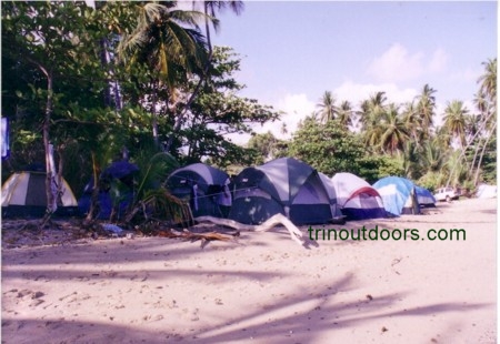
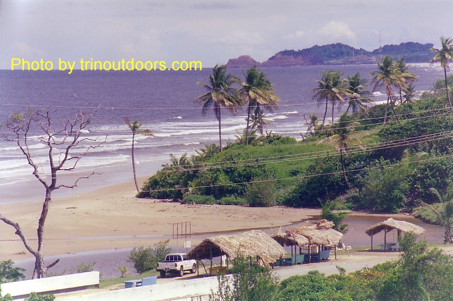
Camping is allowed at Maracas Bay and Tyrico Bay. For the Easter weekend a permit is required
from the Tourism Development Company. The permit is obtained upon payment of a small fee
and designates the specific location where the tent can be placed. Apart from the scenic
beauty of the bay, the popularity of this beach for camping stems from the easy
availability of drinking water, toilets, showers, the close presence of the police station
and shops & bars in the nearby village.
This beach is also popular for camping during the
Easter weekend because of the easy availability of drinking water, toilets, showers and
small shops & bars in the nearby village. The fishing depot at the northern end of the
beach also has potable water.
It is not advisable to camp at the south-eastern end of the bay unless in a large group
as this area, while visually attractive because of the natural forest descending directly
to the beach, is deserted and so less secure.
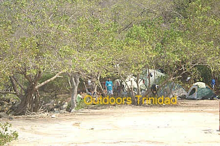
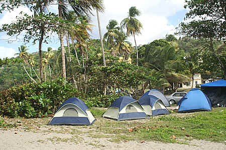
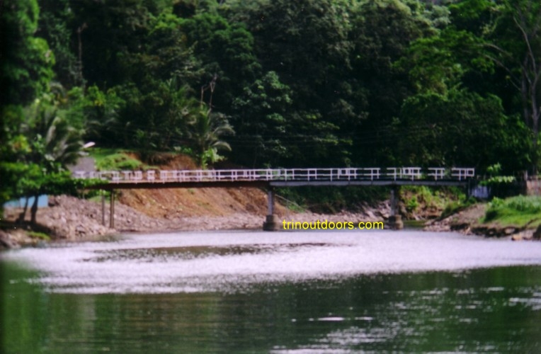
The most popular camping spot in the Blanchisseuse
area is along the banks of the Marianne River. There is a private land owner who
has created a camp ground and allows
camping on his property for a small daily fee. Toilets
and showers are available on the property with a small charge for their use,
plus potable drinking water is available. The
owner has also erected a small bar that serves drinks and simple meals. In addition he allows
car parking within the boundaries of his property. The property is on the
beachfront and a short distance from the banks of the river. Unfortunately
because many persons who go to the beach and the river do not clean up when
they are leaving, the owner of the adjoining property
(Laguna Mar Resort) has erected a wall
along the edge of the property to prevent cars from being driven up to the
river. The driving of cars up to the river mouth compacts the sand making it
difficult for the leatherback turtles to scoop out the sand during the
leatherback nesting season.
The wall was therefore also intended to make it easier for the turtles to
nest by blocking cars from this area. It is still easy to access the river
from the campground as one simply has to walk along the beach from the camping site.
The owner of the Laguna Mar Resort has however now begun to allow vehicles
to use the concrete path alongside the restaurant to access the beach. This
vehicle access is subject to the payment of a small fee for access. To see a
short video of the beachfront visit
Blanchissuese Bay on our Beaches
Page. On the weekends paddle boats
are available for rental on the river.
Just outside the campground there is a small shop and
as
this area is on the outskirts of the village, food and other supplies are
also available in the
village shops for those who have forgotten any essential items. There is a police station
in Blanchisseuse and also a health center that sometimes has an ambulance stationed at it.
Both of these facilities are along the main road. Also along the main road are several pay
telephone booths.
Another popular camping location is the small beach that is directly opposite the Blanchisseuse police station
and at the side of the fishing depot. The area between the sand and the cliff is small so
that there is only sufficient space for one camping group.
While camping is popular in many locations at Easter, Blanchisseuse is one area where
camping is done throughout the year.
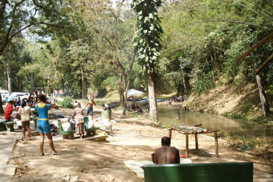
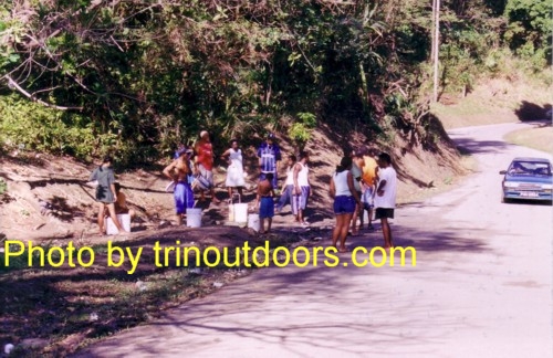
As a result of a Government decision in 1943 to construct a dam, the majority of the
Caura valley has no human habitation. A brief synopsis of the history of the valley is
given on our Other Places of Interest Page. Over
time the name Caura has come to be synonymous with the Trinidadian term "river
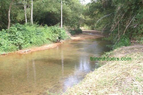
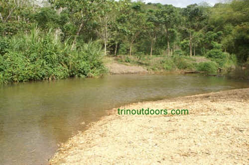
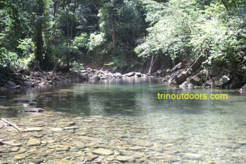
lime".The clear river water and low population make Caura River a favorite for
camping, picnics and recreational bathing.
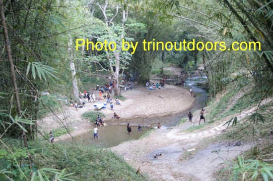
The most popular spots are at the abandoned pump house and are called Pool Number 1 and
Pool Number 2. The river is so popular however that there is insufficient space at these
locations for all the people who go to this valley on a weekend and so every stretch of
the river that has a clearing is used for picnics, usually involving cooking at the
riverside. The majority of this cooking is accompanied by the playing of loud music. The
water level along the river is generally low and so most bathing consists of sitting and
soaking in the river.
As the upper reaches of the valley do not have many homes, there are no shops and so
all camping items must be transported into the valley. Directly along the river bank is
the preferred location for camping and there are Ajoupas at some points. To cater for the
demand for relaxation spaces, a park has been created on the hillside on the western side
of the road between Pool Number 1 and Pool Number 2. To see more photographs of Caura,
visit the Photo
Gallery and enter the search term "Caura".
From the Eastern Main Road in Tacarigua, the location of of the pools is approximately
25 minutes drive along the Caura Royal Road.
The Valencia region is in the eastern part of Trinidad. The Valencia Road
begins in the village of Valencia at the Eastern Main Road and runs until it joins with
the Toco Main Road. The Valencia Road is bisected by several rivers, the Turure, La Seiva
and Oropouche rivers. The river banks in the immediate vicinity of the road are the
popular camping areas. Being so close to the roadway, these areas attract large crowds
particularly on holiday weekends. The Valencia region is also popular for river limes.
Matura Village is in eastern Trinidad, along the Toco Main Road. There are
two areas that are popular for camping in Matura; along the banks of the Matura River and
on Matura Beach. The Matura River bisects the Toco
Main Road and the banks of the river in this area are flat, so suitable for camping. This
river has clear water and is relatively shallow along this stretch hence its popularity as
a camping area, however with many people swimming in the same area, the water gets
slightly cloudy. There is a private landowner who, for a small fee, allows vehicles
to go through his property and so reach a part of the river above the road side
campers.
There are two small shops in the village where forgotten items and ice can
be purchased. There is also a police station in the village. An activity that is sometimes
engaged in by campers in Matura is the hike to the Mermaid Pools (also called Matura Basin).
Sally Bay, along the Toco Main Road and after Matura Village, is another
of the popular camping locations. Most individuals erect their tents either on the beach
or on the northern banks of the Rio Seco River. Along the northern section of the beach
there is a wide flat area bounded by shade trees that is also used for erecting tents.
There is a beach facility with showers and toilets that is open on weekends and public
holidays. There is also a fishing depot on this beach. In the village immediately before
the beach are two small shops (one on the Main Road and one inside the village), while in Matura Village are also two shops.
The Beach Review page has more information on Sally Bay.
Balandra Bay is further along the Toco Main Road, after Sally Bay and Rincon Beach. The road to the beach is
called Balandra Bay Road and is on the southern side of the Toco Main Road. Camping on
this beach is particularly popular at Easter. The two ends of the beach plus the grove
along the Balandra Bay Road are the preferred locations. The trees at the beach ends
create a mixed grove of coconut, almond and sea grape.
Freshwater is available at the fishing facility at the northern end of the
beach. One of the benefits of Balandra, as a camping site, is that the village of Rampanalgas is close by with a well stocked grocery and
bar, vegetable stand and snack vendor. Freshwater is also available in Rampanalgas at a
standpipe on the Main Road. For information on the sea conditions, see the Beaches Page. For more photos of the beach, visit the photo gallery and
enter Balandra in the search field.
Along the Toco Main Road at the 33 kilometer distance marker, shortly
after the center of the village of Rampanalgas is a small cove that is a favorite camping
location of some individuals. This cove is directly alongside the Main Road. The beach
side camping is done on the northern end of the cove where a low wall prevents
encroachment from the sea. Also at the northern end of the cove, a small river flows to
the sea. The accumulation of beach sand prevents the river from flowing directly into the
sea creating a small pool that is ideal cooling off. At the southern end of the cove
another small river crosses the road and enters the sea. Camping takes place on the banks
of this river on the western side of the road (land side).
Both of these camping spots are small spaces with room for only two or
three tents. Fishing is a favorite
activity of campers at this location. The sea can be rough at times on this beach and
there are no lifeguards so most bathing is done in the rivers.
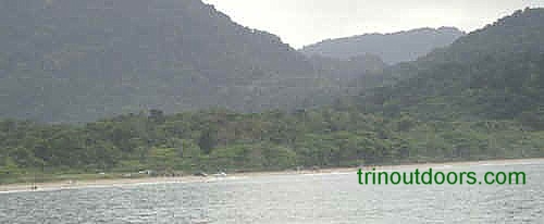
The Toco area has a variety of locations for camping with the most popular being Salybia Bay. This bay is located on the north-eastern
tip of the island along the road leading to the Toco lighthouse. One of the reasons for
the popularity of this particular beach is the presence of a stand pipe that provides
potable drinking water.
There are no houses between the beach and the road and the area has a mixture of
coconut, almond and other trees. On the western end is a grove of trees that is always
shaded and cool. Tents can be erected among the trees. See the Photo Gallery for
pictures of Salybia camping (enter the search term salybia). On the eastern side of the
beach, there is an open area where tents are also erected. The regional corporation
usually places portable toilets throughout the open area during Easter weekend. Food and
other supplies are available in the nearby village. As this is a very popular camping
location during Easter, the area fills up quickly.
Patience Bay, which is also along the road leading to the
Galera Lighthouse, but before Salybia, is another popular location for camping. This bay
has a small river that runs through the center of the bay. Bathing in the river is not
advised as the water in the river flows very slowly. The river bank however provides flat
areas for tents and is above the high tide mark. During holiday weekends this beach has
less campers than Salybia. On our Beaches Page there is more information on Patience Bay.
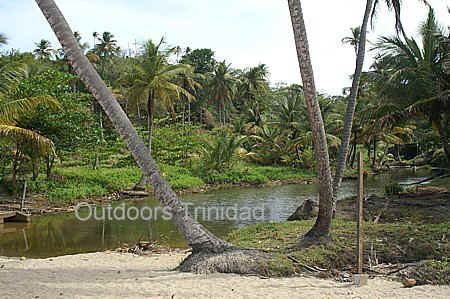
Mission has a very wide flat sandy beach that has ample space for
erecting tents above the high tide mark. There is a small river that meets the sea at the
western end of the beach and has several pools that are ideal for soaking through the heat
of the day or frolicking with children. On the beach there is a parlor that sells
miscellaneous items and there are a few other parlors in Mission village, while the shops
in Toco are not far away. On the Beaches Page is additional
information about Mission.
Camping at La Fouray is truly a back to nature experience. Individuals who camp here
must bring all supplies as there is no freshwater or electricity or shops. In exchange for
such small deprivations the camper is rewarded with a blue-green sea, dramatic rock
formations and the sounds of nature at night. Individuals can camp on the headland which
is cooled by constant sea breezes. The area of the sand beach is also a camping spot as up
from the beach the land levels and tents can be placed among the trees.
For photos of the beach, visit the photo gallery and
enter Fouray in the search field. The Beaches Page
provides directions for finding La Fouray.
Big Bay at Sans Souci on the north east coast of Trinidad is a scenic beach. The beach slopes upward from the sea and
then dips slightly to flatten into a grass sand area that rolls away to a small river. It
is this flat area behind the beach that is used for camping. The apex of the beach has low
sea grape and almond trees that provide a wind break for tents. It is a lovely spot with
the small sea grape trees at the top of the beach, tall coconut palms on the beach side
and almond trees interspersed in the area before the river.
The Paria Main Road is reasonably close by so there is no far distance to drive off
road. There is also a wide flat grassy area just off the road, which is used for parking
vehicles. During the Easter weekend the Regional Corporation provides disposable toilets
for use by campers. The beach is near to the village and in the village there are two
parlours and two bars that can provide some basic foodstuff and alcohol.
Located on the north-east penninsula, approximately 10 minutes drive after the village
of Gran Riviere, Shark River flows through the
Matura National Park. This is a highly accessible river as the river crosses the road on
its journey to the sea. The majority of camping activity takes place along the banks of
the river in the areas near the roadway. On the seaward side are several large pools that
provide a refreshing swim as the water is bracing in its coolness. On the mountain side of
the roadway, the streambed is rocky but there are a few pools in the vicinity of the
roadway. This area is a national park and so has retained its natural vegetation with Mora
forests and bamboo stands along the river.
The upriver portion is idyllic and encourages
exploration. The river flows through a rocky streambed that allows walking along the side
of the river, with the forest descending to the side of the river. Along the river are
clear pools that invite the walker to take a refreshing dip. Periodically small
tributaries join the main river, while hummingbirds and kingfishers may occasionally be
seen.
For those who want to enjoy the ambiance of the river
but only want to spend one day, Shark River is also a good location for a
River Lime.
Matelot is a small village on the north coast of Trinidad
that is accessed by a single road which winds along the coast, passing through the
villages of Cumana, Toco, Lance Noir, Sans Souci and Grande
Rivere. As is typical with this part of Trinidad, it is an area of great natural
beauty with untouched forest, rugged coast line and crystal clear rivers. The Matelot
River enters the sea in the village of Matelot and most of the camping activity is in the
area near the river mouth. Many persons while camped at Matelot undertake the hike to the Matelot Waterfall. In the village of Matelot
there are no real shops just roadside parlors, so it is best to carry everything that you
might expect to need on your camping trip.
Along the road between Shark River and Matelot, several
streams enter the sea and the banks of each of these are also used as camping areas.
North Manzanilla Beach has a wide grassed area that is set back from the shore and
maintained by Cepep. Part of this flat area is open land while other parts have numerous
coconut trees with open spaces between. For those who want to combine activities there is
an old Trace, just west of the camping area, that runs for several miles following the
undulating land and provides an invigorating hike. There are no facilities at North
Manzanilla beach so everything you plan to use, especially water, must be brought in by
you. There are a few small roadside shops along the road leading to the beach but no shops
in the immediate vicinity of the beach.
To get to North Manzanilla you follow the Eastern Main Road to Manzanilla from Sangre
Grande. Immediately after the Manzanilla Gas Station and just before the Anglican Church
you take the left fork in the road. Follow this road for approximately 4.5 kilometers and
then take the road on the left (there is no sign). If you miss this left turn do not worry
because shortly after the main road ends in a dead end above the beach. For more
information on North Manzanilla Beach see our Beaches
Page.
Manzanilla Bay (also called Cocos Bay) is another
popular camping area. This beach is over 20 kilometers in length and so there is ample
room for everyone who wants to camp along this beach. The most popular camping areas are
at the northern end where there are shower and toilet facilities and towards the southern
section of the bay at the Nariva River mouth.
Along the bay near the river mouth between the Nariva River and the sea is private
property where camping is allowed for a small fee. This area is attractive because you are
sandwiched between the river and the sea. Campers should carry insect repellant as there
are mosquitoes at night. For more information on Manzanilla Beach, visit our Beaches Page.
Mayaro Beach lies to the south of Manzanilla Beach and
is approximately 17 kilometers in length. Camping occurs along the beach front at almost
any area where there is room.
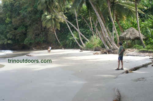
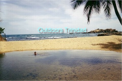
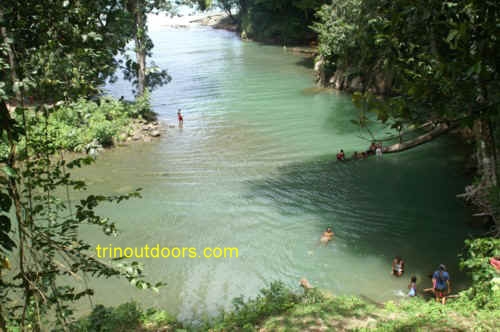
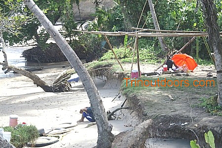
A very popular camping location is at the southern end of the bay after Sandsucker
Drive in the area known as "Indian Bay". In this area, a small river enters the
sea, with the river providing a calm spot for bathing, as shown in the photograph above.
Another popular camping area is at Church
Road in Radix Village.
The Morne Diablo Beach offers a great location
for camping on the bluff overlooking the ocean. The
distance down to the beach is very short and on the actual bluff there is a
constant breeze.
This location provides a level surface with
concrete for pitching tents and there are poles set in the concrete for
those who are simply looking to pull a tarpaulin over poles. There is
sufficient space for several groups on the bluff. The
entire level surface of the bluff is relatively clear of vegetation partly
due to the concrete surface between the various poles. The bluff is backed
by forest on two sides with the other sides being the ocean and a fishing
depot.
The last 4 kilometers of
the road leading to Morne Diablo Beach runs through a Teak Plantation so
there are no houses or businesses in the immediate vicinity of the beach
although on the beach front there is a fishing depot.
One of the things that must be borne in mind
if choosing to camp at Morne Diablo is that you must being sufficient water
as there are no drinking water supplies on the beach. Should you run out of
supplies while camping at this beach there is a shop in Morne Diablo village
but it is approximately 6 kilometers from the beach.
As mentioned earlier there
are no houses within several kilometers of the beach so it is advisable that
anyone choosing to camp overnight on this beach only do so with a very large
group for safety reasons.
This is another of the popular locations for camping in South Trinidad during Easter.
The best spots are along the roadway leading to the beach, where the land between the
trees has been cleared and is maintained by the Ministry of Agriculture.
Ajoupas have been built among the trees and there is also space for
erecting tents. There is no potable water supply in the area so all drinking water must be
brought to the site. There are a few small snack vendors at the the beach and so campers
must bring all food and other supplies.
For additional information on Quinam Bay see Quinam Beach in our Beach Review.
Located midway between Point Fortin and Cedros,
Granville affords the opportunity of camping directly alongside the beach and is very
popular during Easter. There are no shops in the immediate vicinity of the beach but there
are several shops in the village a short distance away. Information on beach conditions
can be found in our Beach Review. To get to
Granville Beach you turn off the Southern Main Road at Granville Road and then turn left
onto Coromandel Road.
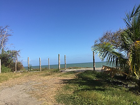
Point Coco Beach lies on the southwestern penninsula between Granville and
Chatam. It is a quiet beach area that is a short distance from a small village but with no
houses on the beach. At high tide the sea comes up the full width of the beach but there
is a raised area suitable for camping as shown in the picture below.
All photographs (unless otherwise stated) are the property of Brian
Ramsey. None of the photographs may be reproduced without the express written
consent of Outdoor
Business Group Limited
and Brian Ramsey.