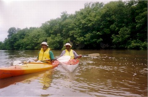
Trinidad provides several
opportunities for kayaking enthusiasts. Below we give a synopsis of several areas for
kayaking in Trinidad. To find the locations referred to on this page, see the Trinidad Map.
One point that should be noted by anyone seeking to kayak in Trinidad
rivers is that care should be exercised during the rainy season particularly if there are
torrential showers in the particular area. Heavy downpours can cause river levels to rise
rapidly and bring debris downstream.
For information on Kayaking
in Tobago, visit our affiliated web site, Caribbean Outdoor Life.
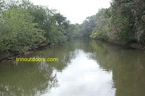
The Nariva River provides a year round opportunity for kayaking and empties into the
sea at Manzanilla Bay. There are two easily
accessible entry points; at the river mouth and at the bridge along the Manzanilla/Mayaro
Road that spans the river. When entering or exiting the river at the river mouth, during
low tide, care should be exercised to ensure that you are not swept out to sea as the flow
out of the river can be quite strong. Along the river it is possible to see basking caimans, while tarpon (known locally as grande ecaille) are sometimes
seen near the surface of the water. The Nariva River mouth is also a popular fishing area.
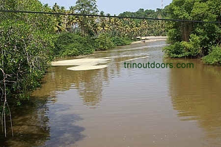
At the southern end of Manzanilla Bay, the Ortoire River empties into the Atlantic
ocean and it also provides a year round opportunity for kayaking. There are several entry
points for this river with the easiest being at the river mouth. Another entry point near
the river mouth is at the fish market where the Manzanilla/Mayaro Road crosses the river.
At the fish market it is possible to park your vehicle and walk down a slight incline to
get access to the river. The Ortoire River, while emptying into the sea at Manzanilla is a
very long river that actually begins on the outskirts of Princes Town in the area known as
Indian Walk. As it approaches the sea, its flow is
enhanced by the joining of the Poole River. Its flow is further enhanced by the joining of
the Balata River on the outskirts of the village of Pierreville in Mayaro. Another easy entry point to the Ortoire River is
alongside the bridge on the Naparima/Mayaro Road that spans the river on the outskirts of
Mayaro.
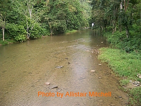
In its lower reaches the Ortoire is quite wide, being approximately 75
feet across. As you proceed upstream from the river mouth and leave the village of Ortoire
the river narrows to approximately 40 - 50 feet and on the outskirts of Pierreville the
river further narrows to approximately 20 - 30 feet across. In the lower reaches the banks
of the river are lined with mangrove however as you proceed upstream the flora changes to
bamboo and forest.
During the rainy season the sediment in the water gives it a muddy brown
appearance, however in the dry season the water is a translucent green. The Ortoire River
mouth is also a popular fishing area.
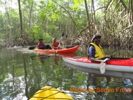
Kayaking in the Godineau area takes you through a variety of habitats, from saltwater
mangrove swamp to fresh water marshland to partially cultivated areas. A variety of
birdlife can be seen on these kayak trips including Scarlet Ibis, Southern Lapwing, Osprey, Savannah
Hawk, Wattled Jacana, Cattle Egret, Yellow-hooded
Blackbird, Lesser Yellowlegs, Black-bellied Whistling Duck and a variety of migrating ducks (during
the northern winter).
The Godineau River is one of the rivers in Trinidad that provides a year round kayaking
opportunity as the water level is always sufficient. This kayak trip can be started either
from the Gulf of Paria along the area known as the Mosquito Creek or inland from the
Woodland area.
The Godineau river is also known as the South Oropouche River.
Kayak Tours along the Godineau River are available from Wetland Kayak Tours - 868-766-4035
Another kayaking opportunity in south Trinidad is the River of Hope in Moruga. This area appears on some maps as the
Moruga River. This river is used by commercial fishermen who live inland and use the river
as their route for piloting their pirogues (boats) out to sea. The river therefore
provides a wide relatively deep channel for the kayaker. An easy entry point to the river
is at the Spring Bridge in La Ruffin, from which you
have the option to either paddle upstream or downstream to the sea.
To get to Gran Chemin, Moruga you travel east from Princes Town and turn
onto the Moruga Road at St Julien. The Moruga Road runs for approximately 23 kilometers
and ends at Gran Chemin. La Ruffin Beach lies to the east of Gran
Chemin, Moruga and is accessed via La Ruffin Road that intersects the Moruga Road
shortly before Gran Chemin. The Spring Bridge on La Ruffin Road spans the River of Hope.
The road that goes from Bonasse and Fulleraton to Icacos in Cedros runs through marsh
and swamp areas. It provides an easy opportunity for kayaking as you literally lift your
kayak off the car or trailer and place it in the water. The marsh area has numerous open
patches of water and in other parts you paddle your kayak through reeds and rushes. This
area is rich in bird life and so while paddling you have the chance to observe many
wetland species. Our Birding Hotspots
Page outlines some of the species that can be seen. One of the attractive features of
Cedros is that the penninsula is narrow, so you are never far from the various villages
and can easily engage in multiple activities. Our Area
Summary Page, located under Places of Interest outlines some of
the other activities to be experienced in the Cedros region.
The Caroni Swamp on the western side of the Uriah Butler Highway is a fantastic place
for kayaking. While it is possible to enter the swamp using literally any of the various
streams and irrigation channels that flow across the Uriah Butler Highway, one of the
better starting points for kayak exploration is to use the Blue River. The launch point on
the Blue River is the same location as where the tour guide boats take on passengers for
bird watching tours.
The Blue River leads to the sea and while the river channel
starts out being relatively narrow, as the river is joined by various tributaries it
widens considerably.
At the initial part of the river the water is brown with a very muddy appearance,
however as you progress along the river and as you branch off the main river the water
quality changes significantly becoming almost translucent green.
The Caroni swamp is a fantastic place for kayaking as you are not restricted to the
main Blue River but can explore the various tributaries and in turn further explore the
side creeks that join these tributaries. Some of these side creeks open into lakes that
are in the middle of the swamp, while others lead to swamp areas that have an ethereal
forest like quality. Some of the lakes are very shallow being only two feet in depth and
so need to be explored at high tide because the water level falls as it turns to low tide
and you can be stuck on a mud bank.
Kayakers can explore the tributaries that are on the northern
side of the Blue River however to explore the tributaries on the southern side of the Blue
River requires a permit as this is a restricted area.
Kayaking through the Caroni swamp is a great way to experience a swamp environment.
Unlike being in a tour boat where there is the noise of the engine, kayaking through the
Caroni allows you to experience the swamp in an almost silent manner with the only sound
being the sound of your paddles hitting the water. Throughout the swamp you can see
Scarlet Ibis flying overhead and as you glide along within the swamp you will see them on
the trees. Two other widely seen residents in this environment are the Tri-coloured heron
and the Little blue heron, along with Cattle and Snowy egret. In the early part of the
Blue River, you can also see Pied Water tyrants and Red Capped Cardinals. The Crested
Oropendola can also be seen inside the swamp along with the Solitary Sandpiper, while the
Bell Bird is heard.
Those who kayak from the launching area to the sea will find the journey takes about
1.5 hours however you need to be aware that if you return when the tide is falling and so
there is a strong flow to the water heading to the sea then the return journey can take
2.5 hours as you paddle against the current. If the wind is blowing the paddling is even
more strenuous.
If you do not own a kayak, to experience kayaking in the Caroni Swamp you can arrange
with one of the various tour guides or check our Events Calendar for the organised kayaking trips.
The Tompei River is on the outskirts of Cumana Village
in Toco.
This is a relatively short kayak trip that can be started from the bridge on the Toco
Main Road that spans the river and goes down stream. Kayaking is not allowed upstream of
the bridge as there is a water intake facility on the up stream side, which supplies the
surrounding areas with drinking water. The river flows through partially cultivated land
and then on to a mangrove area before finally entering the sea.
This kayak trip begins at the
mouth of the river in Sally Bay (Saline Bay) just off
the Toco Main Road in Matura. The lower reaches of this river as it approaches the sea
always has sufficient water depth to allow kayaking throughout the year and the river is
very wide at the lower reaches. As with other rivers in Trinidad however, the kayaking is
best at the end of the rainy season when the water levels are still high to allow you to
explore further up the river. Within a few minutes of the leaving the river mouth you are
enveloped in the stillness of nature with the only sounds being the rustle of animals in
the undergrowth and the whistling of the birds.
Further along this river is the Rio Seco Waterfall, however there are several narrow
rock pools before the waterfall that can present a challenging portage. Most persons visit
the Rio Seco Waterfall
by hiking. The width of the river on its last leg before the sea means that the novice
kayaker has ample room to practice and enjoy the sport of kayaking. The length of the
river however also allows the more experienced kayaker to travel further inland and enjoy
a morning or afternoon on the water. There are lifeguards on patrol on the beach and there
is also a life guard booth at the mouth of the river facing the lower part of the river.
The river mouth and beach front are very easy to get to, as you simply turn off the Toco
Main Road at Salybia Beach Road just before the big bridge. A one minute drive along this
road leads to the beach.
Kayaks are available for rental at the beachfront. At present kayak rentals are only
available on weekends and public holidays. There are also bathroom facilities on the beach
front. In addition to combining a trip to the waterfall with your kayaking, you can also
arrange other nature trips at the water sport center. During the turtle nesting season, if
you stay in the area until nightfall you can include a visit to the nearby Matura beach to
view the nesting of the leather back
turtles.
There are snack vendors on the road way that leads to the beach.
One point to be noted about the beach on which this river empties is that the correct
name is Sally Bay, as the real Salybia Beach is in
Toco near the lighthouse.
This river empties into the sea at Balandra Bay and offers a relatively
short kayak trip through mangrove and hardwood forest. The upper portion of the river has
boulders that require frequent portaging. This kayak trip can be combined with kayaking on
the Rio Seco River or Tompei River to create a full day.
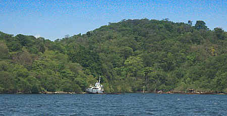
The wide river mouth at Grande Riviere
allows kayaking in the lower reaches of the river. A few of the hotels in the vicinity of
the river have kayaks for use by their guests. Unfortunately as one proceeds upstream,
after crossing the bridge, there are sections where the combination of lowered water level
and boulders requires carrying the kayak to get past the boulders.
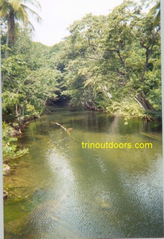
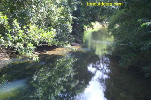
The Marianne River empties into the sea at Blanchisseuse and it is easiest to begin your paddle
from the river mouth. This is not an extended kayak trip for most kayakers as upriver
there is an area known as Three Pools that results in a somewhat difficult portage.
Kayaking in this area is best towards the end of the rainy season as the water level is
high enough to allow paddling for the entire trip. During the dry season there are parts
of the river where the low water level requires walking the kayaks.
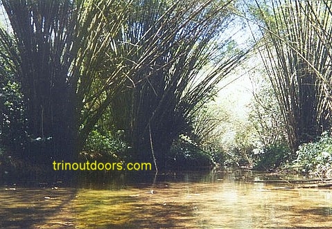
At the river mouth freshwater marsh vegetation exists along the banks of
the river while freshwater swamp forest exists further inland with towering stands of
bamboo. As you kayak along the river a variety of bird life can be seen
including spotted
sandpipers, kingfishers, gray kingbirds and striated
herons.
At the river mouth, there are
kayaks available for rental every day, all year and kayaks
are also available for pre-arranged trips.
Another kayaking opportunity in the Blanchisseuse area is the Yara River.
This river is immediately after the village of La Fillette and at the entrance to
Blanchisseuse. Starting from the river mouth presents a slight difficulty as it is
surrounded by private property with holiday homes but it is possible to walk along the
edges of the properties to get to the river mouth. Kayaking along this river is best
towards the end of the rainy season as the water level is high enough to allow paddling
for the entire trip.
This kayak trip can be combined with kayaking on the Marianne River for a
full day.
Lying just on the outskirts of Port of Spain, this bay is highly
accessible and the inner waters of the bay are relatively calm. The easiest entry point is
at the lookout off of the Audrey Jeffers Highway, popularly known as the Foreshore.
Williams Bay, Chagaramas provides kayaking opportunities in relatively
sheltered ocean waters, as the north-western penninsula blocks the currents of the
Caribbean Sea. In the bays on the coastline opposite the Military museum it is sometimes
possible to see marine iguanas on the rocks and in the sea and capuchin monkeys in the
trees.
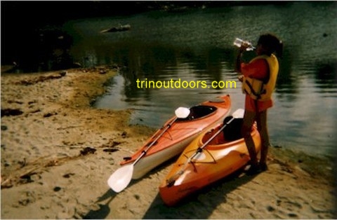
Kayak Rentals are available every day all year from the Kayak Center.
This is a kayaking area that gives you the opportunity to kayak in a relatively
sheltered bay and at the same time observe natural flora and fauna. Hart’s Cut Bay is
located in Chaguaramas and is sometimes called Yachting Association Bay because the
Yachting Association is located in the bay while others call it Anchorage Bay because the
Anchorage nightclub is in this bay. Hart’s Cut Bay derives it name from Daniel Hart,
who in 1856 cut a narrow channel through the neck of Point Gourde to allow small boats to
pass from Carenage to Chaguaramas Bay. Hart's Cut existed well into the twentieth century
before it was abandoned and filled in.
You can launch your kayak from any point along the Western Main Road as it goes past
Hart’s Cut Bay. There are very calm waters inside the bay. It is best to kayak along
the western and southern sides of the bay to avoid any boats motoring around the bay. Near
the entrance to the bay, wind driven waves approach you from the east heading west.
Near
the entrance to Hart’s Cut Bay on the southern side of the bay is Masson’s Bay.
Masson’s Bay is a deep indentation in the Point Gourde peninsula, the entrance to
which is marked by several derelict vessels. The waters of Masson’s Bay are very calm
and clear as the bay is protected from the wind by the penninsula. If you are lucky you
may see the Capuchin monkeys that sometimes come to the trees at the water’s edge.
Marine iguanas often swim at the entrance and climb on to the rocks at the northern
western side of the entrance to the bay. On the northwestern side of the bay near the
entrance are two very small beaches on which are seen are coral fragments that are the
remnants of a long dead coral reef. In the inner parts of Masson’s bay Immature
Scarlet Ibis are sometimes seen.
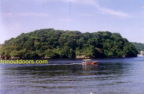
Another kayaking opportunity in the Chagaramas area begins in the area of
the Almoorings Fishing Depot/Crews Inn Marina. From this starting point it is possible to
kayak along the coast to the Bocas or turn south and paddle to Centipede
Island (also
known as Little Gasparee or
Gasparillo) and then across the channel to Gasparee Island.
When paddling in this area one should be alert to the various power boats
that are entering and departing from the various marinas, particularly on weekends.
Other kayaking opportunities in the Chaguaramas area include the trip to
the Five Islands and to the San Diego Islands.
All photographs (unless otherwise stated) are the property of Brian
Ramsey. None of the photographs may be reproduced without the express written
consent of Outdoor
Business Group Limited
and Brian Ramsey.