For those who want more detailed information on
some of the various cycling areas in Trinidad that are off the Main Roads, this page
provides that information.
Many persons use the Chaguaramas peninsula for cycling and the most popular area is
the Macqueripe Road. Although this road has reduced vehicular traffic when compared to
many other major roads in Trinidad, there is still significant vehicle traffic. Chagaramas
however because of its old military roads and natural vegetation provides several cycling
areas with little or no vehicle traffic while mentally refreshing you with the sights of
nature.
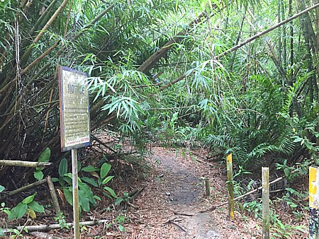
Shortly after you enter Chaguaramas National Park, immediately after the Kayak Center
on the northwestern side of the Western Main Road is a narrow old road that is barred by a
metal barrier gate. There is usually a fruit seller at the entrance to the road. Going
around the gate takes you into an area that is known as Guave Road and enables you to ride
through an area that is mixed agricultural and secondary forest. The road is mainly packed
dirt and eventually exits onto Macqueripe Road.
Further along Macqueripe Road on the right (eastern side), just before Samaan Park, is
Covigne Road. If you had driven to this point you can
park your vehicle in the car park at Samaan Park and begin your bike ride at
this point. The entire ride along this road is through secondary forest.
After a few minutes along Covigne Road the road veers
left and there are large No Entry signs, however there is a dirt road to the
right and it is this dirt road to follow for the bike ride. At times there
is a low barrier across the dirt road to stop vehicle access however
cyclists can skirt the barrier and continue.
At the eastern
end of Covigne Road is a single bar barrier to prevent vehicle access but cyclists can
easily go around the barrier. As you continue there is a choice of going left or right.
The left turn leads to the Cuesa River and shortly before the river on the right (east)
there is a slight incline that leads to a nutmeg grove and a rivulet that tumbles over a
rock face, providing a refreshing shower. The trail on the right immediately after the
barrier provides the opportunity for an exciting ride through vegetation as the road
narrows to a single person track with the vegetation pressing close. There is a gentle
uphill climb that leads to a former World War 2 bunker. To leave the Covigne Road area you
have to go back along the same route as you entered. An interesting addition to this ride
is to use the Huggins Trail (described on
our Other Hikes Page) as the entry point to Covigne Road.
Further along Macqueripe Road is the road that leads to the Chaguaramas Golf Course.
This well paved road provides a ride through alternating patches of secondary forest and
former tonka bean estate. When riding through this area you can often hear the roar of the
Howler monkeys and in the evenings you can see the Amazon parrots coming in to roost. The
road ends at the golf course car park and clubhouse. During the rainy season you can see
the water tumbling down Edith Falls which gives a
dramatic backdrop to the clubhouse. For those in need of light refreshments after the
exertions of their ride, the clubhouse provides the opportunity for a light snack. To the
right of the car park (northwestern side) there is an old road along which you can
continue your ride and which exits onto Macqueripe Road.
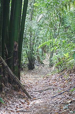
As one approaches the end of Macqueripe Road near to
Macqueripe Beach, there is a road
on the right (eastern side) that leads to the tracking station. The early part of this
ride goes through arching stands of bamboo
that have an almost cathedral feel. The latter portion of this ride is well suited for
those who want a strong cardio-vascular workout because after the bamboo grove it is an
uphill climb to the tracking station.
At the northern end of Macqueripe Road lies Macqueripe
Beach whose crystal clear waters always invite you to abandon your bikes for a short
while and have a swim. For the avid mountain biker the Macqueripe to Chagaramas
Golf Course trail, which begins at the Macqueripe Beach car park, is an exciting ride.
At the southern end of Macqueripe Road immediately after the former power station (Base
nightclub) there is a road on the left (western side) that has a metal swing gate for
blocking vehicles. Cyclists can easily go around the gate. This is a relatively short ride
through secondary forest and then to the Government experimental farm. On afternoons and
weekends there is no exit from this area, so cyclists have to retrace their route and exit
at the entry point.
Many of the rides through these various areas that branch off along the Macqueripe Road
are not of extended duration, however their close proximity allows you to mix and match
areas to get a variety of road surfaces and riding environments.
In
our previous section under Chaguaramas
Biking Trails we focused on areas at the entrance to Chaguaramas,
particularly those areas off the Macueripe Road. There are however other
areas in Chaguaramas that offer interesting areas for cycling. Indeed the
Western Main Road that leads into the Chaguaramas National Park and runs the
length of the peninsula is by itself an interesting ride. Portions of the
road provide you with sea vistas while other sections give you views of the
many yachts that visit Trinidad to avoid the effects of the hurricane season
and have repairs conducted at the many marinas. The road ends at the
entrance to the army base.
An
interesting short diversionary ride is to swing off the Western Main Road
and go along Airways Road. This road takes you behind the Chaguaramas
Convention Center and past the Hotel School and then goes past the Fire
Services Training School before gently descending to join onto the Western
Main Road. Cycling through this area is cycling through a mixture of urban
landscape and scrub forest and at times especially early morning and late
evenings you can see the green parrots coming to and from their roosts while
other birds flit from one patch of undergrowth to another. A very enjoyable
ride for those who are very fit is the ascent of Morne St Catherine. This
road (Cano Ventura Road) branches off Airways road and takes you to the top
of the 1,700 foot Mount St Catherine peak. Going to Mount St Catherine is
bicycling through nature and history with a variety of wildlife and World
War II emplacements. You can learn more about this area in our
Morne StCatherine
section.
Shortly after the Trinidad Yachting Association headquarters is a road on
the left (southern side) that leads to the Point Gourde peninsula. This is
another area that has a long history, in this case going back beyond World
War II and at the same time offers riding on a mixture of roads and trails.It also gives the chance to see Capuchin Monkeys, Squirrel Cuckoos
and Rufous-tailed Jacamars. In the Point Gourde
area are remnants
of
fortifications built
by
the
Spanish and
British between 1796 and 1805 and Admiral Apodaca’s fleet of ships, was
scuttled off Point Gourde in the British invasion in 1797. You
can learn more about this area by visiting our
Point Gourde section on our web
site.
As one continues along the Western Main Road after the Yachting Association
Bay, one encounters several roads on the right (northern side) called
Granwood, 1st Avenue, 2nd Avenue and 3rd Avenue. Entering any of these roads
allows one to explore an area of old trails, abandoned buildings, small
streams, birds in trees and small animals scuttling across your path. All of
these roads interconnect allowing you to crisscross through the area, until
you reach the army's Camp Omega Battleground Camp (at which point one must
turn back).
Many individuals are familiar with the
Bamboo Cathedral in Macqueripe,
Chaguaramas and use the paved road that runs through the area for walking,
jogging, and cycling. There is however a trail in this area that is
excellent for mountain bikers or persons looking for a walk in the serenity
of nature. The entrance to the trail lies on the right immediately as you
enter the road leading to the Bamboo Cathedral.
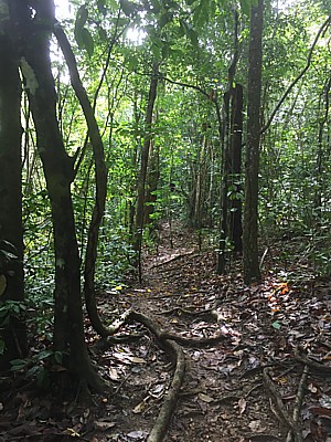
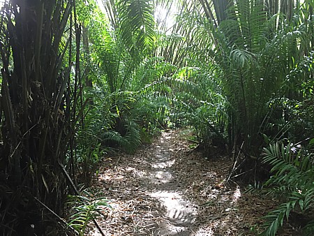
The trail at this point goes through stands of Bamboo and does a loop
that after 15 minutes of walking brings you back close to the entrance on
the paved road. There is however a spur that branches off the trail and
following this spur provides you another 30 minutes of hiking.
The trail is mainly flat with some low short inclines. Some parts of the
trail pass thru arches of bamboo while other parts go through forested land.
In the early mornings you can hear the cries of howler monkeys
reverberating through the forest. If you are lucky you may even see some of
the monkeys. Along some sections of the trail there are numerous Heliconia
balisier plants and these attract hummingbirds seeking to sip on the nectar
from the flowers. These hummingbirds fly so fast through the undergrowth
that you hear the buzzing of their wings rather than see them. Along the way
Blue Morpho butterflies flit ahead of you.
This extended part of the trail also ends on the paved road that runs
through Bamboo Cathedral although at a different location than where you
would have entered.
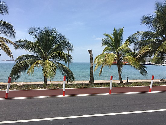
The Chaguaramas peninsula is a favorite location for cycling in Trinidad
with many routes that cater for both road cycling and off-road bicyclists.
Later on this page we identify some of those routes. Among those cycle
routes is the Western Main Road which runs the entire length of the
peninsula and provides cyclists with a relatively flat route.
As this roadway is shared between vehicles, bicycles and joggers, the
road has been widened and a special cycle lane added. Beginning at Skallywag
Bay and extending for 5.5 kilometers, this cycle lane is clearly demarcated
with plastic lane separators and in some sections with a different color
asphalt. This special lane allows cyclists and joggers to be able to enjoy
their recreation without being on the same lane with vehicles.
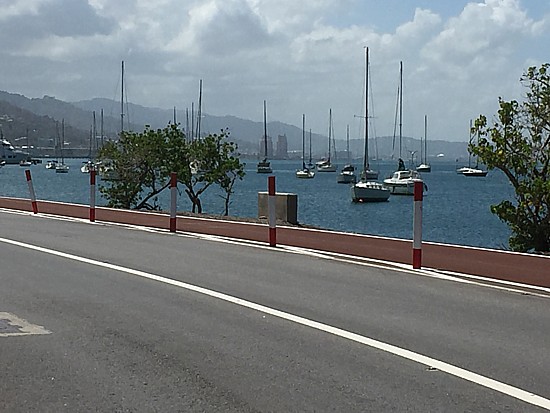
Along the route cyclists will go past parts of Williams Bay, the
Military
History Museum, yachts at anchor and in storage plus some of the
entertainment facilities in the Chaguaramas peninsula. So that cycling along
this bicycle path provides the rider a scenic route.
Trinidad is blessed with a range of old estate roads, hiking trails and hunting tracks
that make excellent trails for riding Mountain Bikes. Here we outline a few of the
Mountain Bike Trails in Trinidad.
Lalaja Road
This mountain bike ride is along another of the trails that are also used for hiking as
it leads to Lalaja Waterfall. If you choose to visit the waterfall however, you need to be
aware that at a point along the trail you will have to leave your bicycle at the side of
the trail. You may therefore choose to simply do the ride up to that point and enjoy the
ambiance and natural setting of Trinidad’s Northern Range. The first part of Lalaja
Road is an old road with a deteriorating surface, as you proceed along the road it becomes
a dirt grass trace. For the majority of the trace it is wide enough to allow two and three
riders to ride abreast. As this is a ride in the Northern Range there are uphill and
downhill portions although none are particularly steep but they can be long. For directions to get to Lalaja Road, see our
Waterfalls Page.
Martinez Trace, Brasso Seco
Martinez Trace is located in Brasso Seco and you can find directions for getting to Brasso Seco on our
Other Places of Interest Page. Approximately 2 miles after you cross the junction of the
Arima Blanchisseuse Road and begin heading into Brasso Seco, you will see Martinez Trace
on your left. The Trace is an old dirt road and there is a old sign nailed to a cocoa
tree. Martinez Trace is a fast, technical downhill ride along a single track that cuts
through the rainforest. There is a 900 foot drop in elevation over the two miles of the
trail. Riding this trail requires at least intermediate level skill at mountain biking. At
the end of the trail, if you take the Brasso Road to return to your starting point it is
approximately 5 miles of mostly uphill.
Madamas Road
The Madamas Road is another mountain bike trail that starts in the village of Brasso Seco. The Madamas Road is in
the heart of the village on the right and the start of the road is well signposted. The
road begins as a bumpy paved road and then becomes a muddy (in the rainy season) single
track. The Madamas Road goes through magnificent rain forest with several stream
crossings. At the second stream crossing you can follow the stream up river to two
waterfalls. The overall length of the trail is 18 kilometers. Although this trail is
listed for intermediate skill level, persons with lesser skill can ride it once they
proceed slowly.
Double Rivers Waterfall Mountain Bike Ride
Many people hike to Double River Waterfall on the outskirts of Brasso Seco but this
trail can also be ridden on Mountain Bikes. This Bike ride is actually part of the overall
ride along the Madamas Road. The trail goes through old cocoa estates and rich tropical
forest, along gently undulating land with a short uphill portion and then a downhill as
you near the waterfall. As with all dirt tails in Trinidad during the rainy season it can
be muddy. The overall time to ride the trail and return is approximately 2 hours, not
counting the time you spend at the waterfall.
Trail to Ti Delma and Laspor Beaches
This mountain bike ride begins at the suspension bridge in Blanchisseuse, although some
persons may choose to begin the ride further along the road. After the bridge the paved
road becomes a wide road of packed dirt. Some individuals choose to begin their ride
approximately 0.4 kilometers after the bridge where in the rainy season there is a major
mud pool. This trail goes through a combination of secondary forest, original rain forest
and old estates. The trail has a mixture of flat sections, gentle down/uphills and 30
– 45 degree downhills. There are two sections where the surface is a smooth clay on
an incline. You can learn more about this trail on our Beaches page in the section, Beyond Blanchisseuse.
Paria Branch Trace, Sans Souci
This trail begins as a paved road and then becomes a dirt track that can be muddy in
the rainy season (June- November). As you progress along the dirt track you will
eventually have to go in single file and there are sections where the trail may be
partially overgrown. Along the trail you will encounter several stream crossings that can
be ridden across or walked across. The trail is a progression of ups and downs going up to
600 feet and then back down to sea level. The trail is essentially one track with only one
turn off, approximately ˝ mile after the start of the trail there is a road that goes
uphill on the left but you need to turn right. At the end of the trail you can reverse
your route and ride back along the trail or ride along the Paria Main Road back to Sans
Souci.
To get to Paria Branch Trace you drive to Toco and then continue on to Sans Souci. At Toco (the small roundabout where you can
turn left to go to the Galera lighthouse)
the Toco Main Road changes name to become the Paria Main Road. On entering Sans Souci you
drive to Beach Break, which is the second bay in Sans Souci. Approximately 100 meters
after Beach Break there is a bridge on the right, which marks the start of the trail. On
your bike ride across the bridge and up the hill taking the first right. Then follow this
trail, the only other turn is about .5 mile after this where a road goes up hill to your
left, do not go there, turn right.
All photographs (unless otherwise stated) are the property of Brian
Ramsey. None of the photographs may be reproduced without the express written
consent of Outdoor
Business Group Limited
and Brian Ramsey.