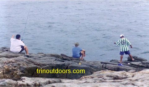
Fishing is a popular recreational
activity throughout the Caribbean and definitely in Trinidad. Anyone with a line, a hook,
bait, patience and a little luck can go fishing. We are an island and so there is an
abundance of locations for fishing and each fisherman has their own favorite fishing spot.
Occasionally however fishing enthusiasts like to try another location.
On this page we outline some of the popular fishing areas where almost every day
individuals can be observed fishing.
For convenience we have divided the country geographically and clicking
on the geographic link below will take you to that section of the country. To find
the locations referred to on this page, see the Trinidad Map
For advice on fishing, visit our Articles section.
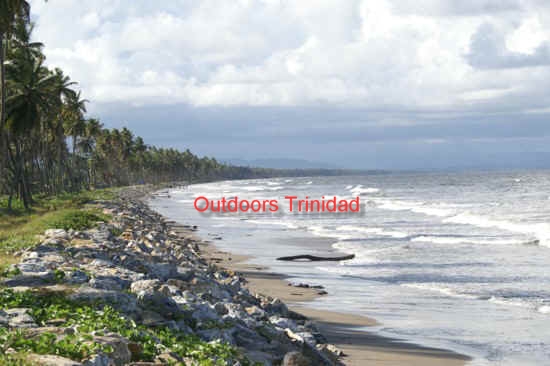
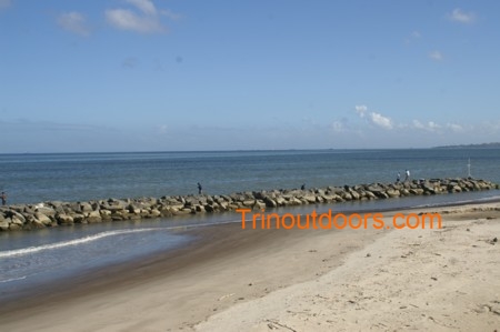
Mucarapo Bay is on the outskirts of Port of Spain, along the Audrey Jeffers Highway,
also known as the Foreshore. Fishing in this area is usually only done at high tide
because at low tide the water level on the in-shore area is extremely low.
The large population in Port of Spain and its environs with its myriad fishing
enthusiasts places pressure on shore based areas of the north-west peninsula of Trinidad
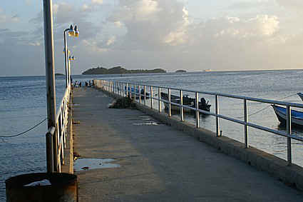
as recreational fisherman seek open sea front. The recent construction of a jetty in
Carenage has provided an additional location for those whose hobby is fishing.
This jetty is located next to the Carenage fishing depot immediately before the Alcoa
bauxite terminal. The jetty is a concrete structure with railings and wide enough to allow
fishing on either side. An added benefit of fishing from this jetty is the row of lights
along the jetty that allow clear vision in the night. The water in this bay is somewhat
shallow and so it would be best to fish as high tide approaches.
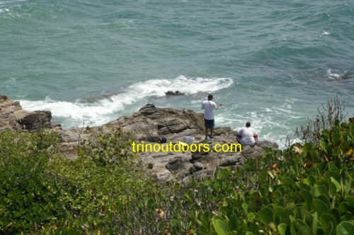
The close proximity of Chagaramas National Park to Port of Spain and its
environs makes it an extremely popular fishing area. Almost every exposed area of
coastline is used for fishing. Within Chagaramas however some locations are used more
frequently than others.
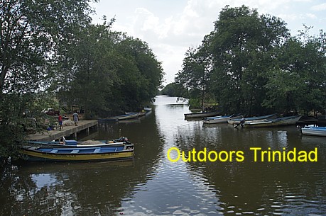
Williams Bay
Williams Bay is located at the eastern end of Chagaramas and is the first
bay encountered as you enter the peninsula along the Western Main Road. Part of the
attraction of this area is the low sea wall that provides a solid platform for standing.
Another attraction is the fact that it is possible to park your vehicles next to the sea
wall. At low tide the sea level in this area is very low and so the majority of fishing is
done at high tide, particularly when high tide occurs during the early afternoon hours
(3pm - 7pm). The eastern end of the bay is the area in which most fishing activity occurs.
This is a fishing spot used by those in the know. The end of the road
leading to the Salt Factory in Chaguaramas (First Avenue South) is a quiet fishing spot
used by locals in the Chaguaramas area. It is a small area with room for only two
fishermen. One of the reasons for it's popularity is the fact that the water level is
deeper than at other land accessible fishing spots in the area.
This bay is along the Western Main Road in the Chagaramas peninsula
immediately after the entrance to the Trinidad and Tobago Sailing Association. Fishing
takes place from the rocks on the edge of the bay along the road. While the catches in
this bay are not huge and, as is typical of fishing, not guaranteed, people either catch
often enough or see others catch often enough to keep them coming back to the bay. The
bottom of this bay is rocky particularly as it approaches the shore so fishermen should
walk with extra hooks, line and weights.
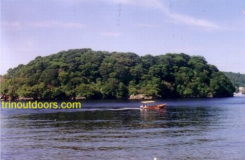
This island is a popular fishing spot for those in the know. The actual
fishing location is not on Centipede Island but actually on a small islet on the northern
side of the island. For those without a boat, a water taxi can be hired at Island Property
Owners facility for the short trip (5 minutes) to the islet. Arrangements can be made with
the water taxi for collection at a designated time or upon a cellular call.
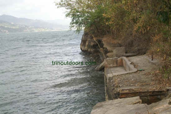
Located at the end of the Tucker Valley Road in Chaguaramas is Macqueripe Bay. The
rocks on the northern side of the bay are often used for fishing. Also used for fishing is
the abandoned jetty on the northern side of the bay. The photo of Macqueripe Beach on the Beaches page shows the jetty.
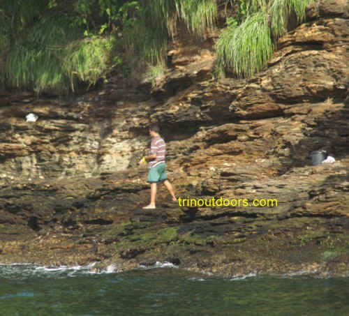
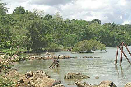
This is not a well known fishing spot but ideally structured for the
recreational rock fisherman. It is on the northwestern side of the Point Gourde penninsula
in Chaguaramas. On this part of the penninsula there is an old seawall with areas that
make good benches. Close to the wall are underwater rock structures that usually attract
fish and there are abandoned ships in the vicinity that also attract fish. Behind the
seawall is a flat area that makes a good campsite for those who want to do an overnight
fishing expedition. The area has many mosquitoes and so insect repellant is required, if
staying overnight. Across the bay is a marina and hangars that provide a visual attraction
at night.
To get to this location is a relatively easy hike of about 40 minutes and
our Other Hikes page has a description of the
hike and directions.
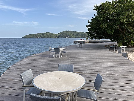
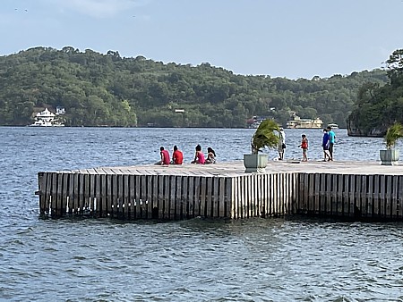
Chaquacabana Resort and Beach club is located at the western end of the
Chaguaramas peninsula, immediately before the entrance to the Regiment and
Coast Guard bases. The resort covers 12.5 acres with a series of suites and
room, clean and beautiful outdoor lawn areas, a pool, a private beach for
swimming, an outdoor bar, an outdoor restaurant and sits on the Gulf of
Paria with a great view of Gasparee, Centipede, Cronstadt Islands. The best
feature however for those interested in fishing is that Chaquacabana Resort
has a 1,800-foot boardwalk that can be used for fishing.
Anyone interested in using the boardwalk for fishing must acquire a day
pass (resort guests exempted) and the current fee is TT $100. The day pass
allows you to fish throughout the day and into the night. The ability to
fish at night is particularly attractive because the design of the resort
and positioning of the boardwalk allows you to do nighttime fishing without
being visible to passing cars on the Western Main Road.
The day pass also gives you use of the pool, bathroom, beach, bar and
restaurant. So, if the fish are not biting or you just want a change of
activity these are available to you.
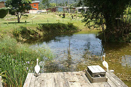
The Maracas Bay Agri-Tourism Park has a small pond that is
stocked with tilapia and cascadura and gives visitors the opportunity to catch fish from
the pond. The fishing is strictly catch and release. You can bring your fishing equipment
or use the rods and bait that the park supplies. This type of fishing is especially good
for introducing small children to the joys of fishing. For more details on the park, see
our section on the Maracas Bay
Agri Toursism Park on the Other Places of Interest Page.
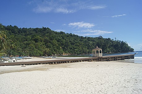
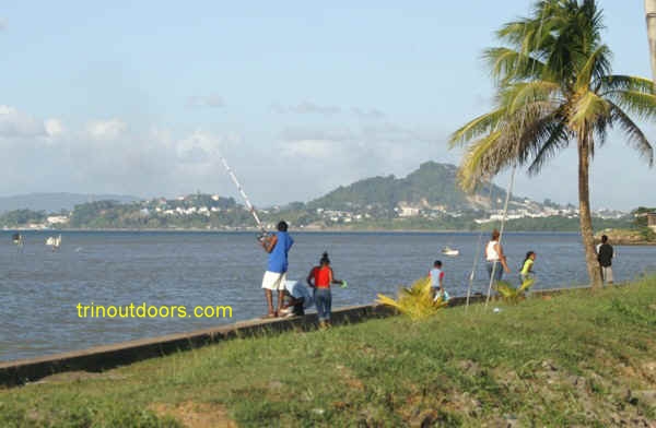
Most people associate Maracas Bay with bathing in the sea, cricket or
football on the beach, relaxing with a group of friends. Most people do not
think of Maracas Bay as a location to go fishing. Yet Maracas Bay is a
location for casual fishing, and this is possible because of the jetty that
is located at the south-eastern section on the bay.
The jetty at Maracas Bay provides a convenient location that is generally
away from most people who are bathing in the sea. The road is nearby so it
is easy to park your vehicle and then walk directly onto the jetty. Only a
few people can fish simultaneously as you need to be at the end of the jetty
to cast your line outwards into the deeper water. The best fishing time is
at high tide as the water at the end of the jetty is then deeper resulting
in the fish being closer to the jetty. It is also best at early morning when
less people are in the water.
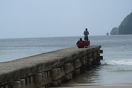
The area around the Maracas Bay Jetty is not known for catching large
fish. Most people catch small fish, however as most will tell you, it
is the excitement of feeling the fish nibble at the bait and then bite and
then the adrenaline surge that comes as you hook the fish and then reel in
the line trying to ensure that the fish stays on the hook.
It is easy to combine a period of fishing on the jetty with a relaxing
swim afterwards in Maracas Bay. Fishing at the jetty also provides the
advantage that if you did not catch anything you can always purchase fish
from the commercial fishermen in the village and tell your friends that you
caught it.
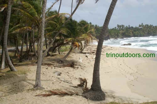
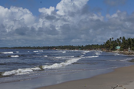
Las Cuevas Beach lies along the North Coast Road,
approximately 8 kilometers east of Maracas. The bay is often used by north coast
commercial fishermen for catching bait fish, as schools of small fish gather in the bay.
Wherever schools of fish gather, larger fish eventually come to prey, hence the popularity
of this bay for fishing enthusiasts. Even if the larger fish are not caught you are
generally certain to catch some of the small bait fish, leading to an enjoyable day. The
north eastern end of the bay in the vicinity of the fishing depot is the most used
location because of the safety caused by the numbers of people in the area.
To get to Fort Abercromby,
you go past Las Cuevas beach and fishing depot and take the first road on the left and
follow the road until it ends at the fort. If you follow the tracks leading north you
emerge on a headland with the sea below. The south track brings you to a promontory
overlooking Las Cuevas Bay. For those using the north
headland, you should carry plenty of line as the headland is a significant height above
the sea.
The rocks at Galera Point are a favorite fishing ground of many,
especially the area below the lighthouse. To get to
Galera Point you turn off the Toco Main Road at the round-a-bout in Toco Village and
proceed easterly, going past the Toco Composite School and Salybia Bay. The lighthouse is at the end of the
road. On arrival at the lighthouse you walk along the northern side of the lighthouse and
follow the track to the rocks. One fact that must be taken into consideration by anyone
going onto the rocks is that the splash of the waves against the rocks can be heavy at
high tide. This can cause the footing near the edges to be slippery. Occasionally the
splash and spray are heavy enough to soak persons near the edge.
The headland at La Fouray is a little known fishing spot but highly
favored by those who know of it. The headland is not far above the water and the water
surrounding is deep so it does not require plenty of line to make a good cast. Spare hooks
and sinkers must be brought on any fishing expedition to this headland as there are
numerous rocks in the water below the headland.
The La Fouray headland is along the same coastline as Galera Point. For directions to La Fouray visit our Beaches Page.
This beach is along the Toco Main Road after Rampanalgas Village and
before Cumana Village. The beach is directly opposite Khan Avenue. It is an area of heavy
surf and currents that is not suitable for swimming but good for fishing. A long heavy rod
is recommended for this beach.
On the Toco Main Road at the 33 kilometer distance marker is a small
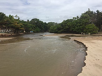
cove where two rivers run to the sea at either end of the cove. The cove is adjacent to
the main road and there are a few locations where there is sufficient space on the edge of
the road to park your vehicle. Part of the attraction of this cove for fishing is
the low sea wall that provides a place for sitting as well as placing your bait and other
equipment. The waters offshore contain rocks, so extra line, hooks and weights should be
brought with you. This cove is also a favourite camping
spot.
At the 34.5 kilometer distance marker on the Toco Main Road, shortly
after the village of Rampanalgas, is a flat cliff top that provides a great location for
fishing. The cliff faces the open ocean on one side and a sheltered bay on another side.
There is ample space for parking several cars off the main road and then one approaches
the ocean side of the cliff.
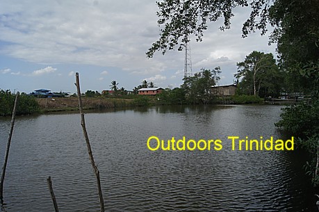
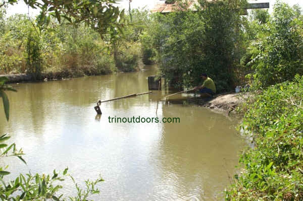
For those who like River Fishing, the area of Fishing Pond is a region to
explore. Traversed by 3 rivers, North Oropouche River, Cunapo River and
Caigual River this region offers possibilities for the river fisherman.
Fishing Pond is an area on the outskirts of Sangre Grande in eastern
Trinidad. The region is primarily an agricultural area with small housing
settlements designated as Upper Fishing Pond, Lower Fishing Pond and Lemond.
Within the area are the North Oropouche Wetlands, the
Fishing Pond Lagoon, the Wind belt Forest Reserve and the
Fishing Pond Beach which is a
continuation of Matura Beach and a
nesting site for leatherback
turtles.
Accessing Fishing Pond is easiest done by using the Oropouche Road from
Sangre Grande although you can also access the area using Logan Road from
North Manzanilla (the junction with the NP Gas
Station). In seeking to fish in the Fishing Pond area you can stop at
the Cunapo River which is crossed by a bridge on Oropouche Road, however
there is very regular traffic crossing this bridge so it would not be a
relaxing experience.
The easiest area to fish on is the Caigual
River. Accessed by going along Oropouche Road and then turning on to Genda
Road and following to the end, this takes you to an area that has no traffic
and you can cast your line from on the banks of the river. At this point the
river runs through a flat agricultural area with no houses in the vicinity
and only small structures used by farmers during the day.
Farmers in the area state that Boche and Grand Ecaille (Tarpon) come up
stream to this section of the river. You can fish from any
section along the banks or arrange with a local boat owner to take you
downstream to the point where Caigual River joins with the North Oropouche
River.
The video below shows the section along the Caigual River. The video was
done during a period after heavy rainfall so the water is discolored.
The L 'Ebranche River begins in the western part of Manzanilla and flows
eastward through Manzanilla to enter the sea at the northern end of
Manzanilla Bay. At the river mouth
there is an opportunity for both river fishing and surf fishing as the beach
front is wide along this part of the coastline.
Residents say that Brochet (Snook), Mullet, Salmon, Pargue (Dog Snapper) can
be found in this river. High tide is the best time for fishing the river as
sea species enter the river on the rising tide, although the falling tide
can also be good at the river mouth as these species depart the river.
Golden hammerhead sharks have been found in this river and a team from
National Geographic has visited Trinidad to study these sharks in this area.
It is said that their golden colour is the result of a diet of crustaceans
mainly crabs and shrimp.
At
low tide a sand bar that partially crosses the mouth of the river provides a
location for fishing the river. There is a wall along the western edge of
the river at the river mouth and this provides a location for fishing the
river mouth at high tide.
To
access the mouth of the L' Ebranche River you proceed along the Mayaro
Manzanilla Road and enter Calypso Road in the vicinity of the
Manzanilla
Beach Facility. Calypso Road runs in front of Carries on the Bay Hotel
and there is a sign for Coconut Cove Hotel. Follow the road to the end where
the Government has constructed a car park. You can also find this location
on the Outdoors Trinidad map.
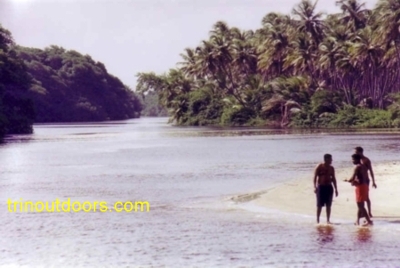
The mouth of the Nariva River is found along the Manzanilla/Mayaro Road. For those
coming from Sangre Grande it is after the initial stretch of coconut trees when the road
swings away from the coast and then rejoins the coast after going through a forested area.
For those approaching from Mayaro, it is shortly after the road leading to Kernahan Village.
This location may be the most popular fishing spot on this entire coastline. It is
possible to fish from the bridge, beach or river bank. The particular species that will
usually be found in estuaries are Tarpon, Mullet, Salmon, Grouper and Nariva has all of
these. As with all river mouth fishing the change of tides is the best time for catching
as the larger fish enter the river on the high tide and exit on the low tide. One factor
to be remembered when fishing in this area is that at dusk, the mosquitoes emerge from the
swamp, so carry repellant.
While the point at which the Nariva River joins the sea is the most popular location
for fishing, there are other areas along this river that are also good locations for
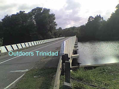
fishing. When approaching this area from Sangre Grande, the road crosses the river
approximately two miles before the river mouth. This bridge provides another location for
fishing. The bridge has been constructed with relatively wide pavements on either side so
that you can stand on the pavement and be out of the flow of the traffic. On this stretch
of the river, schools of grande ecaille (also known as tarpon) are sometimes seen lazily
swimming upstream.
The Manzanilla/Mayaro Road, before this bridge, runs through a coconut plantation. In
the area between the bridge and the Bovell coconut factory the river is 100 – 150
meters from the road. There are areas along the river bank where there is a break in the
mangrove providing direct access to the river and it is possible to walk through the
coconut area to the river.
Another popular fishing area along this coast is at the Ortoire River which is a few
kilometers after the Nariva River. Fishing is possible from the bridge across the river
which has relatively wide pavements and also at the river mouth.
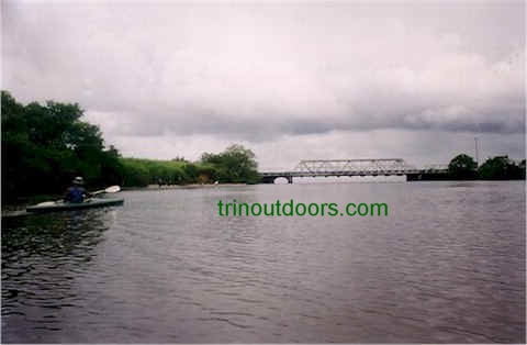
Both the Ortoire and Nariva rivers are also good kayaking
areas.
The Mayaro area is known for fishing with both commercial and
recreational fishermen fishing in the area. Most of the recreational
fishermen do surf fishing along the Manzanilla and Mayaro beaches and
also in the main rivers with the Nariva River being the most popular
and also the Ortoire River. There are however several smaller rivers
in the Mayaro area that provide an opportunity for recreational fishing with
one of these being the Eccles Road River.
Eccles Road is approximately seven minutes drive from the Mayaro Junction
at Plaisance along the Guayaguayare Mayaro Road. From the main road to where
you can access the river is about 2 minutes driving. The easiest access
point is to park at the site of the abandoned hotel and then walk through
the hotel grounds to the river and the beach.
The Eccles Road River is not a large river but it does contain fish and
we can attest that it contains catfish, salmon and broche, plus people
living in the area also say that grand ecaille (tarpon) enter this river at
times. Fishing is possible along the banks of the river and from the sand
bar that straddles the river near the mouth. At times the water from the
river does not reach the sea but stops on the beach as the sand bar blocks
the flow but the level of the river is still sufficient for fishing even in
those periods.
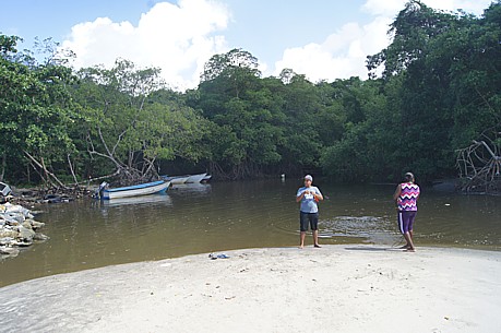
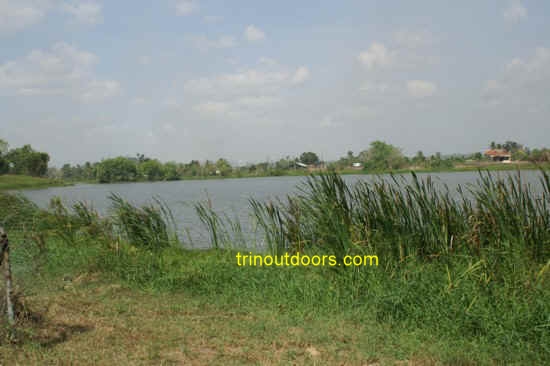
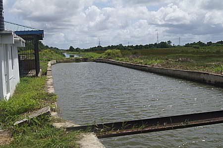
Goodrich Bay in Savonetta Point Lisas is accessed via North Sea Drive (the road leading
to Industrial Gases Limited). At the end of the road is the former Caroni rum shipping
terminal in a large mangrove lined bay. Mangroves are spawning areas for fish and the
young spend their early lives among the mangrove roots, thus attracting larger predator
fish. The rum terminal does not have heavy shipping traffic and so for most of the time
this bay is in its natural state.
On the eastern section of the bay there is a concrete embankment providing a platform
for standing. The southern section is lined with mangroves but there are tracks through
the mangrove and fishermen have created clearings in the mangrove at the water’s
edge.
This fishing location is located on the boundary between Pointe-a-Pierre and Plaisance
Park in South Trinidad. As you descend Pointe-a-Pierre hill heading north on the Southern
Main Road, there is a service station on the eastern side of the road and directly
opposite this service station is a narrow road with a hotel on the corner. Taking this
narrow road leads to the beach. The road is only wide enough for one vehicle to travel and
at the end there is a turning/parking area that can accommodate two vehicles.
The shore area is a combination of mangrove, grass, abandoned concrete abutments and
steel pipe from an old jetty. It therefore provides several locations for standing or
sitting and casting your line. This shore line is on the Gulf of Paria and so will have
brown coloured water particularly in the rainy season.
The entire waterfront of San Fernando is used for fishing, however the
popular area begins at the Wharf and extends is a southern direction to the Paradise
Cemetery with the most popular location being directly opposite the PTSC compound.
As with
most fishing on the western coast of Trinidad, the best time is around high tide
especially when high tide is between 3pm and 7pm.
The proximity of Mosquito Creek to San Fernando and its environs has made it a popular
fishing location for southerners. Mosquito Creek is the name given to the stretch of the
Southern Main road that begins after Cara Suites Hotel and ends at the Godineau Bridge.
The road runs alongside the sea and is backed by the Oropouche Lagoon. A concrete sea wall
has been constructed in an attempt to prevent sea encroachment and it is from this sea
wall that the fishing is done. While fishing takes place along the entire length of the
sea wall, the eastern and western ends are the most popular. At these ends the wall veers
away from the road moving the fisherman away from the vehicular traffic along the road.
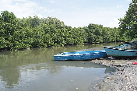
For those with a boat, the Godineau River provides
freshwater fishing as the main river is navigable for a considerable
distance from the sea. You can also travel by car to several points along
the Godineau River that are good for fishing such as the
Sudama Boat Landing facility and
the
Tulsa Trace Picnic Site.
For those without a boat the bridge spanning the river at
its lower reach provides an ideal location for fishing. The bridge spans the
river exactly where it meets the sea and is on the Southern Main Road,
outside of San Fernando immediately next to the Shore of Peace. On the sea
side you can cast your lines straight out, however on the river side (west)
there is a large above-ground water main and the new bridge across the river
preventing you from casting outward. Fishing is still possible from the
bridge on the western side but you have to use a line that is simply dropped
down into the river.
As with all river mouth fishing, the change of tides is the
best time for catching as the larger fish enter the river on the high tide
and exit on the low tide. When casting into the river be aware that at low
tide there is a noticeable movement of the water out of the river. While the
river mouth is a good location for fishing the length of the river provides
other opportunities.
To access the Godineau Bridge for fishing you have to
actually go along the highway past the bridge until you get to the first
round-about. Then you go around the round-about and take the exit to the
Shore of Peace. On the road leading to the Shore of Peace you remain on the
lower road and this leads directly to the bridge. To learn the
history
of the Godineau River Bridge visit our Other Places of Interest Page.
The
bridge on the South Trunk Main Road where the
Godineau River empties into the sea is a well known fishing location;
however the upper reaches of this river are also good for fishing. The
actual name of this river is the South Oropouche River but has been called
the Godineau because in 1840s the French owner of St John's estate called
jean Pierre Godineau, had a canal dug to the sea to make the river navigable
for boats to transport sugar from the estates to the Embacadere at San
Fernando. The Godineau is one of the longer rivers in Trinidad, beginning in
the Moruga area and flowing through the areas of Barrackpore, Penal, Debe,
Woodland before emptying into the sea on the Mosquito Creek.
It
has been identified that more than 29 species of fish are found in the South
Oropouche swamp and river, which include Brouchet, Guabine, Teta, Grande
Ecaille (or tarpon), Cascadoo, Coscorob, Teta, Crayfish, Sardine and Guppy.
One of the easily accessible fishing areas on the upper part of the Godineau
River is located at Sudama Teerath which is where the Pluck Road crosses the
river. There is a concrete boat landing facility so one can fish from the
landing or one can walk along the levees on either side to find a convenient
location and fish from the banks of the river.
You
can find directions to the Sudama Boat Landing Facility by visiting our
map
page
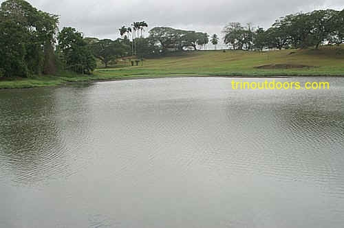
A well known freshwater fishing location in South Trinidad is the pond opposite the
former St Madeline Sugar Factory on the edge of the golf course along the Manahambre Road
to Princes Town. While the pond is visible from the road, there are actually two ponds
with the second pond being to the east of the pond along the golf course. When visiting
the pond you can sometimes see either an Anhinga or an Osprey plunging into the water to
catch fish.
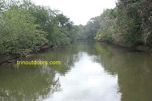
The River of Hope is a wide (by Trinidad standards) river in Moruga that can be
accessed using La Ruffin Road. The
river is fairly deep and used by commercial fishermen to access the sea in their pirogues.
According to the commercial fishermen who live in the area, the river has grouper, tarpon,
salmon and mullet. Fishing can be done from the river bank or from the spring bridge
that spans the river.
For many a young person in the inland areas of Trinidad, fishing along a
river bank or from the edge of a pond with a simple bamboo rod is their introduction to
the world of fishing. For some individuals this remains as their preferred type of fishing
while for others freshwater fishing is an occasional alternative to saltwater. Along
Clarke Road in Penal, shortly after the Petrotrin office, is a moderately sized dam that
is a good location for freshwater fishing. This dam provides the opportunity for catching
cascadoo (cascadura) and guabine (waubeen).
To get to the Icacos
Point fishing area, when you arrive in Cedros at the village of Bonasse
on the Southern Main Road, you turn left onto Perseverance Road and then continue on to
Columbia Road and then to the Icacos Savannah Road. In the heart of Icacos Village you
turn right (west) and continue to the end of the road. The road ends here amid a jumble of
rocks as the sea eats away at the coastline in this area. The rocks provide a convenient
location for standing/sitting and casting a fishing line. To the left of the rocks there
is a sandy beach that also provides an area for bathing and fishing.
This is one area where people have been fishing and catching fish for over 200 years.
On 2nd August 1498 Columbus landed here and called it Punta del Arenal or Sandy
Point. Some time between 1784 and 1797 a land grant was given to create an
agricultural estate and to this date an estate is still operating on this spot alongside
the beach. It has been reported that people from the estate have fished on this spot from
the time the estate was created. Even up to today, people continue to fish from the beach
alongside the estate.
A mile west of Icacos beach is Wolf Reef which is reported to have with 400 lb groupers.
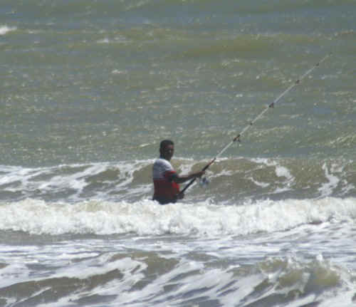
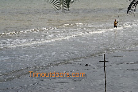
Point Coco beach is used by persons in the Southwestern peninsula for fishing. As this
is a very flat beach with a gentle gradient one has to walk into the surf to cast the
fishing line and then walk back to the beach and place the rod on a pole while awaiting a
bite. To get directions to Point Coco beach see
the Point Coco section on our Beaches Page.
South_Chatham_Beach
Persons who live in the
vicinity of South Chatham beach say that the beach is very good for fishing. As you are
fishing from a beach, long surf rods are recommended with poles in the sand to hold the
rods after the cast, while you wait on the fish to bite. To get further distance
on your cast you can walk into the water while casting and then walk back to the shore and
anchor the rod. Rock salmon are caught on this beach along with a fish the locals call
gobedot. Directions for finding this beach can be found on the South Chatham Beach section of our Beaches Page.
Along the Clifton Hill beachfront a large rock sea wall has been constructed. This rock
seawall now provides an easily accessible location for fishing as the road runs parallel
to the sea wall, so you can park and clamber to the top of the sea wall.
To the immediate east of that sea wall, a rock breakwater has been built. That
breakwater now provides a convenient location for salt water fishing. It is fairly easy to
access the breakwater from the beach as the distance from the sand to the rocks is short.
To obtain directions to this breakwater see the Clifton Hill Beach section of our Beaches Page.
To the east of this rock breakwater there is the new beach facility and just beyond the
facility, the Guapo River enters the sea. All river mouths in Trinidad are good locations
for fishing. At this particular river mouth, mullet can usually be found and at certain
times of the year grand escaille (tarpon) will frequent the river mouth.
In this bay there are two old
jetties and a rock outcrop that provide potentially good fishing locations.
You can find out more about this bay on the
Guapo Bay section of our Beaches Page.
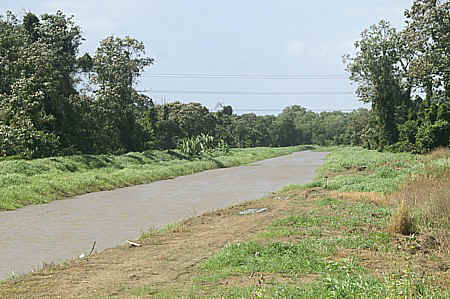
Every weekend at the irrigation canals on the eastern side of the Uriah Butler Highway
in the vicinity of the Caroni Flyover, fishermen can be seen with rods or nets catching
cascadoo (also known as cascadura). An important feature of the cascadura is its ability
to utilize its gut, which is richly supplied with blood vessels, to assist in breathing
when the water becomes low in oxygen. The fish surfaces and gulps air, allowing it to be
spotted by sharp-eyed fishermen and so giving a good indication of where the net or line
should be cast. They tend to rest among the roots of the Soharee plant which grows in
swampy land and also lay their eggs among the roots and so among the roots is a good
location for a line cast.
These canals always have water, with the level being higher in the rainy season. In
addition to cascadoo, coscarob, waubeen, mullet and catfish may be found in these canals,
as in other freshwater areas. From the Uriah Butler Highway, the irrigation canal that
parallels the highway is easily seen but there is also a second canal that lies behind the
first which is easily accessed via a metal bridge next to an old pump house.
In addition to the irrigation canals that run parallel to the Uriah Butler Highway on
its eastern side from the Caroni overpass to the Rexcar walkover, there are several
other areas in the vicinity that are popular fresh water fishing locations. On the eastern
side of the highway, just after the junk yards on the western side of the Uriah Butler
Highway in Guayamare Village, there are two dirt roads. These roads run alongside wide
irrigation canals that flow from Cunupia to the sea. Both of these canals are popular
fishing spots with the second canal being especially popular with families on a Sunday
afternoon.
On western side of Uriah Butler Highway from the Monroe Road exit to the Caroni River
there are several irrigation canals that are also used for fishing. These rivers actually
begin on the eastern side flow across the highway and continue on the western side to
eventually enter the sea or merge into the Caroni Swamp.
Alongside the Blue River (at the Caroni Savannah Road exit where people go bird watching)
there is a bumpy dirt road that follows the river on its northern side. This
road leads to a point where a tributary joins the Blue River and is another popular
fishing spot. The confluence of these two rivers is also a popular liming spot on a Sunday
afternoon. In addition to those who drive to the spot, the Blue River is used by owners of
pleasure boats to have fun running up and down the river and out to the Gulf of Paria and
some boats tie up on the river bank at this spot. Families can usually be seen sitting on
the banks fishing and enjoying each other's company.
The black tilapia is also found in these waters and often locals use nets strung across
the canals to catch this species. On the northern side of the Blue River there are a
series of small lakes where recreational fishermen use strung nets and cast nets to catch
tilapia.
Catching marine swimming crabs in these canals is also very popular. Individuals use a
piece of chicken on a line dangled in the water and when the crab takes hold of the
chicken the line is pulled out of the water and a flattened basket (usually the metal or
plastic cover from a fan) is slipped under to catch the crab if it lets go of the
bait when it comes out of the water.
Mention fishing in central Trinidad and most people immediately think of
the irrigation canals that are visible along the Uriah Butler Highway in the
vicinity of the Caroni overpass. There are however many areas in central
Trinidad where you can spend a relaxing afternoon enjoying freshwater
fishing. One of these areas is in the vicinity of the Cacandee Slipway.
To find the Cacandee Slipway you drive north along the Cacandee Road in
Felicity, Central Trinidad and the road ends on the banks of the Cunupia
River. Along the road, just before the river bank there are 4 marinas that
collectively hold a few hundred pleasure boats. At the end of the road there
is a slipway for boats to enter and exit from the river and to the east of
it there is a cremation site. From the slipway it is approximately one mile
to where the river exits in the Gulf of Paria. Along the way to the ocean
the Cunupia River is joined by the Guyamare River and then intersects with
the Madame Espaynol River which swings in a south easterly direction and is
the fastest route to the Gulf of Paria. At the intersection the Cunupia
River turns north running through the Caroni Bird Sanctuary and eventually
joining the Blue River and heading to the Gulf of Paria.
At the largest of the marinas you can obtain many of the items needed for
a day of fishing such as hooks, fishing line, casters, weights, ice.
If you are the fortunate owner of a boat, this is one location where you
can easily launch your boat to enjoy a day of fishing. For those who are not
so fortunate but still want to enjoy a fishing day, the banks of the river
provide the opportunity to do so. Being bordered on its northern side by
mangrove it can be expected that juvenile fish will live along the banks
while larger fish will swim up the river on the incoming tide to feed. On
the southern side of the river there is a large irrigation channel in which
fresh water species can be found.
If you have a favorite fishing location, send us an
email with the details at info@trinoutdoors.com
For advice on fishing, visit our Articles section.
Surf and Tide
Forecast
If you have a favorite fishing location, send us an
email with the details at info@trinoutdoors.com
All photographs (unless otherwise stated) are the property of Brian
Ramsey. None of the photographs may be reproduced without the express written
consent of Outdoor
Business Group Limited
and Brian Ramsey.