In addition to the built
environment that provides places of interest in Trinidad, there are numerous natural
attractions that are also places of interest. These natural attractions provide variety
for any vacation in Trinidad. Some of these natural attractions include:
Another type of natural attraction experienced in Trinidad is waterfalls and these can
be found on our Waterfalls Page. The numerous rivers in
Trinidad also give rise to other natural attractions and the Other
Hikes Page provides information on some of these river systems.
Caves occur in all types of rocks and topographic situations and are formed by many
different erosion processes. Sea caves are created by wave action, while other caves are
caused by piping in unconsolidated rocks. Lava tube caves are formed through volcanic
activity. As Lava flows downhill and the surface cools and solidifies, the lava continues
to flow under the crust, until the eruption ends. If the liquid lava inside the crust
flows out, a hollow tube remains. The most common caves are created by ground waters that
dissolve the common soluble rocks—limestone, dolomite, gypsum, and salt. Limestone
caves are the most abundant, longest, and deepest. Limestone dissolves under the
action of rainwater and groundwater charged with H2CO3 (carbonic
acid) and naturally occurring organic acids. The dissolution process produces a
distinctive landform known as karst, characterized by sinkholes, sinking
streams, and underground drainage.
The Northern Range of Trinidad has extensive beds of limestone known as the Maraval
formation that run through the the entire range from Diego Martin to Toco. As a
result there are numerous caverns and cave systems within the Northern Range. These
caverns are often the destination for some hikes. One of the
reasons for visiting the caves is to see the interesting geological formations of
stalactites, stalagmites, columns and curtains found within.
Stalactites are formed by groundwater trickling through
cracks in the roofs of such caverns and the water contains dissolved calcium bicarbonate.
When a drop of water comes in contact with the air of the cavern, some of the calcium
bicarbonate is transformed into calcium carbonate, which is precipitated out of the water
solution and forms a ring of calcite on the roof of the cavern. By repetition of this
process the length and thickness of the stalactite is increased. Stalactites grow down
from the roofs of the caves and tend to be long and thin, with hollow cores. The water
moves down the core and precipitates at the bottom, slowly extending the length while
keeping the core open for more water to move down.
Stalagmites grow from the floor up and are commonly found
beneath stalactites; they are formed from the evaporation of the same drip of water that
forms the stalactite. As the water lands on the ground after falling from the stalactite
further evaporation takes place leaving calcite on the ground which builds up with each
drop. Stalagmites are thicker and shorter than stalactites and have no central hollow
core.
Stalactites and Stalagmites are not necessarily paired; when they are, continual
elongation of one or both may eventually join them into a column. Curtains of dripstone sometimes form when water drips from the ceiling
of a cave along joint planes. The word stalagmite comes from the Greek word stalagma
which means "drop" or "drip".
The Caura, Lopinot
and Brasso Seco areas are noted for their
caves and the hikes to these caves but they are not the only areas with caves that are
hiking destinations. The Aripo Caves are a strenuous 3 hour (one way) hike to the largest
accessible cave system in Trinidad. The Oropouche Cavern (also known as the Cumaca
Caves) is a popular hiking destination in Cumaca and has a colony of Oilbirds
within it.
The Tamana Caves are in the Central Range just south of Sangre Grande. The highlight of any visit
to the Tamana Caves is to view the exit of between 1 and 1.5 million bats
of 11 species each evening between 5.30pm and 7pm.
Gasparee Caves are a fascinating network of
underground caves located on the island of Gaspar
Grande, which is the closest island to Chagaramas Bay in north-west Trinidad. The
island is composed of limestone and a combination of wave
action, acidic rainfall and percolating ground-water has dissolved the limestone to
form sculptured caverns, caves and sinkholes. The entire subterranean
system is about 90 feet deep and a 1/2 acre in size. Within the cave system are
interesting geological formations such as stalactites, stalagmites, pillars, flow stones and fringed curtains.
Some of the formations have been given names such as Pulpit Pipe Organ, Lovers and
Dinosaur Head because of their shape. The largest and best known of the caves is called
the Blue Grotto, which has a crystal clear pool that is 30 feet in diameter and reflects
the light entering the cave.
Entry to the caves is only allowed with a registered tour company or
with the permission of the Chagaramas Development Authority. From the boat landing at
Point Baleine it is a 20 minute uphill walk to the entrance to the Blue Grotto and then a
descent of approximately 100 steps into the cave.
The Cumaca Cave has several names; called the Cumaca Cave because it is
near the village of Cumaca in eastern Trinidad, it is also known as the
Oropouche Cavern as the Oropouche River emerges from this cave and the
Guarcharo Cave as it is the home of the Guarcharo bird. The Cumaca Cave is
actually a large cave system with three accessible chambers and other
smaller side caves.
The Northern Range of Trinidad has extensive beds of limestone known as the
Maraval formation that run through the the entire range from Diego Martin to
Toco. The boring action of the Oropouche River channeling through this
limestone has resulted in the creation of the Cumaca Cave. The later
percolation of rainwater through the limestone has then resulted in the
formation of stalactites and stalagmites within the
cave. These geological formations are one of the attractions of the Cumaca
Cave and so made it a place to visit.
The Oropouche Cavern is also the home of species of fish that have adapted
to living in low light or darkness. The most notable of these fish is a
river catfish that was originally thought to be blind with a variation that
was eyeless. It is now known that the catfish is not blind but has a reduced
eye size and unfortunately the eyeless variant has been greatly reduced in
number possibly through interbreeding with the small eye variant. Persons
visiting this cave system often do not see these fish because they shine
their lights in the water looking for the fish. Having adapted to living in
a low light environment, the presence of bright lights causes these fish to
immediately hide under rocks.
The biggest attraction of the Cumaca Cave however is the Guacharo. Known as
the Oilbird and the Devilbird and the Diablotin (little devil), in the past
the young chicks were captured and then boiled to obtain the oil that was
stored in the fat in their bodies. Fortunately we have recognised the
destructive nature of this practice and now these birds are protected and
recognized as a visitor attraction. The Oilbirds are the only nocturnal
fruit eating birds in the world. They forage at night, navigating by
echolocation in the same way as bats, but with a high-pitched clicking sound
audible to humans. The Cumaca Cave has the largest congregation of Oilbirds
in Trinidad and when you enter the cave their clicks and squawks can be very
loud and any light shone on them agitates them (so
it should be avoided). The Devilbirds are such an attraction that from as
early as 1911, these caverns have been visited to see these oilbirds,
with Theodore Roosevelt, the 26th President of the United States of America,
hiking to this cave in 1911.
Visiting the Cave requires carrying a flashlight or headlight because of the
low light level in the caverns. Anyone visiting the Cumaca Cave also has to
be prepared to get wet when they enter the cave as one enters the river to
gain access to the first cavern and has to go through the water to get to
the third cavern. Being in the cave is not the only possibility of getting
wet or muddy as the hike to the cave can be muddy also. These caves are on
private land and so permission must be obtained from the owners (Mr. Gary
Aboud) in order to visit the caves. It may be possible for small groups to
obtain permission from the estate manager on the site. There are two routes
to this cave, one of which is a strenuous and adventurous 3 hour hike that
is almost entirely uphill crossing rivers and streams. The other route is a
fairly easy level 3 hike that has mainly downhill portions (on the way to
the cave) and takes just over two hours. Parts of this trail are usually
over grown, so light long pants are recommended. Hiking boots or trail shoes
are also recommended as the trail can get quite muddy and slippery. Rubber
kitchen gloves are recommended to be worn in the caves to keep bird and bat
poop off hands and it is advisable to carry hand sanitizers for use after
the cave so any food can be handled safely.
The Oropouche Cavern is the star natural attraction in the Cumaca area but it is not
the only interesting place in Cumaca as there are
river liming locations
and the Turure Water Cascades.
The state of Texas in the
United States of America has turned bat watching into a tourist attraction
and is reported to have in one cave the largest colony of bats in the world.
The city of Austin Texas has bat watching as one of its international
attractions and claims that it brings 100,000 visitors each year to the city
and generates US $8 million. Trinidad also has a bat watching experience and
ours is reported to be the second largest in the region with one and a half
million bats roosting in the Tamana Cave. Unlike in the US where the bats
are primarily resident in the late spring and summer months, at Tamana you
can witness the spectacle all year.
Tamana is the highest mountain in the Central Range of Trinidad with an
altitude of 313 meters (1,026 feet). The name Tamana is derived from the
name of an Amerindian Tribe, the Tamanaco, who originally lived in that
area. Millions of years ago this area was a coral reef and geological
activity pushed it up to form the present mountain. As a result of the
limestone, water action has led to the formation of the caves. In fact at
Tamana there are two larger caves, the Main Cave and the Dry Cave, with the
two being interconnected and then two smaller caves that branch off.
In this cavern complex with the
4 caves the main cave has a wide 30 foot entrance and the other caves are
smaller as you progress inwards. Entering the main cave requires navigating
a steep, root-cluttered slope down to the floor. Within the cave are whip
scorpions, geckos, six species of frogs, several species of snake and the
main inhabitant, bats which hang in thousands from the cathedral ceiling.
The highlight of any visit to
the Tamana Cave is to see these one and a half million bats exit the cave in
search of food. With the large number living in the cave, this spectacle can
last for several hours.
Trinidad is home to 67 bat species and 11 of those species roost permanently
in the cave while a 12th species occasionally roosts in the cave. There are
frugiverous (fruit-eating) bats, insectivorous (insect eating) bats, nectar
feeding bats and the greater spare-nosed bat (the largest bat in the New
World) . There are also Vampire bats that feed on the blood of animals.
To reach the cave involves a trek, halfway up the mountain through the
forest and in the dry season this can take about 35 to 45 minutes. In the
rainy season the trail can be muddy and so the hike would take longer. For
those who want to enter the cave before the exit of the bags it is
recommended that gloves, a long sleeved shirt, long pants and boots be worn.
This clothing is recommended because with over a million bats living in one
space there is bat guano everywhere and you would want to avoid the guano
coming in contact with your skin. Other recommended items for a visit to
Tamana Cave are a change of clothing and footwear, a torch- light or
head-lamp for seeing your way on the trip back from the Cave at night,
insect repellent, hand sanitizer and extra water to wash hands and camera.
A visit to this cave system can
also be combined with a walk to the summit for the spectacular view.
The upper Aripo Valley, between the peaks of El Cerro del Aripo and
Chagramal, contains the largest known cave systems in Trinidad. These
include the Aripo #1 (or Main) Cave, the linked Aripo #2 and #3 Caves and
Soho Cave. The Soho Cave was discovered in February 1990 as a result of some
individuals attempting in 1989 to go to the Aripo Cave and making an
incorrect turn on the trail thus not finding the Aripo Cave. On a subsequent
hike in 1990 led by Paul L Comeau to discover where this new trail would
lead, the Soho Cave was discovered. The name "Soho" that was given to the
Cave means announcing discovery of unexpected event.
The Soho Cave has as part of its attractions, stalactites and
stalagmites which are formed by the action of ground water acting on the
limestone. There are large and heavily corroded stalactites and a massive
stalagmite at the cave entrance.
Another of the natural attractions at Soho Cave is an oildbird colony
and they can be seen on the walls of the cave. These Oilbirds are the only
nocturnal fruit eating birds in the world. They forage at night, navigating
by echolocation in the same way as bats, but with a high-pitched clicking
sound audible to humans. Their diet consists of fruit pulp from palm trees
that they transport back to the cave.
The following description of the trail to Soho Cave is provided by
theIsland Hikers Club.
The exploration to Soho Cave starts at the end of the Aripo Road, where
there is a large christophene plantation. The journey will take at least 1 ˝
-2 hours, and the trail passes through intricate forest with some
over-growth. The trek starts with a short ascend and after a twenty minutes
walk the trail comes to a cross section. A visible path on the right leads
to the Soho Cave while the straight route continues onward to the Aripo
Cave. The terrain is mostly hilly, with valleys and streams to cross, and
two–thirds on the trip a noticeable landmark, is a large silk cotton tree.
On both sides of the pathway, there are limestone outcrops and coming from
the sink holes is the strong scent of bat guano. Situated from the main path
in a nearby gully is another small cave called Carikkers Cave. The trail
descends sharply from the ridge to the entrance of the Soho Cave.
It is strongly recommended that a guide be hired for any hike to the Soho
Cave as there are several trails that branch off from the trail to Soho Cave
and so it is easy to get lost. In addition, in the vicinity of the cave,
there are deep sinkholes and caution should be exercised going off the path
The Aripo Cave is as the name suggests in the Aripo valley. There are
actually 3 Aripo Caves with Cave #1, also called the Main Cave being the
most visited of the three. The Aripo Main cave is the longest accessible
cave in Trinidad and Tobago, with a length of 862 meters and a depth of 160
meters.The topography of the Aripo area is
composed of limestone and the Aripo cave has been created by the action of
the water eating the limestone. It has also resulted in the cave having
interesting stalactiteand
stalagmite formations. According to Paul Shaw in
a A Register of the Caves of Trinidad and Tobago, the cave “is structured on
a series of levels, chambers and tunnels, created by water flow under
conditions of falling base level, thus the upper cave system is largely dry,
even during heavy rains. Access to the upper part is by scrambling down a
boulder slope to a stream bed, but access beyond is limited by vertical
drops of 9.2 and 15.2 m. A crawl way, Low Ceiling, has to be negotiated to
reach the furthest section, comprising a waterfall, pool and terminal pot".
While the entrance of the cave can be explored with a flashlight but
penetrating deeper requires proper caving equipment.
Apart from the pure joy of hiking through forest and viewing the limestone
formations at the cave, another reason for visiting the Aripo Cave is to see
the Oilbirds, also known as the Guacharo, the
Devilbird and the Diablotin (little devil). These birds make a tremendous
racket when they are disturbed by the entrance of people to their home. The
Oilbirds nest within the cave and together with the bats that also roost
there create rich deposits of guano that can make exploration slippery.
The following description of the trail to Aripo Cave is provided by the
Island Hikers Club. "The hike to Aripo Cave starts at the end of the
road, situated about a mile past the village where a large christophene
plantation is located .The uphill trek can be describe as moderately
challenging and will take two hours through intricate forest.The terrain is hilly with a few valleys and streams to cross and the
vegetation consist of montane and seasonal forest.
The descent to the cave is surrounded by huge boulders and at the corridor
visitors are greeted to the noisy sound of the oilbirds. The return journey
is mainly downhill and will take about an hour and fifteen minutes".
As with exploring all cave systems in Trinidad, it is strongly recommended
that a knowledgeable guide be hired for any visit to these caves as there
are numerous trails and a wrong turn can cause one to become hopelessly
lost.
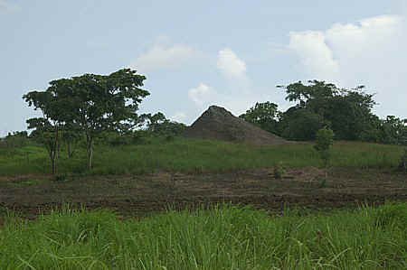
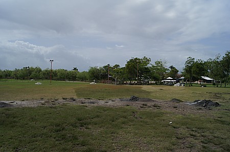
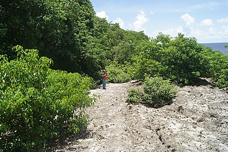
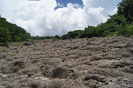
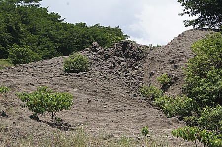
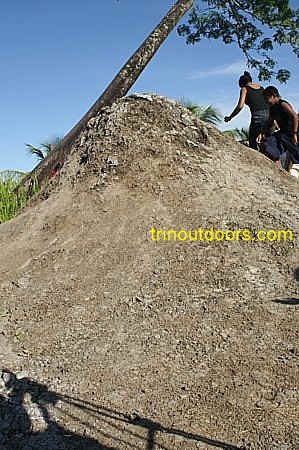
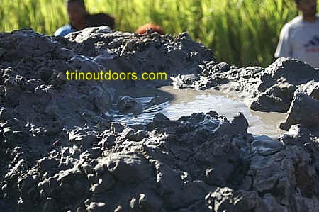
Trinidad is one of the countries that has a preponderance of mud
volcanoes and they form another of the natural
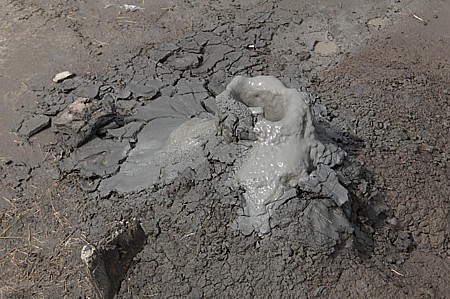
attractions of the country. The term is usually given to areas where there is an extrusion of watery mud or
clay, accompanied by or sometimes forced by methane gas. Occasionally these volcanoes
extrude material with violent force, throwing rocks hundreds of feet into the air.
Commonly the activity of a mud volcano is simply a mild surface upwelling of muddy and
usually saline water accompanied by gas bubbles.
These volcanoes are sometimes known locally as "bouffe"
(french for swelling), "morne" or "yard." The original Amerindian
inhabitants of Trinidad called these areas guaico, meaning "mud-stream". When
the mud is of the dry type, a conical or volcano shape is usually formed. Wet mud tends to
result in depressions.
Some of the mud volcanoes in Trinidad are found at
The Piparo mud volcano (known by
some as Morne Roche) is located in South Trinidad, just east of Marabella.
The area around the mud volcano reaches an elevation of 365 feet (150 feet
in relation to the surrounding land) and covers some 425 acres. This mud
volcano usually sits dormant, but occasionally spews mud hundreds of feet
into the air. Eruptions have been recorded in 1953, 1968, 1969, 1977 and
1997. The 1969 eruption was said to have been a sudden eruption that damaged
houses as far as 60 meters away.
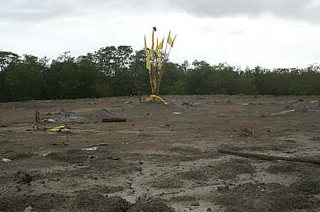
The 1997 eruption is the largest recorded
to date. It was said that the eruption was preceded by several days of loud
noises being heard in the vicinity of the volcano. Then on 22nd February
1997 the volcano erupted and residents reported that the mud was spewing
some 200 feet into the air. Residents also reported that the wave of mud
from the volcano was several feet high and crumbled any house that was in
its path. Ultimately the ejections from the volcano covered 2.5 square
kilometers, houses as much as 500 meters from the mouth of the volcano were
destroyed and 31 families were displaced.
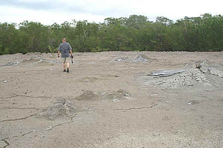
The mud cone that formed after the 1997 eruption has been worn down over
time by the effects of rain. Now the area of the Piparo mud volcano is
essentially a wide flat plain and grasses have begun to grow over the area.
Roughly in the center of that plain is a small mound where the extrusion of
watery mud, clay and gas forces itself to the surface. While there is a
central area where a large mud mound has accumulated there are a few points
on the plain where small up-wellings are seen and gaseous mud comes to the
surface. Residents of the area have reported that after
the magnitude 6.9 earthquake of August 21st 2018, the volcano has become
more active.
On the area around the Piparo Mud Volcano you get a beautiful view of the
rolling hills of central Trinidad. To get to Piparo, take the Guaracara Road
from Marabella heading east and turn onto the Piparo Road.
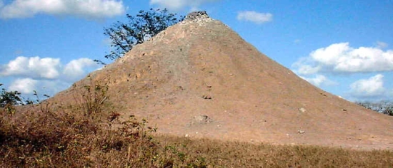
The Digity
mud volcano has the classical cone shape that is commonly
associated with volcanoes. It is approximately 20 feet high with mud and gas being ejected
very infrequently (22/2/2003). It appears also that the amount of mud being ejected is
directly related to the amount of rainfall, since in the dry season little or no activity
is present.
The Digity mud volcano sits atop a small hill on the outskirts of a little village
surrounded by agricultural fields on three sides and a river on the other side. It is
visible from the roadway and is approximately 7 minutes walk from the road along a former
train track (the iron rails are gone but the cross ties are still visible). There are
several routes to get to this volcano with one of the easiest routes being along the San
Fernando Siparia Erin Road. At Debe village you turn onto Lalbeharry Trace (the Police
Post is at the intersection) and drive for 1.8 kilometers. You then reach a four-way
intersection with a cell tower on the left and you turn right on to the road opposite the
cell tower. You drive for 2.8 kilometers and will reach the small village with the
volcano. It is also possible to reach this volcano using Clarke Road in Penal but this
route has numerous turns onto other roads.
Digity Volcano courtesy the Geological Society of Trinidad and
Tobago
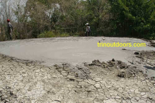
L' Eau Michel (pronounced Lamoshell) Mud Volcano is located in Penal South Trinidad. To be more
precise it is found by going to Penal and then travelling along the Penal Rock Road to
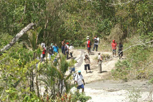
Bunsee Trace. You can drive by car to the end of Bunsee Trace and then the hiking
begins. The hike to the volcano is approximately one hour (fitter hikers can make the
journey in 40 minutes). The terrain is composed of rolling hills and the trail is an
agricultural dirt road. The trail goes through sugar cane fields and teak forest.
The volcano is of the wet type with the mud rising in the form of
bubbles that then flow down the sides of the cone, trailing away from the center in every
direction. The outpourings from this volcano cover a large area. A short distance from the main cone is a smaller mud volcano.
During the rainy season the main cone occupies a larger area. The best time for
visiting the volcano however may be during the dry season as there is no mud to contend
with on the trail. A dry season visit however means dealing with the sun which can be
merciless. There are no shaded areas along the trail during the dry season as the teak
forest loses all its leaves. Any hiker on this trail should wear a wide brimmed hat and
carry plenty of water (at least three bottles).
After visiting the L' Eau Michel volcano, one may want to visit Lamoshell beach.
Devil's
Woodyard is probably the best known of Trinidad's mud volcanoes.
Although most individuals say "the Devil's Woodyard Mud Volcano" this is
really a mud volcano field with several vents scattered across the area.
Devil's Woodyard contains an active subsurface layer combined with methane
gas that forces soft mud to the surface through various cracks in the
ground. As you walk to the center of the area the various vents become
noticeable. The underground forces emit, through surface cracks, warm,
bubbling mud that forms into cones as it cools. For most of the time the
cones in this area simply sputter with small spurts of salt mud. As you look
around you can see the various active cones plus other cones that are no
longer active and at times you can even see cracks where the mud looks like
a small pool with sporadic bubbles and has not yet formed a cone. The
Devil's Woodyard is a very peaceful area with the mud simply giving a slight
hiss and pop sound. It has in the past however erupted violently with the
first recorded eruption being in 1852.
The area surrounding the mud volcano vents has been enhanced with several picnic
benches positioned around the area. There is a large grassy area suitable
for children to run and play. A small cricket field with a small pavilion
has also been erected and there is a paved car parking area. These
enhancements are due to the generosity of several corporate sponsors.
There
are several versions of how the area received the name Devil's Woodyard. In
one version it is said that the site got its name after its first eruption
in 1852 which shook the entire village, felled tall trees and frightened
villagers. The Amerindians, at the time being superstitious, believed that
the devil had come out of the earth and felled the woods. In another version
it is said that the name Devil's Woodyard arose because early European
settlers in Trinidad believed that the sound of the mud bubbling below the
surface was the sound of the devil stockpiling wood. It is more likely that
the persons who believed this area was the work of the devil were the
disbanded black slave soldiers who were shipped from America to Trinidad
after the war of 1812, as this area is in the midst of the geographic region
settled by them and known as the
Company Villages and the Woodyard
lies between New Grant (the home of the First Company) and Sixth Company.
Some Hindus consider the Woodyard a sacred spot and worship there. To reach
Devil's Woodyard go to Princes Town in South Trinidad and then continue on
the Naparima Mayaro Road to Indian Walk area, turning off onto the Hindustan
Road before New Grant and follow the signs.
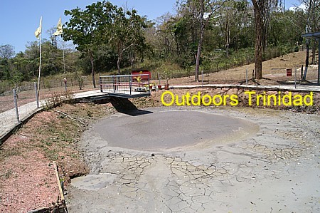
Lagon Bouffe is one of Trinidad’s largest mud
volcanoes being approximately 100 metres wide, covering an area of approximately 2
hectares. The vents that allow the escape of the mud are at the bottom of what was
originally a large lake of water. The mudflows have now displaced the water and due to the
low clay content have spread over the area, creating a large lake of liquid mud. The Lagon
Bouffe therefore differs from other mud volcanoes that, due to their higher clay content,
have cones. Individuals should not attempt to walk across or into the mud lake as the mud
is extremely soft and so there is the danger of being swallowed by the mud.
The Lagon Bouffe mud volcano is located in the Trinity Hills
Wildlife Sanctuary and Reserve. This sanctuary is one of Trinidad's oldest reserves having
been classified a nature reserve in 1934. It covers 16,000 acres and is located in
Southeast Trinidad, west of Guyaguyare. This
sanctuary is home to a variety of wildlife including ocelot, capuchin monkeys, red howler monkeys, deer, manicou (opossums), lappe, matte (tegu lizard),
agouti, quenk (collared peccary), tatoo (armadillo), bellbirds,
parrots, toucans and pigeons. It has several rivers, streams and waterfalls. The
route to the Reserve is the Mayaro-Guyaguyare Road to the end of the road and then turn
onto Edwards Trace. An alternate route is the Rio Claro-Guyaguyare Road and then turn onto
Cats Hill Road and then onto the Trace into the Reserve. The Reserve is a restricted area
and to gain entry permission must be obtained from Petrotrin. Call Petrotrin at 649-5539
before 4 pm from Monday to Friday, or 649-5500/5501 on public holidays.
The Anglais
Point Mud Volcano is located just off the
beach at Palo Seco.
The beach in Palo Seco that bounds the Petrotrin Beach Camp housing estate
is a typical southeast Trinidad beach. Brown sands that are gently lapped by
water which in the dry season is aquamarine and in the rainy season has a
brown tinge inshore transforming to a deep blue further out. Along this
gentle beach there is no hint that on the southern end of the beach is a
large mud volcano with a huge outflow.
Accessing the beach is fairly simple. One drives to the Petrotrin Beach
Camp houses and follows the road past the camp to its end. At that point the
beach is visible and you descend down the hill using a track through the
bushes. Turning right (southerly direction) you walk along the shore for 15
- 20 minutes until you come to the point where the outflow from the volcano
meets the sea. From the beach the short cliff topped with the grey mud gives
no hint of the size of the outflow from this mud volcano.
Ascending on to the level above the beach is fairly simple and if one did
not know it is easy to assume at this spot that the Anglais Point Mud
Volcano is like some other mud volcanoes in Trinidad, merely a level area
with a few small vents where mud and gas occasionally erupt from within the
earth. However as you begin to venture past the shoreline through the scrub
that has taken root an entirely different picture emerges.
As you proceed past the scrub at the lower level an almost lunar like
landscape emerges. It is only at this point that the immensity of the
Anglais Point Mud Volcano, also known as the Beach Camp Mud Volcano, becomes
apparent. At Anglais Point the outflow from the mud volcano descends over
700 feet to the beach to form a mud "glacier", with gullies and ridges
created by the erosion of rain water. It is now that the extent of the mud
flow can be seen and the distance to be covered to reach the source of this
tremendous mud flow.
Continuing up the hill eventually brings you to a large vent, looking
almost like the entrance to the underworld. At this point when you think you
have found the source of the flow, you look further up and realize that the
main volcano vent is even further up the hill.
To find
the mud volcanoes in the vicinity of RE Road, Los Iros, you travel along the
Los Iros Beach Road and just before the beach, the Royal Engineer Road is on
the left. The largest of the mud volcanoes in this area is approximately 2.5
kilometers from the start of R.E. (Royal Engineers) Road.
While
driving along Royal Engineer Road you will see the remains of one of the
Watchtowers that was erected in Trinidad during World War 2. These
Watchtowers were part of the defense effort for Trinidad; a series of watch
towers were constructed around the country near the coast line to provide
locations to spot the presence of enemy ships or submarines. Another of
their roles was to try to prevent the entry of German spies. Other watch
towers in Trinidad can be found at
Green Hill Cedros,La Brea,
and Perseverance in Point Lisas.
After
approximately 2.5 kilometers the road descends slightly, there is a farm on
the right with a two story green building and on the right there is a track
leading into forested land just where the road takes a slight left bend.
This track leads to the largest of the mud volcanoes in this area. The track
is a well-defined one and the hike to the volcano is very short lasting just
a few minutes.
This mud
volcano is of the pool type with liquid mud and bubbles of gas and saline
solution appearing every few minutes. The outflow from the volcano spreads
downhill over a large area and there are smaller vents further down the
hill.
There
are 6 other mud volcanoes in the area of Royal Engineer Road. These other
mud volcanoes all seem to be along the fault line that triggered the August
2018 earthquake. Before reaching the road that leads to the
other smaller volcanoes a
large blue house can be seen on a hill and following the road which branches
off from RE Road leading to the blue house will take you to these smaller
mud volcanoes. These smaller volcanoes are easy to spot as they lie close to
the road and are before you get the hill leading to the blue house.
Video of
smaller volcanoes
The Erin Mud Volcanoes
are part of a chain of mud volcanoes that run from Cedros
to Morne Diablo. Among the Erin Group is the volcano with the largest cone of Trinidad's
volcanoes. The directions for finding this volcano are taken from the Trinidad
and Tobago Field Naturalist Club Trail Guide. You go along the Siparia-Erin Road past
Santa Flora and Palo Seco until you come to Lorensotte South Trace, which is immediately
after the 35 kilometer marker. You turn south onto Lorensotte South Trace and proceed to
the end of the road. The initial section of the road has asphalt but then becomes a dirt
road and in the rainy season it may be necessary to park at the end of the asphalt
section. At the end of the road there is a footpath through the forest that runs in a
south south west direction. This footpath leads to the volcano, merging with a dry shallow
watercourse and then veering out of the watercourse just before a gully. The footpath
climbs uphill to the volcano cone with a total distance of approximately 250 meters from
the end of the road. For the truly adventurous, this volcano provides the opportunity to
take a mud bath.
The
Columbia_Mud_Volcano can more aptly be called the Columbia Mud Volcano
Fields as it is not one single volcano but a series of volcanoes spread out over a large
area of several acres. Found in the Cedros peninsula, between the villages of Fullarton
and Icacos, these volcano fields present an almost lunar landscape. There are multiple
cones, with all being active, constantly emitting hot water and soft clay with a
"pop" sound. The mud from these volcanoes has spread out over a large area
covering everything in its path. There are two volcano fields separated by a three minute
walk. One of the noticeable features in this area, is how nature adapts. In between the
two volcano fields, mangrove plants have begun to grow on this plateau.
These mud volcanoes are approximately one mile inside a coconut plantation on a slight
hill. From the base of the hill to the volcanoes is approximately 10 minutes walk along a
shaded track. It is best to visit these volcanoes in the dry season as during the rainy
season the land in the coconut plantation is often under water.
Each year, Hindu devotees come to these volcanoes in April to perform a puja
(ceremonial worship). The devotions are usually conducted at the first field. They pray to
the Hindu goddess, Mother Durga, and give offerings of fruits, rice and flowers. These
prayers are intended to placate the spirits so that they do not cause destruction with a
major eruption.
Although these volcanoes seem easy to find if you get directions from villagers, they
are in the midst of a large coconut plantation. Once inside the plantation everything
seems the same with no visible landmarks and if you take a wrong turn it is easy to get
lost. It is best to get someone who is familiar with the volcanoes to accompany. A good
person to use for finding the volcano is Clang Sanarthan in the village of Fullarton.
The Galfa Mud Volcano
is in the Green Hill area of Cedros and is said to be linked to the
Columbia Mud Volcanoes as geologists
have found several inactive craters running from Green Hill to Columbia
estate. This mud volcano is very accessible as you can literally drive
directly to it.
Immediately as you enter
Bonasse Village you turn left onto St Marie Road. Readers should note
that there is a St Marie Road and a St Marie Street in Bonasse and the route
to the volcano is on St Marie Road. The St Marie Road is paved but bumpy and
one proceeds along this road for approximately two miles. Along the road
there are signs and flags marking the route to the volcano. Almost at the
end of the road, within sight of the sea, there is a road on the left and
one turns onto this road. After a distance of 0.3 kilometers you reach the
site of the volcano.
This volcano looks like a circular pond and in the center you can see the
upwelling driven by the underground gas. The area around the volcano has
been fenced and a small mandir erected by the Hindu Festivals Society with a
donation from Thirbhawon Seegobin. During the month of April every year,
Hindu devotees gather at this volcano to hold a puja and pray to the goddess
Durga that the volcano will not erupt, as she is perceived to be the power
behind the work of creation, preservation and destruction of the world.
.
The Cascadoux
Trace, Manzanilla, mud volcano is extremely accessible and can easily
be combined with a visit to Mayaro Beach or Manzanilla Beach plus bird watching in the Kernahan area. The volcano is of the
classic conical shape with the mud vent at the top of the cone.
Cascadoux Trace is along the Manzanilla/Mayaro Road. For
those individuals visiting from north Trinidad, Cascadoux Trace is approximately 5
kilometers after the Nariva River mouth. For those
individuals travelling from south Trinidad, Cascadoux Trace is approximately 4 kilometers
after the Ortoire River mouth. On
turning into Cascadoux Trace, you proceed approximately 1 kilometer along the road and
shortly after crossing a bridge, the road begins to rise. At the top of the incline you
can park at the side of the road and the volcano is approximately 3 minutes walk on the
northern side of the road. The mud volcano is at the rear of some houses and so permission
should be requested of the property owners to walk through their property.
The Cascadoux Trace volcano has been linked to the mud volcano off the
coast at Point Radix as it lies along the same fault line. The
Point Radix mud volcano is visible from the land by going along Point Radix Road and then
ascending the hill with the TSTT cellular tower. The Point Radix Road is navigable by car
and parallels the Ortoire River as it empties into the sea.
Off shore mud volcanoes while not common in Trinidad are not unusual. The
most well known of the off shore mud volcanoes is at Chatam in South Trinidad. The top of the volcano
periodically rises above the water to form an offshore island but is eroded by the waves.
The first recorded instance was in 1911, when an island emerged amid an explosion
and flames, rising about 12 feet above sea level. In 1928, an island again emerged,
accompanied by gas explosions, and disappeared within a few weeks. The largest version of
the recurring island appeared in 1964, when a 10.5-acre land mass formed over several
days, ultimately rising 25 feet above sea level. On May 11 2001 the volcano again created
a new island about a mile and a half offshore, in the Columbus Channel. In November 2002
the island off Chatam reappeared but by March 2003 the mud volcano was almost totally eroded below sea level.
The Aripo Savannah is the largest remaining natural savannah in
Trinidad and is an area of approximately 1,600 hectares. It is located in eastern Trinidad
between Valencia and Sangre Grande. It is actually a cluster of savannahs enclosed by
marsh forest. In it are found Savannah Serrette trees, melostome shrubs (Trianna, Monkey
Bone, Bois lissette), tiny bladderworts while the borders are lined with Moriche Palms. It
is a natural savannah determined mainly by soil type. The soil consists of an impervious
clay pan of depths of 50 – 100 cm overlain by fine sand. The clay causes water to
remain on the surface during the rainy season and run off is horizontal, leaching the soil
of its nutrients. Most of the plants are therefore specially adapted to fixing their own
nitrogen or are parasitic or insectivorous. Ground orchids are common. Tiny sundew, which
is a carnivorous plant with leaves adapted for catching insects are found there. Several
species of bladderworts that are aquatic plants with leaves adapted for catching insects
and crustaceans are also found in this savannah. Overall more than 200 species of plant
life are found in these savannas. In addition More than 250 species of birds have been
seen here, and the Savannah Hawk and Fork-tailed Palm Swift are among common sightings.
Also to be seen in the Aripo Savannah are the Red-Bellied Macaw and the Golden Throat
Hummingbird.
This is a protected area and a permit is required for entry. Contact the
Forestry Division at 868-645-1203 for permit details.
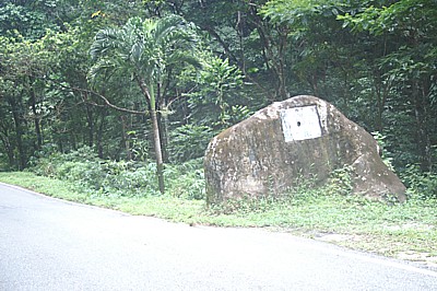
The Cunapo Growing Stone is an interesting geological
phenomenon that has many persons believing that over the years the stone has
grown in size. This huge boulder is estimated to be sixty million years old
and is easily found as it lies at the side of the main road. Going to the
area from Sangre Grande one takes the Cunapo Southern Road and between the
villages of Coal Mine and Plum Mitan at the 11 kilometer (6 3/4 mile) mark
you encounter the Growing Stone. The drive to this geological formation is a
pleasant family adventure as it takes you through small villages and
pristine natural forest. Indeed the boulder lies within a forest reserve
surrounded by pristine forest and at the side of the boulder the land falls
away into a valley that contains a small stream. On the boulder there is a
plaque that has been placed there by the Ministry of Agriculture and helps
identify the stone from the other boulders that lie in the area.
This unique boulder is a "Gritty Sandstone Boulder"
that was created from the sands that originally formed in this area millions
of years ago when the area lay under the sea. The stone came out of the same
formation that created the surrounding hills and the nearby Mount Harris and
throughout the neighboring forest there are several of these huge stones,
all millions of years old. These stones either came to the surface by being
pushed up from below through fault activity or fell from the mountaintop.
As for the belief that the stone grows each year, well it does not actually
grow. Instead the increase in height of the stone is due to the sinking of
the sand around the boulder which automatically increases the height of the
stone as the sand keeps on sinking.
San Fernando Hill (officially known as Naparima Hill) is a 180 metre (600-foot) hill
that rises majestically out of the Naparima Plains. The hill is a landmark in south
Trinidad and the city of San Fernando
has developed around its flanks. The Amerindians called the hill Anaparima which means
"single hill", although some have put forward that it means "place without
water". It is believed that the Amerindians used the hill as a place of worship, with
members of the Warrahoon tribe (Guaraunos or Warao) travelling in canoes from the Orinoco
delta in South America, landing at Icacos, Quinam, Erin and Moruga and travelling overland to San Fernando.
They believed that the hill is the home of their supreme spirit and ancestor hero, inventor
of the first canoe and his mother their divine ancestress. It is said that up to the
1920's the Guarahoons still travelled from South America to worship on San Fernando Hill
and then went to Mount Tamana. According to the Angostura Historical Digest Vol VIII they
created quite a stir in San Fernando in the 1920's as they passed naked through the town.
San Fernando Hill is a limestone outcrop of approximately 100 acres. A photograph taken
from Palmiste Estate in 1895 shows that the hill was originally dome shaped with a
flattened center. Unfortunately for over 200 years the gravel from the hill was quarried
and used for road construction, resulting in the hill being reduced in size by
approximately one third. Protests by citizens' groups led to a halt to quarrying and the
Hill was included in the National Parks and Protected Areas plan of 1980.
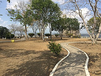
San Fernando Hill is now a place for recreation and relaxation. A process of
reforestation has been implemented so that natural tree cover is now found on many parts.
There are covered areas for picnics and the holding of functions, plus barbecue pits for
outdoor cooking.
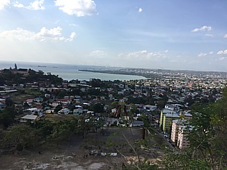
Numerous benches are located on the hill so that you can enjoy the view,
which is stupendous. Looking to the north and Northwest can be see the Point Lisas
Industrial Estate and the coastline of the Gulf of Paria. The eastern and northeastern
views show the Caroni and Naparima Plains plus the rolling hills of the Central Range. As
you look to the southwest, the Pitch Lake at La Brea can be seen
and in the distance the town of Point Fortin
can be discerned.
At the top of the Hill is a visitor center.
This is a two-storey building, on the ground floor, housing a large room
used as an interpretive area displaying images from San Fernando’s history
and culture; from religious pilgrimages of Amerindian tribes to the era of
oil booms and industry. The second storey is an open, breezy gallery-like
area that offers a perfect spot for admiring the view, or having small
formal/informal social, cultural and/or religious events. The building also
houses an office, bathroom facilities and a simple kitchenette.
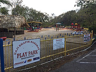
In December 1988, a children's play park was opened just before the top
of the hill. The park commemorated the life of Haji Shafik Rahaman, an
outstanding member of the Muslim community and the Inter Religious
Organisation.
It is possible to drive to the top of the Hill, however for those who like a more
challenging route there are steps which leads from the bottom of the hill at Marryat
Street to its summit. For the really adventurous there are several World War Two bunkers
on the hill that are not readily accessible to the public. To get to the vehicle entrance
to San Fernando Hill you proceed along Circular Road and turn at Soongs Great Wall
Restaurant.
In 1595 Sir Walter Raleigh while in search of gold visited Trinidad and found an
outflow from the Pitch Lake which he used to caulk his ships. It is likely however that he
was not the first to discover this natural wonder of the world as the existence of the
Pitch Lake was certainly known by the Amerindians. The word pitch comes
from the Amerindian word "piche". The Chaima Indians (Amerindians) believed that
the lake was formed as punishment for their cooking and eating the hummingbirds that they
believed held the spirits of their ancestors. In punishment a winged god opened the earth
and swallowed the offending village in the pitch. It now known that the lake is the
result of large quantities of asphaltic oil having seeped into a great quantity of mud
with great pressures and gases. The lighter portion of this mixture evaporating over the
course of centuries, leaving a thick viscous residue.
The Pitch Lake at La Brea in Trinidad is 55 miles (90 kilometers) &
90 minutes from Port of Spain. It is the largest in the world, being approximately 100
acres (40 hectares) and 250 feet (75 metres) deep at the centre. The two other known lakes
are at Lake Maracaibo in Venezuela and at the La Brea Tar Pits at Los Angeles, California.
The entire region derives its name from the lake which is a Spanish word meaning
tar. Trinidadians however have always referred to tar as "pitch". The
"lake" has been mined and its fine asphalt exported since 1859. Some believe
that the lake is inexhaustible as a hole dug one day is completely filled by the next day.
Although most of the surface is firm there are soft areas and a person can sink completely
below the surface. Visitors are free to bathe in the "fountain of youth" which
are natural springs, reputed to have healing properties, appear at the center during the
rainy season: their sulphuric water is supposed to be good for rheumatism, arthritis,
mosquito bites, rashes and skin conditions.
At first sight it seems as though nothing can survive on the lake
surface and yet herons are everywhere, along with hummingbirds, sandpipers and
kingfishers. There is a small museum at the site that houses Amerindian artifacts
recovered from the lake along with the remains of prehistoric animals such as the mammoth.
The site is open daily from 9 am to 5 pm and admission includes a guided tour
of this natural attraction. It is
recommended that you only use approved tour guides. The La Brea Pitch Lake Tour Guides
Association, telephone number (868) 651-1232, operates from the La Brea Visitor Facility,
which includes a cafeteria and a car park.
All photographs (unless otherwise stated) are the property of Brian
Ramsey. None of the photographs may be reproduced without the express written
consent of Outdoor
Business Group Limited
and Brian Ramsey.