Liming is a uniquely Trinidadian term and
essentially means to relax in the company of friends discussing all types of topics. It is
the equivalent of the American phrase "to hang out and shoot the breeze". Liming
takes place in every type of location from street corners, to bars, to the homes of
friends, to beaches. However there is one type of lime in Trinidad that carries a special
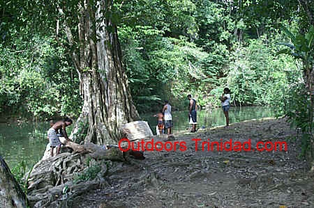
aura and that is a River Lime. Invariably a River Lime includes cooking a meal on the
banks of the river. While that meal can include any type of dish and nowadays includes the
barbecuing of meat, the most acclaimed river limes are those that revolve around curried
duck. The most enjoyable method of cooking is using "three stone", where three
large stones are used to hold the pot and a wood or bamboo fire is built underneath.
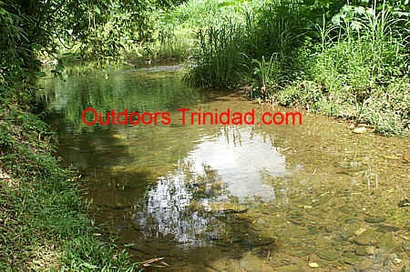
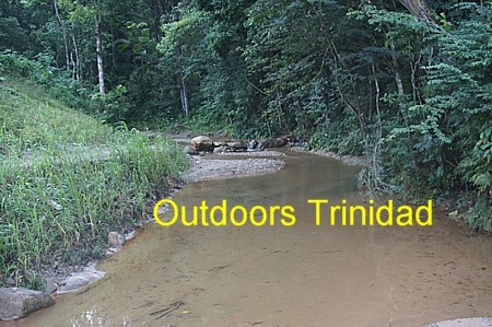
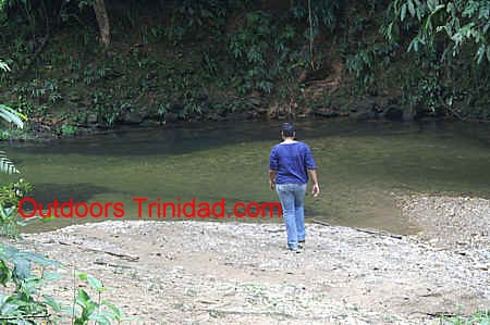
Any river that has clear water and a natural setting is used for a River Lime in
Trinidad. There are however certain river areas in Trinidad that have grown in popularity
as sites for having a river lime and these are identified below.
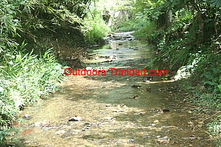
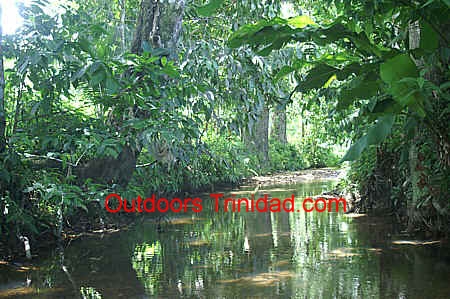
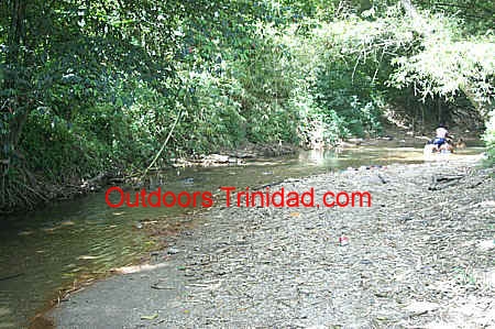
The Maracas St Joseph valley has one of the few rivers that runs through an area with
major housing and yet is not spoiled by development. The river still runs in its natural
state throughout the entire length of the valley.
For those looking to lime by the river it is best however to go up the valley as the
houses thin out from river bank and the hillsides are clothed in natural vegetation. The
flow of the river is smaller than lower in valley but so much cleaner and there are
several locations along the river that are well suited for a good lime. Below we identify
three of these locations that are up the Maracas River.
To get to the Maracas valley you turn from the Eastern Main Road onto Abercromby Street
opposite the Mosque in St Joseph. Abercromby Street becomes the Maracas Royal Road less
than 1 kilometre from the Eastern Main Road.
This section describes the route to the Morang Pools.
Near the northern end of the Maracas St Joseph valley where the Maracas Royal Road begins to climb the
hill, there is a road on the right (east) known as San Pedro. Proceeding the short
distance to the end of San Pedro Road brings you to the river.
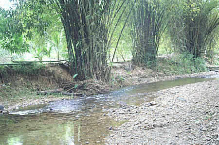
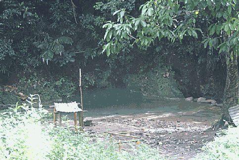
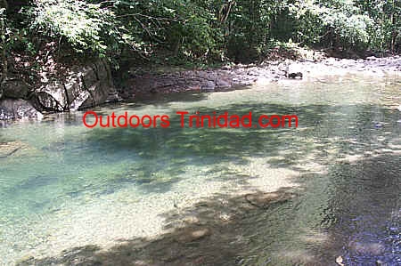
Just before the end of the paved section of San Pedro Road the river has
created a beautiful pool area. The area has been enhanced with mango cocoa,
citrus and ginger lilies. The water is so clean you can see the small
pebbles at the bottom of the pools. Large flat solid rock slabs form the
river sides and bottom here creating the pool area and the water and sun
have coloured the rocks grey to multi-hues of brown. At the edge of the
river there is a sandy area suitable for relaxing and enjoying a meal.
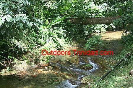
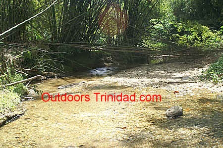
There is a clear smooth track that follows the river from the end of the
road and along it are good locations for liming. Here the river runs as it always has, along hillsides with rich forest dotted with
chaconia, bubbling as it crosses over and between rocks. There is a track that follows the
river from the end of the road and along it are good locations for liming. The sound of
cicacadas fills the air and the only sign of man's passage other than the track is the
occasional coffee and cocoa trees. As you move along the river you may pass a rasta taking
his morning bath in the clean water.
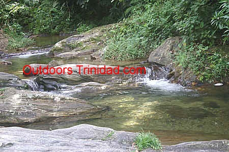
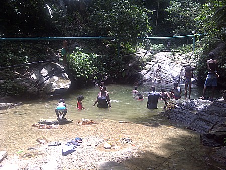
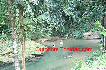
Continuing along the track brings you within 7 to 10 minutes to what are
known as the Morang Pools. The first of these is a large pool with a depth
suitable for swimming. Small children enjoy climbing the rock sides of the
pool and jumping into the water. Above this pool is a smaller pool that is
also suitable for taking a relaxing soak. There is a third pool further
above fed by the spillover of the dam that WASA has created for capturing
the water. One can bathe in the third but of course not in the WASA dam as
that water is used for drinking purposes. The Morang Pools are frequented by
the persons who live at the upper end of the Maracas St Joseph valley.
To access this river lime location you swing off the Maracas Royal Road where the sign
says Bridge Road, ironically still carrying the name although the bridge is no more. A
wide grassy road, with bamboo on one side and citrus/cocoa/banana on the other, leads to
the river. There are two pools here, a small one where the bridge was and a larger pool
about 35 meters up stream. The water is so clean that you can stand on the river bank and
watch the river fish swim in pools.
This location can also be accessed via Waterfall Road. On Waterfall Road there is a
small round-a-bout on the left and you simply follow that road until you get to the other
side of Bridge Road.
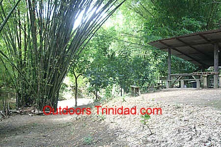
On the Maracas Royal Road, just before the recreation ground, there is a road on the
right called Santa Barbara. Following this road leads to an area where there is a clearing
on the left that is floored with dry bamboo leaves. Here the river quietly flows beneath
towering arching stands of bamboo. The pool at this point of the river is ideal for
a soak.
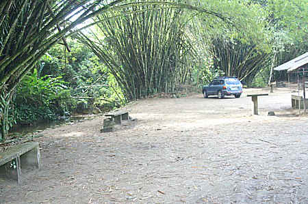
The Arouca River flows through Lopinot and on the side of the Lopinot Historical Complex, there is an area that
has been dedicated to river limes. To get to this area, you go past the Lopinot Museum and
immediately after the football field you take the road on the right. The liming area is a
wide open grassy area with stands of bamboo interspersed throughout the area. metal huts
have been erected near each of the bamboo stools . The river is not deep or wide at this
location and so bathing is mainly for chidren. The entire area however has a very relaxing
feel to it.
Lopinot Village is approximately twenty minutes drive from the Eastern
Main Road in Arouca.
Most individuals when thinking about a river lime on
the Lopinot River think about going to that river at the point just
below the Lopinot Historical Complex.
Some of the reasons that this location comes so quickly to mind is that it
is easily accessible, there is some parking for vehicles and there are sheds
next to the river. A disadvantage of that location is that with several
groups occupying the same location you invariably get someone who spends the
day playing music at a very loud level. At several points downstream from
that location, home owners who live on the river bank have created a liming
area on their property and for a fee groups can rent the spot for the day
and enjoy the river.
For persons who want to enjoy the river in a more natural setting going
to the Lopinot River in Surrey Village provides an alternative. Surrey
Village lies along the road to Lopinot and is 5 kilometers from the Eastern
Main Road in Arouca being a 10 to 15 minute drive up into the Northern
Range. Surrey is a quiet village best known as the home of Jit Samaroo the
legendary steel band arranger and the home of the SuperNova's steel
orchestra plus its Hindu temple. In Surrey Village shortly after the
community center there is a blue painted bar on the right and immediately
after the bar is a narrow road called Lopinot Trace. This road leads
downhill to the river. It is a narrow road with some steep sections but just
a few minutes driving brings you directly on the river. There are houses all
along the road and as it is narrow there is limited parking for vehicles.
This spot along the river is therefore best suited to a small group.
The road ends a few meters from the river and a very short walk brings
you to the river. There are no houses immediately on the river at this spot
and the river flows surrounded by vegetation on both sides. For most of the
year the river at this location will be shallow, more suited to a person who
wants to lie in the water and have it flow around and over them.
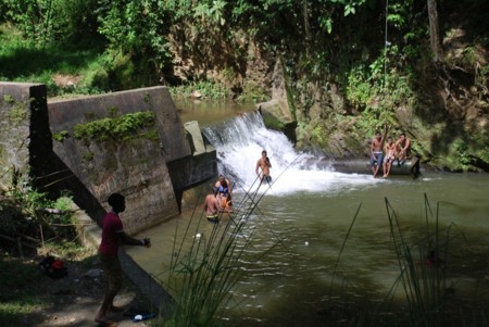
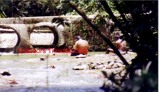
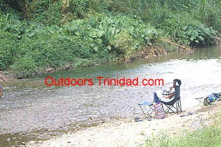
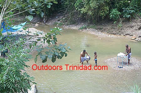
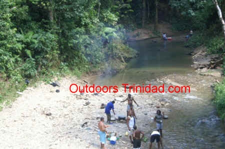
Caura is the most popular location in Trinidad for a river lime with the most popular
spots being at the abandoned pump house and are called Pool Number 1 and Pool Number 2.
The river is so popular however that on a weekend there is insufficient space at these
locations for all the people who go to this valley and so every stretch of the river
that has a clearing is used for a lime, usually involving cooking at the riverside. Near
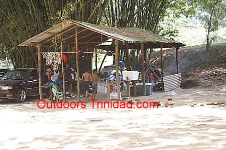
the head of the valley, several ajoupas have been built on the river bank. While these
huts have metal roofs and so are not as picturesque as those with carat and timit leaf
roofs they do provide shelter in the event that rain falls during your river lime.
Caura's popularity stems from the clear water, low population and natural vegetation. As lovely as these pools are, it is not recommended that you stay late at night at these pools.
To learn the reason for Caura's low population see Caura's
history on our Other Places of Interest Page.
Caura valley lies along the Northern Range, five miles east of Tacarigua, accessed from
the Eastern Main Road via the Caura Royal Road.
The road leading to the Aripo valley lies on the
Eastern Main Road just before Valencia, it is a little south of the intersection of
Demerara Road and the Eastern Main Road. At the beginning of the Aripo Road there is a
sign that states "Save the Pawi" and it is appropriate that the sign is placed
there because the Aripo valley is predominantly forest with patches of agriculture. The
road into the valley begins amid rolling countryside and then narrows to a single lane
road that hugs the hillside as you climb into the valley. After 7 kilometres or
approximately 12 minutes of driving you arrive at a fork in the road, taking the right
fork leads to the heart of Aripo village, while taking the left fork leads to an area of
old estates that the Asa Wright Nature Conservancy is now managing. The river lime
locations are on the left fork. On the drive into the valley, numerous birds can be seen
at the forest edge, you may glimpse a rufous jacamar sitting patiently on a tree limb or
see silver-lined tanagers darting across the road. On the left fork the number of birds
increase and now kingfishers may be observed on branches over the river or hawks ghosting
across the sky.
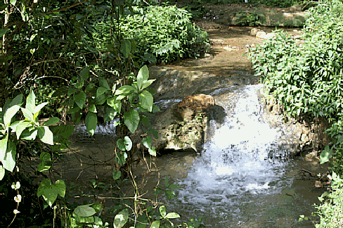
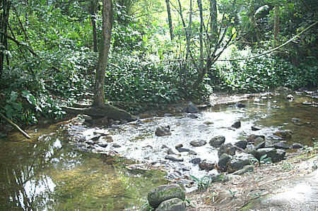
After one minute on the left fork, the first river lime location
is reached. This is on a bend of the Aripo River, where in the shade of a pomerac tree
people have placed boulders to increase the size of the pool that nature has created. To
get to the river, it is an extremely short walk along a track from the road.
The second river lime location is approximately one minute further
along the road. Here the river meanders through a forest glen and there are a few
locations where you can set up for your lime. There are number of small pools ideal for
soaking in the clean refreshing water and at the last pool before the bridge the river
tumbles over the hard rock in a mini-waterfall.
The Guanapo valley is on the eastern outskirts of Arima, accessed from the Eastern Main
Road via the Heights of Guanapo Road. As you enter the road, you must stay with the road
on your right. After approximately 1.9 kilometers you will see the entrance to the Wasa
water plant on the right and the road begins to climb uphill. The river liming locations
are further in the valley beyond the Wasa water plant.
Unfortunately the Government has allowed quarrying in the valley with big Mack trucks
being used to transport the aggregate that is being removed from the hills. The bulldozing
of the hillsides to widen the road to accomodate these trucks, plus the passage of these
trucks, has turned the road into a mix of mud and gravel (as of 18th January 2008). If you
decide to venture into the Guanapo valley for a river lime it would be best to go with a
four wheel drive vehicle, especially if rain has been falling on the previous days.
The Valencia region rivals Caura in terms of its popularity for river limes. The
advantage that the region has is that there are several rivers (Turure River, La Sieva
River, Oropouche River) that drain through the region and so it is able to absorb the
crowds that can descend on it on a holiday weekend. The majority of river limes take
place in the areas where the rivers bisect the Valencia Road. Four of these locations are
detailed below.
This river lime location is at the junction of Cumaca Road and the Valencia Road and is
approximately 2 kilometers from the Valencia Junction (Roundabout). It is a river side
spot at the corner, immediately as you turn onto Cumaca Road. Along here a small stream
flows down from the mountains and the meandering of the river has created several small
pools. This location is good for a cooking lime as the trees along the river bank keep the
area constantly cool. The pools at this spot are small so adults cannot really bathe at
this spot. At one time this spot was maintained by CEPEP and you can see the ginger lilies
and young coconut trees that they planted. Unfortunately they have not kept up the
maintenance so if you are going to have a river lime at this location you should bring
your cutlass as you may have to do some low trimming to clear a comfortable spot.
Along the Valencia Road, approximately 3 kilometers from the Valencia Junction or 1
kilometer from the Cumaca Road Junction, there is a clearing on the left just off the
road, immediately after a bridge. This clearing is often used by those seeking a location
along a river for their lime. The river gently flows along the western edge of this
clearing. This spot has space for approximately 10 vehicles and is shaded by a mixture of
pomerac and cocoa trees plus bamboo patches. As the river winds its way through this area
it has created several small shallow pools that are ideal for soaking in on a hot day.
Along the edge of the river there is a trail that follows the river upstream and leads to
several good cooking spots.
3.5 kilometers from the Valencia Junction just as road begins an uphill climb, there is
a dirt road on left and just inside this road there is a red painted metal gate. A short
drive along this road which is a narrow agricultural trace, leads to a fairly large
clearing on the banks of a river with scattered stands of bamboo. There are several pools
in the immediate vicinity, with one being man made while the others are naturally created
by the bends of the river.
7.5 kilometers from Valencia Junction, along the Valencia Road, just after the signs
for Coosal’s Quarry and Readimix Quarry is the North Oropouche River at Valencia
facility. This is the most popular river liming spot in the Valencia region. It is rare to
find this location without numerous people on a weekend. If you are looking for a quiet
day it is best to go on a weekday, not a weekend. One of the attractions of this location
is that the North Oropouche River is larger than the other rivers in Valencia and so the
pools along the river are larger. There is a paved car park that can accommodate
approximately 15 vehicles and the shoulders of the road are wide so that excess vehicles
can park along the road. Toilet facilities have been installed but these are in a state of
disrepair.
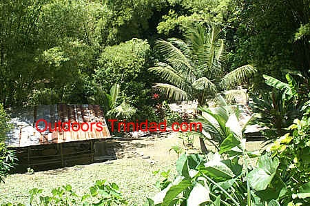
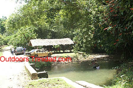
De Freitas Recreation Park, popularly known as De Freitas Ranch, is a private property
that has been structured especially for holding river limes. This ranch in Valencia
Trinidad is accessed by proceeding through the Valencia Junction and going on to the
Valencia Road. A short distance after the Junction you turn on to Quare Road which leads
to Hollis dam (there is a church just before on the right). You follow Quare Road and then
turn on to Bacchus Trace which leads to the De Freitas property.
At the edge of the property the river meanders between banks that are lined on one side
with bamboo and lined with Easter lilies on the other bank. It is along the river bank
that structures have been constructed for river liming. There are nine sheds with
electricity so numerous groups can be accommodated along the river bank. If you are
looking for a quiet river lime it would be best not to go to this property on a holiday
weekend as the sheds are close to each other and so you can be assured that there will be
loud music throughout. Each shed has bricks to facilitate cooking. On the property there
are changing rooms and toilets.
This is a large parcel of land and it is on the rest of the property that the reason
for calling it a recreation park is seen. A short distance from the sheds there is an open
area with a basketball hoop. Near the main entrance there is a swimming pool and
children’s play area with slides. There is also a Guest House on the property.
Along the road leading to Cumaca Village the road
descends to the river and crosses it at a point where there are several
small pools. The location of this bridge across the river provides an
excellent spot for a river lime. The bridge is on a bend of the road and
there is a small short trace on left before bridge. This trace runs
alongside the river and is the best spot for the river lime. There are
shallow pools formed by rocks and by the bends in the river allowing you to
bathe on either side of the bridge. At this point along the river there is
no habitation nearby and immediately as you move off the road the forest
envelopes you so what you hear is the sound of the river, the wind through
the trees and the birds.
It
is possible to have the lime further up the river as there are there are
areas where the river bends and sand bars or shingle beaches have been
formed. Most persons however do not want to have to carry their cooking
implements and drinks very far so the area near the road is the most
popular. If having a river lime at this location you should park well
off the road as there is a quarry further along the road and large trucks
travel along this road.
To
get to the popular spot, you proceed along the Eastern Main Road to
Valencia. At the Valencia Junction you take the left fork onto Valencia Road
(as if heading to Toco). Cumaca Road is along the Valencia Road,
approximately 2 kilometers from the Valencia Junction traffic lights and
there is a sign on the road directing to St Albans Quarry. The distance from
the start of Cumaca Road to the bridge is 4.6 kilometers. The first one
kilometer of the road is paved and then the road becomes a mixture of paved
and gravel road eventually becoming a gravel road.
The road is bumpy in parts but passable. This bridge that marks the
location for the river limes is often used as the start of the hike to the
Turure Water Cascades.
On the eastern outskirts of Matura village, the Matura river crosses the Toco Main Road
just after the police station. The area in the immediate vicinity of the bridge on both
sides of the road is used for river limes. Bamboo predominates along this part of the
river providing shade plus fuel for the fires. This area is so popular on a holiday
weekend that it cannot hold all the people who seek use this area. A few meters beyond the
bridge, set amid some cocoa trees, is a metal gate and upon payment of a small fee you are
allowed drive through the gate to an area up stream with scattered clumps of bamboo and
ample space for a river lime.
The Rio Seco River enters the ocean at Sally Bay just after Matura on the Toco Main
Road. The immediate area of river mouth is the most popular location for river
limes. Apart from the width of the river at this point and the large trees that grow
at the river's edge, plus the fact that you can combine a river bath with a sea bath, it
is popular because of the lifeguard stations on the river and on the beach. One location
that has grown in popularity is the area on the eastern side of the river. On that side of
the river vehicles can be driven off the road and parked close to the river in the shade
of large trees.
A lesser used but much more beautiful spot is to walk upriver from the bridge. A short
distance beyond the bridge the river bends and all the noise of the road traffic
disappears. On this part of the Rio Seco river you have the ambiance of natural forest
with cool clear river water.
Grande Riviere is a small village on the north east coast of Trinidad, reached by
travelling along the Toco Main Road and then continuing after Toco along the Paria Main
Road. It lies after Sans Souci and before Matelot. The village takes its name after the
river, which is French for large river. On the Grande Riviere River there are two main
locations that are used for a river lime.
The bridge across the Grande Riviere river lies at the entrance to Grande Riviere
village. Either side of the bridge on the eastern side of the river is used for holding
river limes.
Some persons like to have their river lime but also have the ability to take a sea bath
and the mouth of the Grande Riviere river provides that possibility. The main entrance to
the river mouth is Hosang Street. You are not allowed to drive your car on the beach but
there is a car park on Hosang Street just after Health Center, which is in very close
proximity to the beach. During the turtle
nesting season you are not allowed to be on beach at night, however you are allowed to
use the beach during the day.
It is also possible to access the river mouth via the Fish Depot. The road leading to
the Depot is on right, just before first main bridge across the river.
Shark River which crosses the Paria Main Road between Gran Riviere and Matelot is another popular location
for a river lime. Both sides of the road are used.
The southern side of the road has space for the car to be driven down next to the river
and has a grove of trees that provides shade. This side of the road has
sufficient space
that several groups can be liming in the area at the same time. Be forewarned however that
the passage of cars along the dirt track leading to the river can cause the track to have
depressions in it. These depressions can cause problems later in the evening when you are
attempting to drive up to the road from the river bank. As a result some people choose to
park along the road. On the northern side of the road just before the bridge there is a
clearing overlooking the river that has two nutmeg trees and space for at least three
cars.
Those who want to do their liming without other groups nearby can easily go upstream as
their is a fairly well defined path that follows the river up stream.
In addition to one day river limes, Shark River is
also a popular location for camping.
Along the Paria Road on the outskirts of Matelot several streams tumble from the
hillsides and cross the road to reach the sea. Most of these are good locations for a
river lime but there is one in particular that has a special twist. This stream is
noticeable because just at the small wooden bridge that crosses the stream is a clear
refreshing pool that is easily seen from the road. If you venture up the river, at the
first bend the jumble of rocks has created an inverted V. The river water pouring over
these rocks is a natural shower that is often used by villagers.
Most of the cooking for river limes at this location is actually done overlooking the
sea which is on the other side of the road. The river being used for the sheer enjoyment
of being in the cool clean water.
The Matelot River is great location for those who want a river lime but do not want to
be molested by hordes of other people. Being such a far distance from the major population
centers means that Matelot does not usually attract large crowds. The stretch of the river
from the school bridge to the sea is the area that is normally used.
The Arima-Blanchisseuse Road begins on the Eastern Main Road just after Maturita. At
the intersection with the Eastern Main Road it is known as the Arima Bye-Pass Road and
then becomes the Arima Blanchisseuse Road. For those coming along the Churchill Roosevelt
Highway, just after you pass the pillars, you turn onto Demerra Road and follow it to the
Eastern Main Road. At the EMR you cross over onto the Arima Bye-Pass Road.
This road winds and climbs over the Northern Range and along many parts there is only
natural forest with the occasional house. Along the Arima-Blanchissuesse Road, there are
two rivers that run parallel to or close to the road at several points and these are the
Arima River and the Marianne River.
Approximately 3.6 kilometers on the Arima-Blanchissuesse Road after leaving the Eastern
Main Road is Manette Ranch. This property lies on the Arima River and has 9 sheds for
cooking and liming. The sheds have electricity and benches. There are toilets on the
property. Manette Ranch is on a bend of the Arima River and there is bamboo arching over
the river plus benches overlooking the river. This property is a commercial venture so
there is a fee for use of the property.
Approximately 4.8 kilometers on the Arima-Blanchissuesse Road after leaving the Eastern
Main Road is Riverside Resort. This river lime location is also on a bend of the Arima
River and parking is off the road in front the house of the owner. To access the
river you have to walk down an incline and there are three sheds on the river bank, each
with electricty, benches and tables.
This is a commercial venture so there is a fee for use of the property
The name Verdant Vale truly describes this area, as it is rich in all of nature's
bounty. This small village along the Arima-Blanchissuesse Road has the distinction of
having the smallest US Army base
in Trinidad during World War II. There are two easily accessible locations that are often
used for a river lime. The first is a small area just off the road on the left,
approximately half way through the village. You can park your car in the open area between
the road and the river.
The second spot is at the entrance to the Dipcon Quarry. Here the river runs close to
the road so that you are not far from your vehicle but the shrubbery on the river bank
gives the feeling of being away from the road. There is space for a tent on the river
bank.
At 31 kilometers from the Eastern Main Road, there is a bridge on the
Arima-Blanchissuesse Road opposite Rangers Camp. This spot is a favorite location for
river limes. At this location there is a double S bend of the Marianne River creating
several pools. The tall forest trees with the cooling breeze and cool water combine to
provide the ingredients for an enjoyable day. The gravel river banks have enough space for
you to cook and lime next to the water.
Some individuals choose to place their chairs in the sections of the river with shallow
pools. In other parts the water is deep enough for you to swim. If the area next to
the road is crowded it is easy to walk a short distance up the river and find a clear
spot.
There is adequate parking at side of the road on either sides of the bridge.
Brasso Seco is the starting point for hikes to the Paria Waterfall and the Madamas Waterfall. It is
the area with the highest recorded rainfall in Trinidad and there are numerous streams
through the valley. An easily acessible and beautiful river liming location in Brasso Seco
is at the Mark To Bridge.
5.8 kilometers from the Brasso Seco Junction is Brasso Trace. The road is a combination
of pitch and gravel in parts but highly passable. If you turn onto Brasso Trace and
proceed for 2.5 km you arrive at the Mark To Bridge. As the river emerges from under the
bridge it has formed a pool filled with clear water that is a delight to bathe in. All
around the area there are cocoa trees and the river winds away from the pool flowing thru
bamboo and cocoa. At the side of the pool is a carat roof hut that is maintained by the
Brasso Seco Tourism Action Committee.
To get to Brasso Seco you use the Arima-Blanchissuesse Road and Brasso Seco Junction is
reached approximately 40 minutes after crossing the Eastern Main Road (19.3 kilometers).
An alternate route is to begin the drive along the Blanchisseuse-Arima Road from the
village of Blanchisseuse and the Brasso Seco
Junction is reached after 45 minutes driving. At the Brasso Seco Junction you turn onto
the Brasso Seco Road and descend in a twenty minutes drive to the village of Brasso Seco.
Marianne River
There are several locations along the Marianne River in Blanchissuesse that are used
for River Limes.
The easiest and most popular entrance is at the side of the restaurant
attached to the Laguna Mar Beach Hotel. At this point a concrete walkway leads from the
road to the beach. This entry point is popular because it leads directly to the section of
the beach where the Marianne River meets the sea.
Persons who organize their lime for this section of the river have the opportunity to
combine a river lime with a beach party.
This bridge lies at the the eastern end of Blanchissuesse village. Either bank of the
river in the immediate vicinity of the bridge is used for river limes. On the
northern side of the river, bamboo predominates. On the southern side of the river there
are several breadfruit trees and between June to August when the breadfruit trees
are laden with fruit those enjoying a river lime often add breadfruit to their menu.
Swimming is possible at this section of the river and on the southern side the river bed
slopes gently allowing those who cannot swim to still enjoy the water of the river.
Beginning at the Spring Bridge in Blanchisseuse
it is an easy hike to the Three Pools on the Marianne River. The trail starts on the right
(eastern side) immediately before the bridge and is a short easy hike that mainly follows
the course of the river. The first pool is used for river limes because the river makes a
bend at this pool creating a small beach and behind the beach the land is fairly flat. To
get to the second and third pools require either swimming across the river or carefully
walking around a rock face both of which would be difficult if burdened with pots and meat
plus coolers of ice.
Approximately 5 miles from Blanchisseuse
is an old agricultural road on the eastern side of the Blanchisseuse-Arima Road, bordered
by 6 pomerac trees and a chain-link fence. There is a hand made wooden sign that states
Pops Avenue to Waterfall. On entering the road you can park your vehicle at the first
house for a small fee. This road becomes a wide grass track and continues directly to the
Marianne River. As the track reaches the river there is a relatively wide flat area that
is used by those looking for a location for their liming. The river bends at this point
and so has a nice bathing area. If you continue down river from this point you will
encounter the Marianne waterfall after
approximately 15 minutes of walking.
The area known as Yarra lies between the villages of La Fillette and
Blanchissuese and the Yarra River winds through the area. Along the North
Coast Road just after La Fillette village there is the Blanchissuesse High
School and shortly after the high school the road crosses the Yarra River.
Anywhere in Trinidad that there is a river with clean flowing water is a
good location for a river lime and the Yarra River is no exception. There
are several locations along the Yarra River that are used for river limes
and three of these are up the river, at the river mouth and at the bridge.
Individuals who want their river lime in a secluded natural forest setting
sometimes opt to go up river where there are several pools with wide sand
banks. To get to the upriver portion you turn right at the road immediately
before the bridge and follow the river. The river mouth is also another
location that is good for a river lime as at the western end of the beach,
the river flows slowly with clear water between sandy banks. There is a
grove of short coconut trees that lies between the river and the sea, while
along one stretch of the river almond trees line the bank.
The beach is fairly easy to get to and our section on
Yarra Beach provides directions. The
only issue for those choosing to have their river lime at the river mouth is
that all the implements have to be hand carried along the beach.
The most
popular location for a river lime on the Yarra River is actually at the
bridge where the North Coast Road crosses the Yarra River. There is a path
on either side of the bridge that leads down to the river and here the river
forms a large pool that is ideal for bathing. No river lime is complete
without food being cooked on the spot or at least a pot cooked at home and
then consumed at the river bank. Liming at the bridge provides two locations
for cooking. There was a previous bridge that crossed the river and when a
new bridge was installed, the road was shifted to cross the new bridge but
the old bridge was left in place. As a result, immediately after the old
bridge the paved road way is still there, providing a place to cook and
lime. In addition, on the opposite side of the road there is a natural
shaded clearing that provides a place to cook, sit and eat.
Maracas Bay is best known as a place for a beach lime but interestingly you can also go
to Maracas Bay for a river lime. The place for this different twist on a River Lime is the
Maracas Bay Agri-Tourism Park. The Maracas Bay River which empties into the sea on the
western end of Maracas Beach also runs through the Park and the management of the Park has
put in infrastructure to cater for the Trini love of a River Lime. At the Park you will
find huts with chulhas and clean water. The Park’s management provides the firewood
so that you just have to walk with your food. If you want a River Lime but do not want to
cook, you can arrange with the Park to have their staff cook on site for you. There are
also modern bathrooms on site. The Park is a commercial venture so there is a fee for
rental of the huts.
Chaguaramas may be better known for its beach limes but it also offers
locations for holding a river lime. One of these locations is at the end of Covigne Road.
To get to Covigne Road you go along Macqueripe Road into Tucker Valley. The road
immediately after the mango field and at the side of Samaan Park that goes past the
National Seed Center is Covigne Road. There is a sign that says Arboretum and North Coast
Trail. Follow Covigne Road to the end.
At end of the road is a barrier and the Arboretum on the right, walk past the barrier
and take the old road on the left. Following this road leads to the Cuesa River. This
river has a low water flow most times, except in periods of heavy rainfall. You can hike
10 minutes up river to a spot where there is a cleared raised bank on the side of a pool.
Most people opt not to take this walk and instead have their lime at the Nutmeg Field.
Shortly before the river there is a track on the right that goes past an old military
bunker. Following this track (2 minute walk) leads to the Nutmeg Field. At this spot a
stream flowing over a large boulder creates a mini waterfall and shower. Just above is a
small pool. The trees in the nutmeg field are spread apart so there is ample space for
liming.
The Arboretum is also used for liming. Two man made pools are on the property and river
water is brought from the nutmeg field to fill the pools. There are a few huts that are
located among bamboo stands on a dry river bank. There is a fee for the use of the
Arboretum property.
The point at which the Nariva River enters the sea at Manzanilla is the location for
many river limes. The most popular river liming spot is the strip of land that is bordered
by both the river and the sea. To gain access to this strip there is a gate just before
the first major bridge across the Nariva River. A small fee is charged for entry to this
area. Along this strip there are several pathways that lead through the coconuts to the
river and the river is shallow enough in the immediate vicinity of the river bank to allow
those who cannot swim to be able to bathe.
The area of the river mouth is the section of the river most used for liming. This
section is maintained by CEPEP and so kept clean. The water spreads out along this section
and at low tide or when the river is not in flood there is a wide sandy area. Between the
road and the river there are many shade trees with spaces between the trees for liming. To
get to the river mouth Point Radix road is used. For those coming from the north Point
Radix Road is on the left, immediately after you cross the bridge spanning the Ortoire
river.
Along the Mayaro-Guyaguyare Road, shortly after Sandsucker Drive, a small
river crosses the road on its way to the sea. The beach sand in this area causes the river
to run paralel to the ocean creating a natural pool literally next to the road. Several
ajoupas have been built between the road and the river causing this area to be popular for
holding a river lime. As a result of the large number of people who frequent this area a
Life Guard station has been erected and is manned during daylight hours.
In
south Trinidad, almost hidden from most people unless you live in the area,
is a delightful picnicking area known as the Tulsa Trace Picnic Site. Those
however who know of it flock to the area on weekends because of its
ambiance. This area provides the opportunity to relax, cook, fish and
generally have a day of fun with family and friends. The site is located at
the Ministry of Works and Transport Drainage Division Penal Calco Pump
Station. Several years ago TIDCO, (Tourism and Industrial Development
Company) in conjunction with the Penal Rotary Club made improvements to the
site to make it more enjoyable for visitors.
The Tulsa Trace Picnic Site is located at the confluence of two waterways;
the Black Water and the Godineau River. On the Channel side there are three
concrete huts each with built in seating and a large central table while on
the land side there are two similar huts. The site also has male and female
toilets that are maintained and clean. In the Black Water people fish for
Cascadoo while there is a mix of species, both fresh and salt water in the
Godineau because of its brackish nature due to tidal influx.
Apart from the huts it is also possible to enjoy the ambiance of the area
and be close to the water. The roadway leading to the picnic site runs
parallel to the Black Water and the banks of the river are lined with Black
mangrove trees. So along the Black Water channel it is possible to sling
hammocks and place chairs in the shade of the black mangrove trees. Using
this area is however best done in the dry season as in the rainy season the
water level rises.
There are no refreshment vendors in the immediate area of the picnic site
but at the corner where one turns into the road leading to the picnic site
there is a bar and also a mini-mart. The area can be noisy on Public
Holidays and Sunday afternoons when some people come and play the music from
their car stereo systems, but as you move into the shade of the mangrove
trees the noise level diminishes.
You can find directions for the Tulsa Trace Picnic Site by visiting our Map
Page.
.
Send mail to
webmaster@trinoutdoors.com with
questions or comments about this web site.
Copyright � 2006 Outdoor Business Group Limited
Last modified:
June 28, 2022
All photographs (unless otherwise stated) are the property of Brian
Ramsey. None of the photographs may be reproduced without the express written
consent of Outdoor
Business Group Limited
and Brian Ramsey.